Summer Hiking Near Leavenworth: Central Washington's Best Trail Season
Leavenworth is one of our favorite places for hiking in Washington, and it’s also an amazing place for a weekend trip. The hiking here is stunning and includes a mix of high alpine trails, beautiful lakes, and even wildflowers in the spring and early summer.
Though hiking in Leavenworth is amazing almost all year round (you’ll need snowshoes in winter), summer is honestly the best and when all of the trails are melted out. From alpine lakes in the Enchantments to lesser-known ridgelines out toward Cashmere and the Entiat, there's a trail here for every kind of hiker, whether you want a short morning hike in town or a full day out in Central Washington's backcountry, this guide is for you!
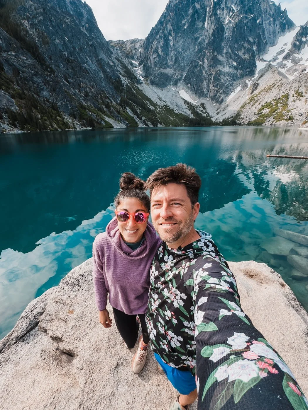
If you're chasing wildflowers specifically, check out our spring wildflower hiking guide instead — this one you’re currently reading is built for summer on the trails. And for more on Leavenworth visits and specific trips into the Enchantments, we’ve got you covered with lots of guides on this area.
Why Trust this Hiking Guide?
We're Washington locals based in Leavenworth, and between our years leading trips for The Mountaineers and hiking this area extensively, we've personally hiked every trail on this list — from the Enchantments to lesser-known routes near Cashmere and the Entiat. This guide reflects what these trails are actually like to hike in summer, not just trail stats pulled from a map.
Affiliate Disclaimer: This blog post contains affiliate links, meaning we receive a small commission on every purchase made with our links at no additional cost to you. Sometimes there is even a discount code for our readers which we specify next to the links.
Table of Contents
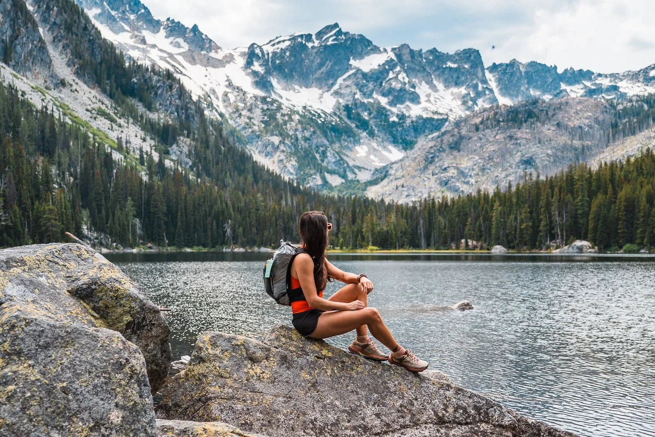
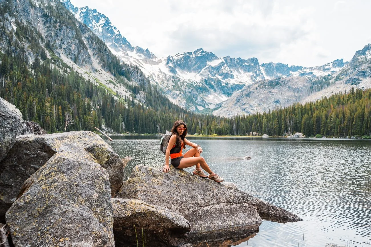
Views at Lake Stuart in the Enchantments
When to Hike Near Leavenworth in the Summer (Seasonal Considerations)
Summer hiking season near Leavenworth generally runs from late June through September, though the exact window shifts year to year depending on snowpack. Higher-elevation trails and passes (think Lake Edna, the upper Core Enchantments) can hold snow into early July in bigger snow years, while lower trails around Cashmere, Wenatchee, and the Entiat are often snow free in the early spring (April and May).
Here's What to Expect and Plan For Once You're Out Here:
Heat: Central Washington summers run hot and dry, especially on lower-elevation, exposed trails. Start early to beat the heat of the day, and don't underestimate how much water you'll need on trails with little to no shade.
Fast-changing alpine weather: Don't let a warm, clear morning fool you into skimping on layers. Weather in the high country can shift quickly, and temperatures drop fast at elevation — we've been snowed on in the Core Enchantments in August before. Pack a warm layer and rain shell even in peak summer if you're headed above treeline.
Wildfire smoke: Smoke season is a real part of hiking in Central Washington in the summer, and it can affect both air quality and visibility with little warning. Check current conditions on Watch Duty before you head out, and have a backup plan (or a different trail) ready if smoke rolls in.
If you're hoping to catch wildflowers instead, our spring wildflower hiking guide covers the best trails and timing for that season — most of these same trails put on a spectacular bloom in the spring.
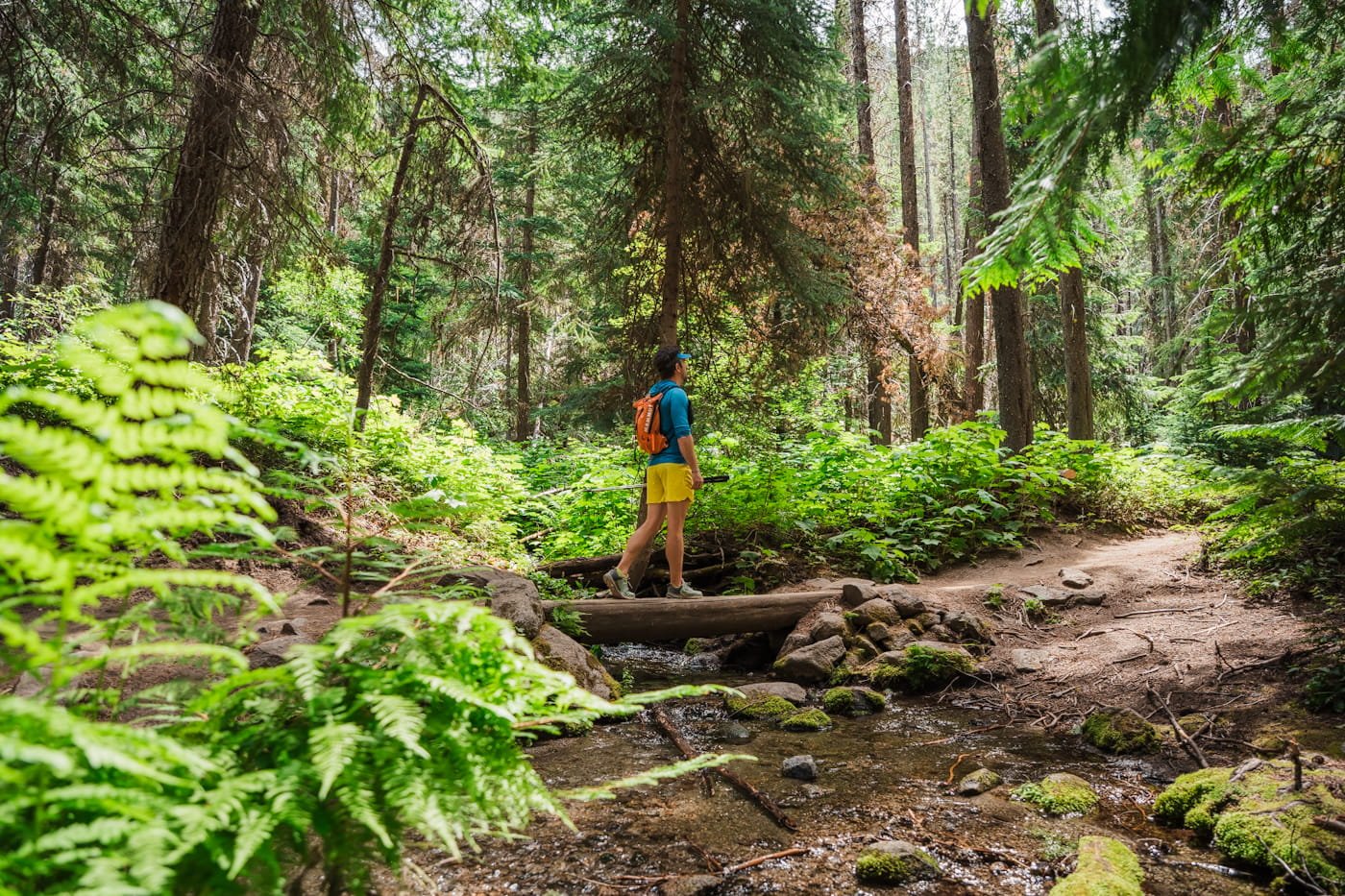
Leavenworth Hiking Tips: Permits, Crowds & Trail Etiquette
Leavenworth's trails (mainly in the Enchantments) see a lot of traffic in the summer, especially the more popular ones in this guide. It’s important to be a responsible hiker and have a backup plan in mind if the parking lot is full. Here's what to know before you go, so you can hike responsibly and be prepared once you're out there.
Leave No Trace on Every Hike, But Especially on Popular Trails
Many of these trails, especially in the Enchantments, see heavy summer use. Stick to established trails, pack out all trash (including food scraps and TP), and camp only in designated sites where required. If a trail feels crowded, it's more important than ever to hike responsibly, small impacts add up fast on high-traffic routes.
→ Check out Leave No Trace for more information on the Seven Principles of LNT.
How to Be a Responsible Hiker
- Stay on trail: Cutting switchbacks causes vegetation damage and erosion.
- Pack out everything: All trash, food scraps, and toilet paper. If you packed it in, pack it out.
- Waste disposal: Use the porta-potty toilet at the trailhead before you leave. If you need to go on trail, use a WAG bag or dig a cat hole at least 6–8 inches deep and 200 feet from the trail.
- Don't feed wildlife: Human food is harmful to wildlife and creates problem animals.
- Leave rocks and plants: Don't build cairns, pick flowers, or move large rocks.
- Be considerate of others: The trail draws a lot of people. Give other hikers space and yield to uphill hikers on the trail.
How to Beat the Crowds on Busy Trails
Start early, or honestly go late for sunset. Trailheads for popular hikes like Colchuck Lake and the Enchantments fill fast, sometimes before sunrise on summer weekends. Weekday hikes will almost always be quieter than weekends, and the lesser-known trails near Cashmere and the Entiat tend to stay uncrowded even in peak season if you want a break from the busier in-town options.
Everyone always recommends going early though, and we’ve actually found trails to be much quieter and parking lots more open later in the day. Doing a sunset hike and starting after all the morning hikers has left can actually be amazing, as long as you are prepared to hike out in the dark. Make sure to have the trail downloaded (we love the Gaia GPS app for this) and a fully charged headlamp if you opt for a sunset hike.
Hiking in the Heat
Central Washington summers get hot, and many of these trails have long exposed stretches with little shade. Bring more water than you think you'll need, start early to avoid hiking through peak afternoon heat, and know that some trails may not have reliable water sources by late summer.
Sun Protection on Exposed Trails
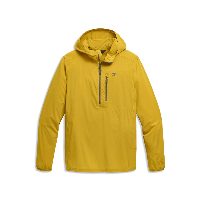
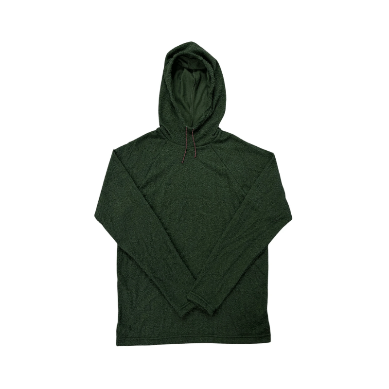
With long stretches of exposed trail and high elevation sun exposure, sun protection isn't optional out here. Bring (and actually reapply) a sweat resistant sunscreen, and consider sun-protective layers like a sun hoodie or a hat with coverage for your neck and ears on trails with little to no tree cover.
Parking, Passes & Trailhead Access
Most trailheads in this guide require either a Northwest Forest/America the Beautiful Pass or a Discover Pass — check which is required for each specific trailhead before you go, since they're not interchangeable. Some trailheads, especially Colchuck Lake and the Core Enchantments, have limited parking and fill early; arriving at sunrise (or earlier) is often necessary in peak season.
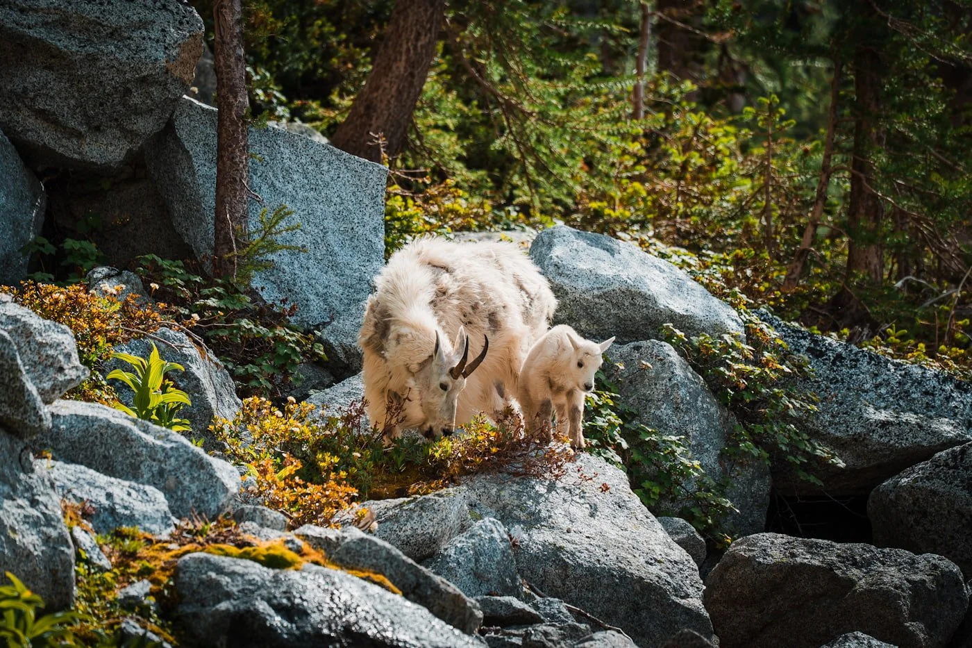
Mountain goats on Aasgard Pass in the Enchantments in late June, shot at 200mm to keep a safe distance
Wildlife to Watch For on Central Washington Trails
This area is black bear country, so proper food storage matters, especially if you're backpacking. In the high alpine, particularly around the Enchantments, mountain goats are common and have grown used to hikers — keep your distance, never feed them, and be extra cautious with sweat-soaked gear, since goats are drawn to salt and can become aggressive around it.
Rodents are also a persistent problem at established campsites, so don't leave food or scented items unattended, even for a few minutes, and use proper food storage overnight. Lower-elevation, drier trails near Cashmere and the Entiat can also have rattlesnakes in summer — watch where you step and reach, especially on rocky terrain.
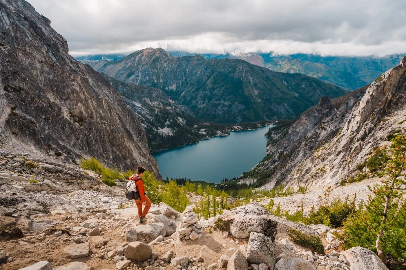
Hiking down Aasgard Pass after a day hike into the Core Enchantments while camping at Colchuck Lake
6 Best Hikes in Leavenworth for Summer
These are the trails you can reach with a short drive (or in some cases, are just above town), ranging from a family-friendly day hike to multi-day trips into the Core Enchantments. Whether you've got a few hours or a few days, this stretch of Leavenworth has some of the best alpine hiking in the entire state.
| Trail | Distance & Elevation | Difficulty | Best For | Dogs | Parking Permit |
|---|---|---|---|---|---|
| Colchuck Lake | Distance 7.6 mi (12.2 km) RT Elev. Gain 2,154 ft (657 m) Duration 4 - 8 hrs | Hard | Best day hike in Leavenworth | ✗ No Dogs |
NW Forest / America the Beautiful |
| Stuart Lake | Distance 8.9 mi (14.3 km) RT Elev. Gain 1,663 ft (507 m) Duration 4 - 6 hrs | Moderate | Quieter and gentler grade than Colchuck | ✗ No Dogs |
NW Forest / America the Beautiful |
| Enchantments Thru-Hike in a Day | Distance 18.3 mi (29.5 km) Point-to-Point Elev. Gain ~6,700 ft (2,042 m) Duration 10 - 16+ hrs | Very Hard | Ultimate single-day Enchantments challenge | ✗ No Dogs |
NW Forest / America the Beautiful |
| Lake Edna | Distance 12 mi (19.3 km) RT Elev. Gain 5,065 ft (1,544 m) Duration 6 - 8+ hrs | Hard | Quiet high-alpine lake without Enchantments crowds | ✗ No Dogs |
NW Forest / America the Beautiful |
| Icicle Ridge | Distance 4.8 mi (7.7 km) RT Elev. Gain ~1,800 ft (549 m) Duration 2 - 4 hrs | Hard | Panoramic ridge workout, minutes from town | ✓ On Leash | None |
| Canyon Crest Trail | Distance 3.5 mi (5.6 km) Loop Elev. Gain 476 ft (145 m) Duration 1.5 - 2 hrs | Moderate | Closest hike to town; family-friendly | ✓ On Leash | None |
Colchuck Lake: The Best Day Hike (or Backpacking Trip) in Leavenworth
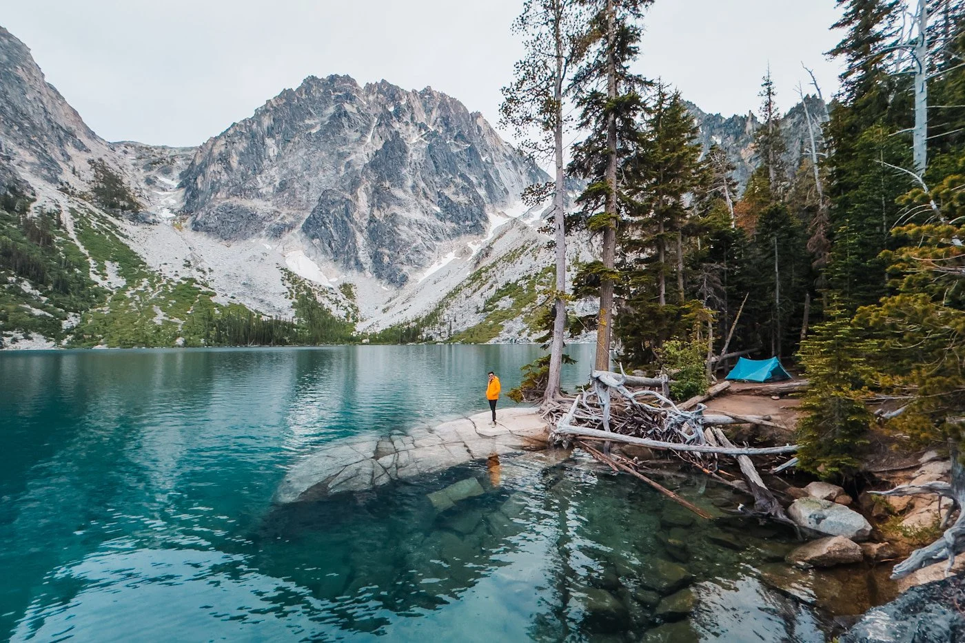
Our campsite at Colchuck Lake in June, 2026
Hike Stats: 7.6 miles round trip | 2,154 feet of elevation gain | 4–6 hours
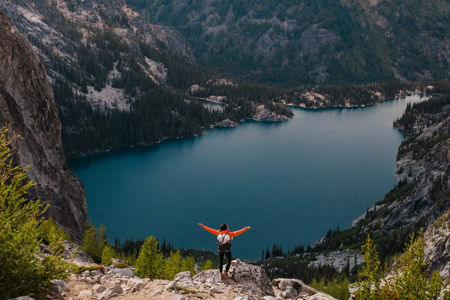
Colchuck Lake is easily one of the most stunning day hikes near Leavenworth, and it's the one hike on this list we'd tell a first-timer to prioritize above all else. The trail climbs about 2,154 feet over 3.8 miles to a stunning turquoise lake cradled beneath the granite walls of Dragontail and Colchuck peaks, and unlike backpacking in the Enchantments, no permit lottery is required to visit for the day.
Just know this is one of the most popular trails in the entire state, and the trailhead parking lot fills up fast, sometimes by 7am on summer weekends. If you have any flexibility in your schedule, hike it on a weekday. You'll deal with a fraction of the crowds and have a much easier time finding parking. If a weekend is your only option, plan to arrive at or before sunrise.
By June, the snow is melted off and the trail is fully clear, and conditions stay solid straight through summer, though that also means peak crowd season. If you want to swim, the water stays cold well into summer, but the flat granite slabs on the west side of the lake make for a great spot to cool off and eat lunch with a view.
For all the details on this trail and what to expect, our complete Colchuck Lake day hiking guide covers everything from trail sections to free day hiking permits, or check out our guide to backpacking Colchuck Lake if you want to spend the night at the lake instead (highly recommend, but overnight permit required).
Lake Stuart: A Beautiful Enchantments Lake With Less Crowds
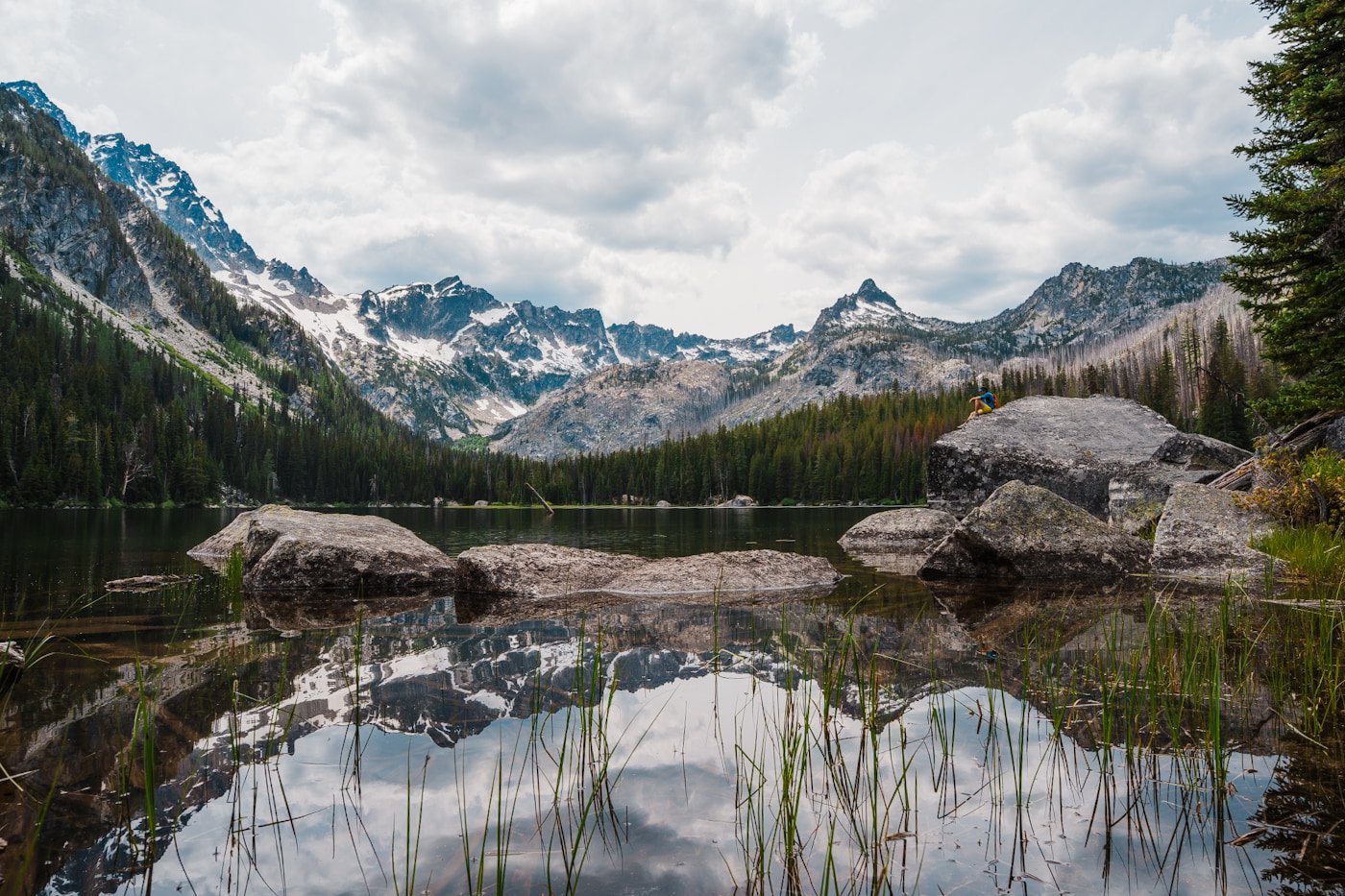
Lake Stuart midday on a weekday
Hike Stats: 8.9 miles round trip | 1,663 feet of elevation gain | 4–6 hours
Lake Stuart is a stunning alpine lake that does not get the same crowds or credit as Colchuck, but it is definitely worth a hike. It shares the exact same trailhead as Colchuck (and sees traffic from Core Enchantments hikers too), so the lot fills just as fast, but the lake is much quieter.
Once past the trail junction at mile 2, where Colchuck hikers veer left, Lake Stuart sees a fraction of the foot traffic, even on the busiest summer weekends. At 8.9 miles round trip with 1,663 feet of gain, it's actually longer than Colchuck, but the grade is far gentler and more gradual, making it genuinely approachable for less experienced hikers.
Summer is peak season here too, with the trail fully clear by June and the open meadows near the lake can be full of mosquitoes, so pack bug spray. Lake Stuart is an easy recommendation for hikers who want the Enchantments experience without Colchuck's crowds or steep, rocky final approach. It’s a hike we highly recommend and wish we had done sooner.
Since parking is shared with Colchuck, the same weekday-or-sunrise advice applies here too, arrive early or hike it midweek if you want the best shot at both a parking spot and a quiet lake.
Our complete Lake Stuart hiking guide has the full trail breakdown, seasonal conditions, and everything else you need to plan your visit.
Enchantments Thru-Hike in a Day: The Ultimate Leavenworth Challenge
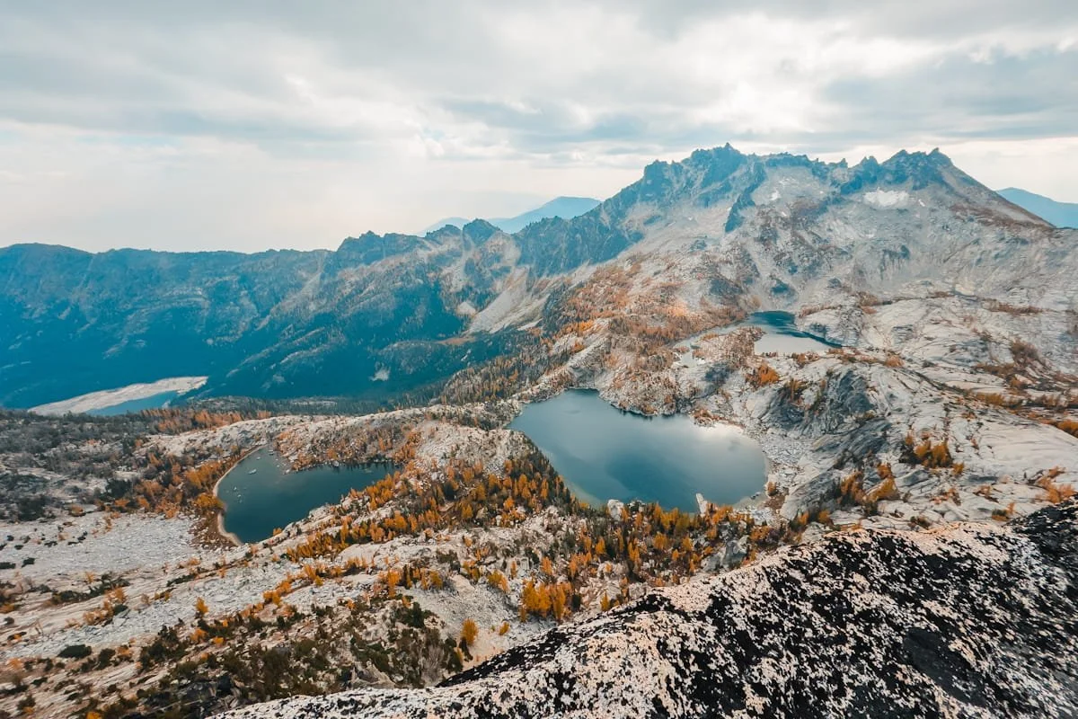
Core Enchantment lakes in the fall during larch season
Hike Stats: 18.3 miles end-to-end | ~6,700 feet of elevation gain | 10–16+ hours
The Enchantments thru hike (also called the traverse) lets you experience the entire basin in a single massive push, no overnight permit lottery required. We did the full thru hike in early October for larch season and it was a long day but such a blast for experienced hikers.
The route runs point-to-point, (usually) starting at the Stuart Lake Trailhead and ending at the Snow Lakes Trailhead, climbing roughly 6,700 feet along the way past Colchuck Lake, up and over Aasgard Pass, through the Core Enchantments, and down past Snow Lakes to finish. Officially from trailhead to trailhead, it’s 18.3 miles, though most hikers end up covering closer to 20+ once you factor in exploring the Core Enchantments along the way.
This is one of the biggest single-day hiking challenges in the state. But for strong, well-prepared hikers who start before sunrise and pace themselves carefully, it's entirely doable, and one of the most rewarding days you can spend in the Cascades.
Our full Enchantments thru-hike guide covers pacing strategy, shuttle logistics between trailheads, gear, and everything else you need to plan the attempt.
→ Prefer to spread the miles over two or three days instead of one massive push? Check out our complete guide to backpacking the Enchantments for permit strategy and trip planning.
Lake Edna: A Quiet High-Alpine Lake Day Hike or Backpacking Trip
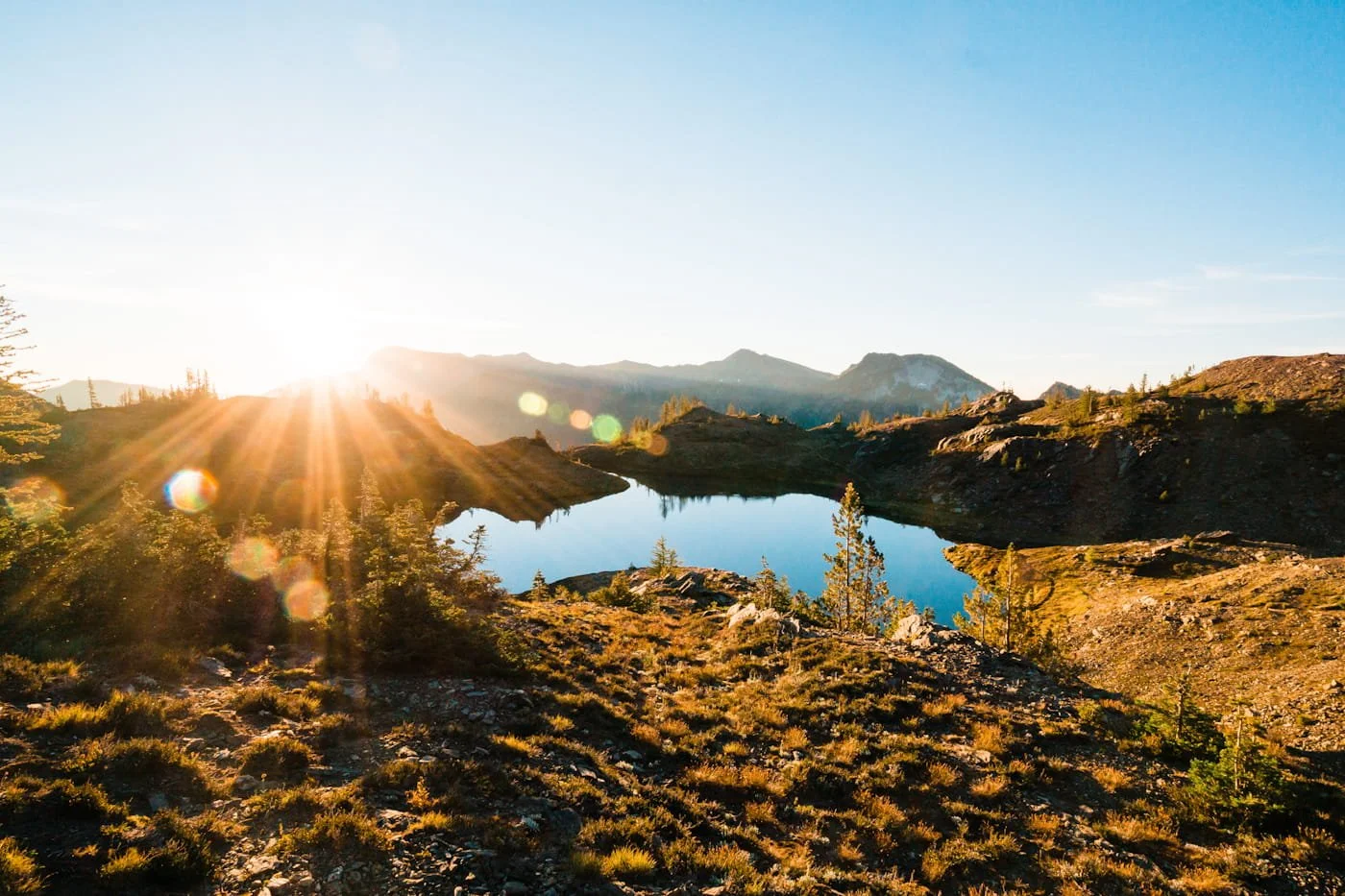
Lake Edna at sunrise while backpacking
Hike Stats: 12 miles round trip | 5,065 feet of elevation gain | 6–8+ hours
We hiked Lake Edna as a backpacking trip, but it’s totally doable as a long day hike. This trail was beautiful, and when we hiked in the summer on a weekend, we actually had the lake to ourselves, which was amazing and almost unheard of in this area.
Lake Edna is a smaller subalpine lake tucked in the mountains via the Chatter Creek Trail and/or Icicle Ridge Trail (much longer for backpackers wanting more miles), and it's a great option if you want a high-alpine destination without the Enchantments permit competition or crowds.
You’ll hike via the Chatter Creek Trail, a 12-mile round trip with roughly 5,000 feet of elevation gain, so know going in that this is a genuinely demanding day. At the top of Chatter Creek Trail, turn left onto the Icicle Ridge Trail (#1570) and continue uphill for another 0.3 miles to reach the lake.
The main trail skirts along the lake's southern edge, with backcountry campsites scattered between the south and east sides if you're backpacking. A toilet sits on a spur trail on the southeast side. If you do camp, stay at least 200 feet back from the lake itself, no camping is permitted closer than that.
To add to your hike, there’s a trail that goes up to the summit of Cape Horn, which is a short hike from the lake and worth it for more views.
We don’t have a dedicated guide for this one yet, but check back as we may add a full write-up for this hike later on. You can find more details on this trail on WTA.
Icicle Ridge: A Leavenworth Ridgeline Hike with Panoramic Views
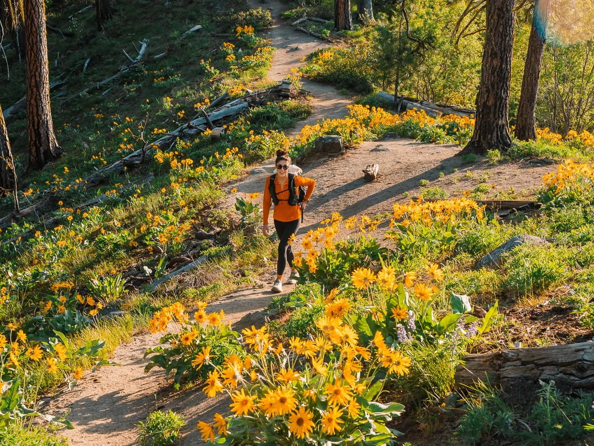
Hiking to the Icicle Ridge view point in late April during balsamroot season
Hike Stats: 4.8 miles round trip | ~1,800 feet of elevation gain | 2–4 hours
If you want a solid workout without committing your whole day, Icicle Ridge is our go-to. The trailhead sits just minutes from downtown Leavenworth, no long drive out Icicle Creek Road required, and it's the hike we come back to again and again, whether we're using it as a training day or just need to get outside for a few hours. This is also an amazing wildflower hike in the spring, with tons of balsamroot blooms in late April and lupine in early May.
The trail starts out fairly mellow for the first half mile before switchbacking steadily up the ridge. In summer, expect full sun and dry, dusty trail for most of the climb, so start early and bring more water than you think you'll need. Once you reach the saddle, you're rewarded with a view of Tumwater Canyon and the Wenatchee River below. From there, take a right and continue a short distance to the main viewpoint, where the entire town of Leavenworth spreads out beneath you with the Central Cascades stretching out behind it.
Plan on about 2 hours round trip at a solid pace, or up to 4 if you want to linger at the viewpoint and soak in the views before heading back down.
Our complete Icicle Ridge hiking guide has the full trail breakdown and more on what to expect each season.
Canyon Crest Trail: The Closest Hike to Town & Family Friendly
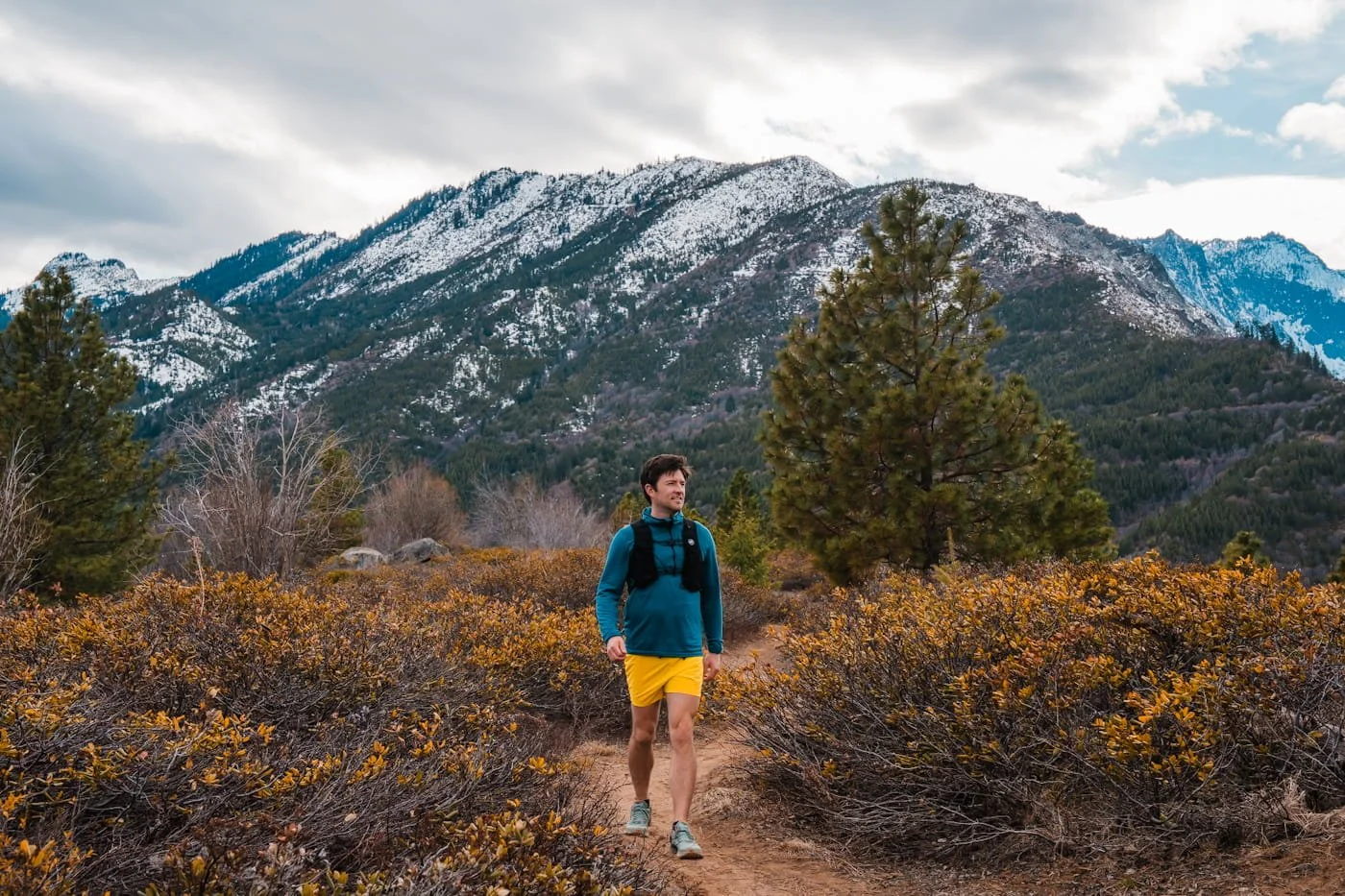
Hiking the Rat Creek section of the Canyon Crest Trail in the early spring before wildflower season
Hike Stats: 3.5 miles round trip | 476 feet of elevation gain | 1.5–2 hours
We love this section of the Canyon Crest Trail for a short hike if you don’t have a full day to spend on the trail, and it’s the most family friendly out of all the hikes in this guide. It's an easy local favorite that rarely draws a crowd, even in peak season, which makes it a great pick when you want a shorter outing without competing for a parking spot.
Located just a short drive from downtown Leavenworth, this is the perfect morning hike with views of the surrounding mountains and town, plus there’s enough parking for the amount of traffic it sees. From the parking pullout, the trail climbs a steady old forest road before transitioning to single track, opening up into sweeping views of the Leavenworth Valley along Rat Creek Ridge.
At 3.5 miles with 476 feet of gain, it's approachable for a wide range of fitness levels and makes a great early morning or half-day hike, it's also a solid option for families with young children. And there are wildflowers if you visit in the spring.
Since there's no water source along the trail, carry everything you'll need from the trailhead, and pack a bit extra if you're hiking it during peak summer heat.
Our complete Canyon Crest Trail guide has the full route breakdown, seasonal conditions, and driving directions.
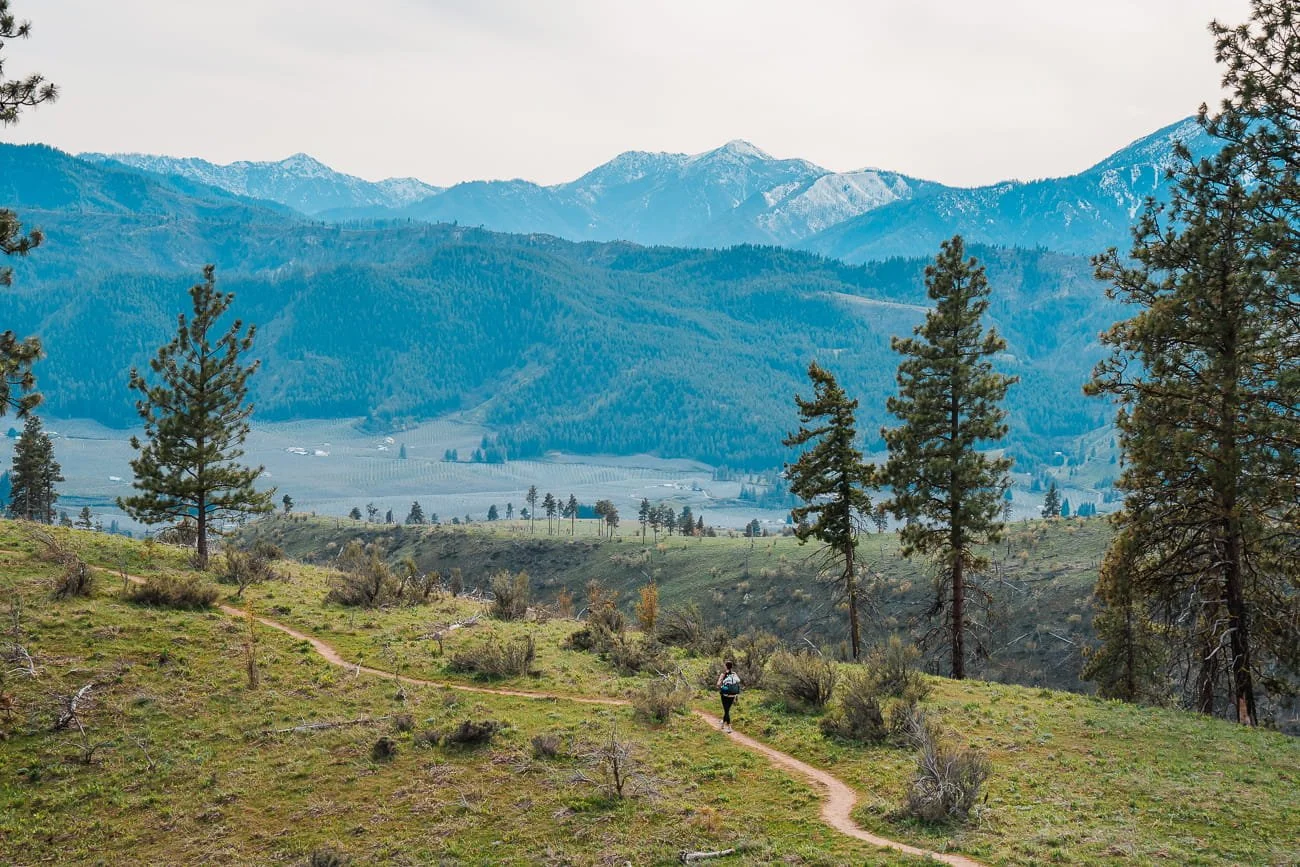
Hiking Olalla Canyon Ridge in Cashmere
3 Best Hikes Just Outside of Leavenworth: Cashmere & Entiat Trails
Willing to drive a little further? These trails near Cashmere and the Entiat are just outside of Leavenworth, and tend to see fewer people than the trails closer to town, especially during peak summer weekends since they are very exposed to the sun. It’s worth noting though, Olalla Canyon is a super popular wildflower hike in the spring, so make sure to plan ahead on that one if you visit during the balsamroot bloom. All three of these hikes do get amazing spring blooms, but they are also worth doing in the summer and still have amazing views all year round.
| Trail | Distance & Elevation | Difficulty | Best For | Dogs | Parking Permit |
|---|---|---|---|---|---|
| Olalla Canyon Ridge | Distance 2.6 mi (4.2 km) RT Elev. Gain 524 ft (159 m) Duration 2 - 4 hrs | Moderate | Popular wildflower hike near Cashmere with sweeping valley views | ✓ On Leash | None |
| Nahahum Trail to Sunrise Peak | Distance 5.7 mi (9.1 km) RT Elev. Gain 1,873 ft (570 m) Duration 3 - 5 hrs | Hard | Hidden gem near Cashmere with panoramic views, fewer crowds than Olalla | ✗ No Dogs | None |
| Steliko Lookout | Distance Up to 6 mi (9.7 km) RT Elev. Gain Up to 1,680 ft (512 m) Duration 2 - 5 hrs | Moderate | Historic fire lookout deep in the Entiat Valley, drivable for high-clearance vehicles | ✓ On Leash | None |
Olalla Canyon Ridge: A Popular Wildflower Hike in Cashmere, WA with Stunning Summer Views
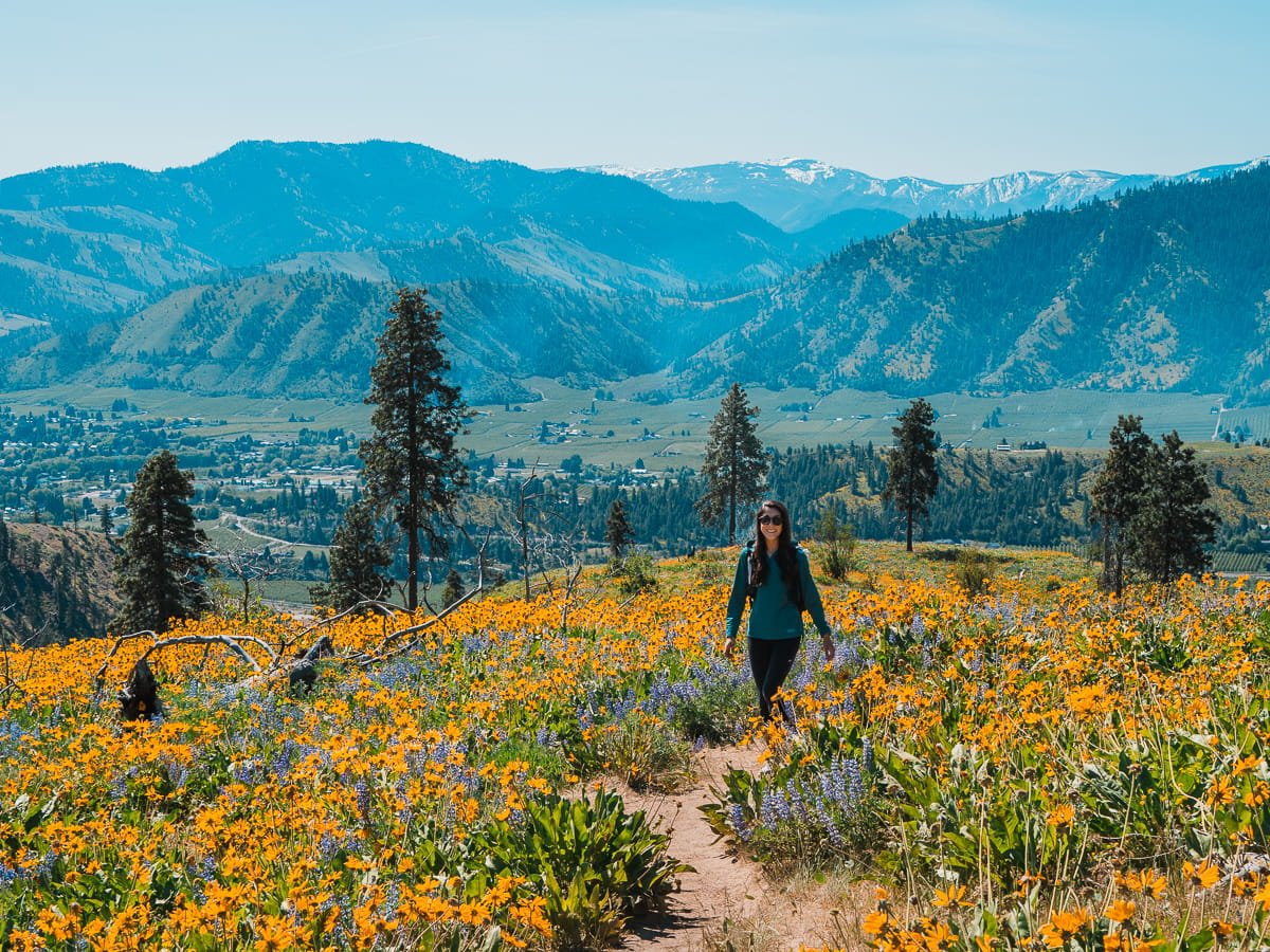
Hiking Olalla Ridge during peak wildflower bloom in April
Hike Stats: 2.6 miles round trip | 524 feet of elevation gain | 2–4 hours
Olalla Canyon Ridge is one of our favorite short hikes near Cashmere, with sweeping views of the Wenatchee Valley and the Stuart Range from an open ridgeline. Just a short drive from both Leavenworth and Wenatchee, it's a short enough hike for an afternoon outing but feels like a real destination once you're up on the ridge.
Here's the thing though: this trail has exploded in popularity over the past couple of years, and the tiny trailhead lot (it holds about 4 cars) simply can't keep up with demand, especially during spring wildflower season. The good news for summer hikers is that the crowds thin out considerably once the blooms fade, making this a much easier and more pleasant visit than showing up in peak April.
Even so, there are a few things worth knowing before you go, especially around parking and trail etiquette, since this remains one of the more sensitive trails in the area when it comes to overuse.
Our complete Olalla Canyon Ridge guide covers everything you need, including parking logistics and alternatives if the lot is full.
Nahahum Trail to Sunrise Peak: A Hidden Gem Near Cashmere
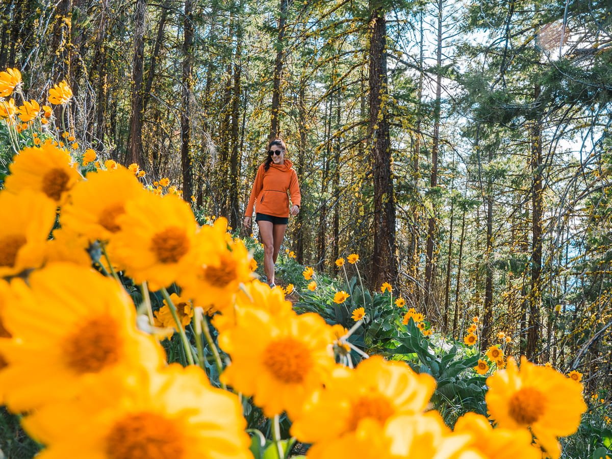
Hiking the Nahahum Trail in the spring for the balsamroot bloom
Hike Stats: 5.7 miles round trip | 1,873 feet of elevation gain | 3–5 hours
Nahahum Trail to Sunrise Peak is worth the drive into the hills above Cashmere for good views and a lot less crowds than most of the other trails. The Nahahum Trail gains elevation throughout the hike all the way to Sunrise Peak, nothing steep or technical, just a consistent, gradual grade that adds up over the miles.
The trail starts at the Cashmere Canyons Trailhead, and it tends to see noticeably less traffic than nearby Olalla Canyon and Sage Hills. This is also one of our favorite spring wildflower hikes, so if you're visiting a bit earlier in the season, check out our full wildflower guide for what's in bloom and when.
Once you're up on the ridge, the payoff is a panoramic view overlooking the hills around Cashmere. Just know that the terrain is fully exposed for most of the hike, with little to no shade, so summer heat hits hard here. Start early, carry more water than you think you'll need, and note that dogs aren't allowed on this trail since it crosses privately owned land.
Since we don’t have a dedicated guide on this trail, you can find more details on WTA.
Steliko Lookout: A Historic Fire Lookout Hike in the Entiat
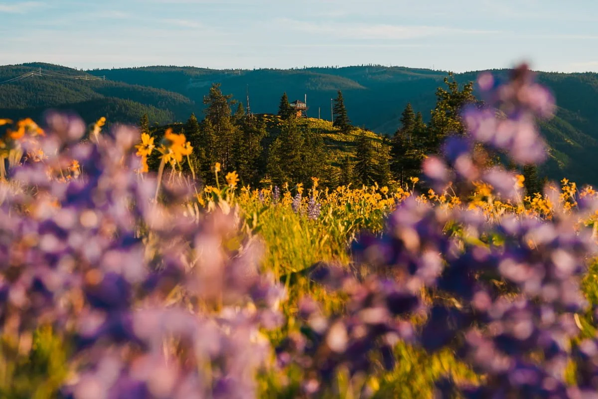
Looking at Steliko Lookout from a side trail during spring wildflowers
Hike Stats: Up to 6 miles round trip | Up to 1,680 feet of elevation gain | 2–5 hours
This is hands down one of our favorite short hikes for spring, but it also has amazing views in the summer too. Steliko Ridge is less known than the trails closer to Leavenworth and Wenatchee, and it's tucked about 45 minutes from Wenatchee, deep in the Entiat Valley.
Here's the best part: depending on your vehicle's clearance, you can drive almost all the way up to the Steliko Lookout at the top of the ridge, or park at the lower trailhead and hike up the forest road instead, adding a little mileage and elevation gain to your day. We parked at the bottom since the road is only good for high clearance vehicles, but it’s not a bad hike up and we didn’t have any cars pass us.
The hike climbs steadily up the forest road before opening onto ridge-top meadows with sweeping views of the Entiat River Valley. It's also one of our favorite spring wildflower hikes in the area, so check out our wildflower guide if you're planning an earlier-season visit.
One important note: the Steliko Lookout itself can be reserved for overnight stays. If it's occupied when you visit, please respect the guests' privacy, enjoy the views and surrounding area, and give them their space.
Since we don’t have a dedicated guide on this hike, make sure to check out the WTA hike page for more details.
Summer Hiking Gear: What to Pack for Leavenworth Trails
No matter which of these trails you pick, a few essentials should be in your pack every time you head out this summer. Central Washington's heat, exposed terrain, and fast-changing alpine weather mean it's worth taking packing seriously, even on the shorter hikes on this list. If you are wondering what to wear, check out our guide on clothing and layers for hiking and backpacking.
The Ten Essentials: Navigation, sun protection, insulation, illumination, first aid, fire starter, repair kit and tools, nutrition, hydration, and emergency shelter. It's a long-standing hiking checklist for a reason, and it applies just as much to a 3.5-mile in-town hike as it does to something like the Enchantments thru-hike.
Sun protection: With so many of these trails running fully exposed (Olalla, Nahahum, and Steliko especially), sunscreen, a hat, and a sun hoodie aren't optional. Reapply throughout the day, especially on longer hikes.
Extra water capacity: Summer heat means you'll go through water faster than you expect, and several trails on this list (Canyon Crest, Steliko, the upper sections of Nahahum) have no reliable water source along the way. Bring more than you think you need, or carry a filter if you're hiking somewhere with creek or lake access.
Layers for the alpine: Even in peak summer, weather at elevation can shift fast, we've been snowed on in the Core Enchantments in August before. Pack a warm mid-layer and a rain shell any time you're headed above treeline.


For day hikes, check out our complete Day Hike Packing List for our full gear breakdown. If you're planning an overnight in the Enchantments instead, our Backpacking the Enchantments packing list covers everything for a multi-day trip.
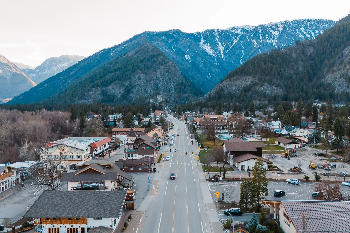
Leavenworth Travel Guide: Getting There, Where to Stay, & Extending Your Trip
Once you've picked your trail, here's everything else you need to plan the rest of your trip, from driving directions to where to sleep after a long day on the trail.
Getting to Leavenworth, Washington
Leavenworth sits right on US Highway 2, making it an easy home base for every hike on this list, whether you're heading into the Enchantments corridor or out toward Cashmere and the Entiat.
Driving from Seattle: About 2.5 hours via US-2 East over Stevens Pass. An alternate route over Snoqualmie Pass (I-90 to WA-970/WA-97 over Blewett Pass) adds about 30 minutes but can be a faster backup during Stevens Pass closures or heavy weekend traffic.
Driving from Spokane (and Eastern Washington): Around 3–3.5 hours via US-2 West or I-90 West, both routes cut through Central Washington's high desert and mountain terrain.
Flying in: Sea-Tac is the closest major airport, about 2.5 hours away by rental car. Pangborn Airport in East Wenatchee, about 30 minutes from Leavenworth, offers a shorter regional flight option via Alaska Airlines if you're already in the Seattle area.
Once you're in town, a car is essential for reaching any of the trailheads on this list, most are 10–45 minutes from downtown depending on which hike you choose.
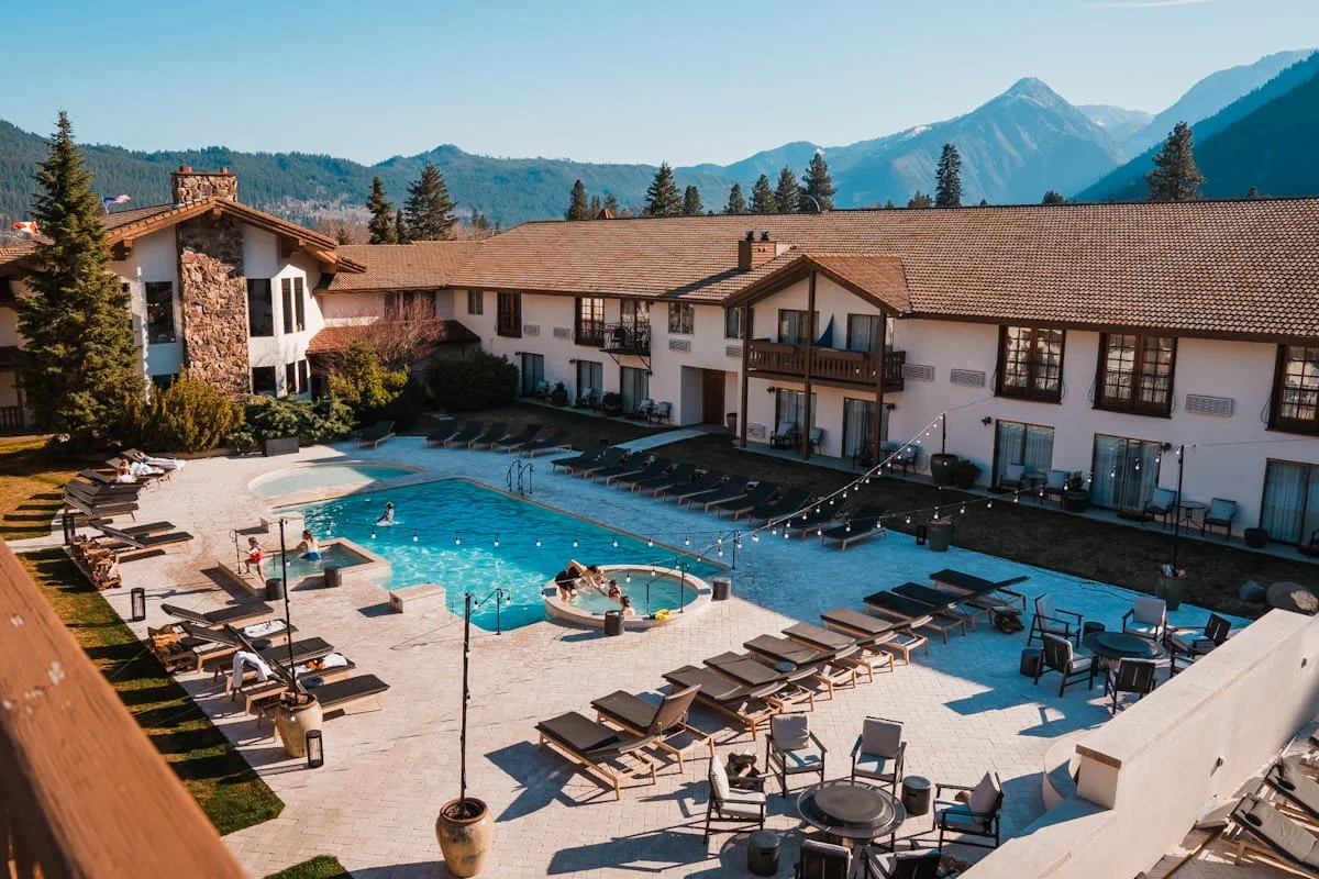
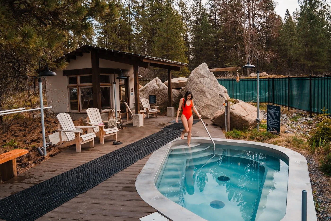
Our favorite hotel in Leavenworth, the Enzian Inn
Where to Stay in Leavenworth, WA
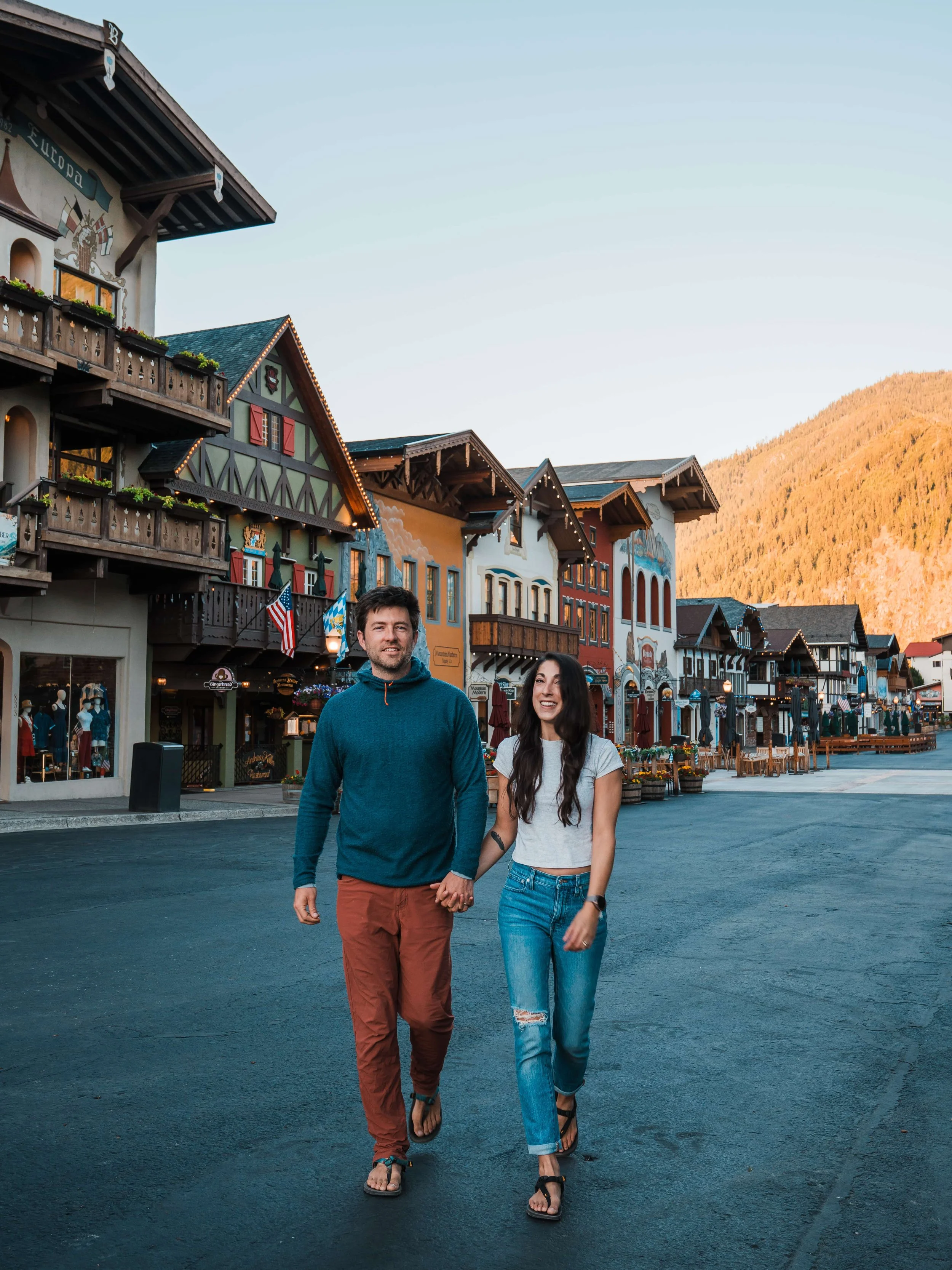
Leavenworth's Bavarian-themed downtown makes a great base for a summer hiking trip, with everything from luxury lodges to budget-friendly chain hotels nearby in Wenatchee. Check out our complete Leavenworth Lodging Guide for our full hotel and campground recommendations.
If you’re looking to stay in a hotel in town, our absolute favorite is the Enzian Inn. We’ve stayed there many times over the years and their rooms are comfortable, and they have the best breakfast we’ve had throughout the entire US.
Extending Your Trip Beyond Hiking
If you're planning to spend more than a day or two in the area, our Leavenworth Weekend Itinerary covers how to round out a trip beyond just hiking, restaurants, breweries, and other things to do in town between trailheads.
Leavenworth Hiking FAQ
What are the best beginner-friendly hikes near Leavenworth?
Canyon Crest Trail to Rat Creek is the easiest on this list at just 3.5 miles with 476 feet of gain, a great option for families or newer hikers. Lake Stuart is a step up in mileage but has a gentler, more gradual grade than most alpine lake hikes in the area, making it a solid "first alpine lake" choice.
Which hikes require a permit?
All of the hikes in this guide only require a free, self-issued day-use permit available at the trailhead, no lottery or reservation needed. The exception is if you want to camp overnight at Colchuck Lake, Lake Stuart, or anywhere in the Enchantments, which requires a separate overnight permit through the Recreation.gov lottery. You may still need a Northwest Forest/America the Beautiful Pass or Discover Pass for parking.
Are any of these hikes dog-friendly?
It varies by trail. Canyon Crest, Steliko, and Olalla Canyon Ridge all allow dogs on leash. Dogs are prohibited throughout the Enchantments (Colchuck Lake, Lake Stuart, Lake Edna, and the thru-hike), and Nahahum Trail also does not allow dogs since it crosses privately owned land.
What should I do if wildfire smoke rolls in?
Central Washington summers can bring wildfire smoke, sometimes with little warning. Check the AirNow Fire and Smoke Map before heading out, and have a backup plan. If smoke is bad on one side of the area, conditions can sometimes be clearer closer to town or at a different elevation, so it's worth checking a couple of options rather than assuming the whole region is affected equally.
Which hikes have good swimming spots?
Colchuck Lake and Lake Stuart both offer swimming, though the water stays cold well into summer at both. Lake Edna is another high-alpine option for a dip if you're up for the mileage to get there.
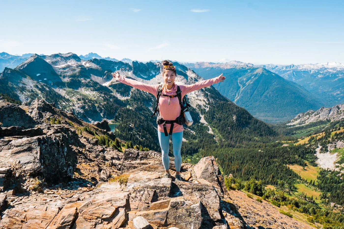
At the summit of Cape Horn, an easy hike from Lake Edna
Final Thoughts on Hiking Near Leavenworth
As a couple who spends so much time in Leavenworth each year, we may be a little biased, but we think the hiking here is absolutely amazing and worth planning a trip around. And of all the backcountry and wilderness areas, the Enchantments and the Alpine Lakes Wilderness in general includes some of our favorite hikes in all of Washington.
We hope this guide helps you plan an amazing hike here, and maybe even gets you to spend a full weekend around town. Leavenworth has so many outdoorsy activities to enjoy!
Happy hiking!
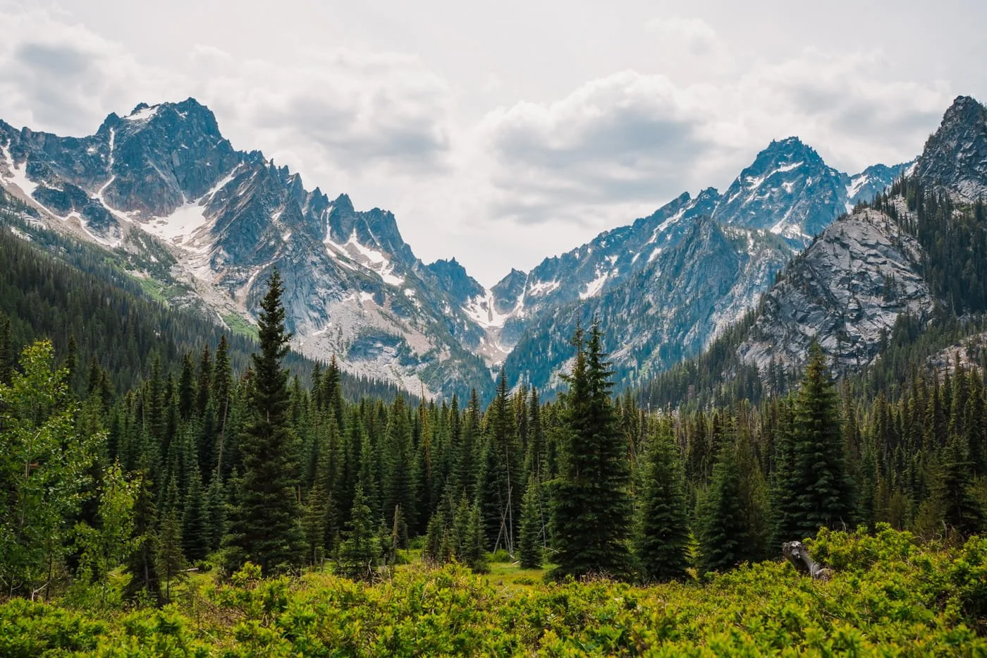
The meadow on the Stuart Lake trail
More Leavenworth & Washington Hiking Guides to Check Out
Liked this Post? Pin it & Save it for Later