
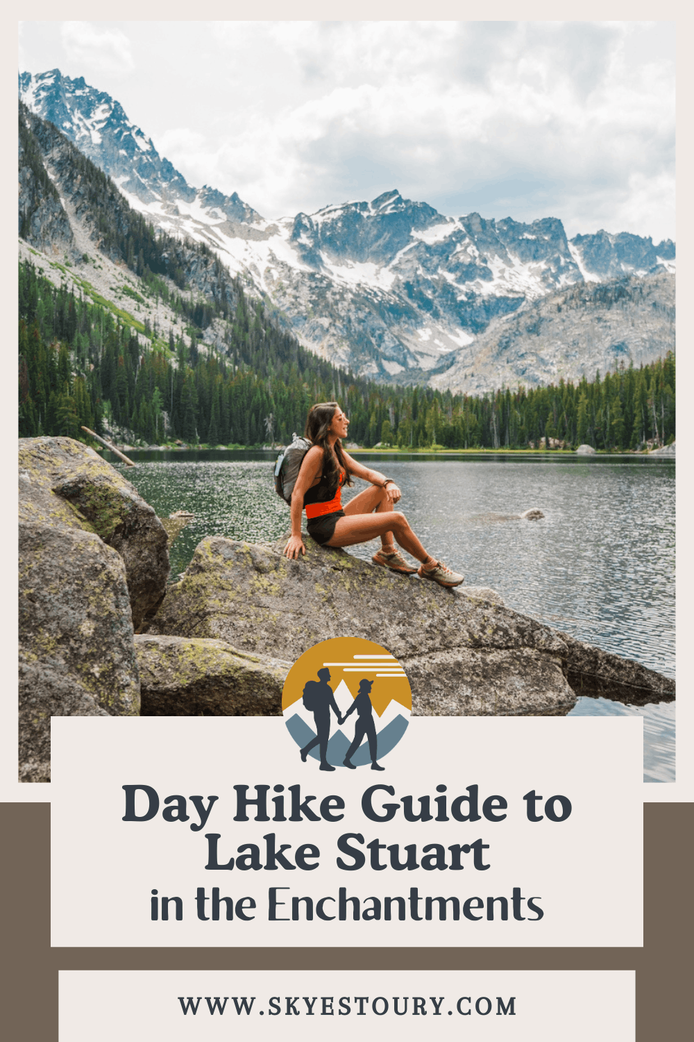
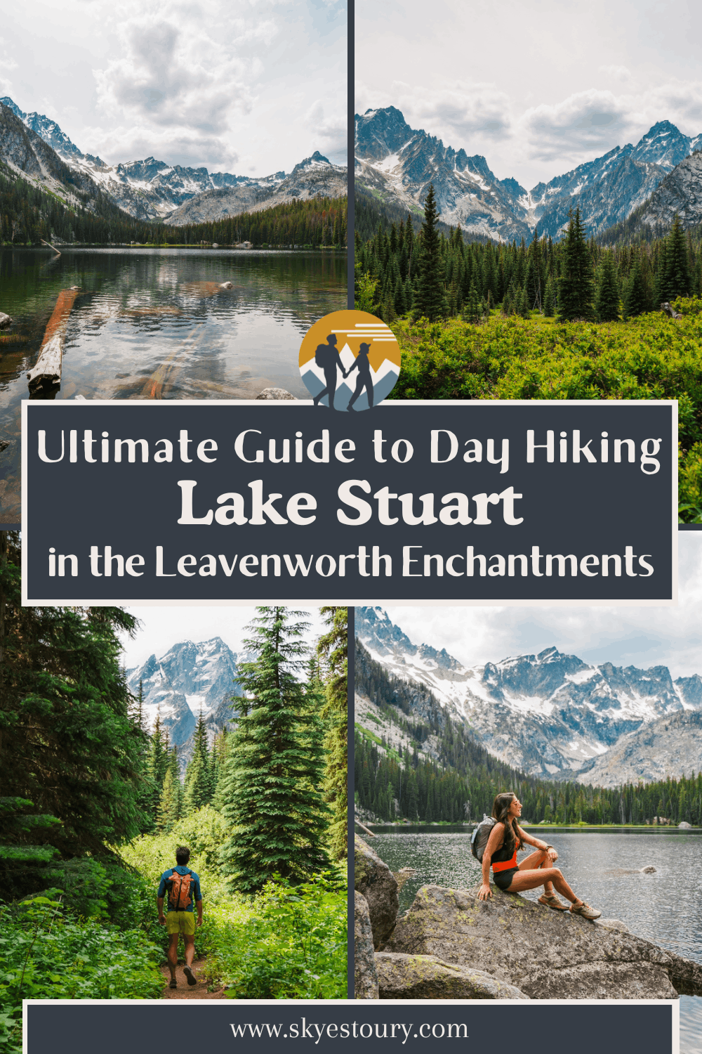
Lake Stuart Day Hike Guide: A Quieter Enchantments Trail in Leavenworth, WA

One of the Enchantments' Most Underrated Hikes: A Stunning Alpine Lake With Far Fewer Crowds
After many backpacking trips into the Enchantments Core, and countless day hikes to Colchuck Lake, we finally hiked to Lake Stuart and are so glad we did. We honestly wish we’d hiked this trail sooner! Lake Stuart is a much lesser hiked lake in the Enchantments, and it’s one that we waited years to hike because we weren’t sure if it would be worth it, but it was. If you are looking for a much quieter experience with a stunning view, this is the perfect Enchantments hike for you.
The trail to Lake Stuart climbs about 1,663 feet over 8.92 miles round trip, mostly along Mountaineer Creek through forest, making this one of the more forgiving hikes in the Enchantments area. It is longer in mileage than Colchuck, but it is less elevation gain and includes stunning mountain views.
Compared to the nearby and very popular Colchuck Lake and Core Enchantments, Lake Stuart is a quieter but no less picturesque option. The hike starts at the same trailhead (so the same crowded parking lot), but once you pass the trail junction with Colchuck, it sees a fraction of the foot traffic, even on the busiest summer weekends.
Lake Stuart is an easy recommendation for hikers who want the Enchantments experience without Colchuck's crowds or steep, rocky final approach. It’s a hike we highly recommend and wish we had done sooner.
→ If you’re interested in hiking Colchuck as well, check out our complete Colchuck Lake day hike guide. Both hikes share the same trailhead and the first 2 miles of trail. Another great option if you have a lot of time (a full 12-20 hours), is the full Enchantments thru hike in a day.
→ And a quick note about the naming conventions in this blog and on maps: The official name of the lake is Lake Stuart but the trail and trailhead are referred to as Stuart Lake Trail and Stuart Lake Trailhead. Confusing but we want to follow USFS map naming conventions.
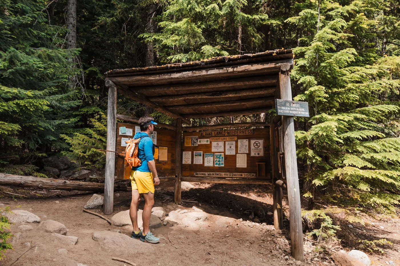
Lake Stuart Trailhead Kiosk
Quick Trail Stats: Hiking to Lake Stuart
Distance
8.9 mi (14.4 km) round trip
Elevation Gain
1,663 ft (507 m)
Difficulty
Moderate
Duration
4-6 hours
Day-Use Permit
Free self-issued at trailhead kiosk
Parking Pass
Northwest Forest Pass or America the Beautiful
Vehicle Access
All vehicles
Dogs
No dogs permitted
Cell Service
None
Popularity
Low, but shares a very popular trailhead
Affiliate Disclaimer: This blog post contains affiliate links, meaning we receive a small commission of every purchase made with our links at no additional cost to you. Sometimes there is even a discount code for our readers which we specify next to the links.
Table of Contents
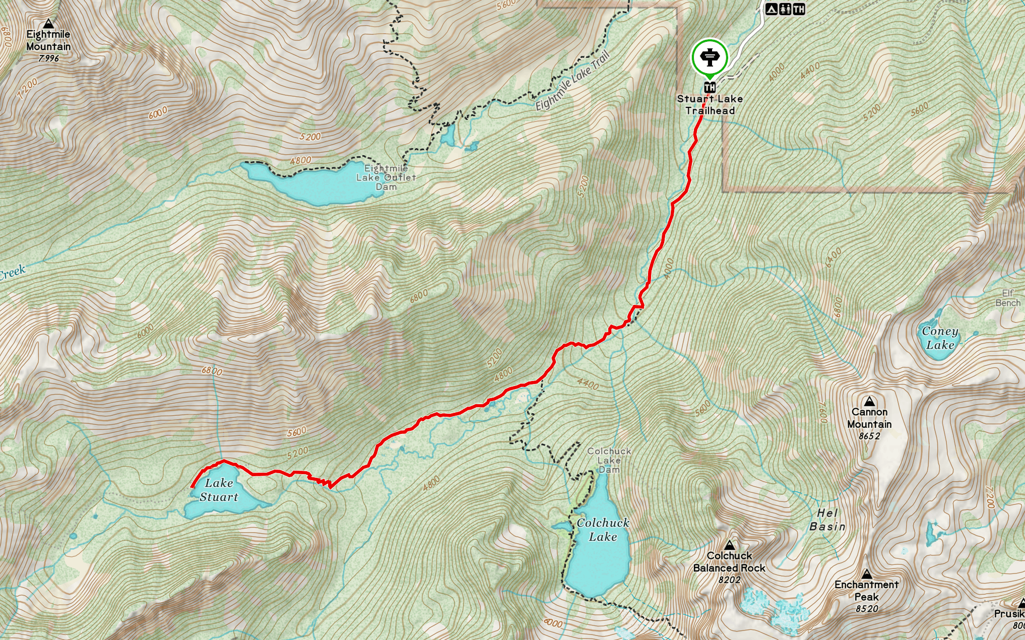
Overview map of the trail from Stuart Lake Trailhead to Lake Stuart
Where is Lake Stuart Located?
Lake Stuart is located in the Enchantments, within the Alpine Lakes Wilderness, approximately 15 miles southwest of Leavenworth, Washington. The lake sits in a broad meadow basin at the base of Mount Stuart's north face, one of the highest non-volcanic peaks in Washington. The lake is accessed via the Stuart Lake Trailhead off of Icicle Creek Road, the same trailhead used for the popular Colchuck Lake hike, so be prepared for tough parking every day of the week, but especially on weekends.
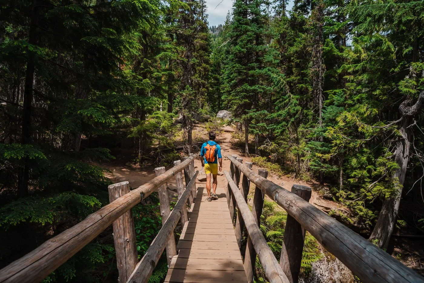
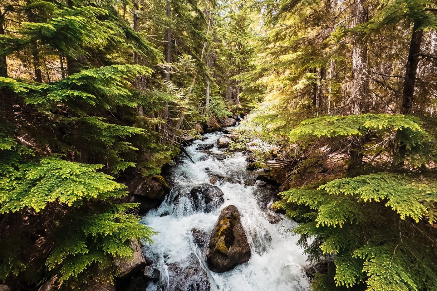
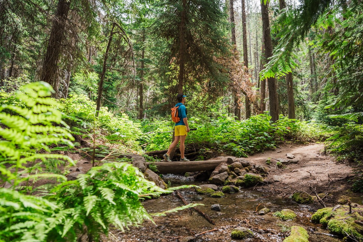
Bridge crossing over Mountaineer Creek
Stuart Lake Trail Hike Difficulty
The trail to Lake Stuart is a moderate hike, but is noticeably gentler than going up to Colchuck Lake. The grade is steady rather than steep, climbing gradually alongside Mountaineer Creek for most of the route before leveling out into open meadows near the lake. There are some rocky and rooted sections and as of late June, 2026 some down trees to navigate as you get closer to the lake.
Trekking poles are still helpful, especially on the way down, but this is a much more approachable hike for those newer to alpine terrain. If you're comfortable on trails with sustained, gradual uphill, you'll be fine. But still be prepared for a 4-6 hour hike depending on your level of fitness.
You'll Love Hiking the Stuart Lake Trail If You:
Have hiked 6–10 miles before with 1,500+ feet of elevation gain
Want an alpine lake experience without Colchuck's crowds or steep final approach
Are looking for a good "first alpine lake" hike in the Enchantments area
Consider a Different Hike If You:
Are looking for a short, easy walk under 4 miles
Want the most dramatic mountain scenery in the area (consider Colchuck Lake instead)
Are hiking with very young children or beginners unfamiliar with sustained elevation gain
Lake Stuart Hiking Guide: Route, Distance & Elevation Gain
Shoreline view from Lake Stuart
The Stuart Lake Trail begins at the Stuart Lake Trailhead and follows the same trail as Colchuck Lake for the first 2 miles before forking off toward Lake Stuart at a signed trail junction. If you get to the log bridge creek crossing into a large boulder field, you have gone too far, the trail junction was just before this crossing.
The total round-trip distance is 8.9 miles (14.4 km) with 1,663 ft (507 m) of elevation gain.
Stuart Lake Trail Elevation Profile
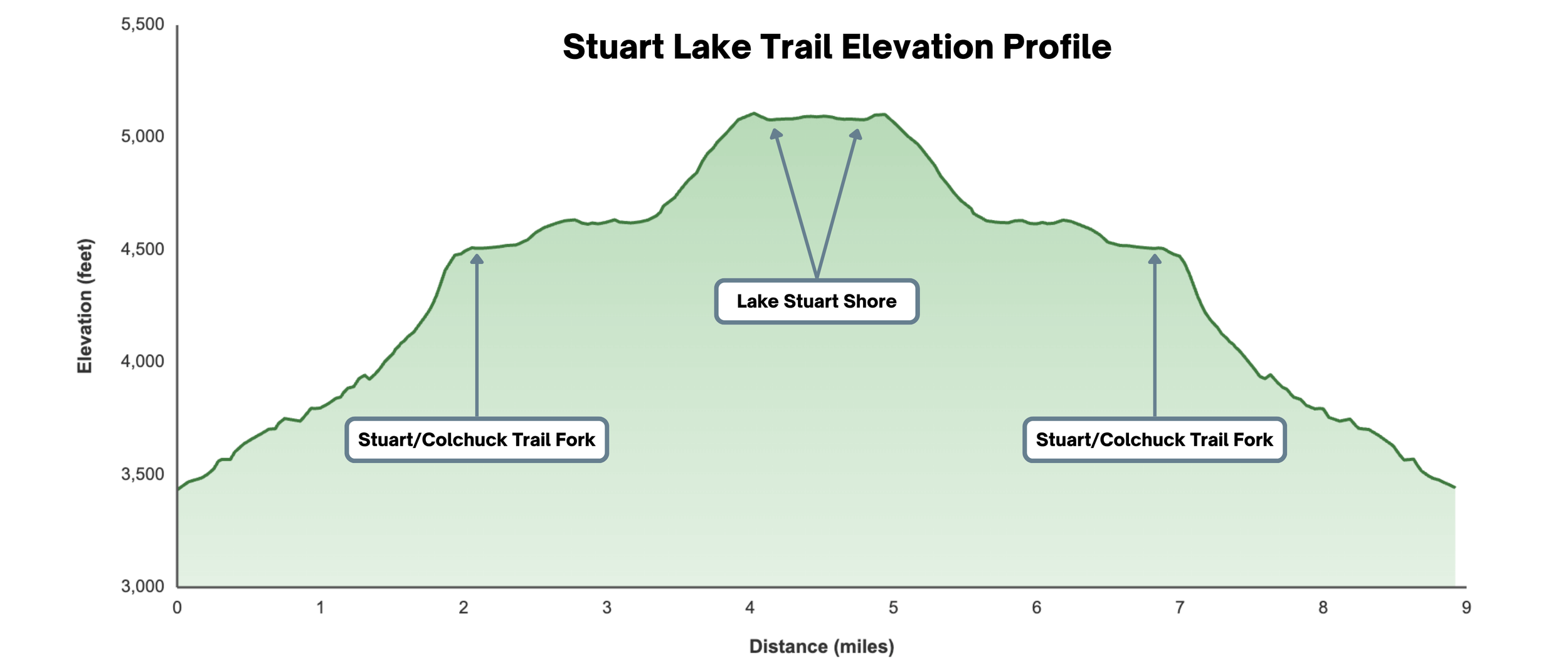
Roundtrip elevation profile from Stuart Lake Trailhead to Lake Stuart
Trail Section 1: Stuart Lake Trailhead to the Trail Junction with Colchuck Lake (Mile 0–2)
Early section of Lake Stuart trail
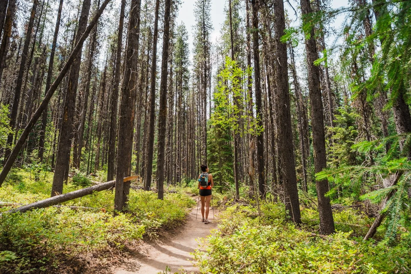
The trail begins at the far end of the Stuart Lake parking lot (same as Colchuck Lake). The first section is a gentle grade for the first mile and forested, following along the side of Mountaineer Creek.
After crossing the bridge over Mountaineer Creek, you will start to gain more elevation, but it remains more gradual than the upper section of the Colchuck Lake trail.
Take care with your footing on the uneven terrain, there are roots and boulders throughout the trail. At approximately 2 miles, you'll reach a signed trail junction. Continue right at the fork for Lake Stuart.
Section Stats:
Distance: 2 mi (3.2 km)
Elevation Gain: ~1,048 ft (319 m)
Terrain: Forested trail, moderate grade, footbridge crossing
Estimated Time: 45–75 min
Section 2: Trail Junction to Lake Stuart (Mile 2–4.46)
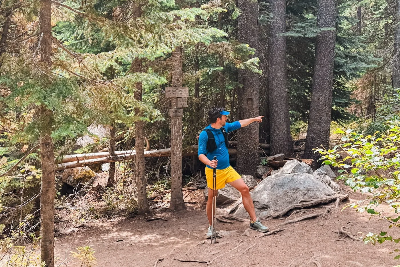
Be sure to head right at the Lake Stuart/Colchuck Lake junction
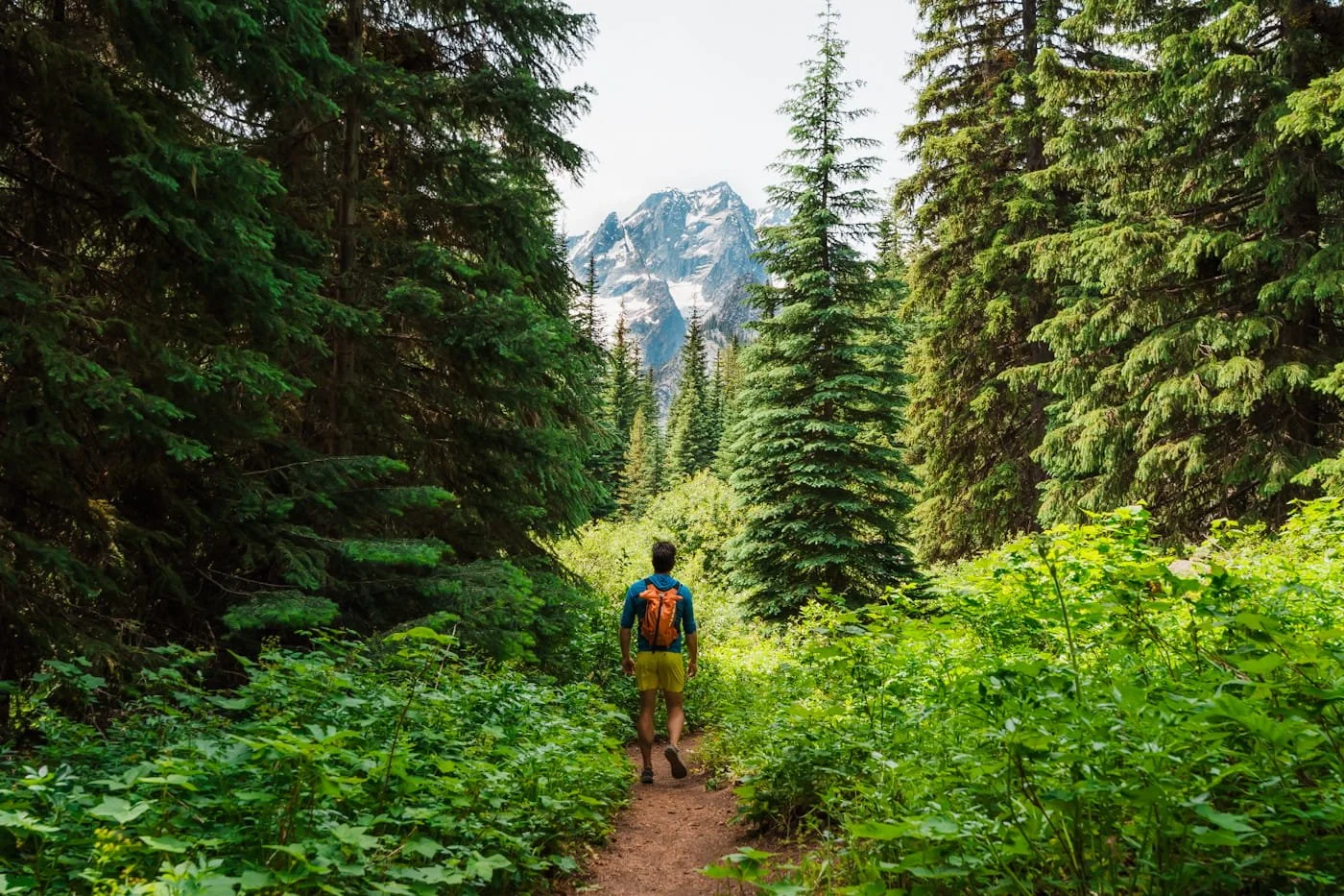
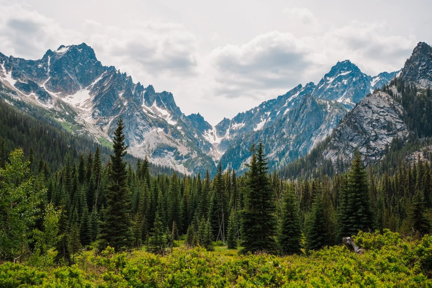
After the junction, the trail to Lake Stuart mellows out considerably compared to the Colchuck side. The grade eases a little and the trail continues alongside Mountaineer Creek through forest before opening into a broad subalpine meadow with amazing mountain views.
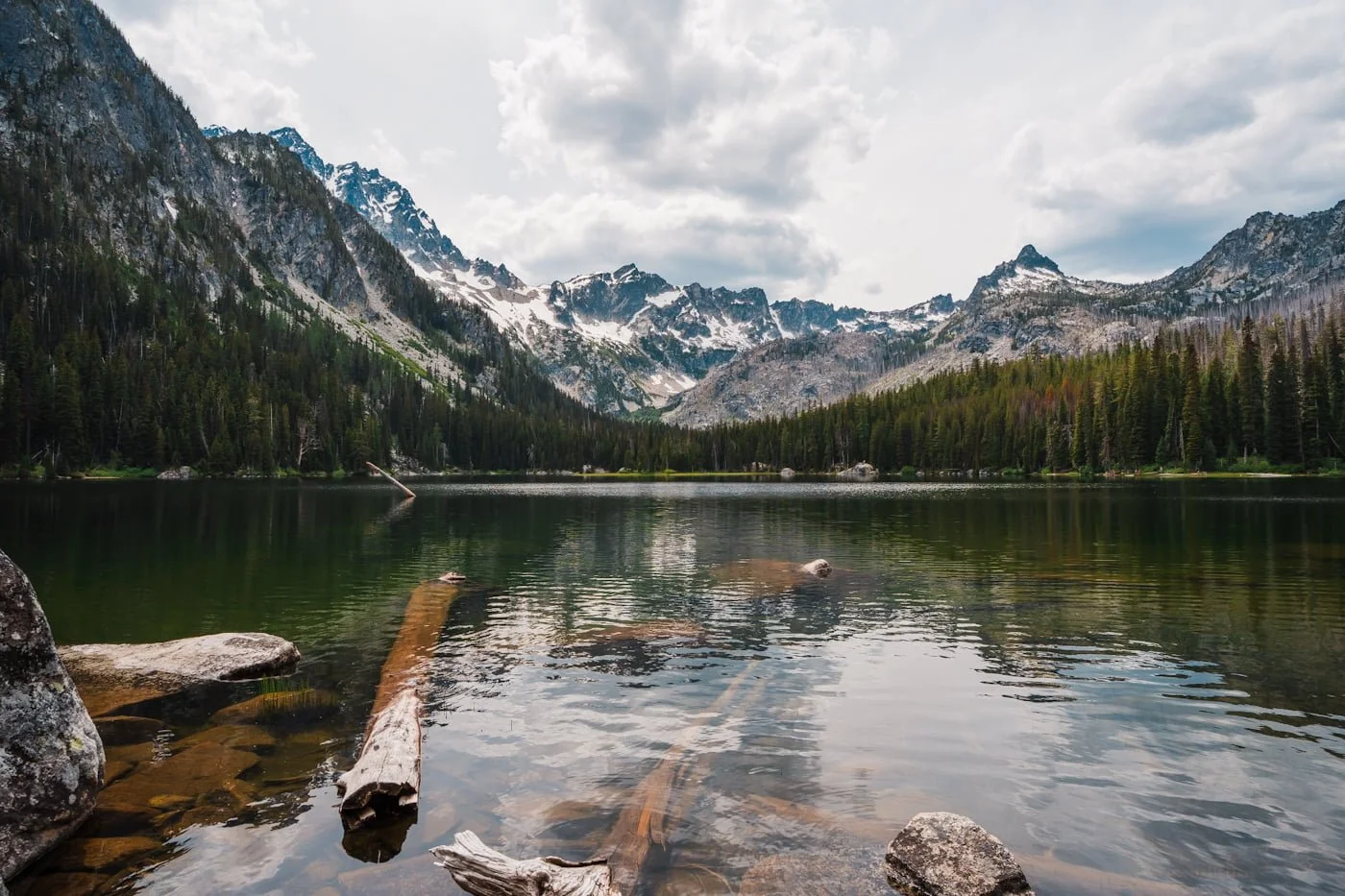
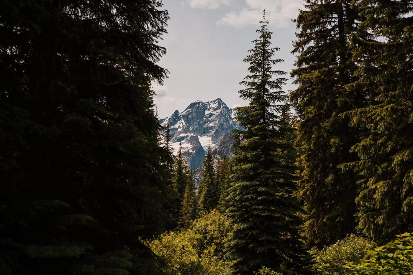
As you approach the lake, the trees thin out and you hike through a meadow where Mount Stuart's massive north face comes into view, dominating the skyline above. This section of the hike is absolutely stunning and worth stopping to take a few photos, before continuing on to the lake.
Section Stats:
Distance: ~2.46 mi (4 km)
Elevation Gain: ~615 ft (188 m)
Terrain: Gradual forested climb, opening into meadow near the lake
Estimated Hiking Time: 1–1.5 hours
Section 3: Reaching Lake Stuart and What to Do When You Get There
Shoreline of Lake Stuart in late June
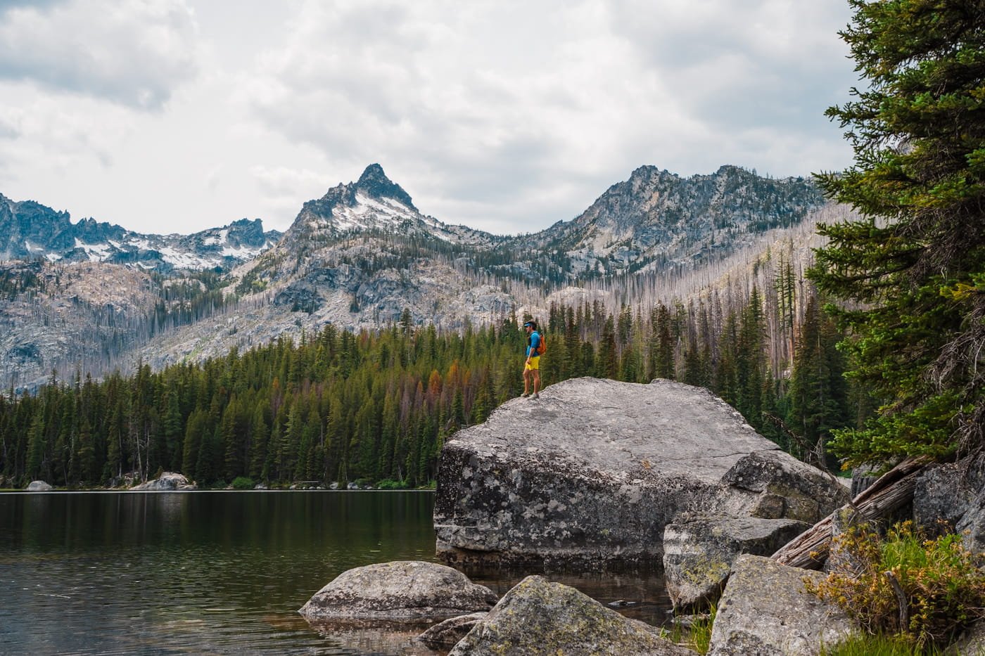
Lake Stuart sits in a more open, alpine basin, a contrast to Colchuck's dramatic granite cirque. Mount Stuart rises above the far end of the lake but is mostly hidden by another ridgeline, and with Sherpa Peak visible to the east. The shoreline here is smaller than at Colchuck, and you need to take a left at the first trail break to get the best views of the peaks. Continuing around the lake is still beautiful, but you won’t get the same mountainous views.
The lake is shallow enough in places to make it a genuinely pleasant summer swimming spot but expect a silty bottom and underwater vegetation near the shore.
View of Argonaut Peak (left) and Sherpa Peak (right) from Lake Stuart Trail
The Best Time to Hike Lake Stuart
The season you choose to hike dramatically affects your experience at Lake Stuart. Trails, snow coverage, and the color and mood of the lake all change throughout the year. The table below covers what to expect each season so you can plan accordingly.
Hiking Seasons at a Glance
| Season | Conditions | Recommended Gear | Recommendation |
|---|---|---|---|
| Early Season May – Early June Intermediate |
|
|
A good option for a quieter early-season hike. Lake Stuart's gradual, lower-exposure approach is more forgiving than Colchuck's in early season, but the meadow near the lake can still hold snow and mud. Note the road up to the trailhead reopens typically in early May, but this depends on snowmelt. |
| Peak Summer July – Mid-August All Skill Levels |
|
|
Ideal for most hikers and a great first alpine lake hike. The trail will be fully clear and the gentle grade makes it approachable for newer hikers. Start early, the shared trailhead lot fills by 8 AM on weekends. Monitor air quality during wildfire season. |
| Late Summer Late August – Mid-September All Skill Levels |
|
|
One of the best times to hike. Warm temps, fewer bugs, no snow, and pleasant swimming conditions in the meadow shallows. |
| Larch Season Late September – Early October All Skill Levels |
|
|
A nice, quieter larch-season alternative if you want a break from Colchuck's crowds. The open meadow gives a different, more spread-out view of fall color than Colchuck's basin. Start early, the shared parking lot still fills fast this time of year. |
| Shoulder Season Mid-October – November Advanced |
|
|
Not recommended for most hikers. Snow can linger in the meadow well into the season, and trail conditions become unpredictable without proper traction gear and experience. Check road closure and conditions before heading out. |
Additional Resources to Check Out Before Your Hike
NOAA Point Forecast for the Lake Stuart Area - Detailed hourly temperatures and conditions
USFS Enchantments Page - Rules, regulations, and area updates
Washington Trails Association Lake Stuart Trip Reports - Trail condition updates from the hiking community
Air Now Fire & Smoke Map - Air quality and wildfire closures
Sunrise/Sunset Times - Plan your start time around available daylight
GaiaGPS Enchantments Route - Our free GaiaGPS map layer with the route, parking, camping and bathrooms marked
Start of Lake Stuart trail
Stuart Lake Trailhead: Parking, Permits & Trailhead Information
The Stuart Lake Trailhead is a well-established trailhead with parking, but there are a few things worth knowing before you arrive. Though Lake Stuart is a lot less popular then Colchuck Lake, they share the same parking area and so it can be very busy on weekends and even weekdays in the summer.
Seasonal Trailhead Access
Although hiking is technically open year round, the roadway off of Icicle Creek Road is closed seasonally in the winter due to snow. Typically, the road is clear of snow and reopens to the trailhead in early May, but this depends on seasonal snowmelt.
If you’re looking to hike in the early spring or late fall, check in ahead of time with the USFS Ranger Station.
Parking at the Stuart Lake Trailhead
The lot is a standard gravel pullout with space for roughly 30–35 vehicles and additional parking along the north side of the forest road. You must display a Northwest Forest Pass ($5/day or $30/annual) or an America the Beautiful pass on your dashboard, there is not a way to pay to park once you arrive.
Do not park in any spaces marked for overnight permit holders; those spots are reserved exclusively for backpackers with overnight permits and are enforced (you will get ticketed or towed). Overflow parking extends down the access road, but obey all posted “No Parking” signs. Rangers actively ticket vehicles that block the road or park in restricted areas.
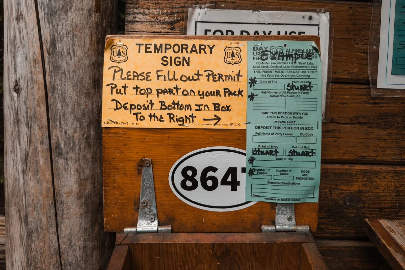
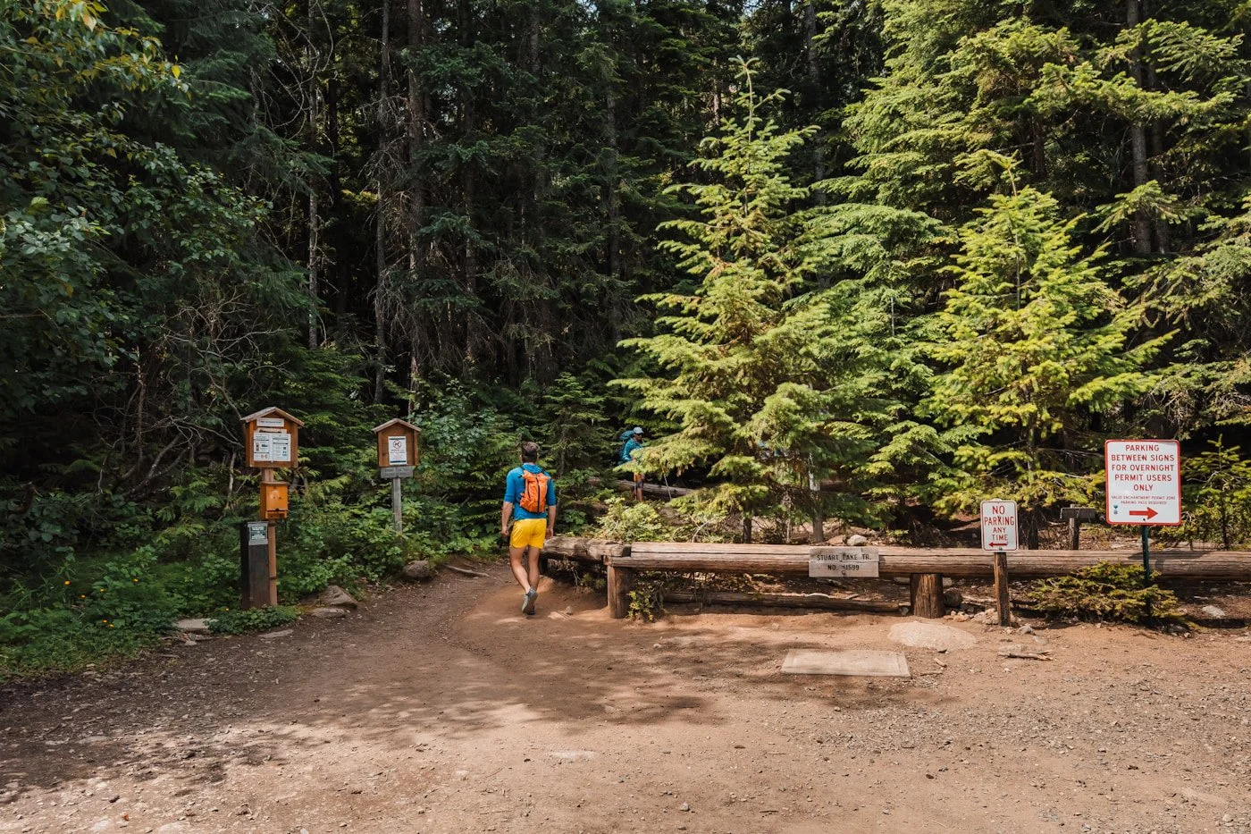
Self-Issue Permit Kiosk
The free day-use permit kiosk is located at the trailhead, right at the start of the trail. Fill out your permit for your group and display it on one person’s pack throughout your hike.
Restrooms
Pit toilets are available at the trailhead. They can get rough on busy summer weekends though , so always pack a personal supply of toilet paper.
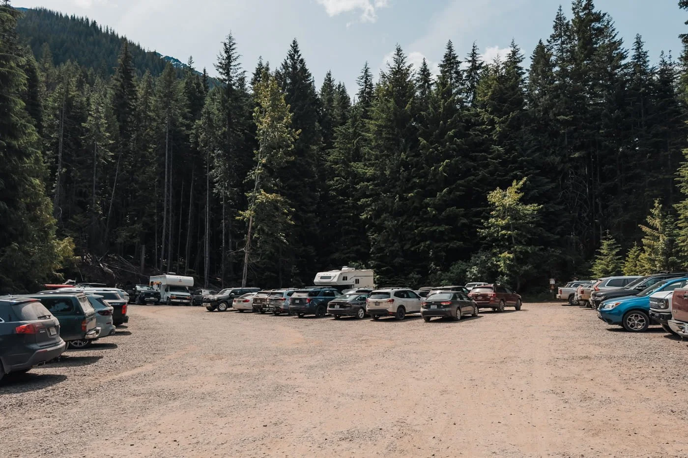
Lake Stuart trailhead parking lot
Tips To Get a Parking Spot at the Stuart Lake Trailhead
The Stuart Lake Trailhead parking lot fills fast on summer weekends and even earlier during larch season. If you arrive and the lot is full, have a backup hike in mind. Or, even better, see our recommendations below on how we have been able to get a parking spot, even on weekends.
Here’s What We Recommend:
Get there early: During peak summer and fall months, the trailhead fills up fast. During the summer, even on weekdays, the parking lot can be full by 8:00 AM. During larch season, it can be full even earlier. Starting before sunrise puts you at the lake during the best light of the day. During peak season, we typically aim to start no later than 7:30 AM on weekends and 6:00 AM on popular larch season weekends.
Carpool to the trailhead: If you’re meeting friends, you can carpool from Leavenworth or a pullout along Icicle Creek Road and cut back the number of parking spaces you need.
Book a trailhead shuttle in advance: Two local companies offer service to the Stuart Lake Trailhead. Inquire for specific time and costs to/from the trailhead. Shuttles are especially worth considering during larch season when the lot is at its most chaotic.
Alternate Hike Options if the Stuart Lake Trailhead is Full
It happens (a lot), especially on summer weekends, the Stuart Lake Trailhead fills fast and fills early. Don't let a full parking lot derail your day. Here are tips if it’s full when you arrive.
Come back later in the day: Most day hikers start early and are back at their cars by early afternoon. If you arrive and the lot is completely full and there aren’t spot along the north side of the forest road, driving back around 3:00-4:00 PM often frees up spots as morning hikers clear out. Not as many hikers go in for sunset, if you do, make sure to pack a headlamp.
Park back at the Eightmile Trailhead: When the main lot is full, it’s possible to hike in from the Eightmile Lake Trailhead. That will add an additional 1.7 miles round trip to your day. Obey all posted No Parking signs and don't block the road. Rangers do ticket, and the access road is narrow.
Pivot to a nearby hike: If the lot is full and you don't want to wait or shuttle, the Icicle Creek corridor has solid backup options within a short drive.
Eightmile Lake is another option in the same corridor. It sits in its own quiet drainage in the Eightmile/Caroline Zone of the Alpine Lakes Wilderness and sees a fraction of the Colchuck crowd. The trail is about 6 miles round trip with around 1,400 feet of gain, leading to a beautiful alpine lake backed by mountains.
Icicle Ridge is several miles back towards Leavenworth on Icicle Creek Road, requires no permit or parking pass, and delivers sweeping ridgeline views of Leavenworth and the surrounding Cascades. It's 4.8 miles round trip with 1,800 feet of gain. Dogs are welcome on leash.
Flat and well shaded early section of Stuart Lake Trail
Safety & Tips for Hiking to Lake Stuart
While Lake Stuart is a day hike, it's still an alpine hike in the Cascades. Here are the key safety considerations we always keep in mind on this trail.
Water & Creek Crossings: Mountaineer Creek is bridged and easy to cross. Always bring plenty of water (1.5–2L) and/or a water filter. There are good water sources along the trail and at the lake. If filtering from the creek, be careful of high spring flows and choose a safe access point to collect water.
Mosquitoes in the Meadow: The meadow near Lake Stuart can have intense mosquito activity, especially in late spring and early summer. Bring bug spray and consider a head net if you're sensitive to bites.
Weather Changes Quickly at Elevation: Lake Stuart sits at roughly 5,060 feet and is exposed to alpine weather. Even on days that look clear in Leavenworth, conditions at the lake can be cold, windy, or wet. Always carry an extra layer and a rain jacket. Check the NOAA mountain forecast the day before you go.
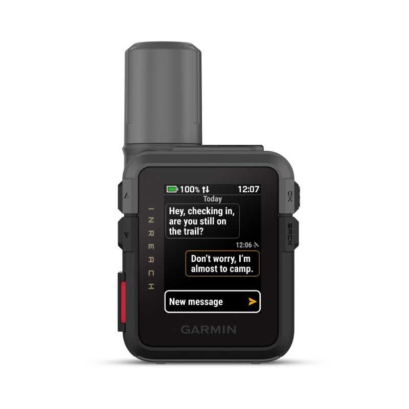
Cell Service: Expect no cell service once you enter Icicle Creek Canyon just outside of Leavenworth. Download our GPS track before you leave the parking lot and consider carrying an activated satellite communicator for emergencies.

The best photo spots along the Lake Stuart shoreline
What to Pack for Your Lake Stuart Day Hike
Sure, it’s a day hike, but we see so many unprepared hikers along this trail, so it’s very important to make sure you have all the gear, water, snacks, and extra layer you need to have a good time and be a responsible hiker. Below is what we personally carry and recommend for this hike.
→ For a more comprehensive packing list with everything we bring on day hikes, see our Day Hike Packing List.
Navigation & Safety
Navigation App: We use GaiaGPS to download and view the trail track before and during the hike. The app and mapping works offline with no cell service, just be sure to download the map area before you head out of service. We created a free route for you with the trailhead and trailside bathrooms marked.
Satellite Communicator: Garmin InReach Mini 3, for SOS capability and backcountry messaging.
Headlamp: If you start before sunrise, linger at the lake or move slower than expected, you may be moving in darkness. We regularly pack our ultralight Nitecore NU25 for hikes.
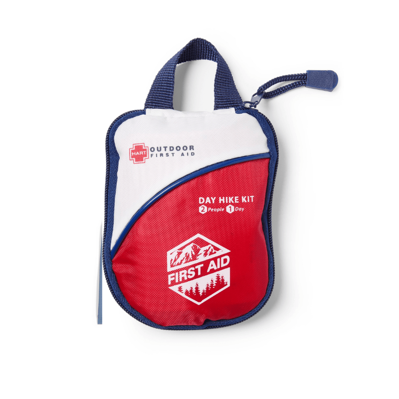
Basic First Aid Kit: We always carry a small first aid kit for minor cuts, blisters and other issues that arise on the trail.
Traction (Seasonal)
Microspikes: Might be needed for early season (May) and late shoulder season (October - November). We use Kahtoola Microspikes on our boots or trail runners when needed.
Hiking Shoes & Trekking Poles
Trekking Poles: Helpful on the steep descent, especially if your knees get tired on long downhills. We prefer collapsible or Z-style trekking poles for easy pack storage.
Hiking Boots or Trail Runners: We both hike in trail runners for all of our summer day hikes, and prefer them over boots. The terrain is rocky enough on this trail that you want solid grip, but not technical enough to require heavy boots. We cover some of our favorite footwear on our complete What to Pack For a Day Hike Guide.
Hydration & Water Capacity
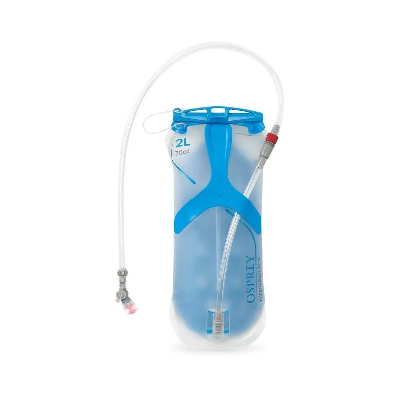
Water Bottles or Water Reservoirs: For this hike, you’ll want to carry at least 2L of water unless you plan on filtering water along the way.
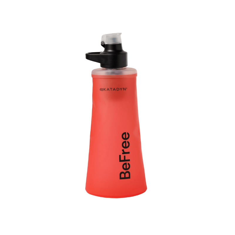
Water Filter: If you’d like to filter water, you can fill up at Mountaineer Creek or at the lake. Katadyn BeFree 1L is our favorite on-the-go filter.
Sun & Weather Protection
Sun Hoodie: The exposed upper trail and lakeside can be hot and sunny. A good sun hoodie is one of the best investments for Pacific Northwest hiking. We love the Outdoor Research Astroman Air Hoodie. For more info, check out our deep dive into other sun hoodies on our Best Sun Hoodies for Hiking Guide.
Rain Jacket: If rain is in the forecast, you’ll want to have a rain layer. Outdoor Research Helium Rain Jacket is lightweight and packs small. This is a great just-in-case wind/rain layer when rain is unlikely. If there is serious rain in the forecast, you’ll want something more waterproof like an Outdoor Research Aspire/Foray Rain Jacket.
Sunscreen: Dermatone Sport Sunscreen is our long time favorite. Reapply at the lake, especially if you're spending time on the reflective water's edge.
Blister Prevention
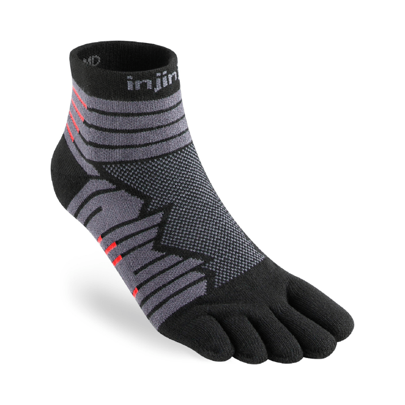
Hiking Socks: Injinji Toe Socks are our favorite for dusty and high mileage days. Yes, toe socks can be a little weird at first, but they are genuinely excellent for toe blister prevention on long rocky hikes.
Blister Tape: We love Leukotape K. It holds on to sweaty feet and stretches with movement. The key is to apply it to known hot spots before you start.
→ Make sure to check out our full Day Hike Packing List for everything we recommend packing on alpine day hikes.
Hiking Gear We Use & Love


Views along the Stuart Lake Trail
Leave No Trace at Lake Stuart
Lake Stuart sees real foot traffic, much of it from hikers using this trailhead to access Colchuck Lake and the Core Enchantments. With high foot traffic comes real impact, from damaged vegetation to crowded shorelines and waste left behind. With ongoing USFS staffing cuts affecting ranger presence on the ground, it's more important than ever that every hiker who visits takes LNT seriously.
Here’s How to Be a Responsible Hiker:
- Stay on trail. The alpine environment around Lake Stuart is fragile and extremely slow to recover. Don't shortcut switchbacks, and stay on rock or established trail when moving around the lake.
- Pack out everything. All trash, food scraps, and toilet paper. If you packed it in, pack it out.
- Waste disposal. Use the vault toilets at the trailhead before you leave. If you need to go on trail, use the provided pit toilets or dig a cat hole at least 6–8 inches deep and 200 feet from any water source, trail, or camping area.
- Don't feed wildlife. The grey jays and chipmunks are very bold. Don't encourage them — human food is harmful to wildlife and creates problem animals.
- Leave rocks and plants. Don't build cairns, pick flowers, or move large rocks.
- Be considerate of others. This trailhead draws a lot of people. Keep noise down at the lake, give other hikers space, and yield to uphill hikers on the trail.
- Drones are not permitted. As a wilderness area, drones are not allowed.
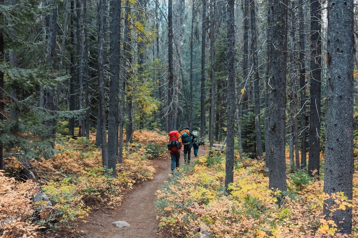
Backpackers hiking along the Stuart Lake Trail
Overnight Backpacking at Lake Stuart
Lake Stuart is an amazing backpacking destination and it is part of the Enchantments permit lottery. Overnight Enchantment permits for either the Stuart or Core Zones are required to stay overnight at Lake Stuart.
Camping sites are all marked on our GaiaGPS Enchantments Map. Check out the following pages for more details on the permit system and what to pack for backpacking in the Enchantments:

Overview map from Leavenworth Washington to Lake Stuart Trailhead
How to Get to Lake Stuart
The Stuart Lake Trailhead is the starting point for the Lake Stuart hike and is accessed via Icicle Creek Road southwest of Leavenworth. The drive from Downtown Leavenworth to the Stuart Lake Trailhead normally takes around 35-40 minutes.
→ Road conditions worth noting: Icicle Creek Road is paved but be very aware of potholes. The final spur road to the trailhead is a very steep, unpaved gravel roadway. All standard vehicles, even with low clearance can make it with careful driving.
| From | Distance | Drive Time | Route |
|---|---|---|---|
| Leavenworth, WA | ~13 miles | ~33 minutes |
Leavenworth → Icicle Creek Road → Eight Mile FS Road 7601 |
| Seattle, WA | ~150 miles | ~3.5 hours |
I-5 → I-405 N → WA-522 E → US-2 East over Stevens Pass → Leavenworth → Icicle Creek Road → Eight Mile FS Road 7601 Alt: I-90 over Snoqualmie Pass → WA-970 → WA-97 over Blewett Pass → US-2 W. Adds ~30 min but useful during Stevens Pass closures. |
| Bellevue / Eastside, WA | ~120 miles | ~3 hours |
I-90 E or WA-520 E → US-2 East over Stevens Pass → Leavenworth → Icicle Creek Road → Eight Mile FS Road 7601 |
| Wenatchee, WA | ~35 miles | ~1 hour |
US-2 West to Leavenworth → Icicle Creek Road → Eight Mile FS Road 7601 |
| Spokane, WA | ~200 miles | ~3.5 - 4 hours |
US-2 West or I-90 West → US-2 to Leavenworth → Icicle Creek Road → Eight Mile FS Road 7601 US-2 is more direct and scenic through central Washington's high desert. |
Directions From Downtown Leavenworth
Drive southwest on Icicle Creek Road
Continue approximately 8 miles on Icicle Creek Road
Turn left onto the steep gravel road to the Stuart Lake Trailhead (signed)
The parking area is at the end.
Google Map Directions from Downtown Leavenworth

Your Lake Stuart guides enjoying downtown Leavenworth, WA
Where to Stay Near Lake Stuart: Leavenworth Hotels & Camping
If you’re planning hikes in the Enchantments, you’re going to want to stay in Leavenworth, Washington, a charming Bavarian-themed mountain town about 25 minutes from the main trailheads. We love spending time in town before or after hikes, and it’s honestly a really great weekend spot if you’re coming from Seattle or Eastern Washington.
Leavenworth has a lot of great restaurants and breweries, a couple gear shops, and a wide range of lodging options. See our complete Leavenworth Lodging Guide for in-depth hotel and camping recommendations.

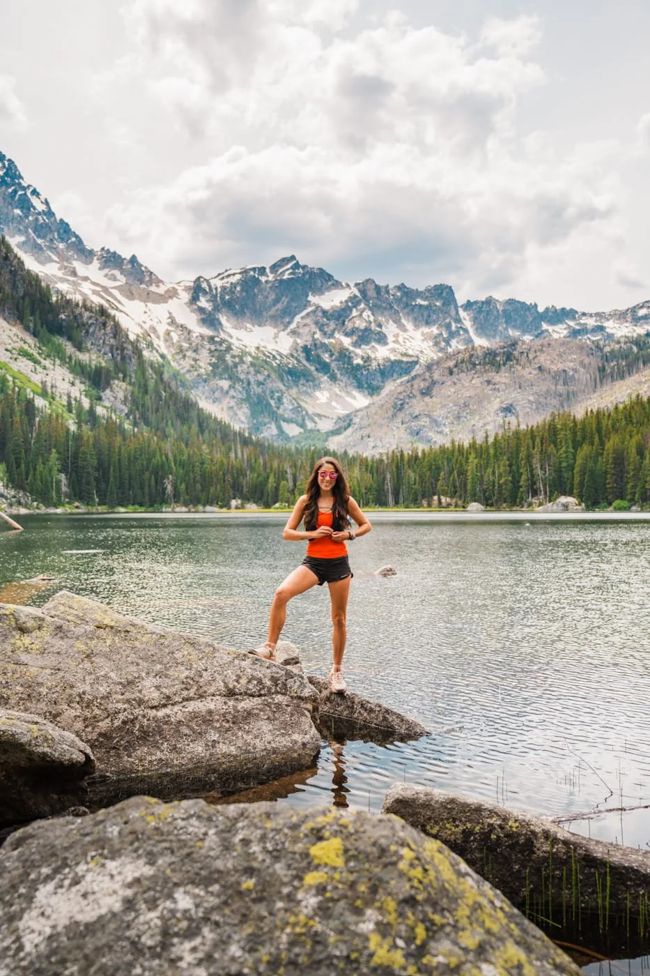
Enjoying the Stuart Lake waterfront views
FAQ: Day Hiking Lake Stuart
How hard is the Lake Stuart hike?
The Stuart Lake trail is rated moderate. The trail gains ~1,663 feet over ~4.46 miles one-way, with a gradual, steady climb through forest and a gentle meadow approach near the lake. It's a noticeably easier hike than its neighbor Colchuck Lake, and a good option for hikers building up to bigger alpine objectives.
Do I need a permit to hike Lake Stuart?
Yes, you need to fill out a free, self-issued day-use permit available at the trailhead kiosk, no reservation required for day hiking. You also need a Northwest Forest Pass or America the Beautiful Pass for parking. If you want to camp at Lake Stuart, that requires a separate overnight permit for the Stuart Zone through the Recreation.gov lottery.
How long does it take to hike to Lake Stuart?
Most hikers complete the round trip in 4–6 hours depending on pace, how long you spend at the lake, and fitness level. Strong hikers who move efficiently can do it faster; plan for the higher end of that range if you want to relax at the lake and take your time.
What time should I start the Lake Stuart hike?
Start by 7:30–8:00 AM on summer weekends to guarantee parking, since this trailhead also serves Colchuck Lake and Core Enchantments traffic. An earlier start also means better morning light at the lake.
Are dogs allowed on the Stuart Lake trail?
No. Dogs are prohibited throughout the Enchantments permit area, including the trail to Lake Stuart. This is actively enforced by rangers.
Is there water on the Stuart Lake trail?
Yes, there's a good water source at Mountaineer Creek (bridged, ~1 mile in) and the lake itself is an excellent refill spot. Most hikers bring their own water (1.5–2L) and a backup water filter like the Katadyn BeFree.
Can beginners hike to Lake Stuart?
Yes, more so than most alpine lakes in the area. Lake Stuart's gradual grade and lack of technical terrain make it a great choice for hikers newer to alpine hiking, though you should still be comfortable with 6–9 mile hikes and 1,500+ feet of gain.
What's the best time of year to hike Lake Stuart?
Mid-July through September for the best all-around conditions. See our seasonal table above for full details.
Is there parking at the Stuart Lake Trailhead?
Yes, but it fills fast, mostly from Colchuck Lake and Enchantments traffic sharing the same lot. Plan to arrive before 8:00 AM on summer weekends. A Northwest Forest Pass or America the Beautiful Pass is required for parking.
Can I camp at Lake Stuart?
Yes, with an overnight permit for the Stuart Zone, obtained through the Recreation.gov lottery. The Stuart Zone is one of the easier Enchantments zones to draw a permit for, unlike the highly competitive Core Zone. See our Enchantments Backpacking Guide for permit details.
What should I pack for the Lake Stuart hike?
See the gear section above for our full recommendations. At minimum: water + filter, snacks/lunch, extra warm layer, rain jacket, sun protection, bug spray, and a downloaded navigation track. Check out our Day Hike Packing List for a full rundown on gear to pack.
Is the Stuart Lake trail the same as the Colchuck Lake trail?
Yes and no. Both hikes start at the same trailhead and share the same trail for the first 2 miles. At a signed junction around mile 2, the trail splits: bear right for Lake Stuart, bear left for Colchuck Lake. From that point they're completely separate destinations.
How far is Lake Stuart from Seattle?
The Stuart Lake Trailhead is approximately 150 miles from Seattle, about a 3.5-hour drive depending on traffic. Take I-5 or I-405 north to US-2 East over Stevens Pass, then continue into Leavenworth and turn south on Icicle Creek Road to the Lake Stuart Trailhead. An alternate route via I-90 over Snoqualmie Pass is a good backup during Stevens Pass closures or heavy weekend traffic on US-2.
Can I swim in Lake Stuart?
Swimming is permitted at Lake Stuart. The water can be cold (low-to-mid 50s°F) even during hot summer months, but the lake is shallower in places than Colchuck, making it a slightly more approachable swimming spot but also the silty lake bed added more underwater vegetation to the swimming areas. There's no lifeguard, no amenities, and no designated swimming areas.

Final Thoughts on Hiking Lake Stuart
Lake Stuart is honestly a must-do hike, and shouldn’t be passed up for Colchuck Lake. If you want a longer day, you could even do both, since they share the first couple of miles. It took us years to do this hike, and now we really do wish we had done it sooner.
It was so nice to have sections of the trail all to ourselves on a week day, and even to get most of the lake without any other people. If you don’t want crowds at the lake, this is the perfect hike for you. And it would make a great trail run as well.
Happy Hiking!
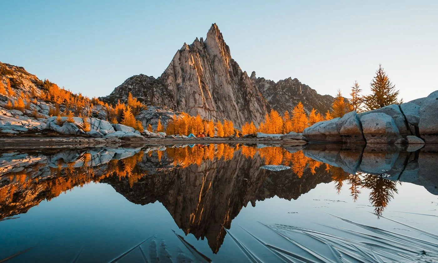
Our campsite below Prusik Peak in October in the Core Enchantments
Read On: More Enchantments & Leavenworth Guides
Enchantments & Leavenworth Hiking Guides
Gear Guides & What to Pack
Visiting Leavenworth
Liked this Post? Pin it & Save it for Later

How to Spend the Perfect Weekend in Leavenworth, WA: An Outdoor Adventure Itinerary
This image is copyrighted and owned by Skye Stoury Photography and skyestoury.com, if you would like to licence any images on this site, please email us at hello@skyestoury.com