
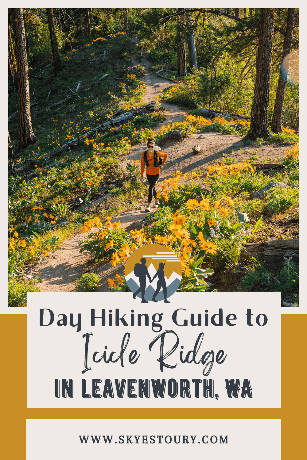
Icicle Ridge Day Hike: The Closest Trail to Downtown Leavenworth

A Perfect Half-Day Hike Right in the Heart of Leavenworth, Washington
If you're visiting Leavenworth and looking for a half-day hike with mountain views and a good workout, add Icicle Ridge to your list. The trailhead is just minutes from downtown, and the trail itself delivers wildflowers in spring and amazing views year-round.
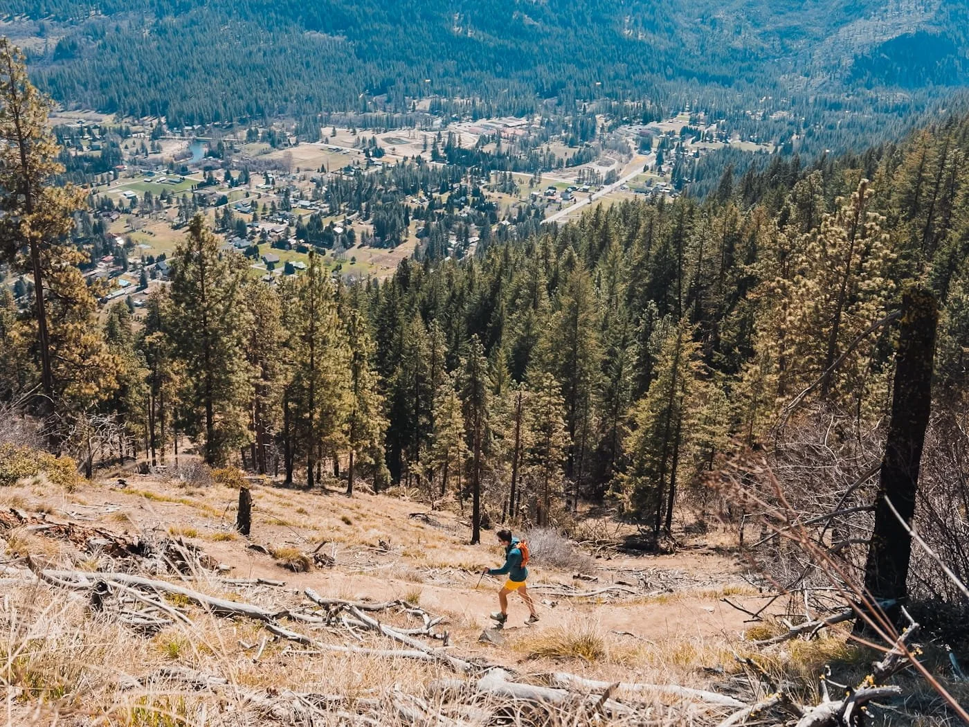
From the first viewpoint on the ridgeline, you look out over the city of Leavenworth, down into Tumwater Canyon, and if you continue up the ridge, a sweeping view of the Central Cascades.
We've been hiking Icicle Ridge for years, it's our go-to every time we're in town, whether we're using it as a training hike or just scratching our outdoor itch on a shorter day. This guide covers the out-and-back hike to the viewpoint, which is the most popular and accessible version of this trail.
→ Have a full day? Colchuck Lake is our top pick for the best day hike in the Leavenworth area.
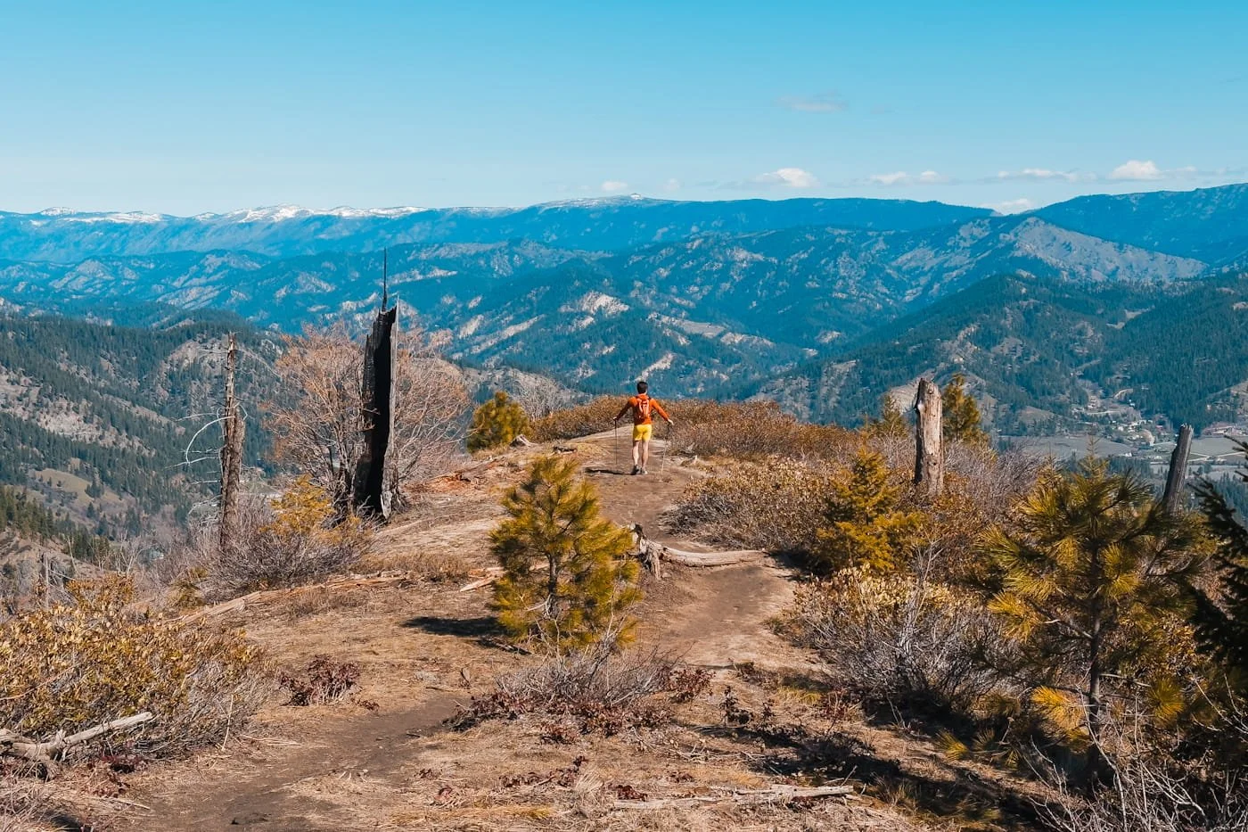
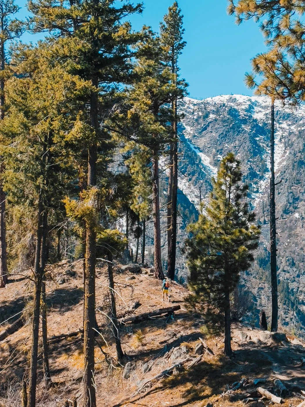
Walking up to the view point overlooking Leavenworth
Quick Facts: Hiking Icicle Ridge to the Main Viewpoint
Distance
4.8 mi (7.7 km) round trip
Elevation Gain
1,800 ft (548 m)
Difficulty
Moderate
Duration
2-4 hours
Day-Use Permit
None needed
Parking Pass
None needed
Vehicle Access
All vehicles
Dogs
Permitted on leash
Cell Service
Full coverage
Popularity
Very popular
The trail starts out mellow but then consistently climbs to the ridge and view point. The distance to the view point is short enough (4.8 miles RT) to fit into a morning or afternoon without committing your whole day. Spring, summer, and fall are all great times of year to visit.
Affiliate Disclaimer: This blog post contains affiliate links, meaning we receive a small commission of every purchase made with our links at no additional cost to you. Sometimes there is even a discount code for our readers which we specify next to the links.
Table of Contents
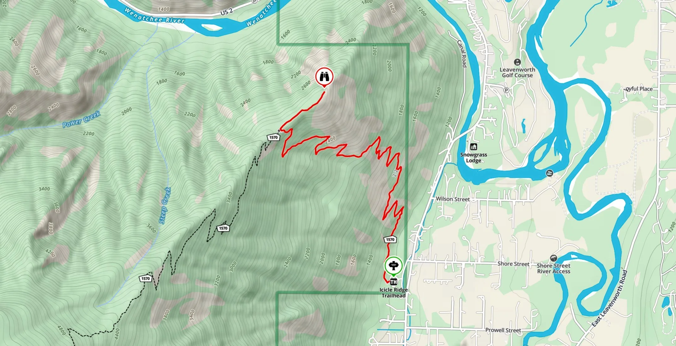
Icicle Ridge Trail overview with trailhead and viewpoint marked
Icicle Ridge Trail: Distance, Elevation, & What to Expect
Icicle Ridge is a moderate hike with a continuous climb. It gains elevation steadily from the trailhead and doesn't offer many flat breaks along the way. The distance is relatively short at 4.8 miles (7.7 km) roundtrip to the view point, and 1,800 feet (548 m) of gain. This hike is short enough to fit into a morning or afternoon, which makes it perfect if you’re only in town for a weekend.
The majority of this guide focuses on hiking to the viewpoint overlooking town, since that is what most hikers plan for. But, lower down we do go into hiking the full ridge.
Hiking Icicle Ridge to the Saddle and Viewpoint Above Town
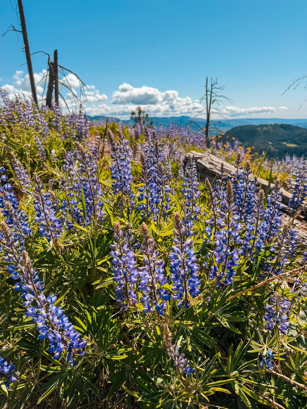
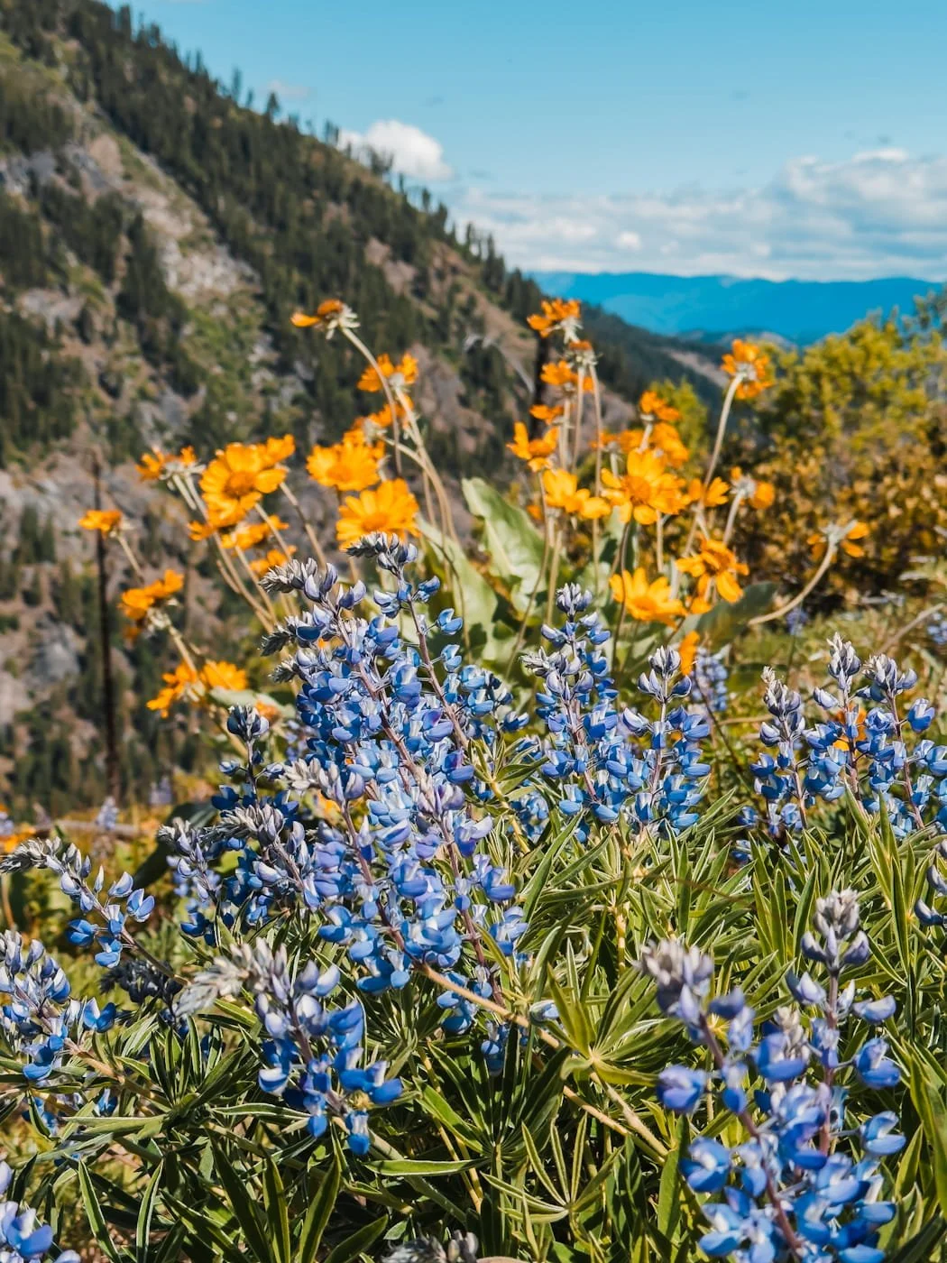
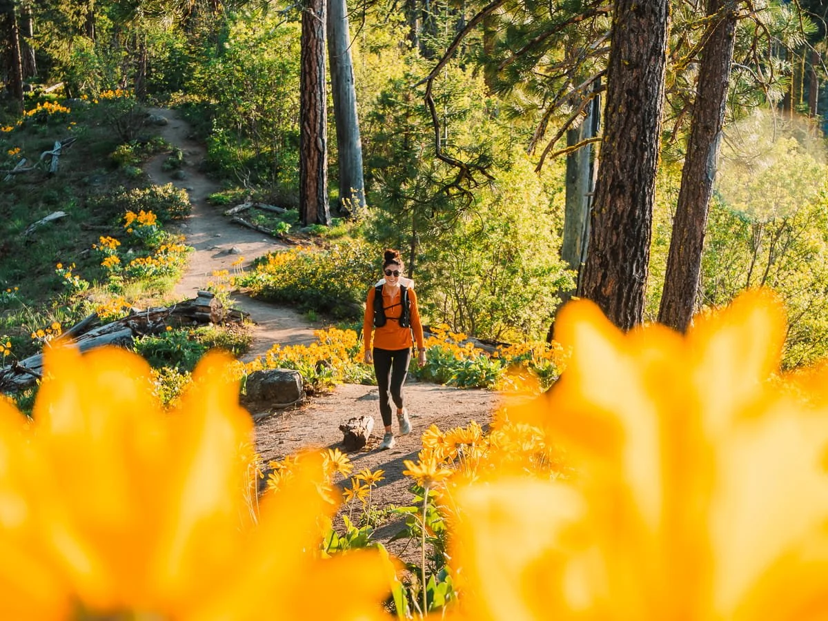
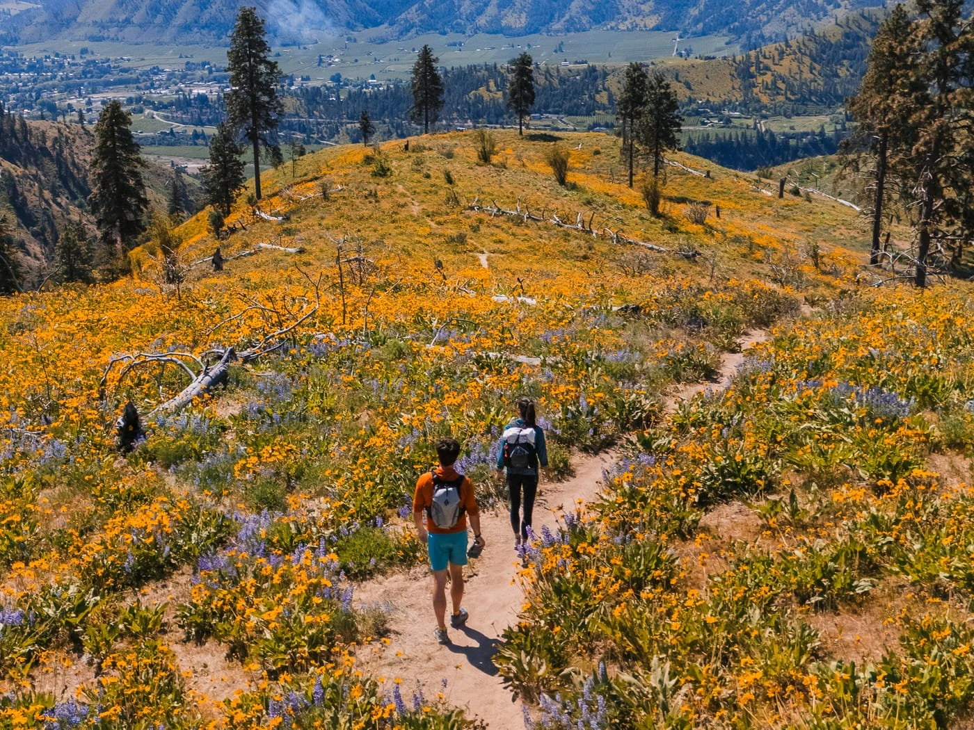
The trail starts out semi-flat before steadily gaining elevation after the first half mile. If you hike it in the spring, you’ll be treated to balsamroot blooms, lupine, and a lot of other small wildflowers. You’ll continue to switchback up the ridge, and eventually reach the saddle where a lot of hikers will stop.
As you reach the saddle, you’ll get a beautiful view of Tumwater Canyon and the Wenatchee River. From the saddle take a right and hike a short distance to the main viewpoint that overlooks the town of Leavenworth. This is a great place to stop for a snack or just take in the views before descending back to the trailhead.
You should plan for 2 hours minimum round trip for making it to the viewpoint and back at a solid hiking pace, and up to 4 hours if you're spending more time before descending.
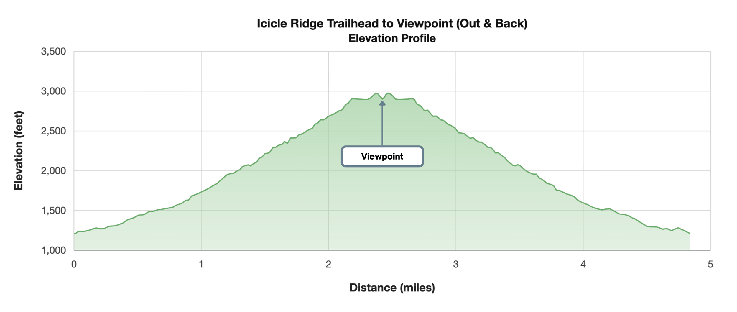
Icicle Ridge hike round trip elevation profile
We highly recommend downloading a map of the trail before setting out. We love to use GaiaGPS and provide a free track with all the hikes we share.
Continuing On to the Top of Icicle Ridge (Optional)
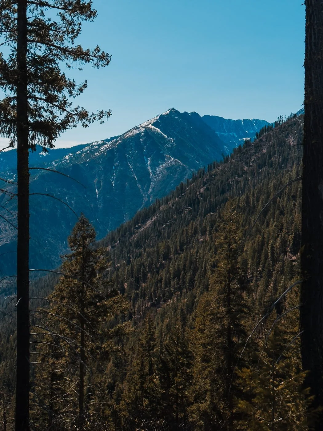
From the saddle and viewpoint, the trail follows the ridge high above both Icicle Creek and Tumwater Canyon for over four more miles with significant additional elevation gain. The full Icicle Ridge trail very long, about 20 miles or more, and can be connected down to the Fourth of July Trailhead down Icicle Road (14 miles car to car from Icicle Ridge TH to Fourth of July Creek), or even farther into the mountains to Lake Augusta.
If you hike several more miles up the ridge from the saddle you will get views of the Enchantment peaks, Mount Stuart, and Mount Cashmere. This is a much bigger outing and the snow often lingers up high, later in the season.
Best Time to Visit Icicle Ridge
Icicle Ridge is an amazing hike year round, though each season comes with its own character and a few things worth knowing before you go. If you don’t want to be hiking in snow, opt for spring, summer, or fall.
Hiking Icicle Ridge in Every Season
Spring is one of the best times on this trail. The wildflowers (golden balsamroot and purple lupine) cover the hill slopes in late-April to early May each year and the temperatures are still mild. Be aware that the upper ridge may still have some snow into late May, so check for recent community reports before you go.
If you’re searching for more spring wildflower spots, check out our guide on the Best Spring Wildflower Hikes Near Leavenworth.
Summer is peak season for visiting Leavenworth and brings longer days, reliable weather, and is a great time to hike. Start early on hot days as many parts of the trail are unshaded. There is still a chance of seasonal forest fires in the area, be sure to check current and forecasted air quality.
Fall is also a great time to visit this trail. The air cools down, and the fall colors in the valley below add something extra to an already spectacular view.
Winter transforms the trail into a snowshoe or microspike route. The lower sections featured in this guide are often still manageable, but the upper ridge can be icy and exposed. Check recent conditions before heading out and come prepared with the right traction gear such as microspikes, trekking poles and even snowshoes for extra deep snow conditions.
What to Expect on the Icicle Ridge Trail By Season
| Season | Conditions | Recommended Gear | Recommendation |
|---|---|---|---|
| Spring Top Pick March – May All Skill Levels |
|
|
One of our favorite times on this trail. The wildflower displays are beautiful! |
| Summer June – August All Skill Levels |
|
|
Start early on hot days as the sustained climb on the open hillsides gets hot in midday heat. Monitor air quality during wildfire season. |
| Fall September – October All Skill Levels |
|
|
Cooler conditions and the fall colors in the Leavenworth valley make this a great time to visit. |
| Winter November – February Advanced |
|
|
A rewarding snowshoe or microspikes route for experienced winter hikers. The lower sections are often manageable, but the upper ridge can be icy. Check recent trip reports before heading out and come prepared with proper traction gear. |
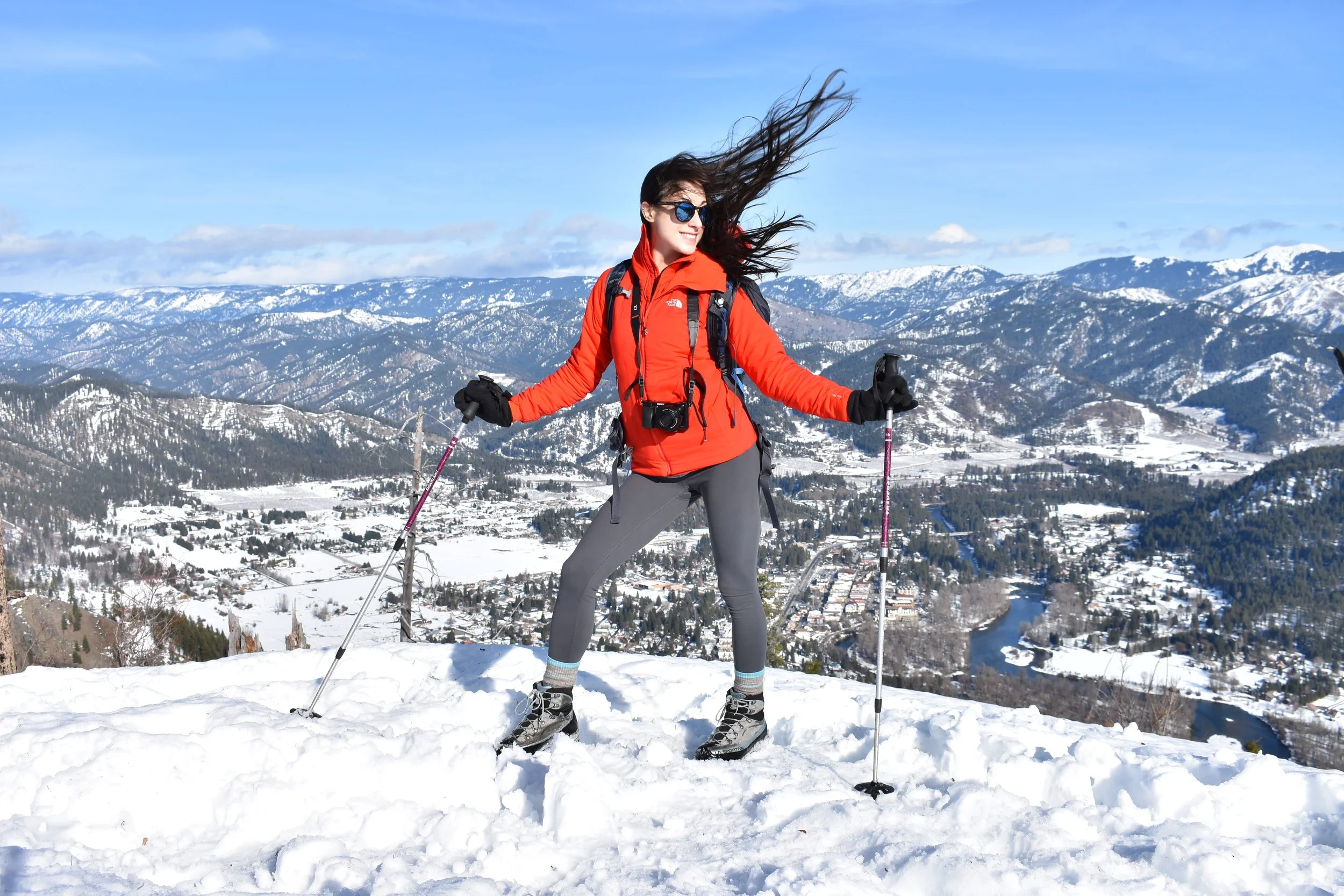
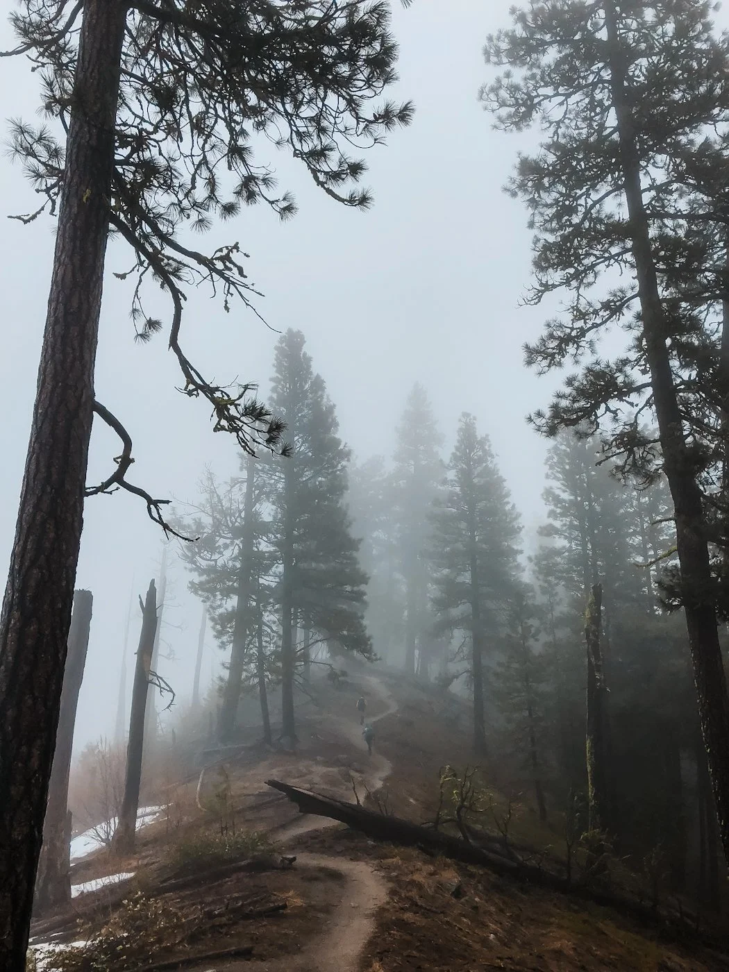
Skye hiking Icicle Ridge in the snow
Snow Considerations when Hiking Icicle Ridge in the Winter or Early Season
Though this trail is doable in the winter, there are some special considerations to keep in mind. You will need to bring extra layers for warmth, trekking poles, and microspikes or snowshoes.
When snow is present the trail can range from compact snow and ice to knee deep snow. After heavier snowfall, snowshoes may be necessary on the lower sections of the trail as well. Typically the trail is packed down by frequent hikers, but if you’re visiting shortly after a big snowfall you should also consider bringing gaiters to keep snow out of your boots on the approach.
As always, check recent trip reports on Washington Trails Association to get an update on conditions (don’t forget to leave your own update post-hike!
→ Check out our Fall and Winter Hiking Gear Guide for our favorite cold weather gear and what to pack.
Main trailhead for Icicle Ridge
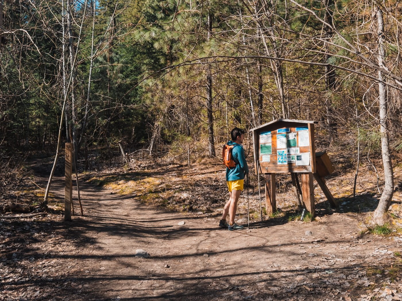
Getting to the Icicle Ridge Trailhead
From downtown Leavenworth, head south on Icicle Creek Road, just off the roundabout at the west end of town at the 76 station. Follow Icicle Creek Road for approximately 1.5 miles and turn right off Icicle Road at the intersection of Shore Street and then make an immediate left, into what looks like a driveway. After 100 yards the trailhead parking lot will be on your right.
The roadway to turn off of Icicle Creek Road is not well marked or signed, so be sure to use this google map link to guide you there. The road is paved and the parking lot is dirt but both are suitable for all vehicles.
Turn off for parking for the Icicle Ridge Trail
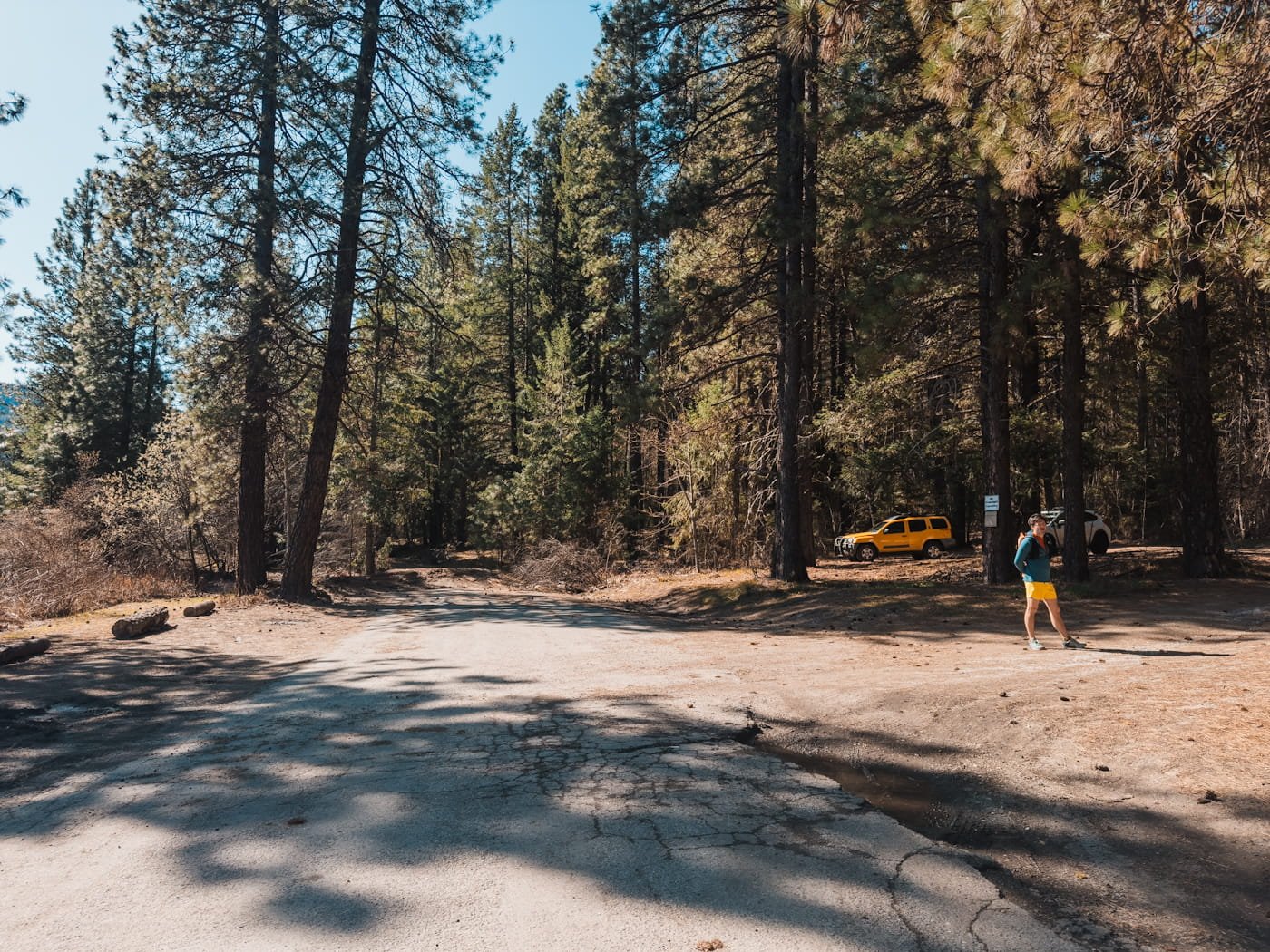
Parking at Icicle Ridge
Parking is generally easy unless you’re visiting during peak summer weekends. The trailhead parking lot accommodates 20+ vehicles. No parking permit is required.
There is a locally sponsored porta-potty at the trailhead, but always pack your own toilet paper just in case.
Additional Resources to Check Before Your Hike
NOAA Point Forecast for the Icicle Ridge Area - Detailed hourly temperatures and conditions
Washington Trails Association Icicle Ridge Trip Reports - Trail condition updates from the hiking community
Air Now Fire & Smoke Map - Air quality and wildfire closures
Sunrise/Sunset Times - Plan your start time around available daylight
GaiaGPS Icicle Ridge Route - Our free GaiaGPS map layer with the trailhead, route, and bathrooms marked
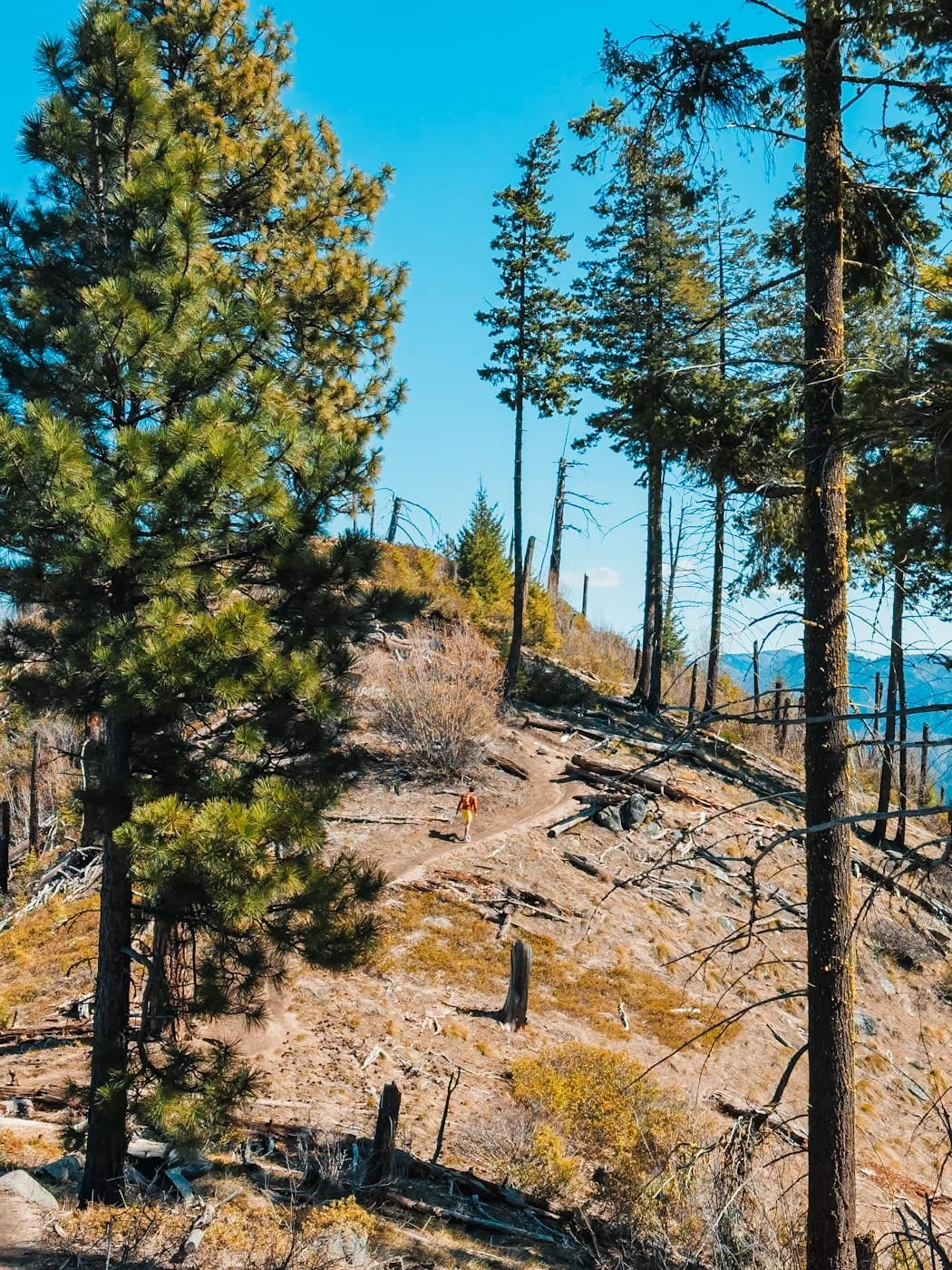
About half way up the Icicle Ridge Trail
What to Pack for Hiking Icicle Ridge
Having the right hiking gear is always important, we’ve seen hikers without backpacks or even water on this trail, which can cause major problems if the hike takes longer than you expected. Make sure to pack enough water as there is no where to fill up along the trail.
Yes, it’s a short hike, but you still need to be prepared for anything. Check out our Day Hike Packing List for a full breakdown of everything you should pack, and pay particular attention to the items below for Icicle Ridge specifically.
Navigation & Safety
Navigation App: We use GaiaGPS to download and view the trail track before and during the hike. The app and mapping works offline with no cell service, just be sure to download the map area before you head out of service. We created a free GaiaGPS route for you with the trailhead and trailside bathrooms marked.
Satellite Communicator: Although cell phone service is available throughout the hike, we still carry our Garmin InReach Mini 3, for SOS capability and backcountry messaging as a good habit for all our hikes.
Headlamp: If you start before sunrise, linger at the ridge or move slower than expected, you may be moving in darkness. We regularly pack our ultralight Nitecore NU25 for hikes.
Basic First Aid Kit: We always carry a small first aid kit for minor cuts, blisters and other issues that arise on the trail.
Footwear & Poles
Trekking Poles: Helpful on the steep descent, especially if your knees get tired on long downhills. We prefer collapsible or Z-style trekking poles for easy pack storage.
Hiking Boots or Trail Runners: We both hike in trail runners for this trail. The terrain is rocky enough that you want solid grip, but not technical enough to require heavy boots. We cover some of our favorite footwear on our complete What to Pack For a Day Hike Guide.
Hydration & Water
Water Bottles or Reservoirs: For this hike, you’ll want to carry at least 2L of water (especially in the summer) as there are no opportunities to refill along the way.
Sun & Weather Protection
Sun Hoodie: The shade-free upper section of the trail can be hot and sunny. A good sun hoodie is one of the best investments for Pacific Northwest hiking. We love the Outdoor Research Astroman Air Hoodie. For more sun hoodie options and comparisons, check out our gear review on the Best Sun Hoodies for Hiking.
Sunscreen: Dermatone Sport Sunscreen with SPF 50 is our go-to for all activities since it’s lightweight and sweat resistant. Reapply on the ridge, especially on sunny days.
Blister Prevention
Hiking Socks: Injinji Toe Socks are our favorite for trail days. Yes, toe socks can be a little weird at first, but they are genuinely excellent for toe blister prevention on long rocky hikes.
Blister Tape: We love Leukotape K It holds on to sweaty feet and stretches with movement. The key is to apply it to known hot spots before you start.
Traction (Seasonal)
Microspikes: Necessary for winter hikes (Nov – Feb) when the trail is snow covered and icy. We use Kahtoola Microspikes on our boots or trail runners.
Snowshoes: Typically needed shortly after large snowfall events before the trail has been compacted. We use MSR Lightning snowshoes for deep snow days.
Gaiters: These help keep snow out of your boots and are another good option to have during deeper snow days. Can’t go wrong with the original OR Crocodile Gaiters.


Hiking Icicle Ridge during wildflower season in the spring
Leave No Trace On Icicle Ridge
Icicle Ridge is a popular hike that sees hundreds of visitors each year. With high foot traffic comes real impact, from damaged vegetation, and eroded trails, to waste left behind. With ongoing USFS staffing cuts affecting ranger presence on the ground, it's more important than ever that every hiker who visits takes Leave No Trace seriously.
Here's how to do your part:
- Stay on trail. Cutting switchbacks causes vegetation damage and erosion.
- Pack out everything. All trash, food scraps, and toilet paper. If you packed it in, pack it out.
- Waste disposal. Use the porta-potty toilet at the trailhead before you leave. If you need to go on trail, use a WAG bag or dig a cat hole at least 6–8 inches deep and 200 feet from the trail.
- Don't feed wildlife. Human food is harmful to wildlife and creates problem animals.
- Leave rocks and plants. Don't build cairns, pick flowers, or move large rocks.
- Be considerate of others. The trail draws a lot of people. Give other hikers space, and yield to uphill hikers on the trail.

The Leavenworth sign in town
Where to Stay Near Icicle Ridge: Leavenworth Hotels & Camping
If you plan to come to Leavenworth for more than just one hike, there’s a lot of camping and hotel options in town. Leavenworth is a charming Bavarian-themed mountain town about 5 minutes from the trailhead, that has great restaurants, gear shops, breweries, and a wide range of lodging options.
→ See our complete Leavenworth Lodging Guide for in-depth hotel and camping recommendations.
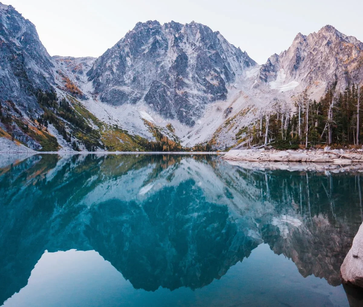
Colchuck Lake in the Enchantments
Extending Your Trip
If you want to explore more of the Leavenworth area? This is a adventurers and vacationer paradise. The surrounding area offers incredible hiking, rock climbing, and alpine lakes worth exploring.
Additional Hikes, Tours, & Guided Trips in the Leavenworth Area
Hike Colchuck Lake - A bigger challenge than Icicle Ridge but rewards you with one of the Cascade’s most beautiful alpine lake views.
Hike Canyon Crest to Rat Creek Loop - A shorter and easier day hike than Icicle Ridge, but also with stunning wildflowers in the spring and beautiful mountain views in every season.
Lake Wenatchee State Park - Camping, water access and flat forested hikes. Great spot to spend the day and it’s family friendly.
Explore Downtown Leavenworth - This Bavarian themed town features a wide range of coffee shops, restaurants, stores and breweries
Float the Wenatchee River - An scenic float along the calmer portion of the Wenatchee river. Starts at the edge of town and ends near downtown Leavenworth.
White Water Rafting- For the more adventurous, spend the day rafting the white waters of the Wenatchee river.
Rock Climbing - Leavenworth is a world-class climbing and bouldering destination. Bring your gear or book a guided trip.
FAQ: Hiking Icicle Ridge
How hard is the Icicle Ridge hike?
Icicle Ridge is rated moderate. The trail gains 1,800 feet over 2.4 miles one-way (to the viewpoint) on a continuous, steep grade. The distance is short enough to complete in a morning or afternoon, and most hikers with a reasonable base of fitness can complete it.
How long does it take to hike Icicle Ridge?
Plan for 2 to 4 hours round trip depending on your pace and how long you linger at the viewpoint. Fit hikers moving at a steady pace can complete the round trip in under 2.5 hours. If you're stopping for photos, taking breaks, or continuing further along the ridge, budget closer to 3–4 hours.
Is there parking at the Icicle Ridge Trailhead?
Yes, the trailhead has parking for 20+ vehicles and is rarely difficult to find a spot, unless it’s a peak summer weekend. No parking permit is required.
Can I hike Icicle Ridge in winter?
Yes, with the right gear. The lower sections are often manageable in winter, but the upper trail can be icy and exposed. Microspikes are recommended when snow or ice is present, and snowshoes may be needed after significant snowfall. Check recent trip reports before heading out in winter conditions.
Can I bring my dog on Icicle Ridge?
Yes, dogs are welcome but must remain on leash. Always pick up after your dog and pack out waste bags, do not leave them along the trail.
Do I have cell service on Icicle Ridge?
Yes, cell service is available throughout the trail, making Icicle Ridge one of the more accessible hike options near Leavenworth.
How close is Icicle Ridge to downtown Leavenworth?
Very close, just minutes down Icicle Creek Road from downtown, making it one of the most convenient quality hikes in the entire area.
Is Icicle Ridge kid-friendly?
Icicle Ridge can be a great hike for older kids and teenagers with a solid base of fitness, but it's not ideal for young children or beginners. The trail climbs continuously from the trailhead with no flat sections to recover on, and the exposed upper ridge has little shade. If you're hiking with kids, plan for a slower pace, bring extra water and snacks, and be prepared to turn around at whatever point makes sense for your group.
What is the best viewpoint on Icicle Ridge?
The best viewpoint is reached by taking a right at the ridge saddle and hiking a short distance to the final vista that overlooks Leavenworth. From here you'll see the city of Leavenworth and Tumwater canyond spread out in the valley below.
Is there a fee to hike Icicle Ridge?
No, there is no day-use fee or parking pass required to hike Icicle Ridge. The trailhead is free to access and the parking lot accommodates 30 or more vehicles.
Final Thoughts on Hiking Icicle Ridge
If you’re visiting Leavenworth, this is a great hike to get out for half a day. When we’ve spent months in Leavenworth at a time, we’ll usually do this hike once a week for training. You just can’t beat the views from along the ridge!
Though this hike is rated moderate, it’s short enough to do in the morning and still have time in the afternoon. But if you’re looking for longer hikes in the area, check out some of our other Leavenworth hiking guides below.
Hiking Olalla Canyon Ridge in Cashmere, WA
More Guides for the Leavenworth Area
Enchantments & Leavenworth Hiking Guides
Colchuck Lake Day Hike Guide: The Best Trail in Leavenworth, WA
How to Hike the Enchantments in One Day: Complete Thru-Hike Guide
Gear Guides & What to Pack
Leavenworth Lodging

Liked this Post? Pin it & Save it for Later


Best Hikes & Must-Stop Spots in Valley of Fire State Park
Colchuck Lake Day Hike Guide: The Best Trail in Leavenworth, WA
This image is copyrighted and owned by Skye Stoury Photography and skyestoury.com, if you would like to licence any images on this site, please email us at hello@skyestoury.com