
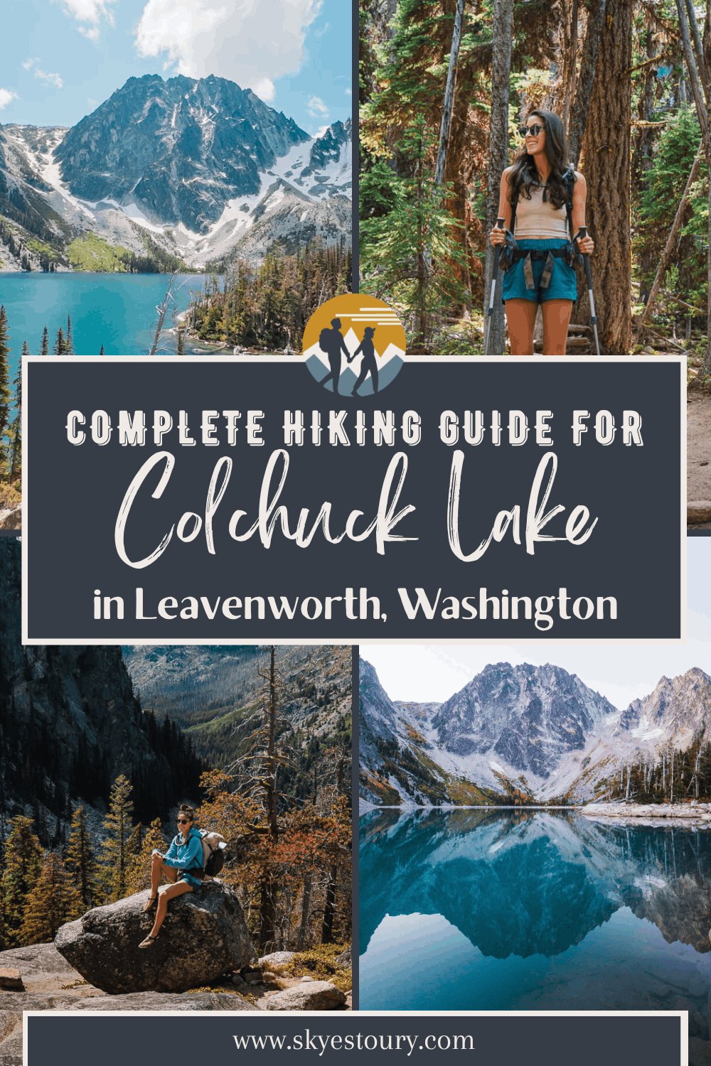
Colchuck Lake Day Hike Guide: The Best Trail in Leavenworth, WA

No Permit Lottery Required - Here's How to Experience the Enchantments as a Day Hike
If you've spent any time researching hikes near Leavenworth, Washington, you've almost certainly come across Colchuck Lake. It’s honestly one of the most stunning alpine lakes in the entire state and a very popular hike worth adding to your bucket list.
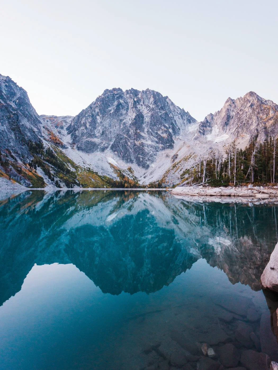
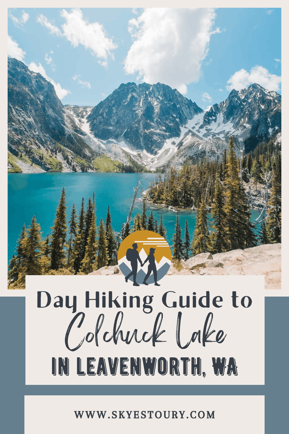
Colchuck Lake sits at 5,574 feet in the Alpine Lakes Wilderness and is cradled beneath the dramatic granite walls of Dragontail Peak and Colchuck Peak. The trail to get there climbs about 2,154 feet over 3.8 miles of forested switchbacks and rocky terrain, making this a moderately challenging but very achievable day hike for most active hikers.
We've hiked to Colchuck Lake countless times over the years, for early morning photography sessions, as a warm-up before bigger objectives, and on the way up Aasgard Pass to the core Enchantments. It remains one of our favorite hikes in Washington, and this guide covers everything you need to know to make the most of your visit.
Looking for a less popular day hike in the Enchantments? Check out Lake Stuart! And for even more hikes near Leavenworth, we have a full hiking guide on the best trails around.
→ If you're thinking about tackling the full Enchantments traverse, check out our complete Enchantments day hike guide. Colchuck Lake is the first major waypoint on that route. And if you were lucky enough to win an overnight permit for Colchuck Lakeor the Core Zone, head over to our Enchantments backpacking guide for multi-day trip planning.
Why Trust This Guide?
We're Washington locals and experienced backcountry hikers who have visited the Enchantments area many times over the years. Between leading trips with The Mountaineers, completing the full Enchantments thru-hike in a single day, backpacking the Core Zone multiple times, and climbing peaks like Prusik Peak and Colchuck Peak, we know this trail well across every season and condition. We've hiked to Colchuck Lake in midsummer wildflower season, during golden larch season, and in early season snow.
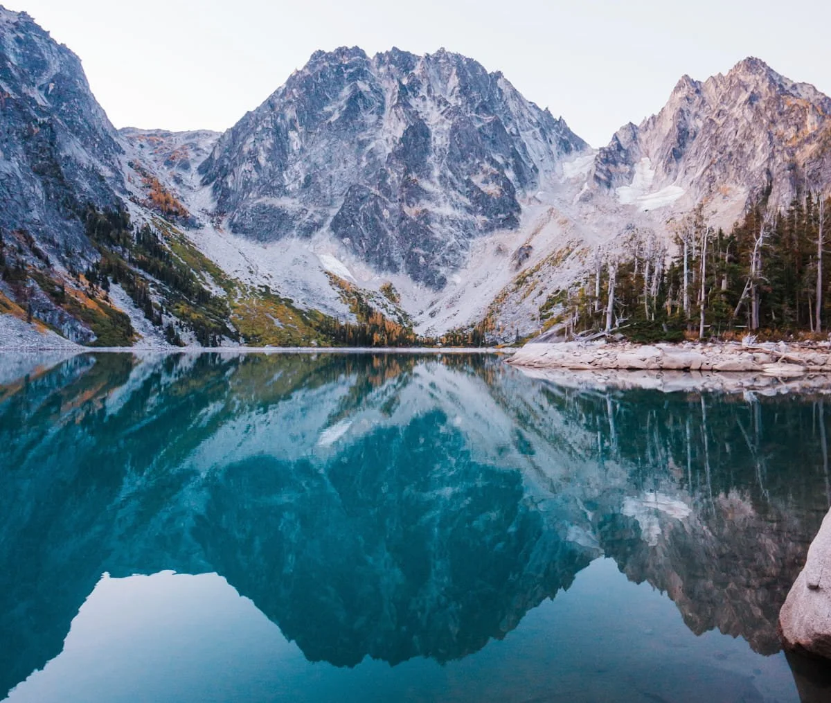
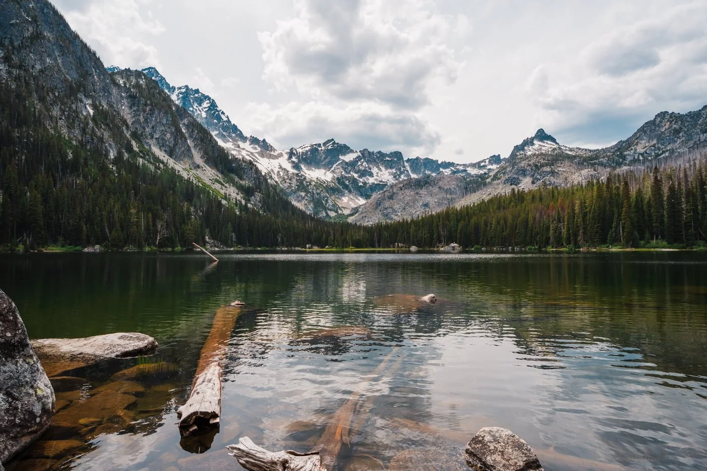
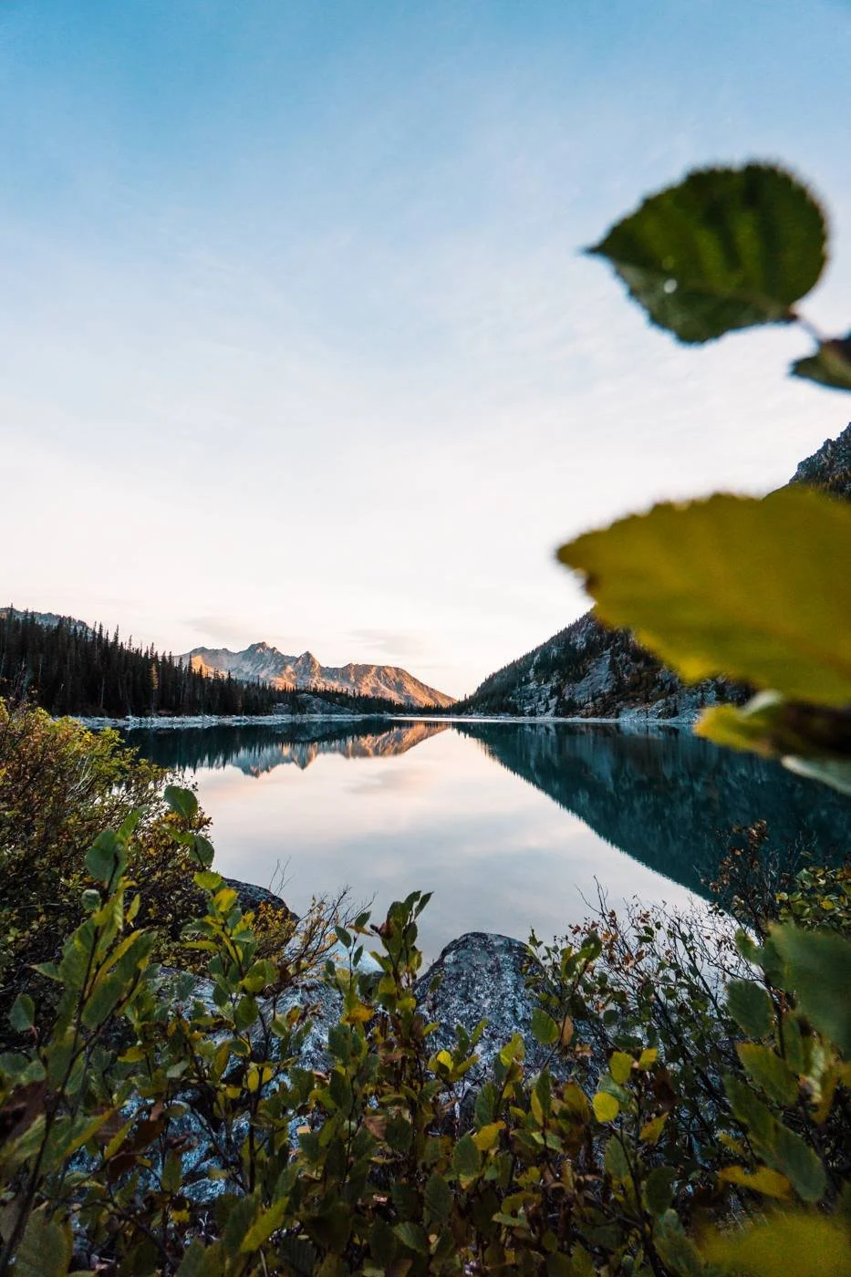
Colchuck Lake before sunrise
Quick Facts: Hiking to Colchuck Lake
Distance
~7.6 mi / 12 km round trip
Elevation Gain
~2,154 ft / 657 m
Difficulty
Moderate to Difficult
Duration
3–6 hours
Day-Use Permit
Free self-issued at trailhead kiosk
Parking Pass
Northwest Forest Pass or America the Beautiful
Vehicle Access
All vehicles; watch for potholes
Dogs
No, prohibited in Enchantments permit area
Cell Service
Minimal to none
Popularity
Very popular
Affiliate Disclaimer: This blog post contains affiliate links, meaning we receive a small commission of every purchase made with our links at no additional cost to you. Sometimes there is even a discount code for our readers which we specify next to the links.
Table of Contents
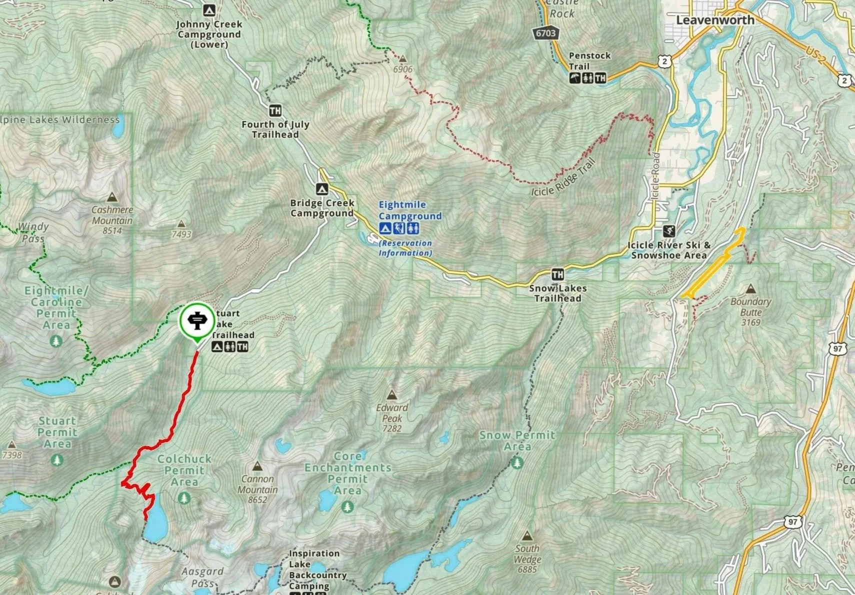
Overview map of Stuart Lake Trailhead to Colchuck Lake
Where is Colchuck Lake Located?
Colchuck Lake is located within the Alpine Lakes Wilderness in the Okanogan-Wenatchee National Forest, approximately 15 miles southwest of Leavenworth, Washington. The lake sits at the base of Dragontail Peak and Colchuck Peak in the Stuart Range, a dramatic cluster of granite summits that form the western boundary of the Enchantments basin.
The lake is accessed via the Stuart Lake Trailhead off of Icicle Creek Road. Because of its iconic scenery and relatively accessible trailhead from Leavenworth, Colchuck Lake is one of the most popular day hikes in Washington State.
Colchuck Lake Hike Difficulty
The trail to Colchuck Lake is a moderate to difficult hike depending on your fitness level. The first mile is gradual, but after that the trail climbs steadily and doesn't let up until you reach the lake. There are rocky and rooted sections along the trail, making this hike much more than a casual nature walk.
Trekking poles can definitely help with the uphill and ease the knee abuse on the way down. It's one of the most rewarding day hikes in Washington and definitely worth a visit. If you're comfortable on trails with sustained uphill and some uneven terrain, you'll be fine.
You'll Love This Hike If You:
Have hiked 6–10 miles before with 2,000+ feet of elevation gain
Are comfortable on rocky, rooted trails
Are training for or thinking about attempting the full Enchantments thru-hike
Consider a Different Hike If You:
Struggle on sustained uphill terrain or have significant knee, ankle or mobility issues
Are looking for a short, easy walk with big views
Are hiking with very young children or beginners unfamiliar with rugged terrain
→ Check out our Day Hike Packing List to make sure you have the basics dialed in before heading out.
Colchuck Lake Trail Guide: Route, Distance & Elevation
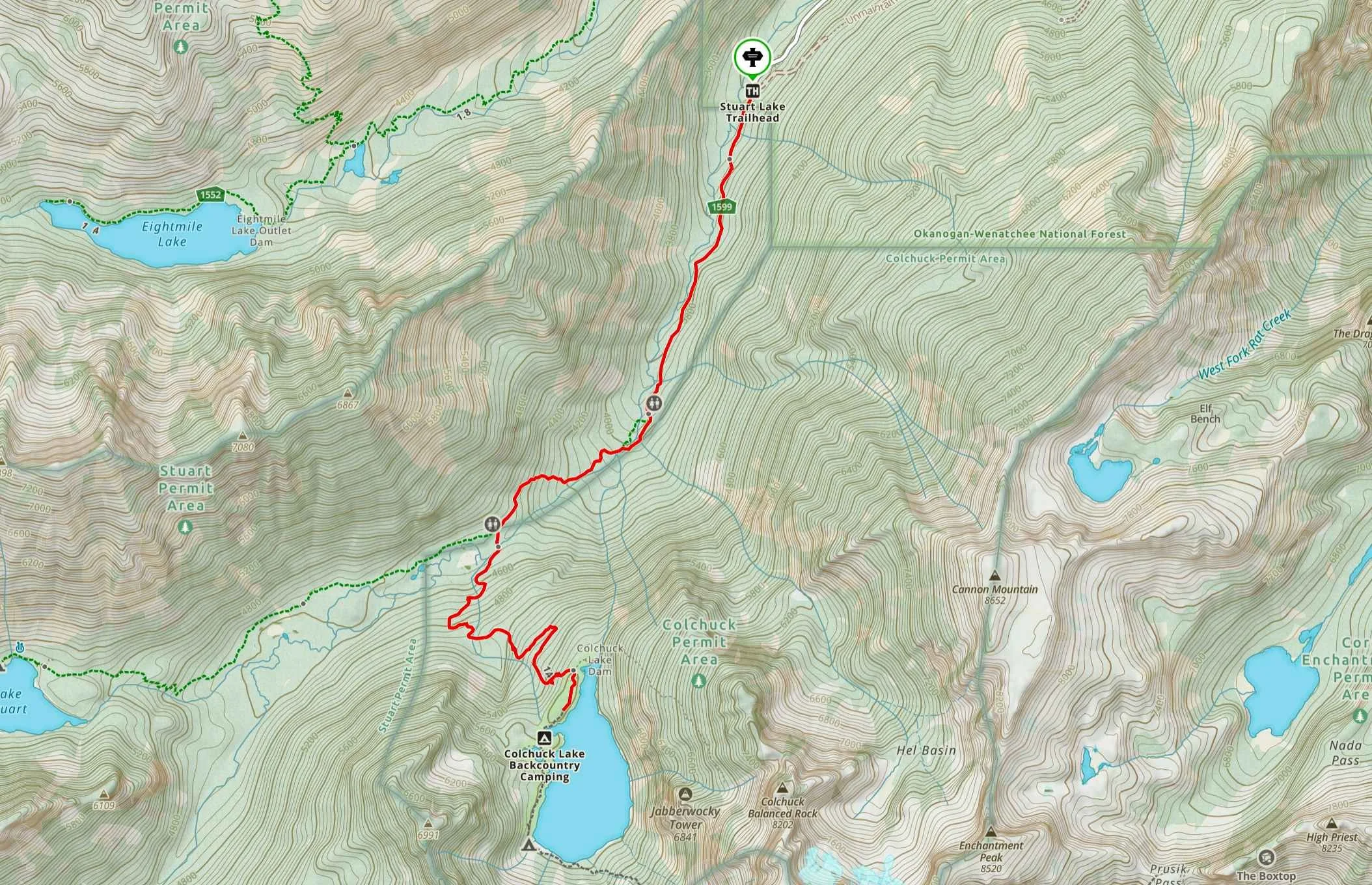
Stuart Lake Trailhead to Colchuck Lake hiking route.
The Colchuck Lake trail begins at the Stuart Lake Trailhead and follows the Stuart Lake Trail for approximately 2 miles before splitting off toward Colchuck Lake. The total round-trip distance is ~7.6 miles (12 km) with 2,154 ft (657 m) of elevation gain. We've broken the hike into three natural sections (see section below) so you know what to expect at every stage.
Colchuck Lake Elevation Profile
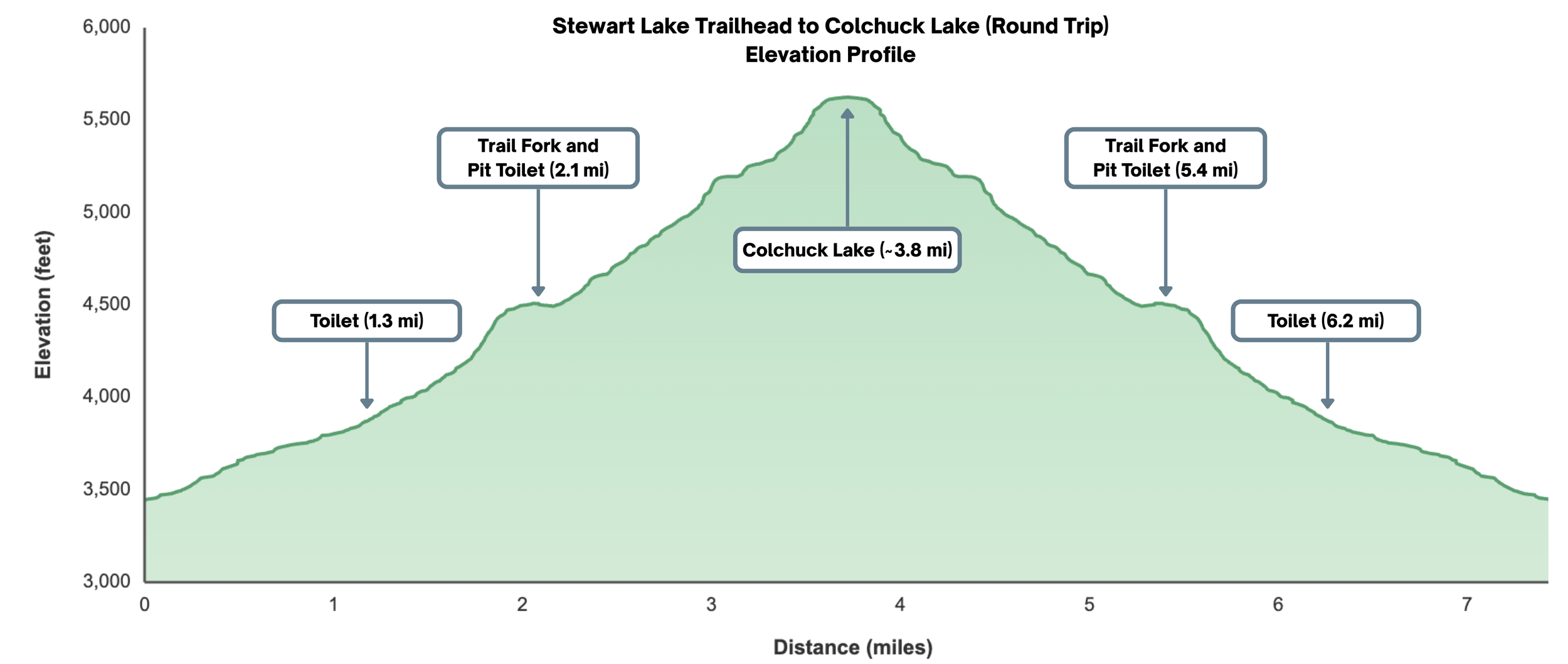
Round trip elevation profile from Stuart Lake Trailhead to Colchuck Lake. Pit toilets are available at the trailhead, along the hike and at Colchuck Lake. Although the one at the lake is often in rough shape, we recommend bringing your own Wag Bag just in-case it’s full.
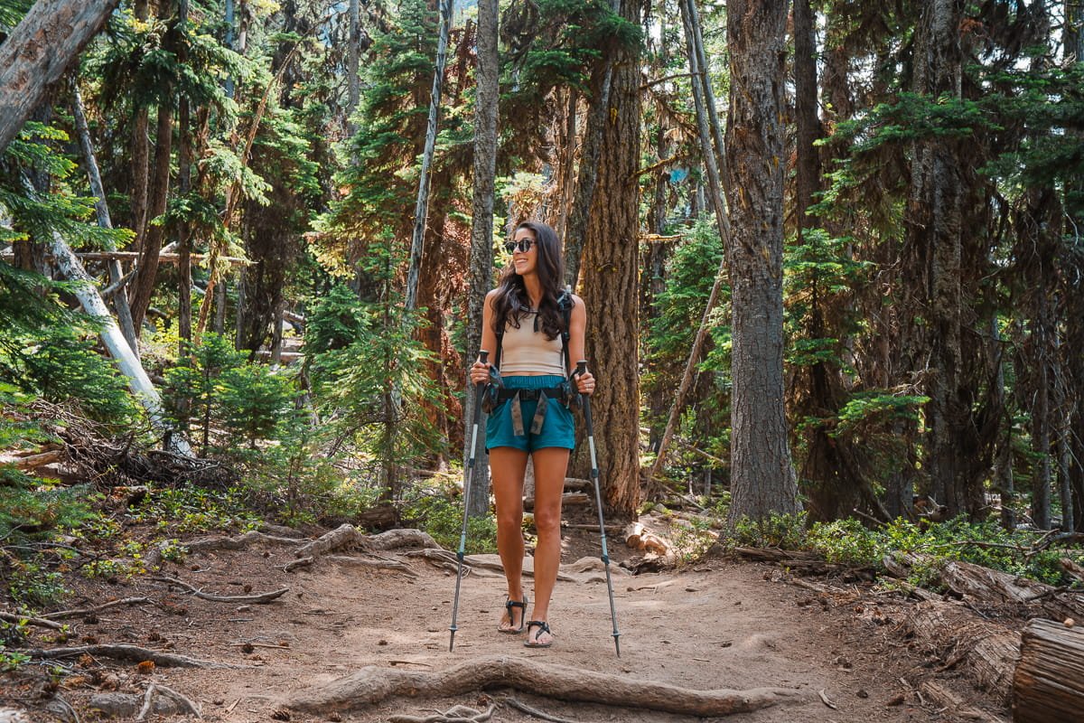
Moderate first mile along the trail.
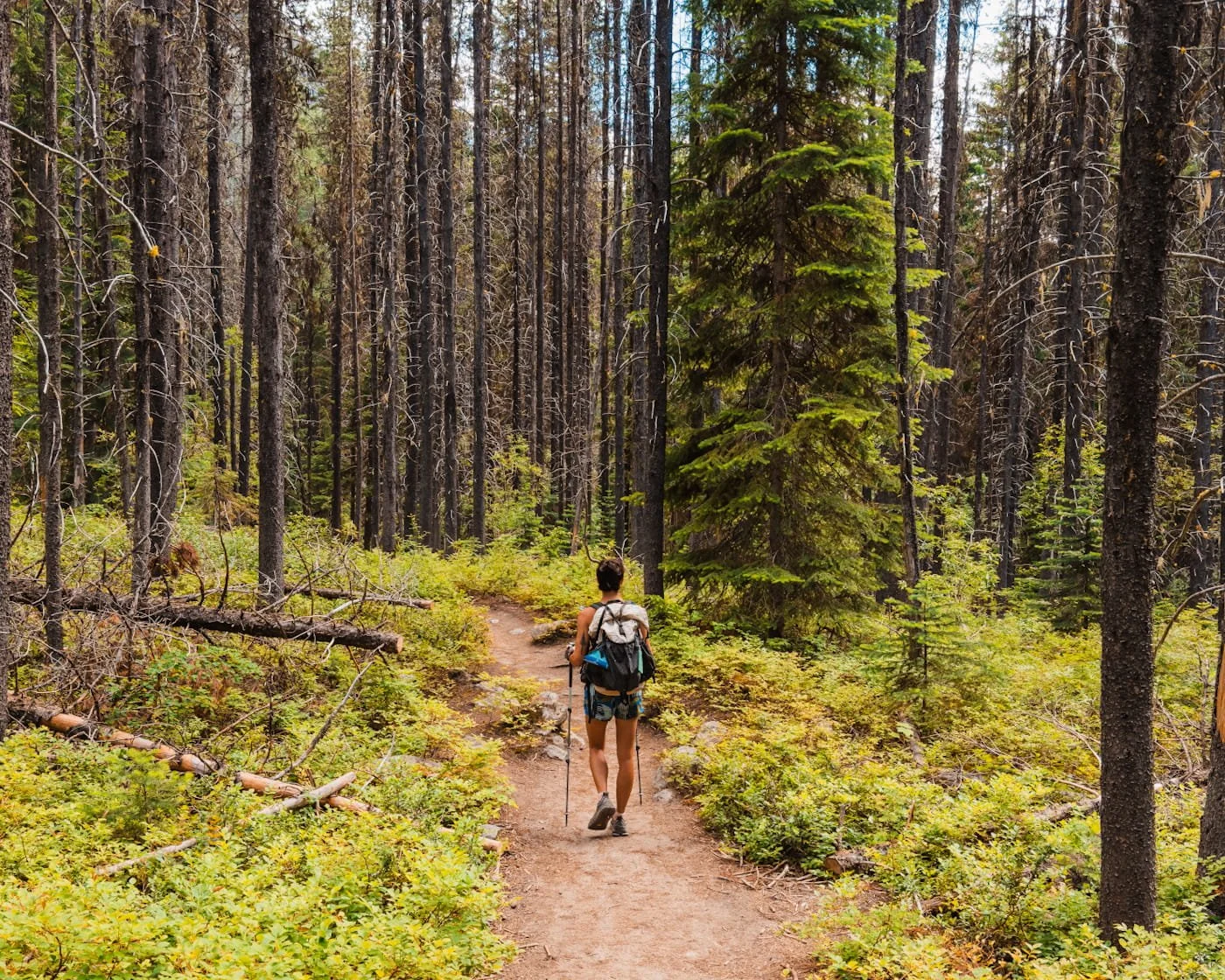
Section 1: Stuart Lake Trailhead to the Trail Junction (Mile 0–2)
The trail begins at the far end of the Stuart Lake parking lot. The first mile is gentle and forested. After roughly a mile, you'll cross Mountaineer Creek on a footbridge.
After the crossing, the trail steepens. You'll gain elevation through a series of switchbacks with occasional filtered views through the trees. At approximately 2 miles, you'll reach a signed trail junction to go left for Colchuck Lake.
Section Stats:
Distance: 2 mi (3.2 km)
Elevation Gain: ~1,048 ft (319 m)
Terrain: Forested trail, moderate grade, footbridge crossing
Estimated Time: 45–75 min
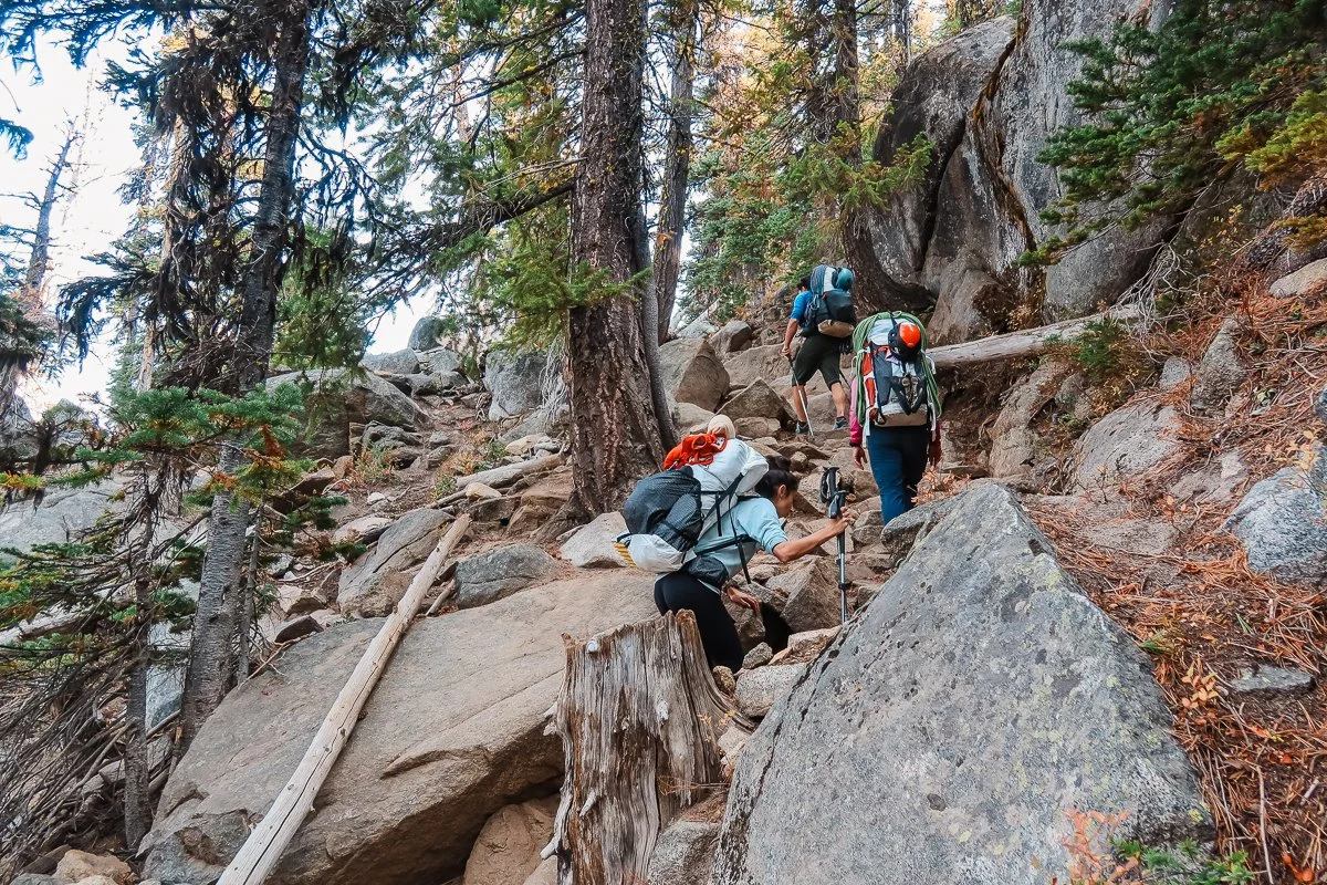
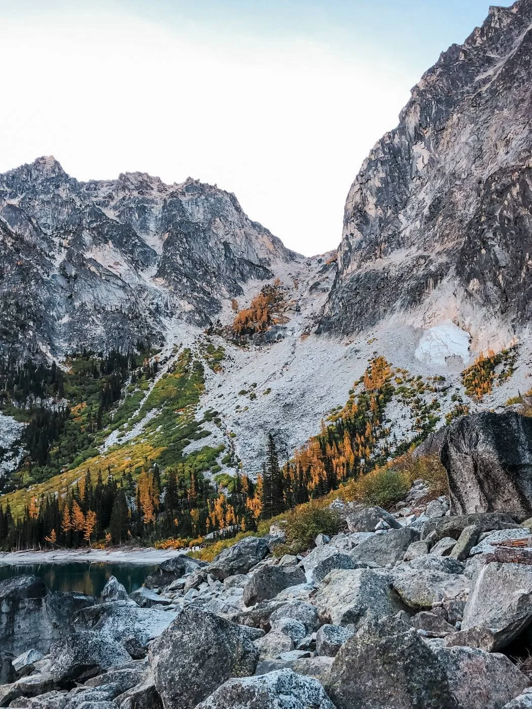
Steeper rock section of the trail. Photo credit: Rob Busack from our overnight climbing trip to the upper core of the Enchantments
Section 2: Trail Junction to Colchuck Lake (Mile 2–3.8)
After the junction, the trail to Colchuck Lake climbs more aggressively. The grade picks up and you'll work through some rockier terrain with a few boulder sections that require a bit of careful footing.
As you near the lake, the forest opens up and you'll get your first glimpses of granite walls above. The trail does a short, rocky scramble over a boulder field before opening to the lakeshore.
Section Stats:
Distance: 1.8 mi (2.9 km)
Elevation Gain: ~1,106 ft (337 m)
Terrain: Rocky switchbacks, rooted trail, short boulder scramble at lake approach
Estimated Time: 1–2 hours
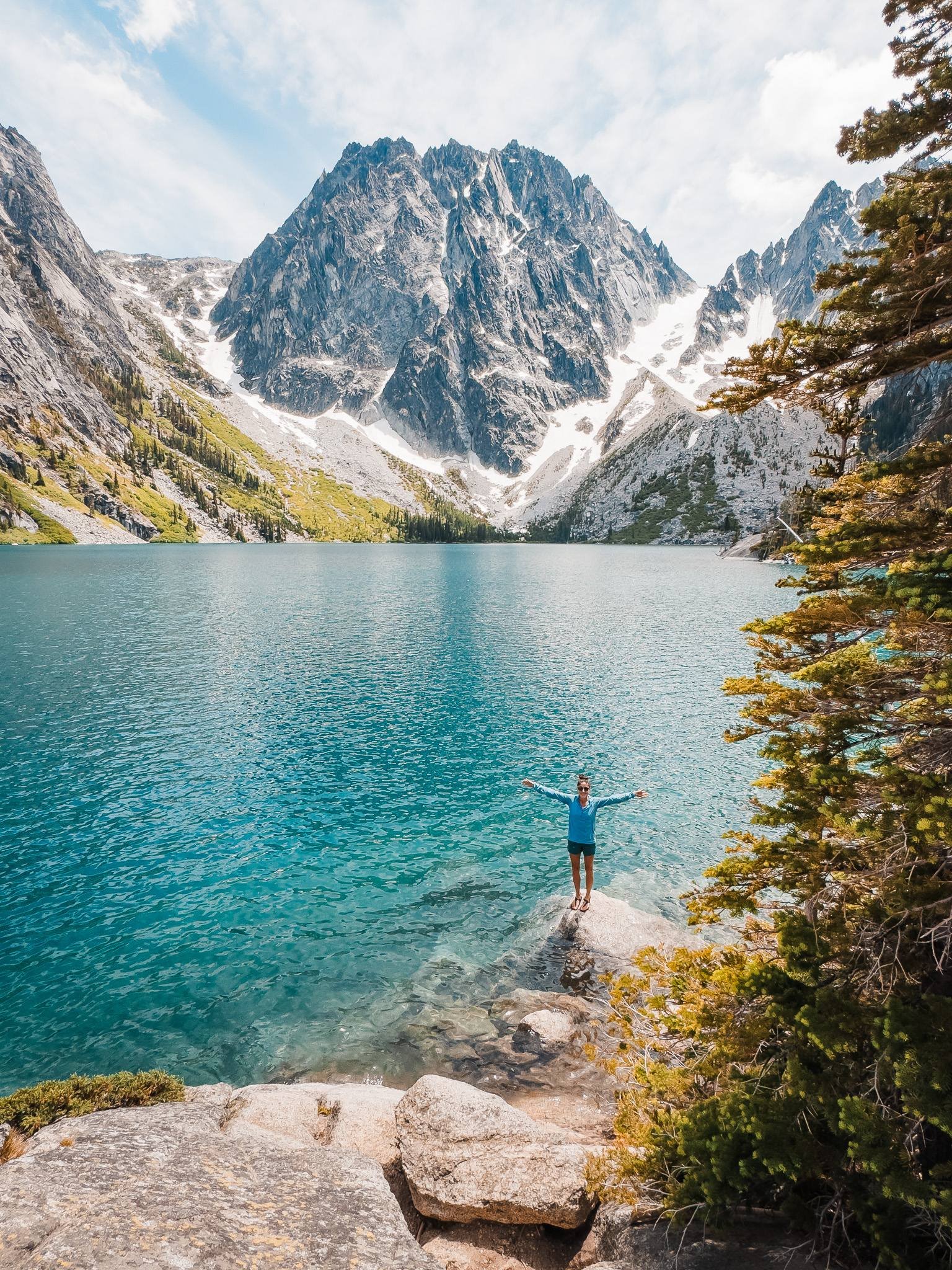
Section 3: Reaching Colchuck Lake and What to Do When You Get There
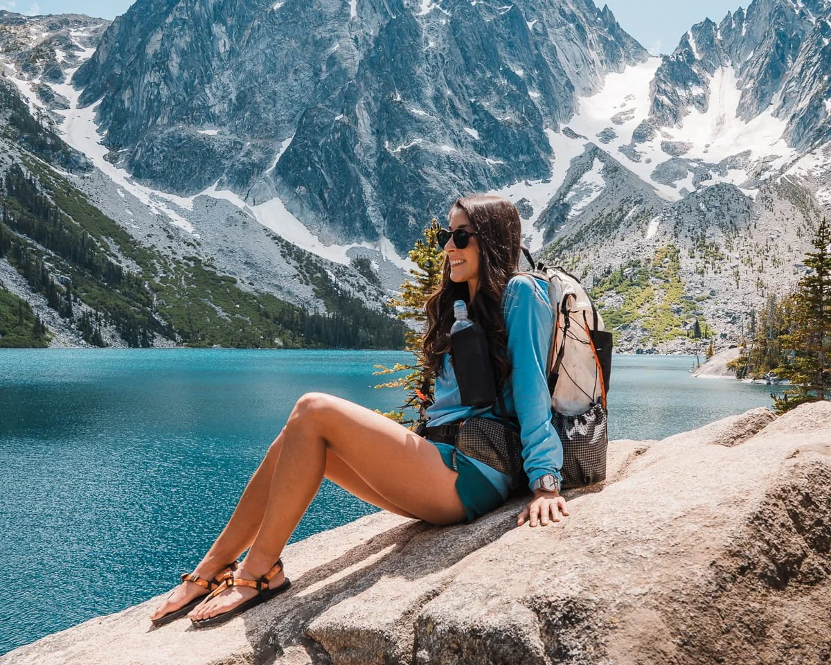
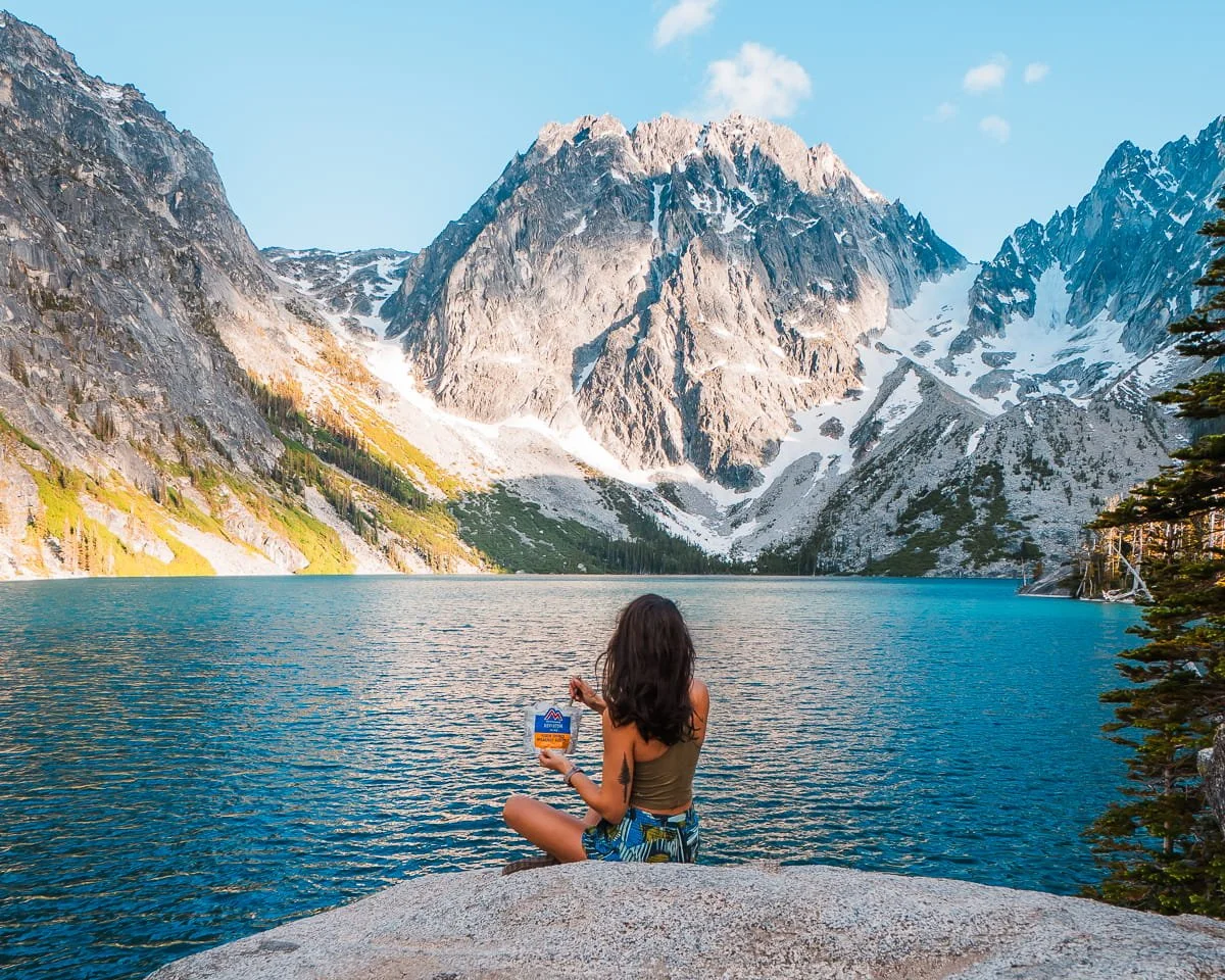
Once you reach Colchuck Lake, enjoy the views or even go for a swim. Most hikers arrive at the main outlet area and stop there, but if you have energy and time, it's worth exploring a bit further along the south shore. The views shift as you move around the lake, and you'll get different angles on Dragontail and Colchuck peaks.
If you look across the lake toward the far end, you'll see the jumbled boulder field and steep talus that leads up to Aasgard Pass, the gateway to the Core Enchantments.
Colchuck Lake Tips:
The northwest shore has the best views of both peaks and makes for great photography
On sunny summer afternoons, the reflected light off the water makes the turquoise color even more vivid
There are some flat granite slabs on the west side of the lake that make excellent lunch spots, just watch out for hungry chipmunks and grey jays.
Best Time to Hike Colchuck Lake
The season you choose dramatically affects your experience at Colchuck Lake. Trails, snow coverage, and the color and mood of the lake all change throughout the year. The table below covers what to expect each season so you can plan accordingly.
| Season | Conditions | Recommended Gear | Recommendation |
|---|---|---|---|
| Early Season May – Early June Advanced |
|
|
For experienced hikers with snow travel experience only. The upper trail and boulder approach can be difficult with snow or ice. Not recommended as a casual early-summer hike. Note the road up to the trailhead reopens typically in early May, but this depends on snowmelt. |
| Peak Summer July – Mid-August All Skill Levels |
|
|
Ideal for most hikers and first-timers. The trail will be fully clear and navigable. This is the easiest and safest time for a first visit. Start early, parking fills by 8 AM on weekends. Monitor air quality during wildfire season. |
| Late Summer Late August – Mid-September All Skill Levels |
|
|
One of the best times to hike Colchuck Lake. Warm temps, no snow and great alpine swimming temps |
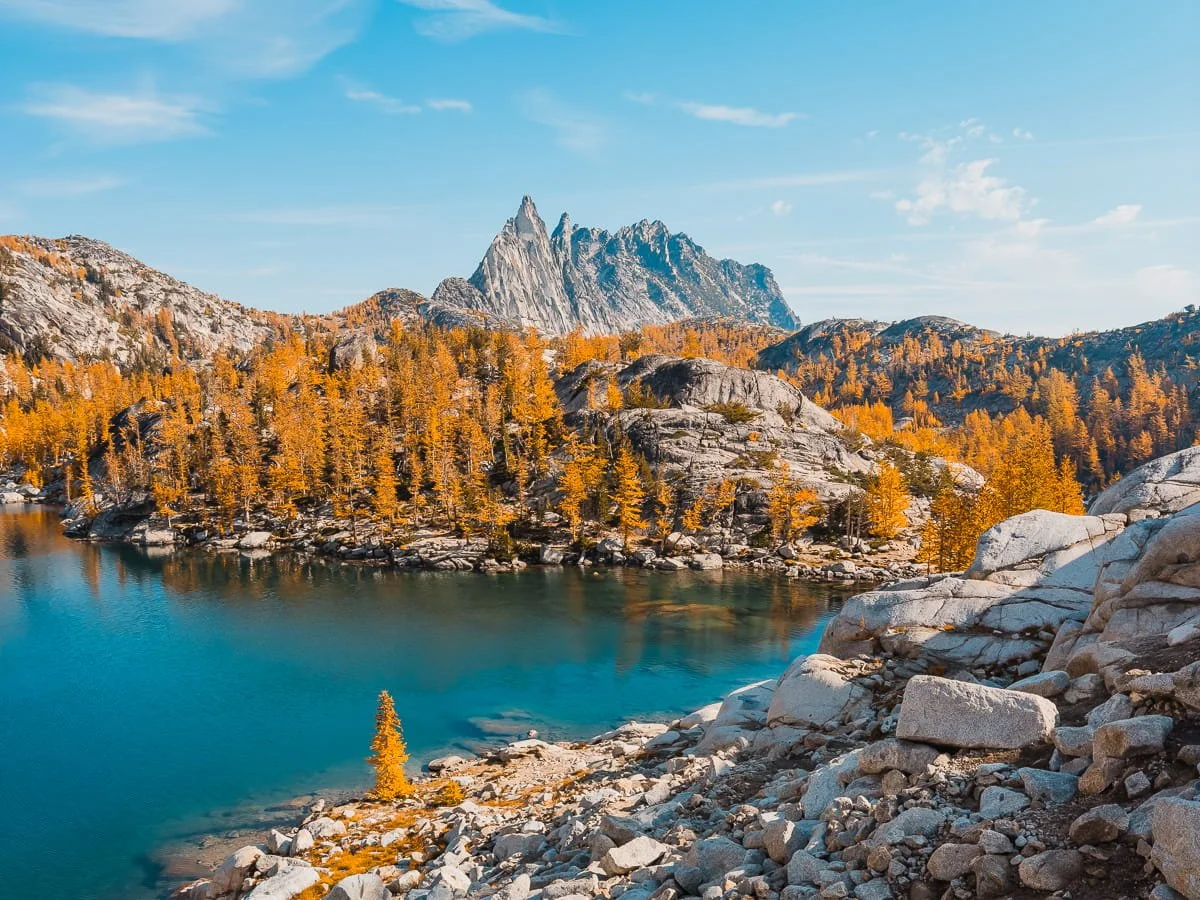
| Larch Season Top Pick Late September – Early October Intermediate |
|
|
Our personal favorite time to visit. The larch color on the slopes above the lake and around the boulder approach is absolutely stunning. Start at or before sunrise. Larch season brings the biggest crowds of the year to this trailhead. |
| Shoulder Season Mid-October – November Advanced |
|
|
Not recommended for most hikers. Snow and ice on the rocky upper section and boulder scramble can be dangerous without proper traction gear and experience. |
Additional Resources to Check Before Your Hike
NOAA Point Forecast for the Colchuck Lake Area - Detailed hourly temperatures and conditions
USFS Enchantments Page - Rules, regulations, and area updates
Washington Trails Association Colchuck Lake Trip Reports - Trail condition updates from the hiking community
Air Now Fire & Smoke Map - Air quality and wildfire closures
Sunrise/Sunset Times - Plan your start time around available daylight
GaiaGPS Enchantments Route - Our free GaiaGPS map layer with the route, parking, camping and bathrooms marked
The trailhead at the Stuart Lake parking lot.
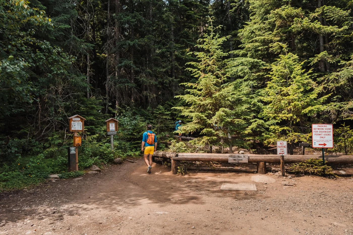
Stuart Lake Trailhead: Parking, Permits & Trailhead Info
The Stuart Lake Trailhead is a well-established trailhead but there are a few things worth knowing before you arrive.
Seasonal Trailhead Access - Although Colchuck is open year round, the roadway off of Icicle Creek Road is closed seasonally for snow. Typically road is clear of snow and reopens to the trailhead in early May, but this depends on seasonal snowmelt. If you’re looking to hike in the early spring or late fall, check in ahead of time with the USFS Ranger Station.
Parking -The lot is a standard gravel pullout with space for roughly 30–35 vehicles. You must display a Northwest Forest Pass ($5/day or $30/annual) or an America the Beautiful on your dashboard. Do not park in any spaces marked for overnight permit holders; those spots are reserved exclusively for guests with overnight permits and are enforced. Overflow parking extends down the access road, but obey all posted No Parking signs. Rangers actively ticket vehicles that block the road or park in restricted areas.
Self-Issue Permit Kiosk - The free day-use permit kiosk is located at the trailhead, right at the start of the trail. Fill out your permit for your group and display it on one person’s pack throughout your hike.
Restrooms - Pit toilets are available at the trailhead. They're functional but can get rough on busy summer weekends and during larch season. Always pack a personal supply of toilet paper.
The Trail Start -The trail begins at the far end of the parking area. Look for the trailhead signage and the permit kiosk.
Tips To Get a Parking Spot at Stuart Lake Trailhead
The Stuart Lake Trailhead parking lot fills fast on summer weekends and even earlier during larch season. If you arrive and the lot is full, here are your options.
Get there early - During peak summer and fall months, the trailhead fills up fast. On popular summer weekends, parking is gone by 8:00 AM. During larch season, it can be full even earlier. Starting before sunrise puts you at the lake during the best light of the day. During peak season, we typically aim to start no later than 7:30 AM on weekends and 6:00 AM on popular larch season weekends.
Carpool to the trailhead - If you’re meeting friends, you can carpool from Leavenworth or a pullout along Icicle Creek Road and cut back the number of parking spaces you need.
Book a trailhead shuttle in advance - Two local companies offer service to and from the Snow Lake trailhead to the Stuart Lake Trailhead. Inquire for specific time and costs to/from the trailhead.
Shuttles are especially worth considering during larch season when the lot is at its most chaotic or if you're doing the full Enchantments thru-hike and need a two-trailhead solution anyway.
Alternate Options if the Stuart Lake Trailhead is Full
It happens (a lot), especially on summer weekends and during larch season, the Stuart Lake Trailhead fills fast and fills early. Don't let a full parking lot derail your day. Here are your best options.
Come back later in the day - Most day hikers start early and are back at their cars by early afternoon. If you arrive and the lot is completely full with no overflow available, driving back around 1:00–2:00 PM often frees up spots as morning hikers clear out.
Park back at the Eightmile Trailhead - When the main lot is full, it’s possible to hike in from the Eightmile Lake Trailhead. That will add an additional 1.7 miles round trip to your day. Obey all posted No Parking signs and don't block the road. Rangers do ticket, and the access road is narrow.
Pivot to a nearby hike - If the lot is full and you don't want to wait or shuttle, the Icicle Creek corridor has solid backup options within a short drive.
Eightmile Lake is another option in the same corridor. It sits in its own quiet drainage in the Eightmile/Caroline Zone of the Alpine Lakes Wilderness and sees a fraction of the Colchuck crowd. The trail is about 6 miles round trip with around 1,400 feet of gain, leading to a beautiful alpine lake backed by mountains.
Icicle Ridge is a few miles back toward Leavenworth on Icicle Creek Road, requires no permit or parking pass, and delivers sweeping ridgeline views of Leavenworth and the surrounding Cascades. It's 4.8 miles round trip with 1,800 feet of gain. Dogs are welcome on leash, which is a bonus if you brought yours and forgot about the no-dogs rule at Colchuck Lake.
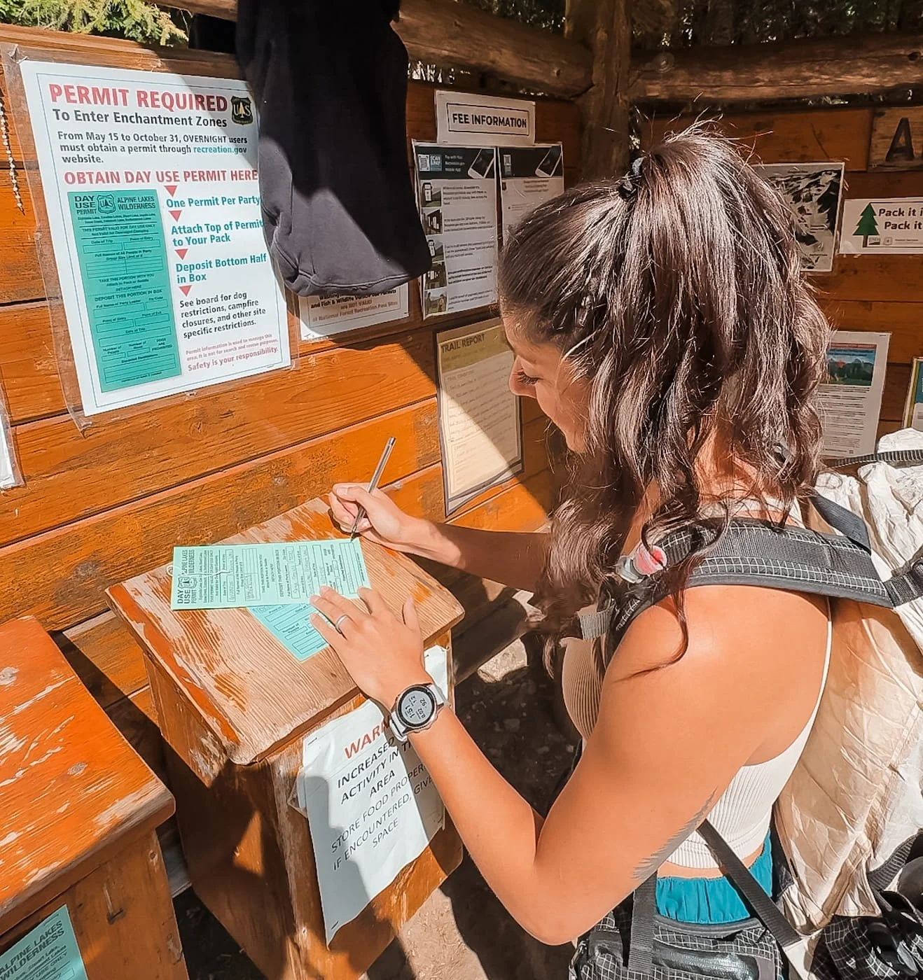
Skye filling out a day hike/day use permit at the trailhead
Permits & Fees: What You Need to Hike Colchuck Lake
Good news, hiking Colchuck Lake as a day hike is refreshingly straightforward on the permit front. No lottery, no Recreation.gov application, no advance planning required. Here's exactly what you need before you hit the trail.
Day-Use Permit (Free) - A free self-issued day-use permit is required and available at the trailhead kiosk. You fill it out on-site before starting your hike, it takes about a minute.
Parking Pass (Required) - You must display either a Northwest Forest Pass ($5/day or $30/annual) or an America the Beautiful Pass at the Stuart Lake Trailhead. Rangers do check.
Overnight Camping - This guide covers the day hike only. If you want to camp near Colchuck Lake, you'll need to win an overnight permit for the Colchuck Zone through the Recreation.gov lottery. This is a separate and competitive process. See our Enchantments backpacking guide for full details on the permit lottery, and check out our guide to backpacking Colchuck Lake for more information on camping here.
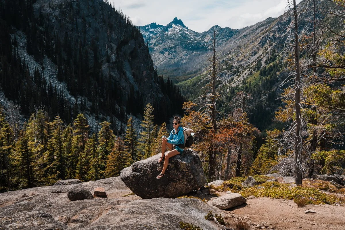
Taking a break on the way up to the lake
Safety Tips for Hiking Colchuck Lake
While Colchuck Lake is a day hike, it's still an alpine hike in the Cascades. Here are the key safety considerations we always keep in mind on this trail.
Start Early on Weekends and During Larch Season
The Stuart Lake Trailhead parking lot is infamous for filling up fast. On popular summer weekends, parking is gone by 8:00 AM. During larch season, it can be full even earlier. Starting before sunrise puts you at the lake during the best light of the day. During peak season, we typically aim to start no later than 7:30 AM on weekends and 6:00 AM on popular larch season weekends. The extra early time during larch season (late September - early October) is due to a large portion of thru-hikers who are doing the full Enchantments traverse and need that extra early start.
Water & Creek Crossings
Mountaineer Creek is bridged and easy to cross. Always bring plenty of water (1.5-2L) and/or a water filter. There are great water sources along the trail and at the lake. If filtering from a creek, be careful of high spring flows and choose a safe access point to collect water.
Weather Changes Quickly at Elevation
Colchuck Lake sits at nearly 5,600 feet and is exposed to alpine weather. Even on days that look clear in Leavenworth, conditions at the lake can be cold, windy, or wet. Always carry an extra layer and a rain jacket. Check the NOAA mountain forecast the day before you go.
Cell Service
Expect no cell service once you enter Icicle Creek Canyon just outside of Leavenworth. Download our GPS track before you leave the parking lot and consider carrying an activated satellite communicator for emergencies.
Summer at Colchuck Lake
What to Pack for Your Colchuck Lake Hike
You don't need to go ultralight for Colchuck Lake, but you'll want to pack smart. Below is what we personally carry and recommend for this hike.
→ For a more comprehensive packing list, see our Day Hike Packing List.
Navigation & Safety
Navigation App: We use GaiaGPS to download and view the trail track before and during the hike. The app and mapping works offline with no cell service, just be sure to download the map area before you head out of service. We created a free route for you with the trailhead and trailside bathrooms marked.
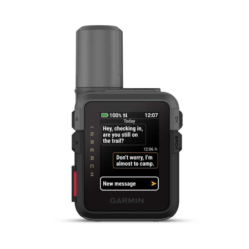
Satellite Communicator: Garmin InReach Mini 3, for SOS capability and backcountry messaging.
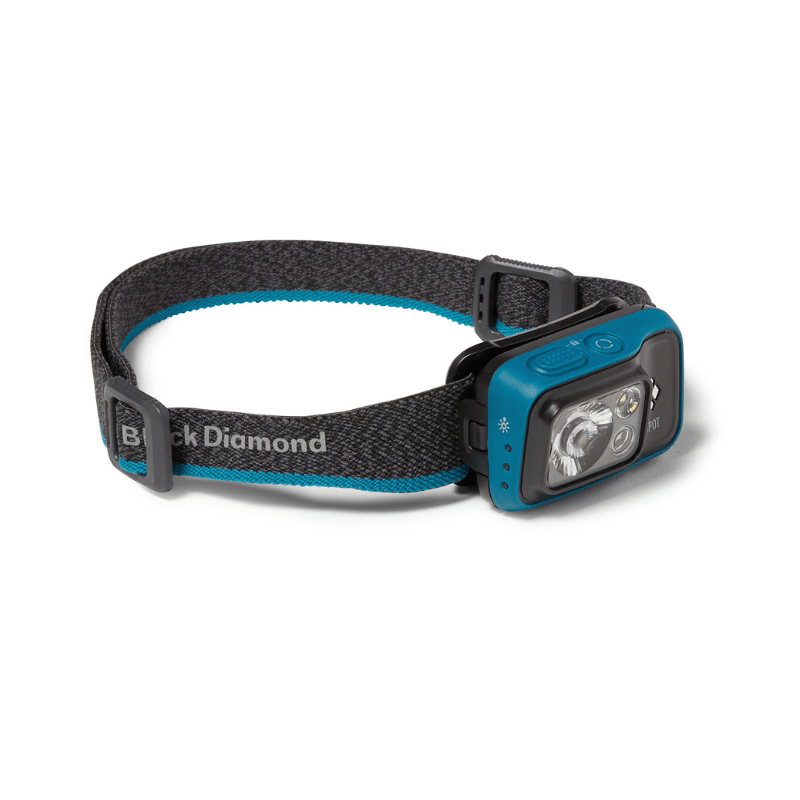
Headlamp: If you start before sunrise, linger at the lake or move slower than expected, you may be moving in darkness. We regularly pack our ultralight Nitecore NU25 for hikes.
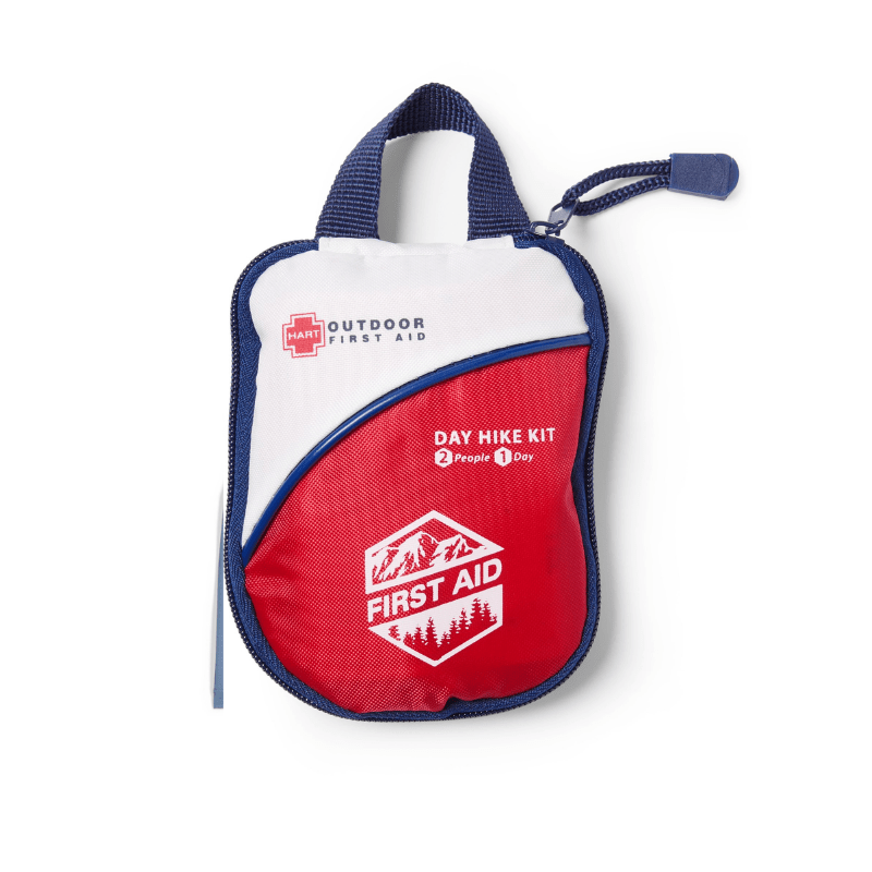
Basic First Aid Kit: We always carry a small first aid kit for minor cuts, blisters and other issues that arise on the trail.
Traction (Seasonal)
Microspikes: Necessary for early season (May– early June) and late shoulder season (October) when the upper trail and boulder approach can be icy. We use Kahtoola Microspikes on our boots or trail runners.
Footwear & Poles
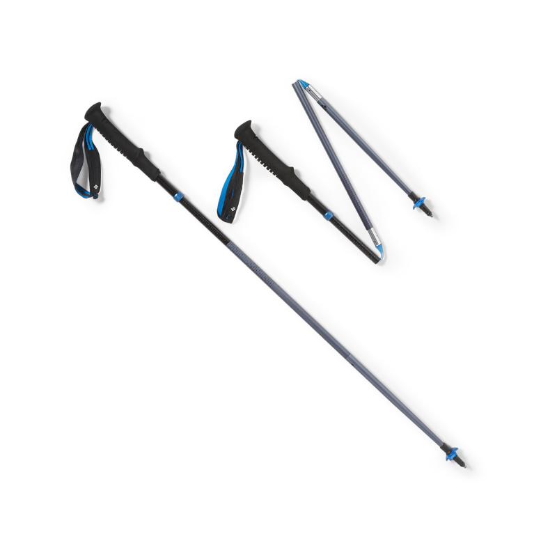
Trekking Poles: Helpful on the steep descent, especially if your knees get tired on long downhills. We prefer collapsible or Z-style trekking poles for easy pack storage.
Hiking Boots or Trail Runners: We both hike in trail runners for this trail. The terrain is rocky enough that you want solid grip, but not technical enough to require heavy boots. We cover some of our favorite footwear on our complete What to Pack For a Day Hike Guide.
Hydration & Water
Water Bottles or Reservoirs: For this hike, you’ll want to carry at least 2L of water unless you plan on filtering water along the way.
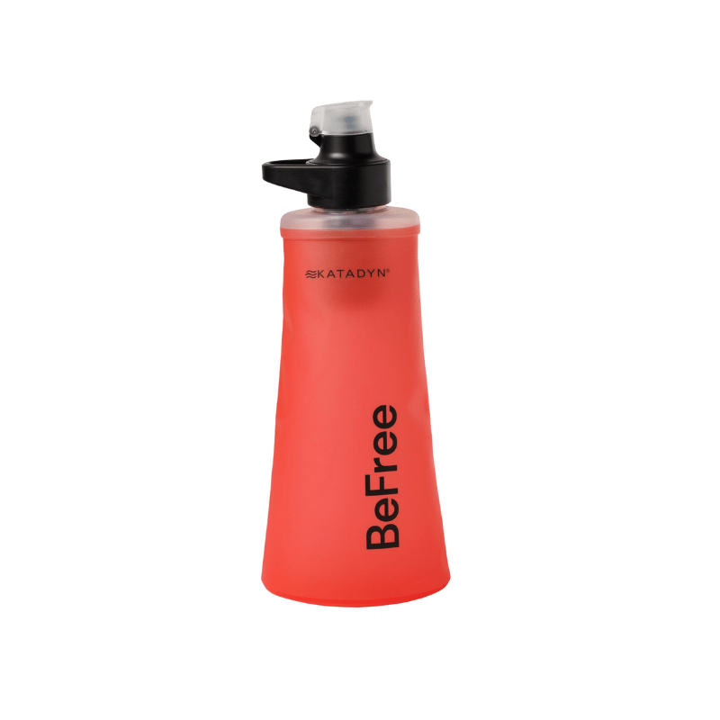
Water Filter: If you’d like to filter water, you canfill up at Mountaineer Creek or at the lake. Katadyn BeFree 1L is our favorite on-the-go filter.
Sun & Weather Protection
Sun Hoodie: The exposed upper trail and lakeside can be hot and sunny. A good sun hoodie is one of the best investments for Pacific Northwest hiking. We love the Outdoor Research Astroman Air Hoodie. For more info, check out our deep dive into other sun hoodies on our Best Sun Hoodies for Hiking Guide.
Rain Jacket: If rain is in the forecast, you’ll want to have a rain layer. Outdoor Research Helium Rain Jacket is lightweight and packs small. This is a great just-in-case wind/rain layer when rain is unlikely. If there is serious rain in the forecast, you’ll want something more waterproof like an Outdoor Research Aspire/Foray Rain Jacket.
Sunscreen: Dermatone Sport Sunscreen is our long time favorite. Reapply at the lake, especially if you're spending time on the reflective water's edge.
Blister Prevention
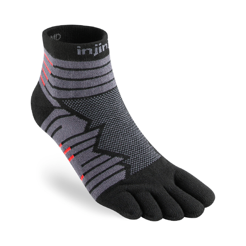
Hiking Socks: Injinji Toe Socks are our favorite for dusty and high millage days. Yes, toe socks can be a little weird at first, but they are genuinely excellent for toe blister prevention on long rocky hikes.
Blister Tape: We loveLeukotape K. It holds on to sweaty feet and stretches with movement. The key is to apply it to known hot spots before you start.
→ See our full Day Hike Packing List for everything we recommend packing on alpine day hikes


Lunch break on the shore of Colchuck Lake
Leave No Trace at Colchuck Lake
Colchuck Lake is one of the most visited alpine lakes in Washington. With high foot traffic comes real impact. From damaged vegetation, crowded shorelines to waste left behind. With ongoing USFS staffing cuts affecting ranger presence on the ground, it's more important than ever that every hiker who visits takes LNT seriously. Here's how to do your part:
- Stay on trail. The alpine environment around Colchuck Lake is fragile and extremely slow to recover. Don't shortcut switchbacks, and stay on rock or established trail when moving around the lake.
- Pack out everything. All trash, food scraps, and toilet paper. If you packed it in, pack it out.
- Waste disposal. Use the vault toilets at the trailhead before you leave. If you need to go on trail, use the provided pit toilets or dig a cat hole at least 6–8 inches deep and 200 feet from any water source, trail, or camping area.
- Don't feed wildlife. The grey jays and chipmunks at Colchuck Lake are very bold. Don't encourage them — human food is harmful to wildlife and creates problem animals.
- Leave rocks and plants. Don't build cairns, pick flowers, or move large rocks.
- Be considerate of others. Colchuck Lake draws a lot of people. Keep noise down at the lake, give other hikers space, and yield to uphill hikers on the trail.
- Drones are not permitted. As a wilderness area, drones are not allowed.
How to Get to Colchuck Lake (Stuart Lake Trailhead)
The Stuart Lake Trailhead is the starting point for the Colchuck Lake hike and is accessed via Icicle Creek Road southwest of Leavenworth.
From Downtown Leavenworth:
Drive southwest on Icicle Creek Road
Continue approximately 8 miles on Icicle Creek Road
Turn left onto the steep gravel road to the Stuart Lake Trailhead (signed)
The parking area is at the end.
Road Conditions: Icicle Creek Road is paved and well-maintained. The final spur road to the trailhead is steep, unpaved gravel. All standard vehicles can make it in summer, but high-clearance is helpful in early season when washboarding and potholes are common.
Driving from Major Cities
| From | Distance | Drive Time | Route |
|---|---|---|---|
| Seattle, WA | ~150 miles | ~3.5 hrs |
I-5 → I-405 N → WA-522 E → US-2 East over Stevens Pass → Leavenworth → Icicle Creek Road Alt: I-90 over Snoqualmie Pass → WA-970 → WA-97 over Blewett Pass → US-2 W. Adds ~30 min but useful during Stevens Pass closures. |
| Bellevue / Eastside, WA | ~120 miles | ~3 hrs |
I-90 E or WA-520 E → US-2 East over Stevens Pass → Leavenworth → Icicle Creek Road |
| Wenatchee, WA | ~35 miles | ~1 hour |
US-2 West to Leavenworth → Icicle Creek Road |
| Spokane, WA | ~200 miles | ~3.5 - 4 hrs |
US-2 West or I-90 West → US-2 to Leavenworth → Icicle Creek Road US-2 is more direct and scenic through central Washington's high desert. |
Downtown Leavenworth shops and restaurants
Where to Stay Near Colchuck Lake: Leavenworth Hotels & Camping
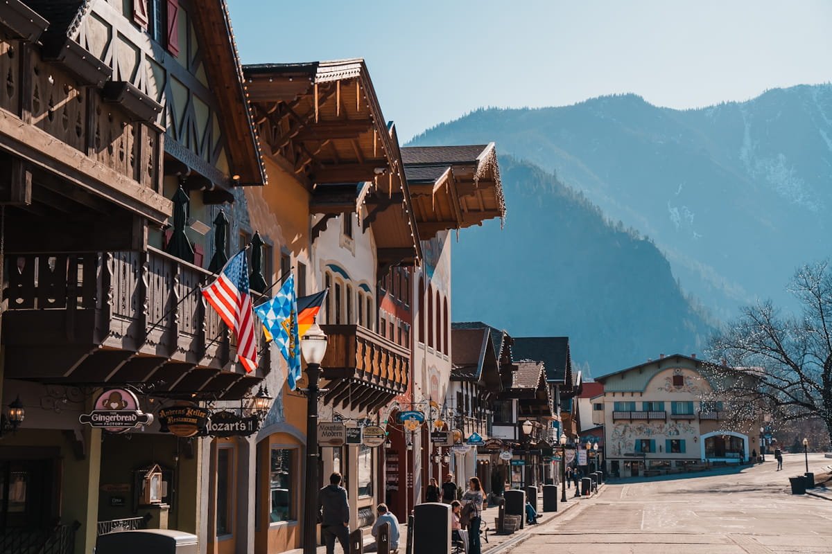
Most visitors base themselves in Leavenworth, Washington, a charming Bavarian-themed mountain town about 25 minutes from the trailhead. It has great restaurants, gear shops, breweries, and a wide range of lodging options. See our complete Leavenworth Lodging Guide for in-depth hotel and camping recommendations.
Additional Day Hikes Near Colchuck Lake
The Icicle Creek corridor has some of Washington's best alpine hiking within a short drive. Here are a few of our favorites as additional or backup trips.
Lake Stuart Out-and-Back
Same trailhead as Colchuck Lake, different destination. After the Colchuck junction at mile 2, continue right toward Lake Stuart for a quieter and less crowded experience.
Trailhead: Stuart Lake Trailhead
Difficulty: Moderate, similar grade to Colchuck but slightly less steep
Distance: 8.9 mi (14.3 km) round trip
Elevation Gain: ~1,663 ft (498 m)
Duration: 5 - 8 hours
Permit: Free self-issue day-use at trailhead
Parking: A Northwest Forest Pass ($5/day or $30/annual) or an America the Beautiful Pass
Conditions: Check WTA trip reports
GPX Route: GaiaGPS map to Stuart Lake
Icicle Ridge Out-and-Back
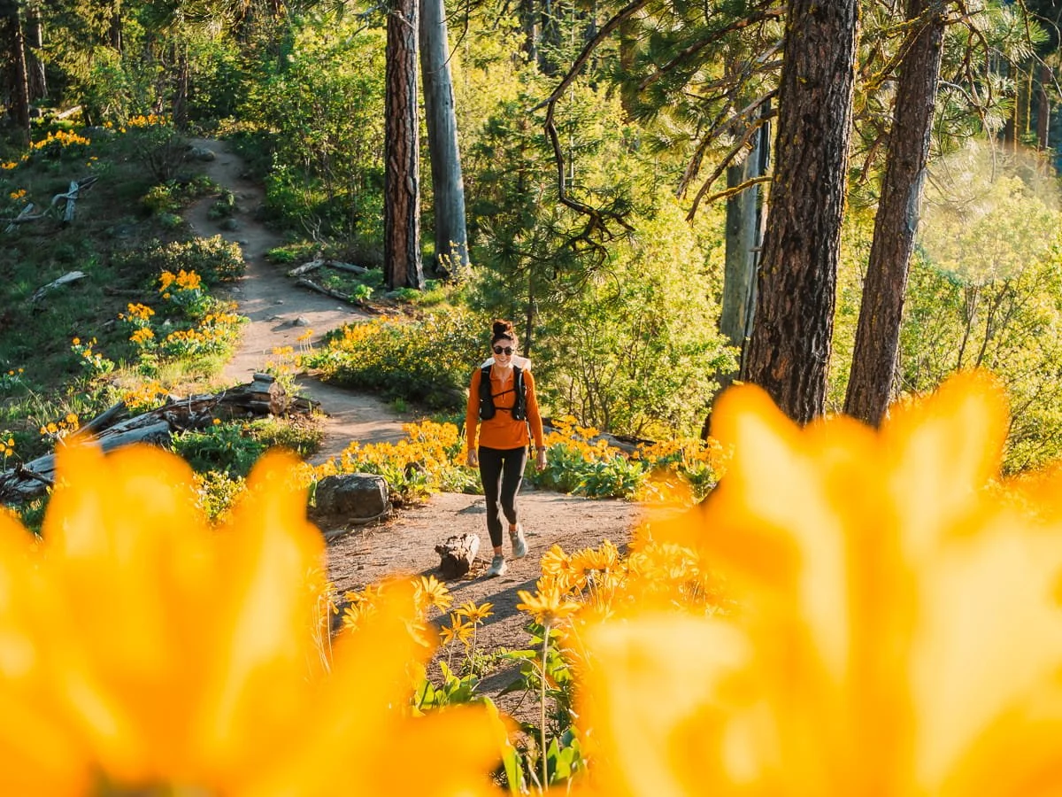
Icicle Ridge during peak spring bloom
One of the best lower-elevation hikes in the Leavenworth area, and a great option when you want views without the alpine lake crowds. Icicle Ridge climbs steadily through a mix of forest and open sun-exposed slopes bursting with wildflowers in spring, eventually reaching a ridge-line with sweeping panoramic views of Leavenworth and the surrounding Cascade peaks.
Trailhead: Icicle Ridge Trailhead
Difficulty: Moderate
Total Distance: 4.8 mi (7.7 km) round trip
Elevation Gain: ~1,800 ft (549 m)
Highest Point: ~3,000 ft (914 m)
Duration: 2–4 hours
Use Permit: None required
Parking Pass: None required
Dogs: Allowed on leash
Best Season: April - June wildflower season
Trail Conditions: Check recent WTA trip reports
GPX Route: GaiaGPS map to Icicle Ridge View Point
The Full Enchantments Thru-Hike (Enchantments Traverse)
Prusik Peak in the Core Enchantments during the fall
If you've hiked to Colchuck Lake and you're looking for a bigger challenge, the full Enchantments traverse is a popular thru-hike of the core Enchantments. Colchuck Lake is actually the first major waypoint of the 18.3-mile thru-hike, which continues up Aasgard Pass into the Core Enchantments and descends past Snow Lakes to a second trailhead. No overnight permit required, just a free self-issued day-use permit and a very early start.
→ Read our Complete Enchantments Day Hike Guide for everything you need to plan and complete the traverse.
FAQ: Hiking Colchuck Lake
How hard is the Colchuck Lake hike?
Colchuck Lake is rated moderate to difficult. The trail gains ~2,154 feet over ~3.8 miles, with a steady climb through forest and a rocky final approach with a short boulder scramble. It's very doable for fit hikers but will feel challenging if you're not used to sustained uphill on uneven terrain.
Do I need a permit to hike Colchuck Lake?
You need a free self-issued day-use permit available at the trailhead kiosk, no reservation required. You also need a Northwest Forest Pass or America the Beautiful Pass for parking. If you want to camp at Colchuck Lake, that requires a separate, competitive overnight permit through the Recreation.gov lottery.
How long does it take to hike to Colchuck Lake?
Most hikers complete the round trip in 3–6 hours depending on pace, how long you spend at the lake, and fitness level. Strong hikers who move efficiently can do it in under 3 hours round trip. Plan for 5–6 hours if you want to relax at the lake and take your time.
What time should I start the Colchuck Lake hike?
Start as early as possible, ideally at or before sunrise during weekends and summer months. The parking lot fills by 8:00 AM on summer weekends and even earlier during larch season. Morning light also makes for the best photography at the lake.
Are dogs allowed on the Colchuck Lake trail?
No. Dogs are prohibited throughout the Enchantments permit area, including the trail to Colchuck Lake and the Colchuck Zone. This is actively enforced by rangers.
Is there water on the Colchuck Lake trail?
Yes, there's a good water source at Mountaineer Creek (bridged, ~1 mile in) and the lake itself is an excellent refill spot. Most hikers bring their own water (1.5-2L) and a backup water filter like the Katadyn BeFree.
Can beginners hike to Colchuck Lake?
Active beginners who are reasonably fit can absolutely do this hike, but it shouldn't be your first alpine trail. We recommend being comfortable with 5–8 mile hikes with 1,500+ feet of gain (e.g. Mount Si, Mailbox Peak, etc.) under your belt before tackling Colchuck Lake.
What's the best time of year to hike Colchuck Lake?
Mid-July through September for the best all-around conditions. Late September to early October for larch season. See our seasonal table above for full details.
Is there parking at the Stuart Lake Trailhead?
Yes, but it fills fast. The lot is first-come, first-served for day hikers (overnight permit holders have designated spots). Plan to arrive before 8:00 AM on summer weekends. A Northwest Forest Pass or America the Beautiful Pass is required for parking.
Can I camp at Colchuck Lake?
Not without an overnight permit for the Colchuck Zone. Camping without a permit is prohibited and rangers enforce this. See our Enchantments Backpacking Guide for permit details.
What should I pack for the Colchuck Lake hike?
See the gear section above for our full recommendations. At minimum: water + filter, snacks/lunch, extra warm layer, rain jacket, sun protection, and a downloaded navigation track. Check our Day Hike Packing List for a full rundown.
Is the Colchuck Lake trail the same as the Stuart Lake trail?
Yes and no. Both hikes start at the same trailhead and share the same trail for the first 2 miles. At a signed junction around mile 2, the trail splits: bear left for Colchuck Lake, bear right for Stuart Lake. From that point they're completely separate destinations.
How Far is Colchuck Lake from Seattle?
Colchuck Lake is approximately 130 miles from Seattle, about a 3-hour drive depending on traffic. Take I-5 or I-405 north to US-2 East over Stevens Pass, then continue into Leavenworth and turn south on Icicle Creek Road to the Stuart Lake Trailhead. An alternate route via I-90 over Snoqualmie Pass is a good backup during Stevens Pass closures or heavy weekend traffic on US-2
Can I swim in Colchuck Lake?
Swimming is permitted at Colchuck Lake. Beware that the water can be extremely cold (low-to-mid 50s°F) even during hot summer months. The best entry spots are along the flat granite slabs on the west side of the lake. There's no lifeguard, no amenities, and no shallow wading areas.

At Colchuck Lake for sunrise
Final Thoughts on Hiking Colchuck Lake
Colchuck Lake is one of those places that keeps us coming back year after year. We come back to enjoy the spectacular views, turquoise water and scenic trail. Colchuck Lake is certainly popular for a good reason and is one of Washington’s best hikes. We hope it inspires you to continue enjoying, exploring and even advocate to protect these special places for future generations.
Happy Hiking!
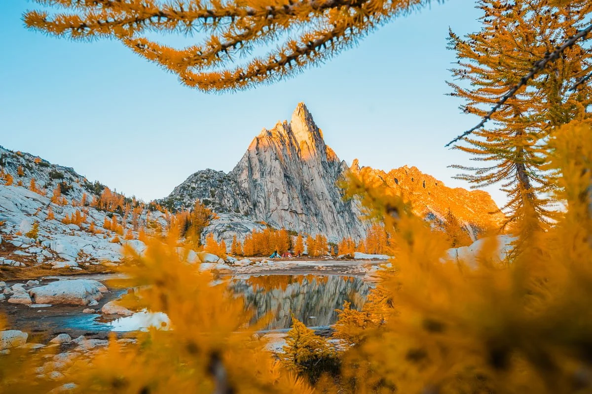
Camping in the Core Enchantments during larch season
Read On: More Enchantments & Leavenworth Guides
Enchantments & Leavenworth Hiking Guides
Gear Guides & What to Pack
Leavenworth Lodging
Liked this Post? Pin it & Save it for Later

Icicle Ridge Day Hike: The Closest Trail to Downtown Leavenworth
Olalla Canyon Ridge: The Best Wildflower Hike Near Leavenworth, WA
This image is copyrighted and owned by Skye Stoury Photography and skyestoury.com, if you would like to licence any images on this site, please email us at hello@skyestoury.com