
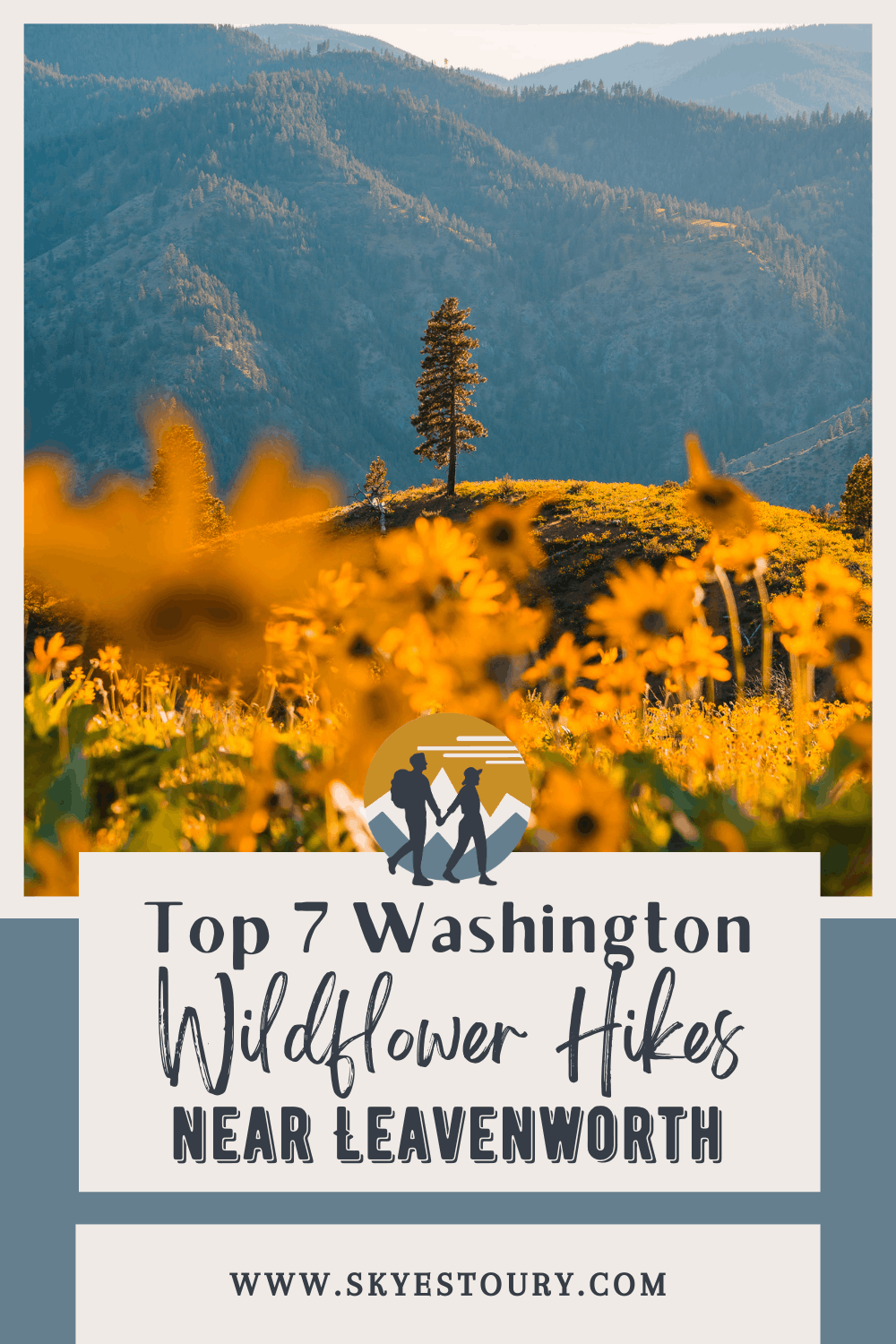
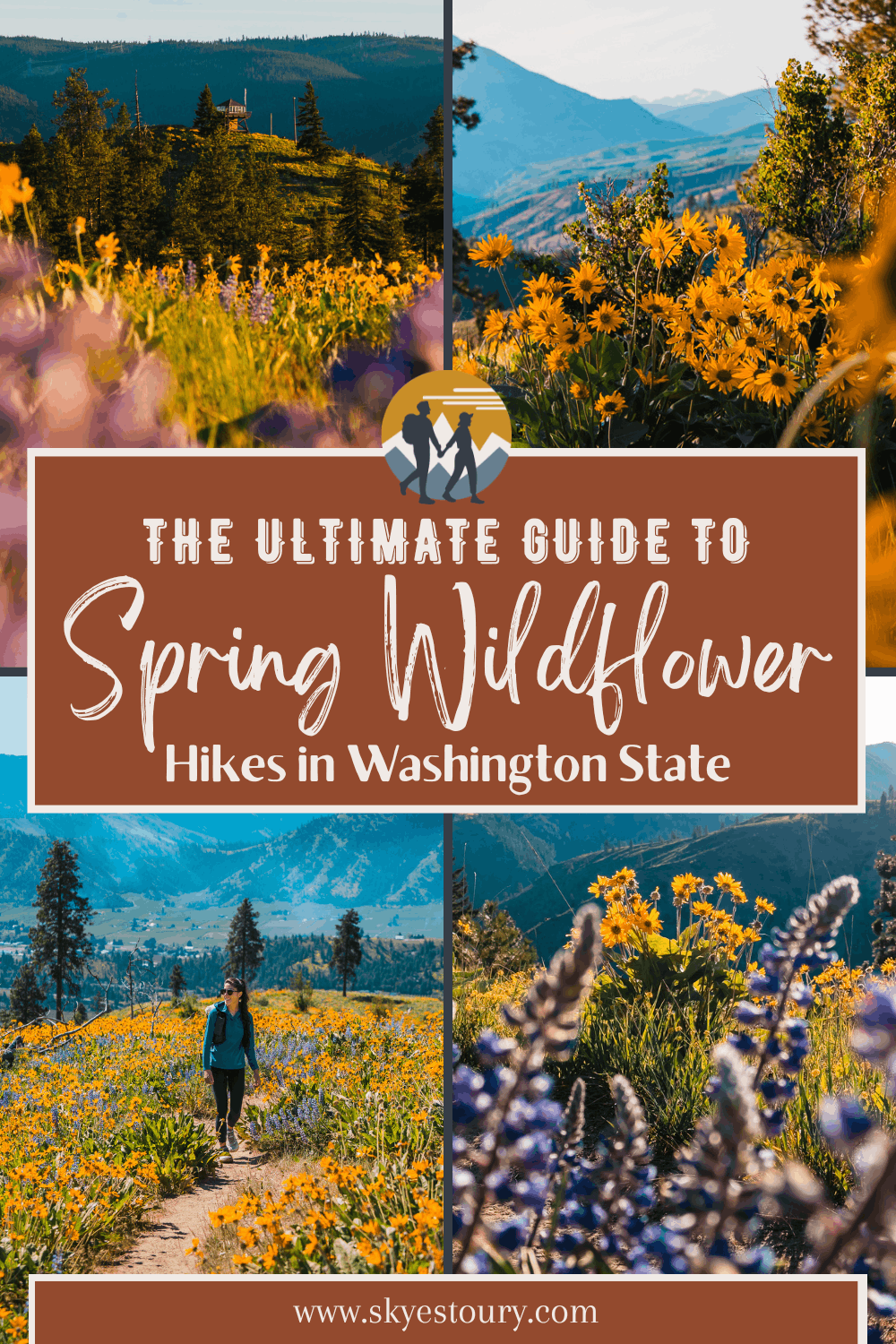
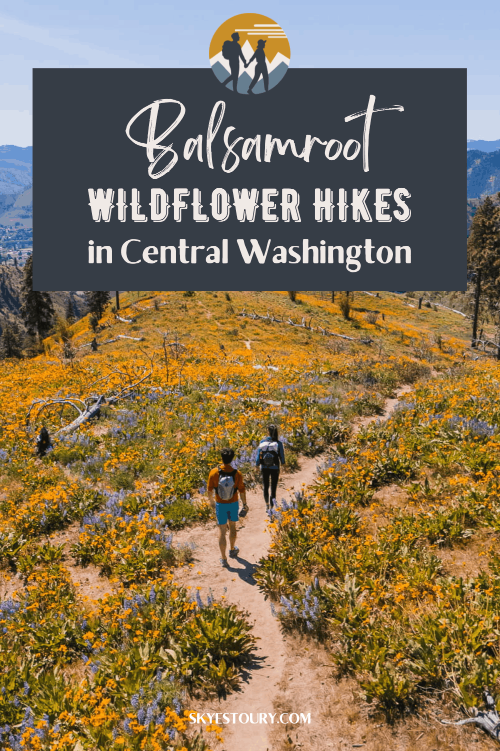
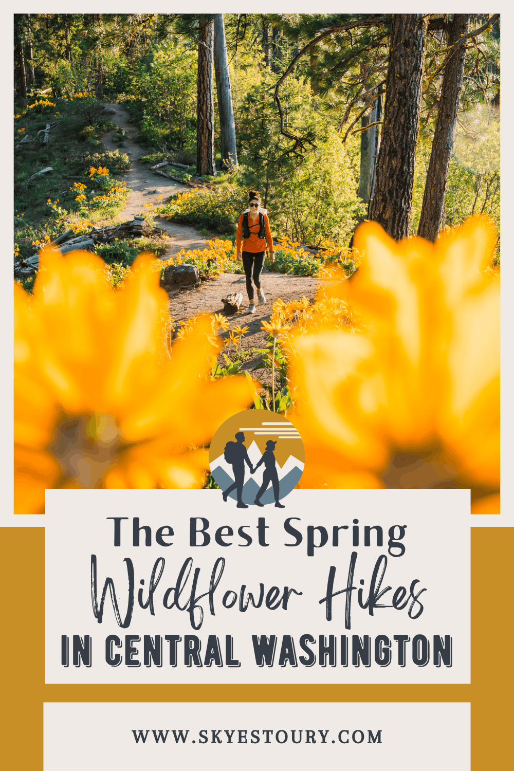
7 Best Wildflower Hikes in Washington: Central Cascades & Leavenworth (2026)
Your Complete Guide to Balsamroot and Lupine Hikes in Central Washington
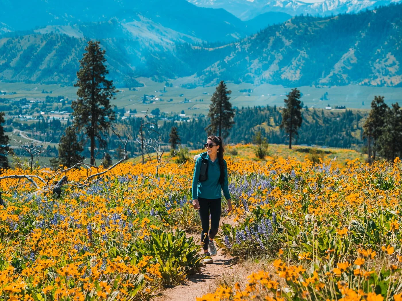
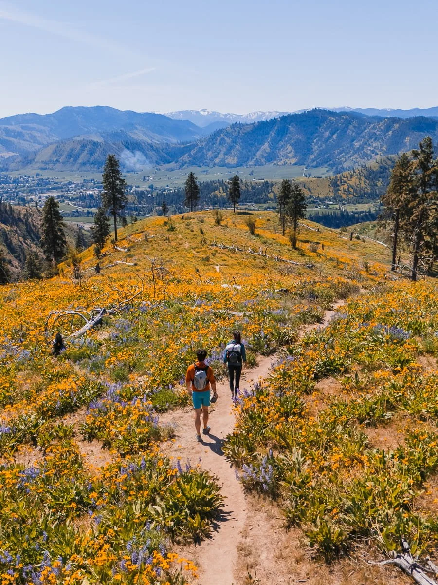
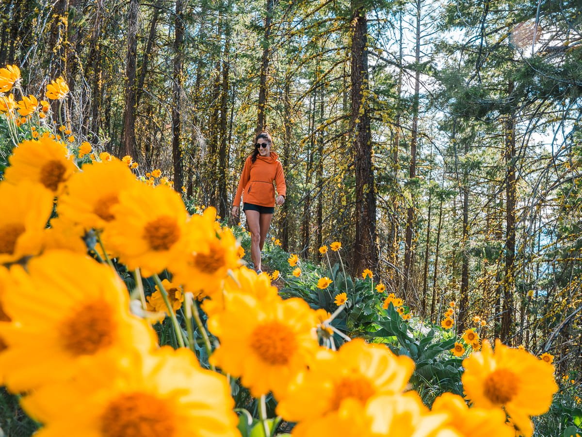
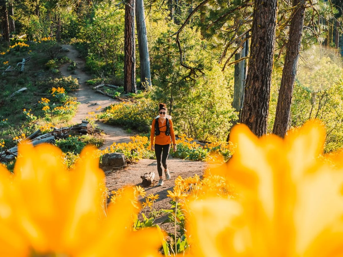
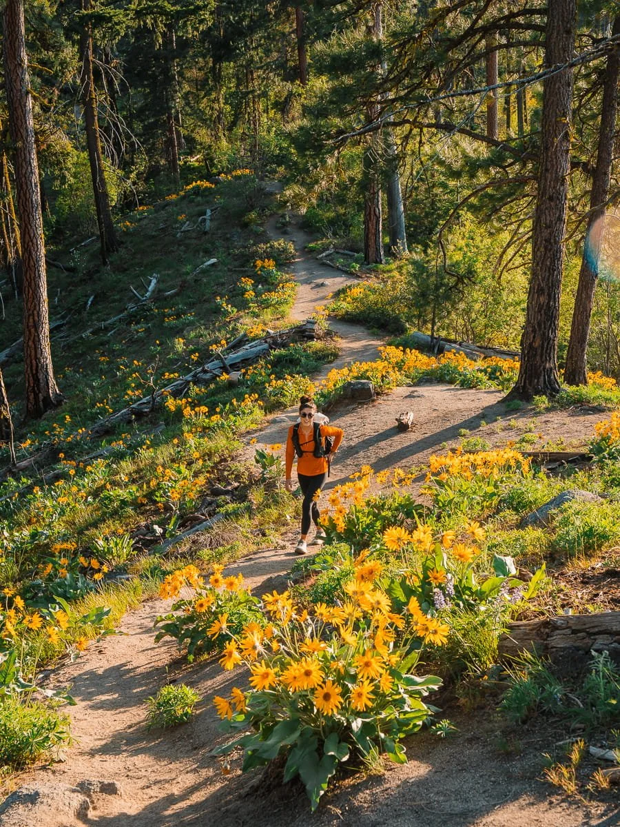
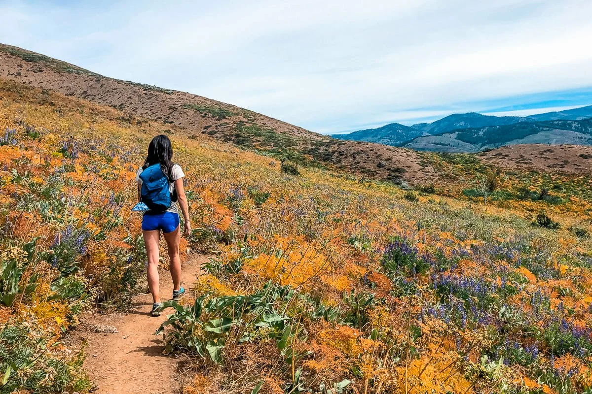
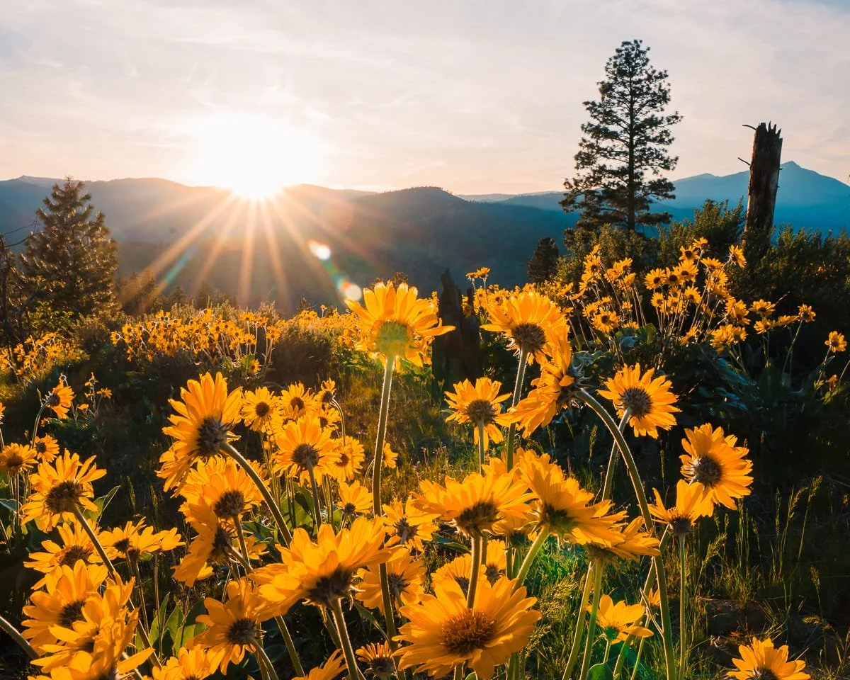
Looking for the best wildflower hikes in Washington? You're in the right place! Central Washington has some of the most incredible balsamroot and lupine displays we've ever seen. Every spring, the foothills and ridge lines around Leavenworth, Wenatchee, the Entiat, and the Methow Valley in Washington State transform into a wildflower lover’s paradise, golden hillsides as far as you can see, mixed with vibrant purple lupine.
We spent all of last spring in Leavenworth checking off as many wildflower hikes as we could, and honestly, it was one of the best hiking seasons we've experienced. Seeing entire mountainsides covered in gold reminded us of larch season, except instead of golden needles, it's thousands of balsamroot flowers lighting up the landscape. If you're a sucker for gold and yellow in the outdoors like we are, balsamroot season in Central Washington is going to become one of your favorite times to hit the trails.
This guide covers the 7 best wildflower hikes near Leavenworth and Wenatchee that we explored last spring, including some lesser-known gems that offer spectacular blooms without the massive crowds.
Why trust this guide? We're Washington locals (Skye & Garrett) who spent the entire 2025 spring wildflower season hiking these trails, photographing the blooms, and figuring out exactly when and where to find the best displays. We've also been exploring wildflower hikes across Washington for years, and these seven trails are truly the best of the best for balsamroot and lupine in Central Washington. Plus, as photographers, we made sure every trail on this list is absolutely stunning, not just to hike, but to photograph too.
Below you'll find everything you need to plan your Washington wildflower hike: when to go for peak blooms, detailed trail info for each hike, what to pack, and where to stay in the area.
Affiliate Disclaimer: This blog post contains affiliate links, meaning we receive a small commission of every purchase made with our links at no additional cost to you. Sometimes there is even a discount code for our readers which we specify next to the links.
Table of Contents
What Wildflowers Will You See in Central Washington?
Central Washington's spring wildflower displays are dominated by two spectacular species that create the iconic color palette of golden hillsides and purple accents that draw hikers from across the Pacific Northwest. You may see a lot more types of flowers on your hikes as well, but we are focusing this guide on both balsamroot and lupine hikes.

Balsamroot flowers in Entiat, Washington
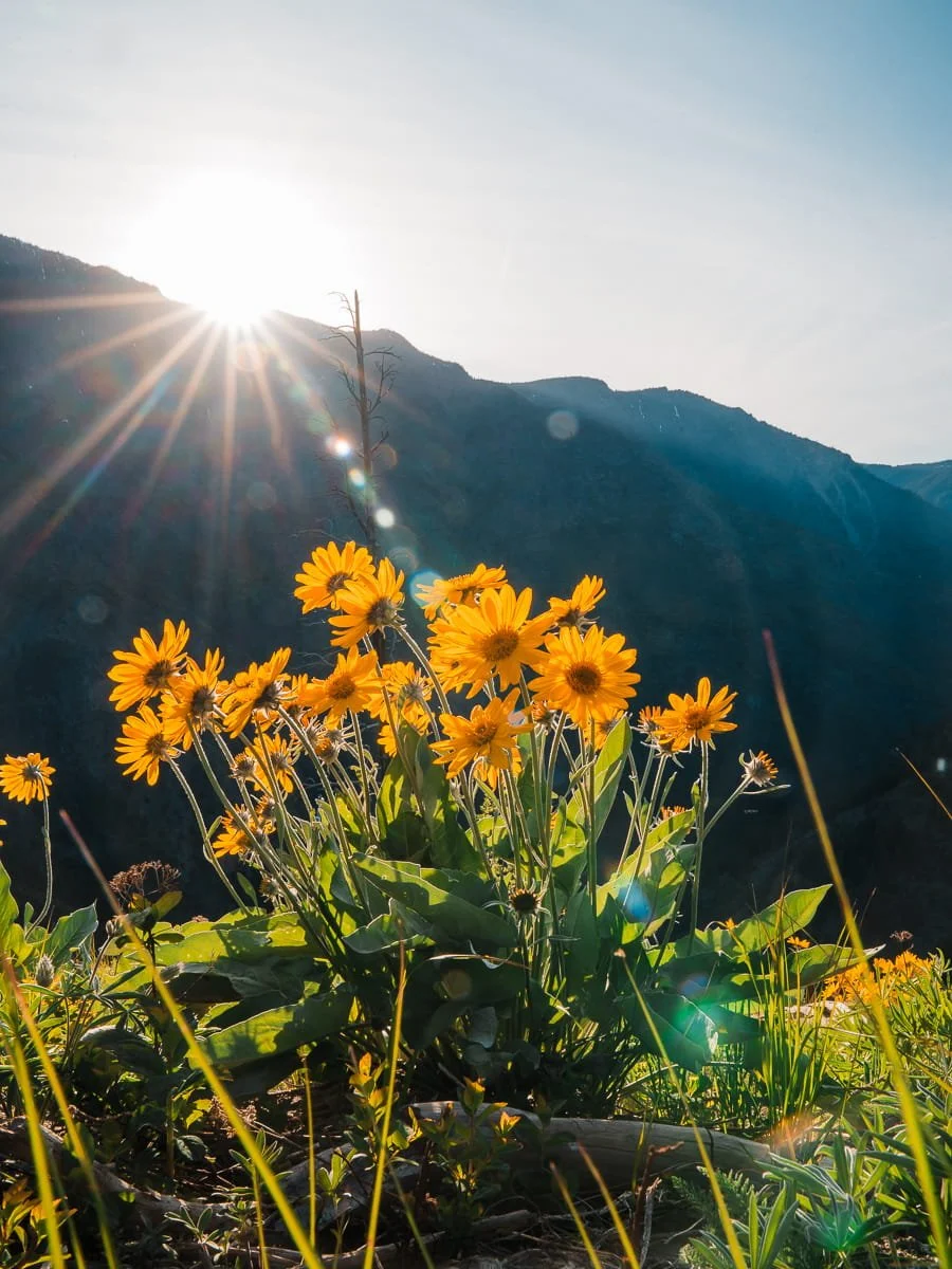
Balsamroot (Balsamorhiza sagittata)
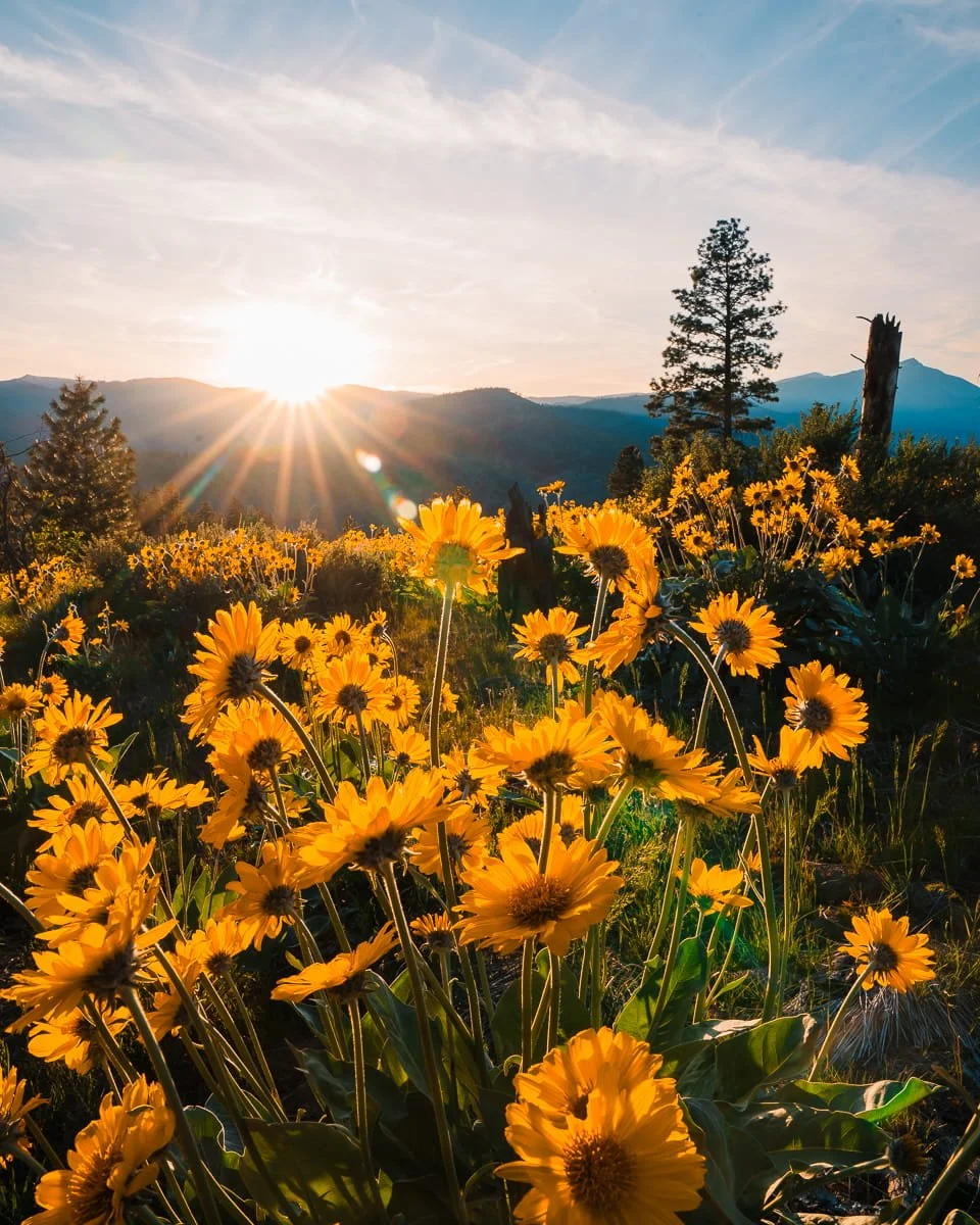
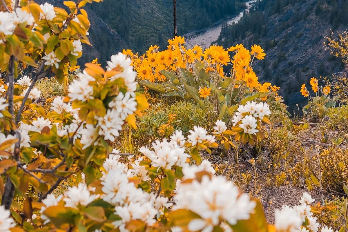
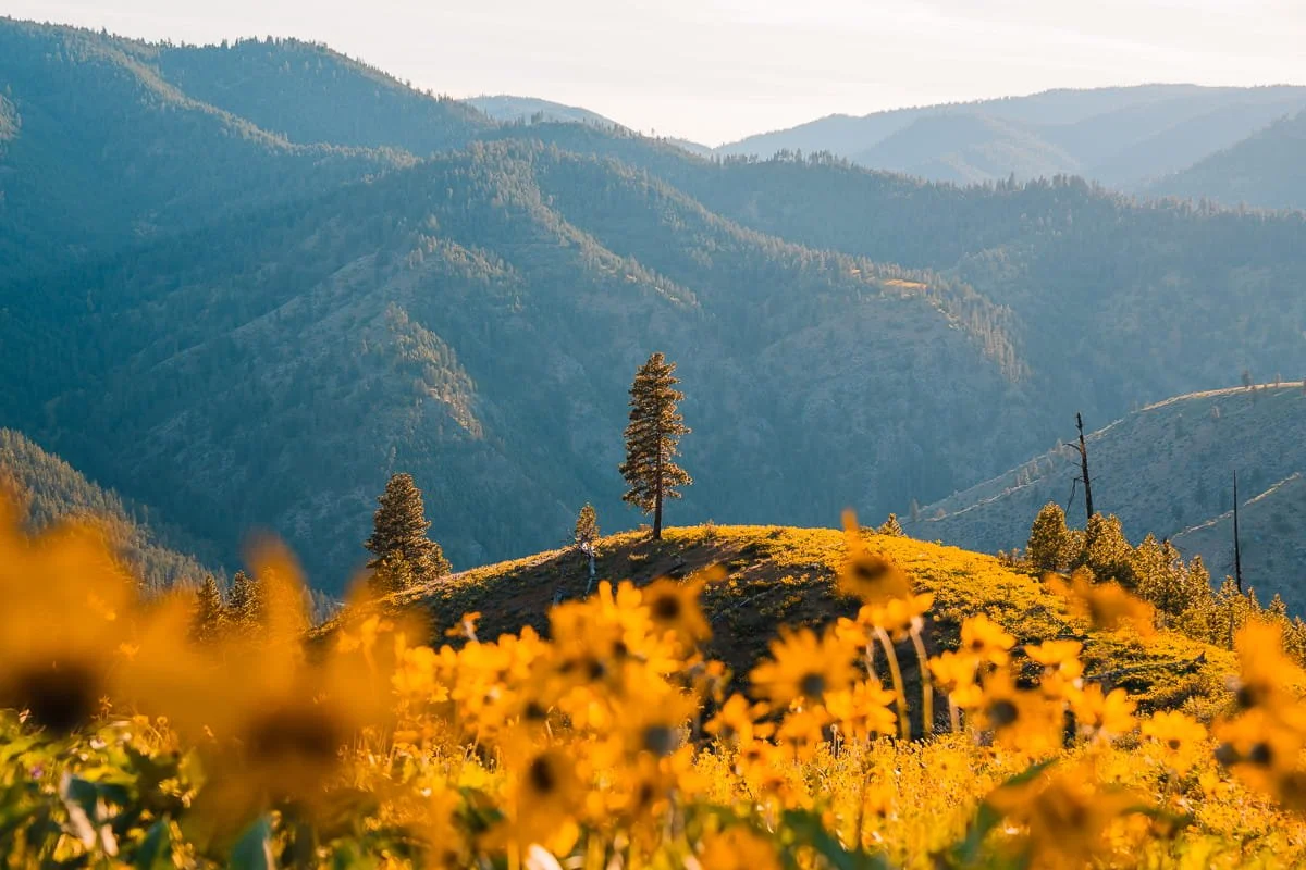
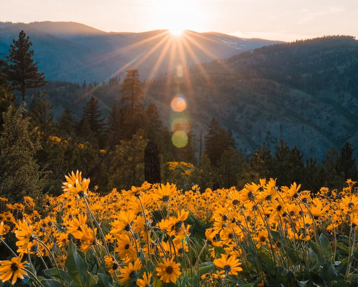
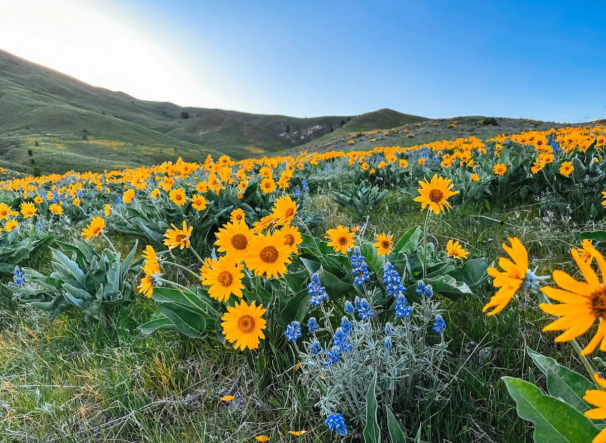
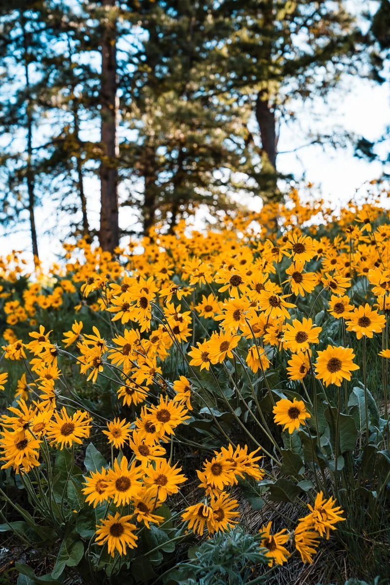
Balsamroot is the star of the show throughout Washington in the spring and the main flower you will see on all of the hikes below. These bright yellow flowers are often mistaken for oversized daisies or sunflowers, and it's easy to see why, their bright golden petals and large flower heads (3-5 inches across) create a sunflower-like appearance that covers entire hillsides during peak bloom.
But balsamroot is actually part of the aster family and is uniquely adapted to the high desert environment of Central and Eastern Washington. Each plant produces large, silvery-green arrow-shaped leaves and sturdy stems that can reach 1-2 feet tall. The plants have deep taproots that can extend 6-10 feet into the ground, allowing them to survive the hot, dry summers after their brief spring blooming period.
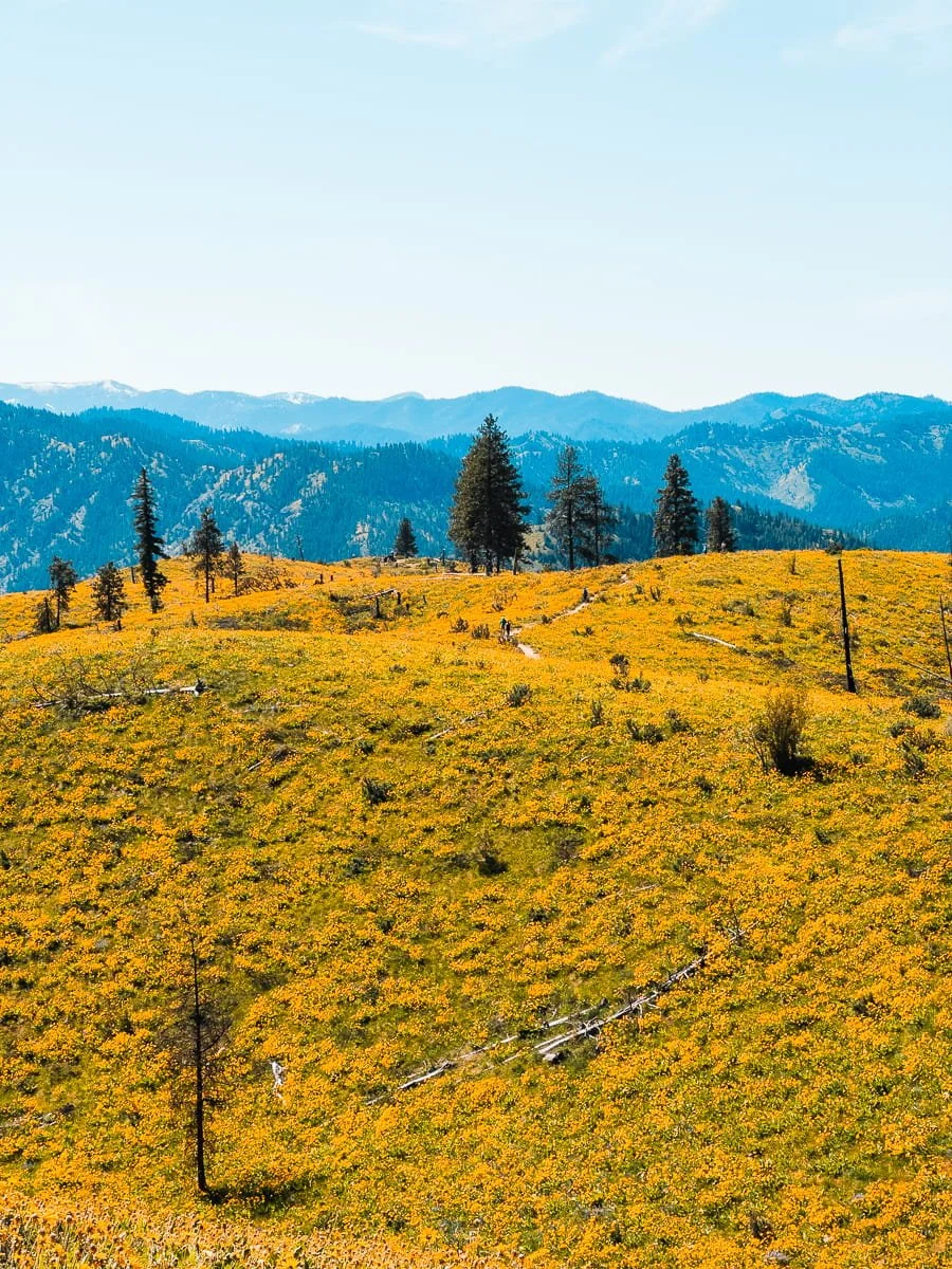
During peak season in late April and early May, balsamroot transforms entire mountainsides into seas of gold. The flowers are particularly photogenic in morning and late afternoon light, when their petals glow against the backdrop of snow-capped Cascade peaks. Indigenous peoples of the region traditionally used balsamroot for food and medicine, harvesting the roots and seeds.
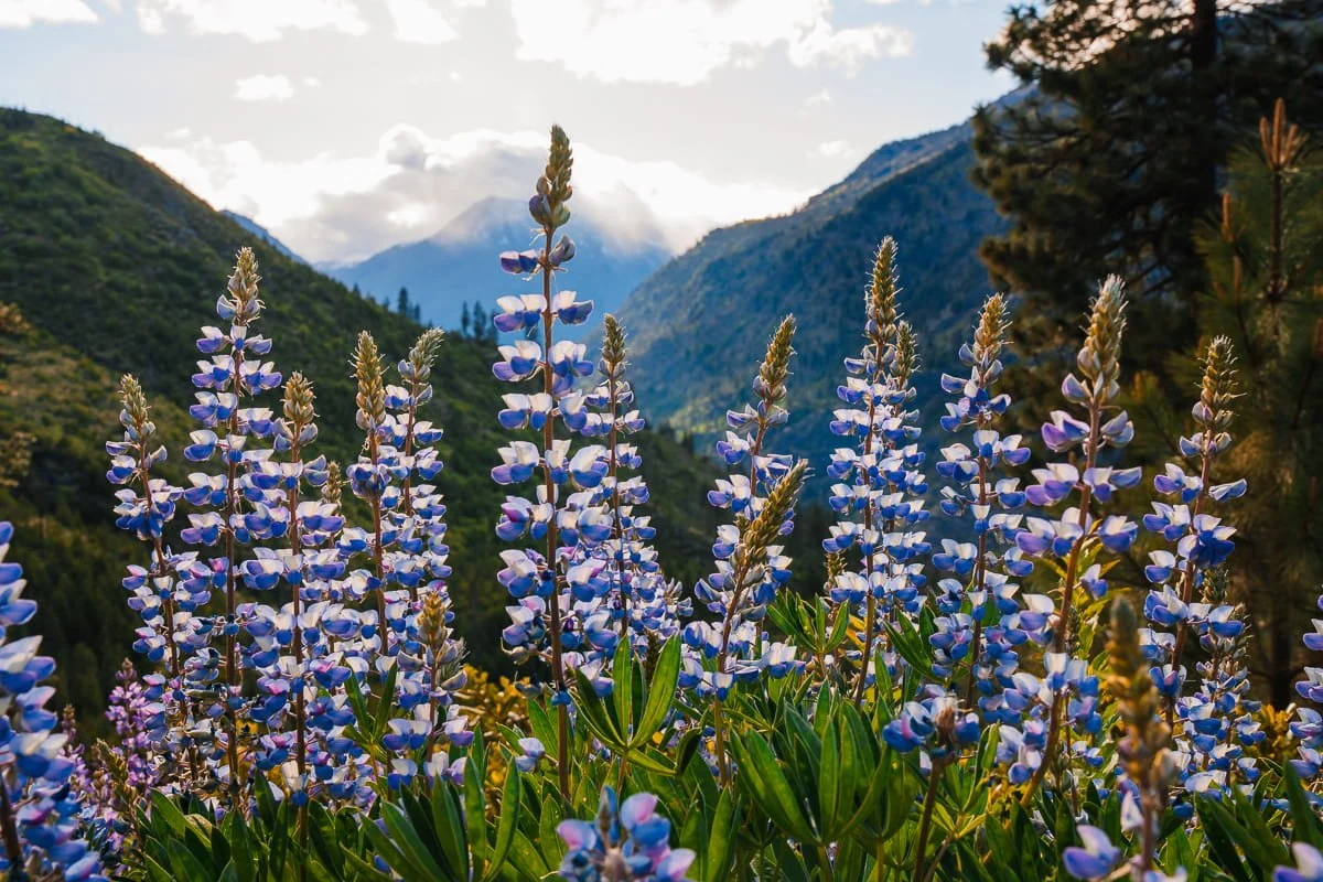
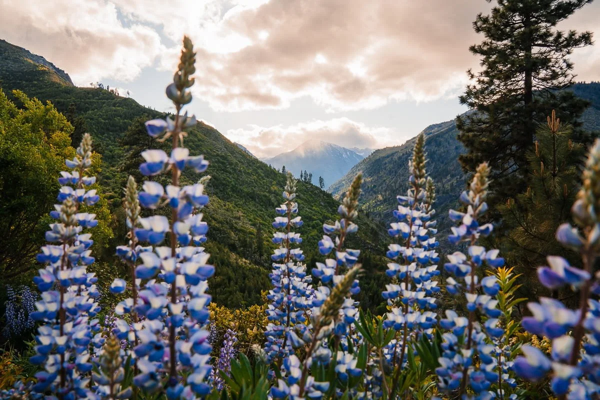
Lupine in Leavenworth, Washington
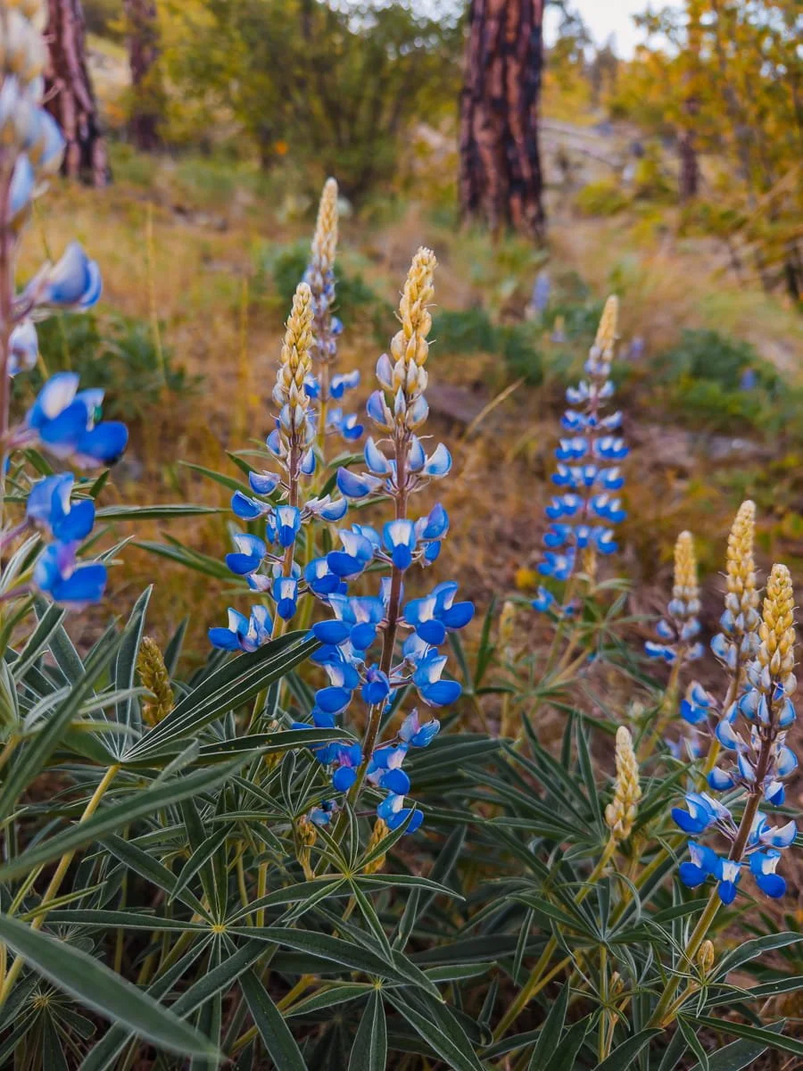
Lupine (Lupinus spp.)
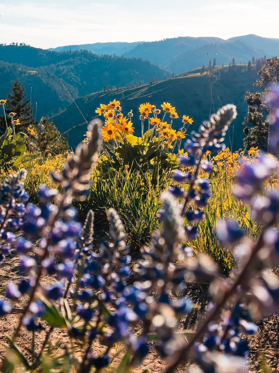
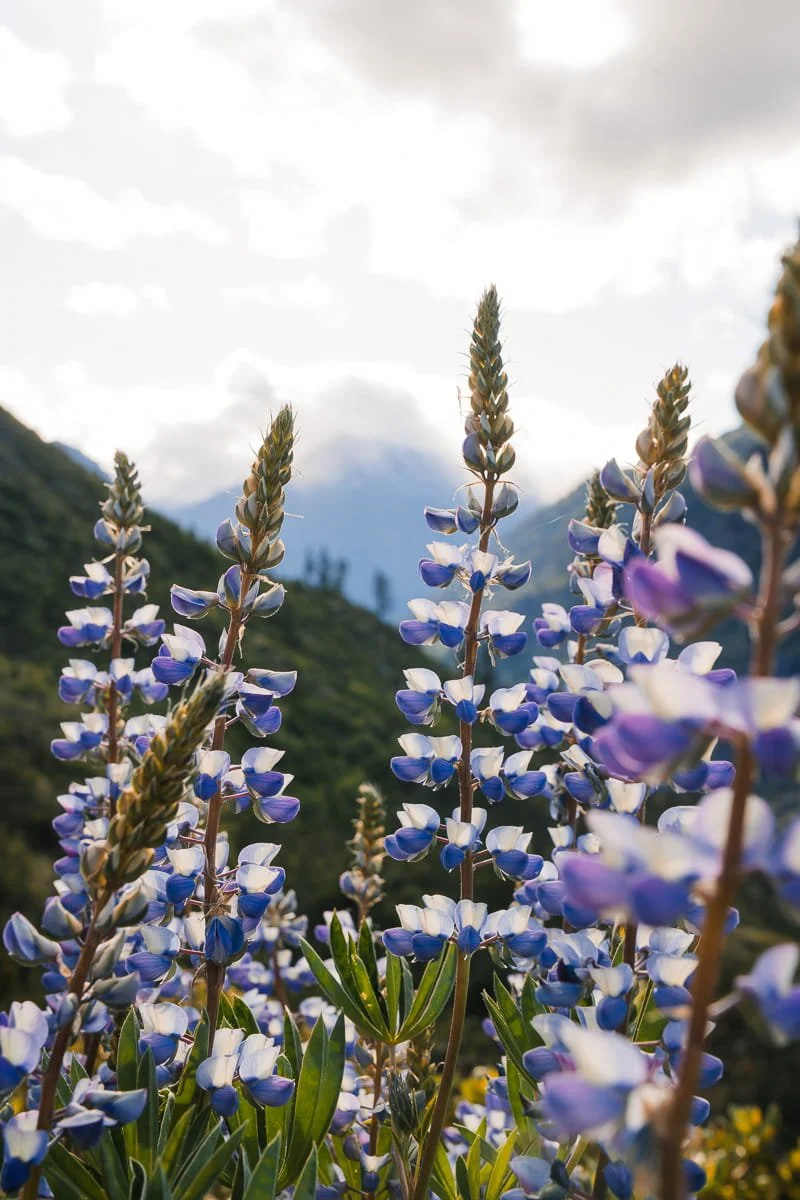
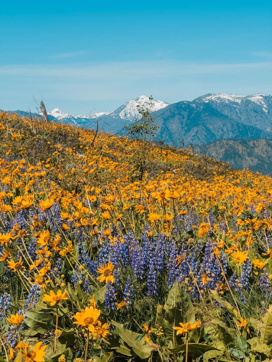
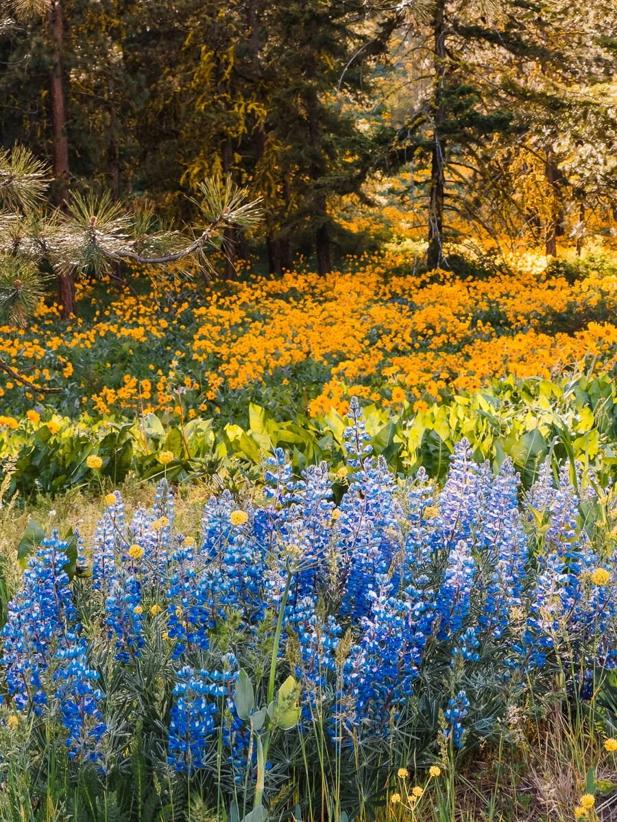
Lupine provides the perfect purple (or pink) complement to balsamroot's golden display. These striking flowers grow in tall spikes covered with dozens of individual pea-like blooms, typically in shades of deep purple, violet, or blue. Some varieties also bloom in pink or even white, adding subtle variation to the color palette.
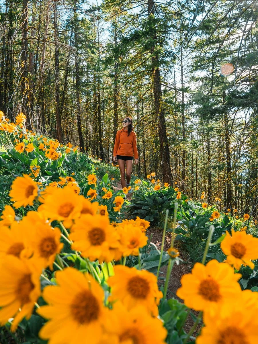
Lupine typically blooms slightly later than balsamroot, with peak displays occurring from mid-May into early June depending on elevation. Leavenworth’s Icicle Ridge is a perfect example of blooming season, as it gets covered in balsamroot first and then a few weeks later is all lupine. I did this hike twice last spring and got to see both.
The flowers are members of the legume family and play an important ecological role by fixing nitrogen in the soil, enriching the nutrient-poor volcanic soils common in Central Washington.
You'll often find lupine mixed throughout balsamroot meadows or forming their own purple patches on hillsides. The combination of golden balsamroot and purple lupine against green grasses and blue skies creates the quintessential Central Washington wildflower scene that photographers and hikers travel hours to witness.
Wildflowers on Icicle Ridge in Leavenworth, Washington
Other Wildflowers You Might See on Central Washington Hikes
While balsamroot and lupine steal the show, Central Washington's wildflower season includes dozens of other species.
Desert Parsley (Lomatium spp.) - Small yellow umbrella-like flower clusters that bloom early season, often appearing before balsamroot, some desert parsley varieties bloom in purple/wine colors (Columbia desert parsley)
Phlox - Low-growing pink or white flowers that carpet rocky areas
Indian Paintbrush - Vibrant red-orange bracts that add splashes of fire to meadows
Death Camas - Delicate white star-shaped flowers (beautiful but poisonous—don't touch!)
Bitterroot - Pink flowers that hug the ground in rocky, exposed areas
Arrowleaf Groundsel - Bright yellow flowers on tall stems, often found at higher elevations
The diversity of wildflowers increases with elevation, so longer hikes that climb from lower sagebrush zones into subalpine meadows offer the greatest variety of species.
Golden hour with balsamroot flowers along the Steliko Lookout hike in Entiat, Washington
When Do Balsamroot Wildflowers Usually Bloom in Central Washington?
Timing your visit for peak balsamroot bloom is the key to experiencing Central Washington's wildflower season at its best. And since the hikes in this guide focus on balsamroot blooms, we’re going to speak to the timing for these wildflowers in particular.
Unlike most alpine wildflowers that bloom predictably once snow melts, balsamroot timing varies significantly from year to year based on winter snowpack and spring temperatures. Since 2026 was a low snow year, they may come early. But, the Leavenworth area also got a dump of late season snow in March this year, so it may be a little harder to predict the exact timing.
If you’re looking for lupine, they usually bloom a couple of weeks later than the balsamroot, and can continue well into summer depending on the location and elevation.
Typical Bloom Timeline for Balsamroot
Early Season (Late April - Early May)
Lower elevation trails (2,000-3,000 feet) around Wenatchee and along the Columbia River typically see peak balsamroot blooms first. Trails like Olalla Canyon Ridge, Sage Hills, and the lower sections of Nahahum Trail usually hit peak color in the last week of April through the first week of May. Sage Hills balsamroot blooms a week to two weeks earlier than trails in Leavenworth and Cashmere.
Mid Season (Early to Mid-May)
Mid-elevation trails (3,000-4,000 feet) near Leavenworth and Entiat reach peak bloom in early to mid-May. Canyon Crest Trail, Icicle Ridge, and Steliko Ridge typically peak during this window, with balsamroot covering hillsides while lupine is just beginning to emerge.
Late Season (Late May - Early June)
Higher elevation trails (4,000+ feet) and north-facing slopes bloom latest, often extending into late May or early June. This is also when lupine reaches peak bloom at lower elevations, creating beautiful mixed displays alongside late-blooming balsamroot.
What Affects Bloom Timing?
Winter Snowpack
Heavy snow years delay bloom by 1-2 weeks, while light snow years advance it. The snowpack acts as a moisture reservoir that influences soil temperature and water availability.
Spring Temperatures
Warm, sunny spring weather accelerates blooming, while cool, wet springs delay it. A stretch of 70-80°F days in late April can trigger rapid blooming across entire regions.
Elevation
For every 1,000 feet of elevation gain, expect blooms to lag by approximately one week. This means you can "chase" peak bloom up the mountains as the season progresses.
Aspect
South-facing slopes receive more direct sunlight and bloom 5-10 days earlier than north-facing slopes at the same elevation.
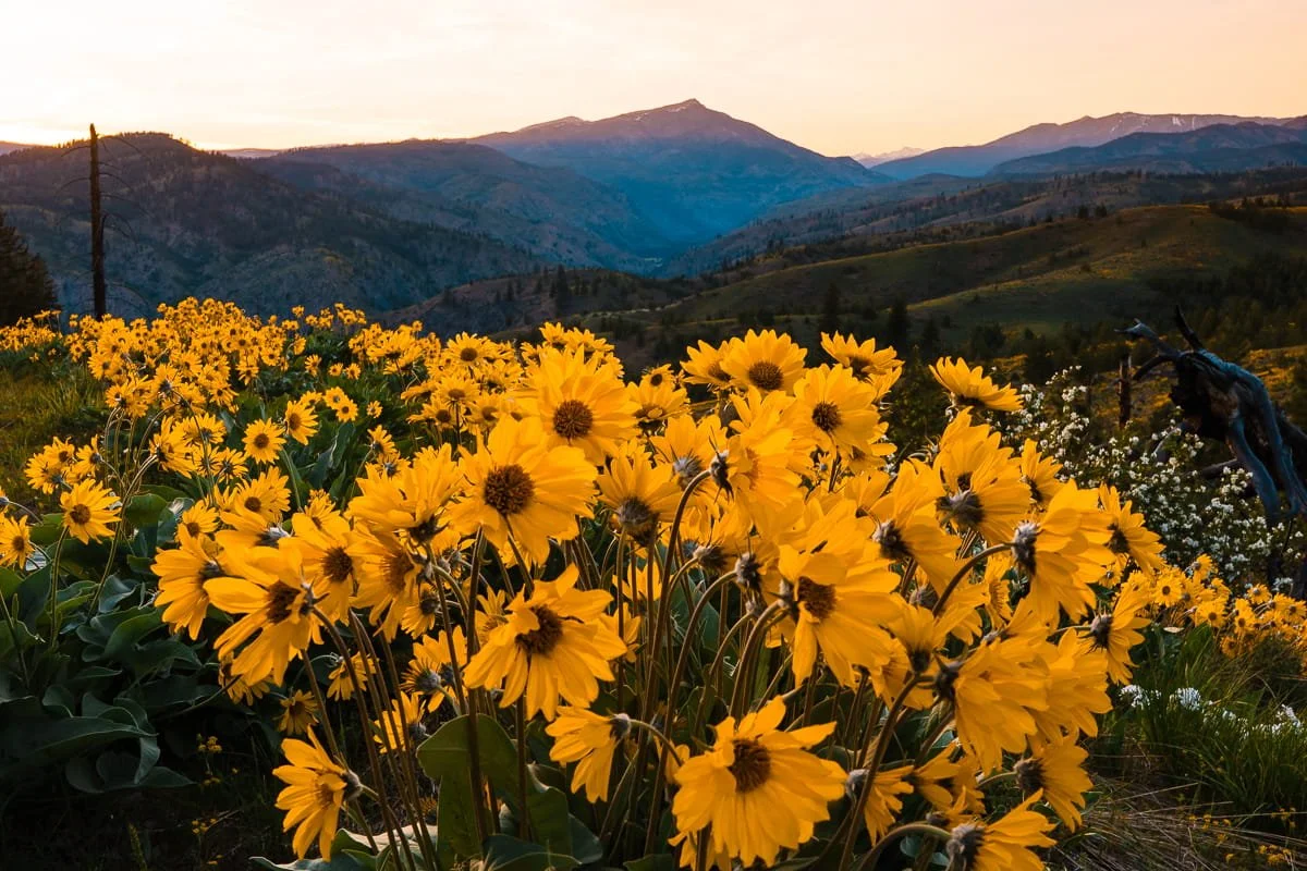
Balsamroot at sunset in the Entiat
How to Predict Peak Bloom
It can be hard to predict exactly when peak blooms will happen, and each hike will be a little different in terms of timing. But the majority of these hikes will bloom in early May, with lupine peaking mid May. The best strategy for timing your visit is to monitor real-time conditions starting in mid-April.
Check Trip Reports - Washington Trails Association (WTA.org) and AllTrails feature recent trip reports where hikers share wildflower conditions and photos. Look for reports from the past 3-5 days.
Follow Local Hiking Groups - Facebook groups like "Washington Hikers and Climbers", keeping track of trip reports on Washington Trails Association’s hiking pages and even on AllTrails hikes, all of which provide real-time bloom updates and photos.
Watch Weather Patterns - If you see a week of warm, sunny weather (70°F+) in late April, blooms will likely peak within 7-10 days. Plan your trip accordingly.
Use Elevation to Your Advantage - If you miss peak bloom at lower elevations, simply head to higher trails where flowers are just beginning. This extends your window for catching prime displays.
Peak Bloom Duration
Individual balsamroot flowers last about 10-14 days once they open. However, because different slopes and elevations bloom at slightly different times, most trails offer good wildflower displays for 2-3 weeks. The absolute peak—when hillsides are 80-100% covered in blooms—typically lasts just 5-7 days per trail.
This narrow peak window is why flexibility in your trip timing is so valuable. If you can monitor conditions and adjust your plans by even a few days, you'll dramatically increase your chances of witnessing the most spectacular displays.
If You Can Only Visit Once
If you need to book accommodations or travel plans in advance and can't adjust based on conditions, aim for the last week of April through the first week of May (approximately April 25 - May 7). This window historically offers the best chance of catching peak bloom on at least some of the trails in this guide, even in early or late bloom years.
Hiking Olalla Ridge in Cashmere, Washington
What to Know Before Your Central Washington Wildflower Hike
Hiking wildflower trails in Central Washington during peak blooming season in spring comes with a few unique considerations compared to your typical summer hike in the Cascades. These trails have grown in popularity over the last few years, especially during peak balsamroot season, so you can expect serious crowds on weekends in late April and early May.
Our biggest tip? Have a backup plan. If you arrive at a trailhead to find an overflowing parking lot or cars lined up down the road, don't add to the problem—head to one of the less popular hikes on this list instead. Overcrowding isn't fun for anyone, and it can cause serious damage to fragile wildflower meadows and trails.
Better yet, hike midweek if you can. We did all of these hikes on weekdays last spring and had zero issues finding parking or dealing with crowds. The trails were quieter, the experience was better, and we got way more opportunities for photos without other hikers in the frame.
Check out the details below for everything you need to know to have a safe, fun, and responsible wildflower hike in Central Washington.
Weather and Temperatures in the Central Cascades
Spring weather in Central Washington can be very unpredictable. While days are often sunny and warm (60-80°F), temperatures can drop significantly in the mornings and evenings, especially at higher elevations. Thunderstorms in Central Washington are rare but rain is very common in the spring, so always check the forecast before you go and be prepared for changing conditions.
Because of changing weather, always pack extra layers and the Ten Essentials.
Trail Conditions in Central Washington
This guide focuses on lower elevation trails (under 3,500 feet) which are typically snow-free by late April in the Leavenworth/Wenatchee area. To target the best times, we recommend always checking for recent trip reports on Washington Trails Association or All Trails before heading out to confirm trail conditions (and adding your own trip report after you visit).
Some of these trails involve significant elevation gain. Switchbacks can be steep, and the dry, loose soil can make footing tricky in places. Trekking poles are helpful for stability and reducing impact on your knees during descents.
Sun Protection on Spring Hikes
Sun exposure can be intense in Central Washington. The combination of elevation, low humidity, and minimal tree cover means you could be in direct sunlight for hours. Sunscreen, sunglasses, and a sun hat or sun hoodie are essential. Be sure to check out our guide reviewing the Best Sun Hoodies and Sun Shirts for Hiking.
Parking and Trailhead Access
Many of these trails require a Northwest Forest Pass ($5 day pass or $30 annual pass) or America The Beautiful Pass to park at the trailheads. And some of these trailheads are reached via gravel forest roads that can be rough but are typically accessible to all vehicles by late April. Popular trails can fill up quickly on peak wildflower weekends. Arrive early (before 8:00 AM) or later in the day for sunset to secure parking, especially on trails near Leavenworth.
Weekday visits offer more solitude and easier parking.
Wildlife Considerations on Trail
Central Washington is home to rattlesnakes, which become active in spring and are most commonly seen on warm, sunny days on lower-elevation trails. Stay on established trails, watch where you put your hands and feet, keep your pets leashed, and give snakes space if you encounter them. This is a good reason not to go off trail or walk through the wildflower meadows, since you can’t see the ground and snakes could be present. Rattlesnake encounters are rare but possible, we’ve had our share of scares over the years in the Leavenworth area in spring.
Black bears are present throughout the region but encounters are uncommon on these day hikes. Make noise on the trail if you feel worried, especially in brushy areas, and store food properly if taking breaks. Good food storage goes for other critters too, don’t set your pack down and walk away. Rodents will chew holes into your pack and eat your snacks.
Ticks are also common in these areas in the spring. To avoid them, wear long pants, check yourself after hikes, and consider treating clothing with permethrin.
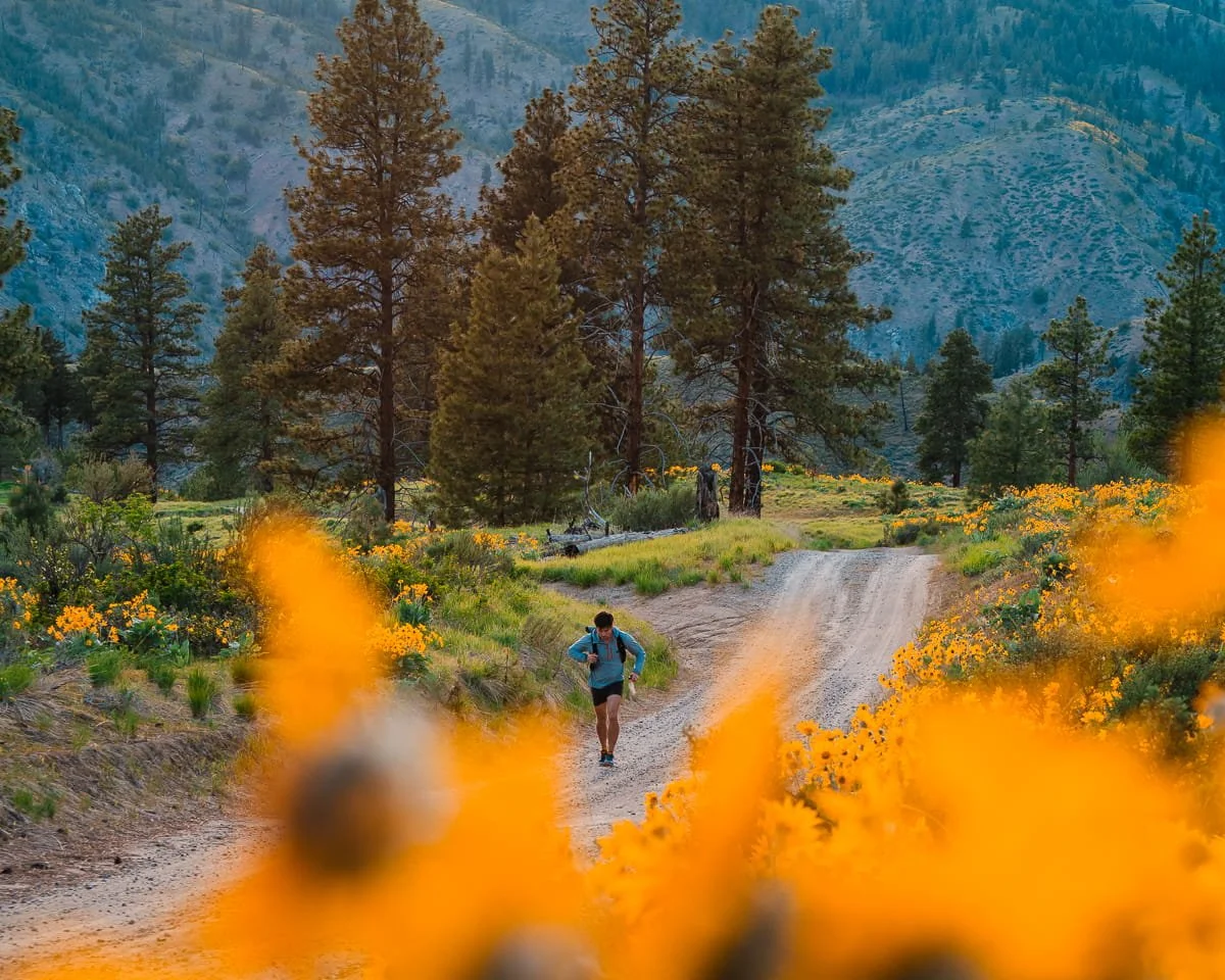
Garrett trail running up to Steliko Lookout
Leave No Trace Ethics for Wildflower Season
Wildflower season brings huge crowds to Central Washington's trails, and with that comes increased pressure on these fragile high desert ecosystems. We've seen the damage firsthand—trampled meadows, picked flowers, and trash left behind—and it's heartbreaking.
Following Leave No Trace principles isn't just about being a good hiker; it's about making sure these wildflower displays are still here for future generations. The biggest thing we want to get across is DO NOT pick any wildflowers. We have seen too many hikers doing so, and always speak up when we see it. We hope you will do the same.
Below is what you need to know to recreate responsibly during wildflower season.
Stay on Established Trails
This is the big one. Trampling vegetation creates long-lasting damage in wildflower meadows. A single footstep can destroy years of growth, create new social trails (unofficial paths created by foot traffic off-trail), and ruin the blooms for everyone who comes after you. This goes for both people and pets. Keep your dog on leash and don’t let them run through the meadows.
We know it's tempting to wander off-trail for that perfect photo when you're surrounded by thousands of balsamroot flowers, but please don't. We have managed to get amazing photos while staying on trail, it’s all about perspective and the angle you shoot at.
Always stay on established trails, even when it's crowded. If you need to stop for photos, step on rocks or bare dirt rather than vegetation. The flowers will still be stunning from the trail, we promise.
Don't Pick Flowers
This should go without saying, but we've seen people do it on just about every hike, so we're saying it anyway: don't pick the wildflowers. Every flower you pick is one less seed for next year's blooms. Wildflowers are part of the ecosystem—pollinators depend on them, and removing them disrupts the natural cycle. Plus, balsamroot flowers wilt almost immediately after being picked, so you're literally destroying them for nothing.
Enjoy them with your eyes and camera, but leave them rooted in the ground where they belong.
Pack Out All Trash
Carry a small bag for trash and pack out everything you bring in: food scraps, wrappers, toilet paper, everything. "Leave only footprints" means exactly that. No orange peels, no apple cores, no "biodegradable" items left behind. If you brought it in, pack it out.
Respect Wildlife
Give animals space and never feed wildlife. Keep dogs leashed (required on most trails) to protect both wildlife and sensitive vegetation. If you encounter wildlife on the trail, maintain distance and never approach for photos. We've had some close rattlesnake encounters on these trails, and trust us, you want to give them plenty of room.
Use Designated Toilets When Available
Many trailheads have pit toilets, but we always pack a roll of toilet paper just in case. If you really need to go on the trail, follow proper Leave No Trace practices: go at least 200 feet from water sources and trails, dig a cat hole 6-8 inches deep, and pack out toilet paper in a sealed bag.
These Cleanwaste kits are great for emergencies and to throw in your pack, but you’ll want to pack some extra TP since they don’t provide much.
Educate Others (Kindly)
If you see someone stepping off-trail or picking flowers, politely share why it matters. We're all learning, and kind education goes a lot further than judgment or social media shaming. A friendly "Hey, just so you know, stepping on the flowers damages them for next year" can make a real difference.
Bottom line: These trails are getting more popular every year, and that's awesome, more people getting to experience these incredible wildflower displays is a good thing. But it only works if we all do our part to protect them. Let's keep Central Washington's wildflower hikes beautiful for everyone.
Balsamroot blooms at sunset along the Steliko trail in the Entiat
The 7 Best Wildflower Hikes in Central Washington for Balsamroot & Lupines
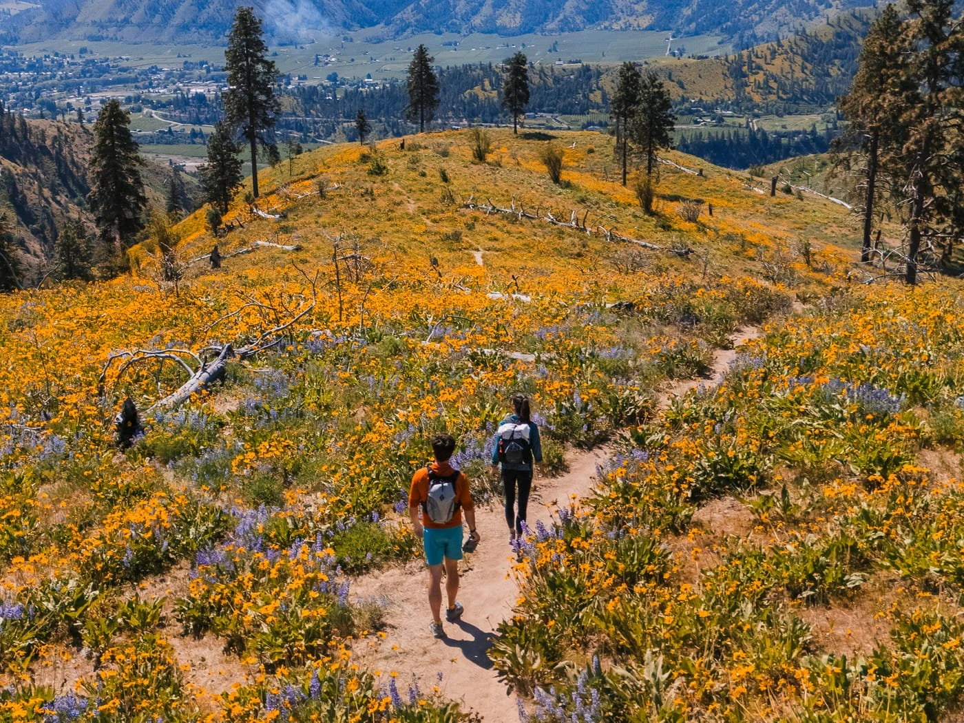
Now let’s get into the good stuff, the seven wildflower hikes that blew us away last spring.
We've explored dozens of trails across Central Washington during wildflower season, and these delivered the most spectacular balsamroot and lupine displays, the best views, and the most rewarding experiences. Each trail offers something different, some are short and steep with incredible ridge-top views, while others are longer, more remote adventures where you'll have wildflower meadows almost to yourself.
Quick tip: These trails are listed roughly in order of popularity, but checkout the table below in order of blooming timeline. If Olalla Canyon or Sage Hills are packed, head to Steliko Ridge or Lewis Butte instead, they offer equally stunning blooms with way fewer crowds.
For each trail below, you'll find detailed logistics, our firsthand experience during peak bloom, timing tips, and what makes each hike special. Let's dive in!
Central Washington Wildflower Trail Comparison
All 7 trails at a glance — sorted by bloom timing from earliest to latest.
| Trail | Distance & Elevation | Difficulty | Peak Bloom | Dogs | Permit |
|---|---|---|---|---|---|
| Olalla Canyon Ridge Cashmere | Distance 2.6 mi (4.2 km) RT Elev. Gain 524 ft (159 m) Duration 2-4 hrs | Moderate | Late Apr - Early May | ✓ On Leash | None |
| Sage Hills Wenatchee | Distance 11.8 mi (19 km) RT Elev. Gain 2,268 ft (691 m) Duration 6-8 hrs | Hard | Late Apr - Early May | ✓ On Leash | None |
| Nahahum to Sunrise Peak Cashmere | Distance 5.7 mi (9.1 km) RT Elev. Gain 1,873 ft (570 m) Duration 5-7 hrs | Hard | Early May - Mid May | ✗ No Dogs | None |
| Canyon Crest Leavenworth | Distance 3.5 mi (5.6 km) RT Elev. Gain 476 feet (145 m) Duration 1.5-2 hrs | Moderate | Early May - Mid May | ✓ On Leash | None |
| Icicle Ridge Leavenworth | Distance 4.8 mi (7.8 km) RT Elev. Gain 1,960 ft (597 m) Duration 2-4 hrs | Hard | Mid May - Early June | ✓ On Leash | None |
| Steliko Ridge Entiat | Distance Up to 6 mi (9.7 km) RT Elev. Gain Up to 1,680 ft (512 m) Duration 2-5 hrs | Moderate | Mid May - Mid June | ✓ On Leash | None |
| Lewis Butte Winthrop | Distance 5.34 mi (8.6 km) Loop Elev. Gain 966 ft (294 m) Duration 3-5 hrs | Moderate | Late May - Early June | ✓ On Leash | Discover Pass |
* Bloom timing varies 1-2 weeks each year based on snowpack and spring temperatures. Check recent WTA trip reports before heading out.
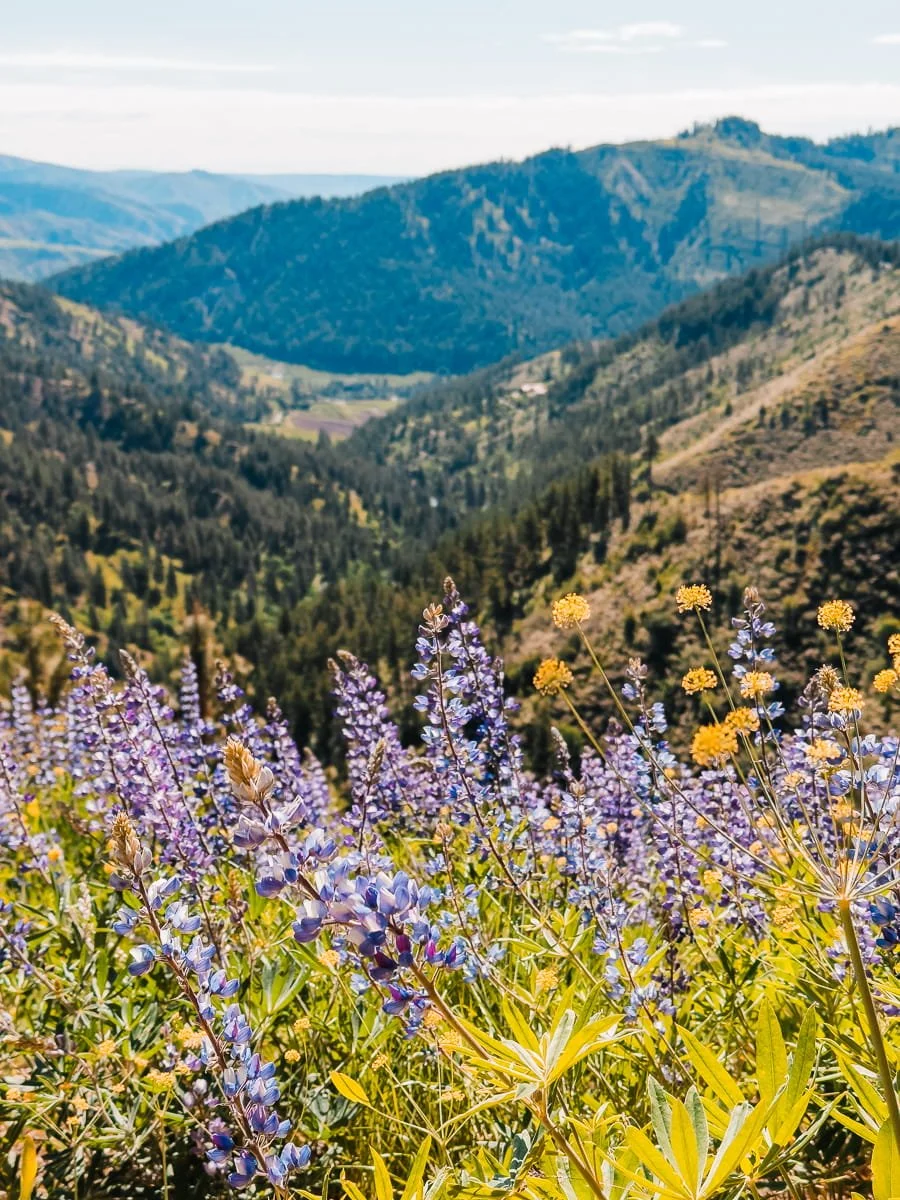
Olalla Canyon Ridge (Cashmere, WA)
Hiking at the top of Olalla Ridge
This is hands down one of our absolute favorite wildflower hikes in all of Washington. If you only have time for one hike from this list, make it Olalla. The combination of stunning ridge-top views, incredible wildflower density, and easy access from Wenatchee makes this trail unbeatable during peak bloom.
Located just 15 minutes from Wenatchee, in Cashmere, Olalla Canyon Ridge delivers one of the most spectacular balsamroot displays we've ever seen, and the lupine blooms at the same time, so you get that perfect golden-and-purple contrast that makes Central Washington wildflower season so special.
This relatively short but semi-steep hike climbs to a ridge with sweeping views of the Wenatchee Valley. The trail wastes no time gaining elevation, switchbacking up exposed slopes from the start, and within minutes you're surrounded by hillsides absolutely covered in balsamroot and lupine.
What makes Olalla extra special is the sheer density of wildflowers. During peak bloom, balsamroot covers every available inch of hillside, creating an endless sea of gold.
Once you reach the ridge, the panoramic views open up in all directions. On a clear day, you can see the Stuart Range in the distance, the Wenatchee Valley below, and wildflower-covered slopes stretching as far as you can see. It's absolutely stunning, especially in late afternoon light when the golden blooms glow against the mountains.
The relatively short distance makes this accessible for a quick after-work hike if you're staying in the Wenatchee or Leavenworth area, and it's one of the best trails on this list for photographers.
For more details on Olalla Canyon, check out our full guide on this hike.
Important note: This trail has exploded in popularity over the last few years, and unfortunately, that's led to issues with trash, illegal parking, and off-trail damage. Please practice Leave No Trace ethics and stay on the trail. If you arrive and the parking lot is full, don't park on the road—you risk a ticket or towing. Instead, choose a different hike from this list.
Olalla Canyon Ridge Trail Details
Trailhead: Olalla Canyon Trailhead
Difficulty: Moderate due to elevation gain
Total Distance: 2.6 miles (4.2 km) round trip
Elevation Gain: 524 feet (159 m)
Duration: 2-4 hours depending on pace and photo stops
Best Time for Wildflowers: Late April through mid-May
Parking Permit: None, parking is limited and restricted to the trailhead only. As of 2025, please do not park on the road or you risk a ticket and/or towing
Access Road: Suitable for all vehicles
Dogs Allowed: Yes, on leash
Bathrooms: None
Popularity: Very Popular.This trail has grown in popularity the last few years causing friction with local hikers. There is limited parking and no facilities at the trailhead. Please practice Leave No Trace, if you find the trailhead full, consider checking out an alternative trail nearby like the Nahahum Trail or Sage Hills Trail (details below)
Full hiking guide on Olalla with more information and everything you need to know to hike.
Sage Hills Trail (Wenatchee)
Wildflowers on the Sage Hills trail in Wenatchee, photo credit: Nick Block
Starting from Kenzie's Landing just outside downtown Wenatchee, Sage Hills is one of the longer, more demanding hikes in this guide, but it's absolutely worth the effort, and you can easily turn around early if you want a shorter day.
This trail climbs steadily through open high desert terrain, and the wildflower displays just keep getting better the higher you go.
What makes Sage Hills special is the variety of wildflowers and ecosystems you'll pass through. Early on, you're hiking through classic sagebrush landscape dotted with balsamroot and bitterbrush. As you climb higher, the trail opens up to sweeping views of the Wenatchee Valley and surrounding ridgelines, with lupine and desert parsley filling the meadows. By the time you're up on the upper sections of the trail, you're walking through some of the most expansive wildflower displays in the entire Wenatchee area.
The sustained elevation gain and longer distance keep crowds way lighter than shorter hikes like Olalla Canyon or Castle Rock, so if you want a quieter, more immersive wildflower experience without fighting for parking, this is your hike.
Heads up: This trail is closed between Dec 1 and April 1 each year to protect mule deer and other wildlife. Please respect all trail closures.
Sage Hills Trail Details
Trailhead: Kenzie’s Landing Trailhead
Difficulty: Moderate to difficult due to sustained elevation gain
Total Distance: 11.8 miles (19 km) round trip (easily modified a shorter out/back day)
Elevation Gain: 2,268 feet (691 m)
Duration: 6-8 hours round trip
Best Time for Wildflowers: Late April - early May
Parking Permit: None
Dogs Allowed: Yes, on leash
Road: Suitable for all vehicles
Bathrooms: Pit toilets
Landmanager: Chelan-Douglas Land Trust
Popularity: Quite popular during high flower season, get there early.
Nahahum Trail to Sunrise Peak (Cashmere)
Hiking just below the lookout point on the Nahahum Trail
This is one of the best lesser-known wildflower hikes on this list. We hiked Nahahum on a weeknight in spring of 2025 and had the entire trail to ourselves, just us and thousands of balsamroot flowers. If you want spectacular blooms without the crowds you'll find at Olalla Canyon or Sage Hills, this is it (at least on weekdays).
Located near Cashmere between Wenatchee and Leavenworth, the Nahahum Trail to Sunrise Peak is moderate to challenging depending on your fitness level. But it's incredibly rewarding and has both lupine and balsamroot blooms.
The trail climbs relentlessly to Sunrise Peak, gaining elevation quickly from the start, but you're walking through wildflower displays the entire way up. Balsamroot, lupine, and desert parsley cover the exposed slopes from the very beginning, so even if you don't make it all the way to the summit, you'll still get an amazing wildflower experience.
What sets Nahahum apart is the sheer scale of the wildflower meadows on the upper ridge. During peak bloom, you'll walk through what feels like miles of flowers stretching across the ridgeline, with panoramic views opening up in every direction. The combination of endless wildflowers and big mountain views makes this one of the most photogenic hikes in Central Washington.
This is definitely a hike for people who don't mind a sustained, steep climb, but if you're willing to put in the work, you'll be rewarded with some of the best wildflower displays in the region, and way fewer people to share them with.
Good to know: No dogs are allowed on this trail (it's privately owned land open to hikers). The trail can get hot and exposed, so start early and bring plenty of water.
Nahahum Trail to Sunrise Peak Details
Trailhead:Cashmere Canyons Trailhead
Difficulty: Difficult due to sustained elevation gain and length
Total Distance: 5.7 miles (9.1 km) round trip to Sunrise Peak
Elevation Gain: 1,873 feet (570 m)
Duration: 5-7 hours round trip
Best Time for Wildflowers: Early May through mid May
Parking Permit: None required
Dogs Allowed: No
Road: Suitable for all vehicles
Bathrooms: Pit toilets
Popularity: Moderate, arrive early on weekends though
Canyon Crest Trail (Leavenworth)
Lupines on the side of the road near the parking for the Canyon Crest Trail
We basically stumbled onto this trail by accident while exploring forest roads in Leavenworth, and we're so glad we did. Canyon Crest is one of those local favorites that somehow hasn't blown up yet, which means you can actually find parking and enjoy the wildflowers without massive crowds.
Located just 5 minutes from downtown Leavenworth, the Canyon Crest to Rat Creek Loop delivers expansive lupine meadows, balsamroot flowers, and stunning views of the Leavenworth Valley without the chaos you'll find at more popular trails.
The hike follows a wide forest road with steady but manageable elevation gain, and once you reach the upper sections, you're rewarded with sweeping wildflower displays and big valley views.
It's not the most dramatic trail on this list, but it's beautiful, accessible, and reliably uncrowded, which counts for a lot during peak wildflower season. If you’re in Leavenworth in the spring, add this hike to your list.
The trailhead has a small amount of parking and (usually) a porta-potty, and we've never had issues finding a spot, even on weekends. If you're looking for an easy wildflower hike close to Leavenworth where you won't have to arrive at dawn to snag parking, this is it.
For more details on this hike and what to expect, check out our full guide on the Canyon Crest Trail to Rat Creek Loop.
Pro tip: If you have extra time after your hike, drive a little further up Mountain Home Road to the picnic site that overlooks the valley—the views are incredible. Just note that the road gets more rutted and eroded between the trailhead and the picnic area, so take it slow if your car has low clearance.
Canyon Crest Trail Details
Trailhead: Canyon Crest Trailhead
Difficulty: Moderate, short section of steep forest road and then eases off.
Total Distance: 3.5 miles (5.6 km) round trip
Elevation Gain: 476 feet (145 m)
Duration: 1.5 - 2 hours round trip
Best Time for Wildflowers: Late April through mid-May
Parking Permit: None required
Dogs Allowed: Yes, on leash
Road: Suitable for all vehicles
Bathrooms: Porta-potty
Landmanager: Chelan-Douglas Land Trust
Popularity: Moderate, easy access and ample parking.
Full hiking guide on Canyon Crest
Icicle Ridge Trail (Leavenworth)
Hiking up the Icicle Ridge trail to the view point after the saddle
Icicle Ridge is one of our all-time favorite hiking trails in Leavenworth. We've hiked it countless times in every season—but spring wildflower season is when it absolutely shines.
This past spring, I hiked it twice just to catch the different bloom stages, and I'm so glad I did. Garrett and I did it together for the balsamroot flowers and then I did it as a solo hike later on for lupines. It makes a great solo hike since it’s close to town and you have cell service the entire time.
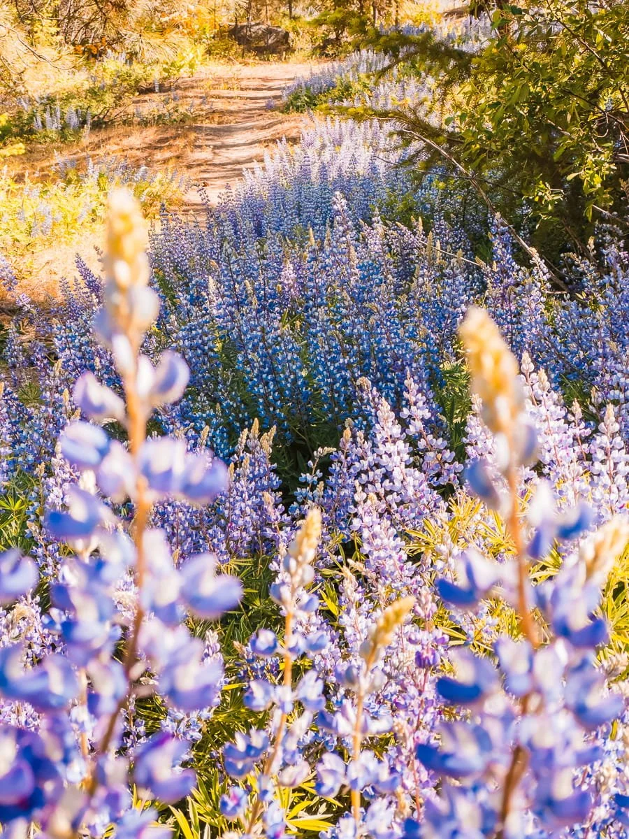
In early May, the ridge was completely covered in balsamroot once you reach the first viewpoint. Then in late May, I came back to find the entire trail, from the parking lot all the way up to the ridge, blanketed in purple lupine. Same trail, totally different wildflower experience just a few weeks apart.
Located just minutes from downtown Leavenworth on Icicle Creek Road, Icicle Ridge is a challenging, high-elevation trail that delivers some of the most spectacular wildflower displays in the Leavenworth area.
This trail gains elevation quickly and relentlessly, climbing from Icicle Creek to ridge-top meadows with stunning views of the Stuart Range and surrounding peaks. It's steep, it's a workout, and you need a decent fitness level to enjoy it—but the combination of wildflowers, ridge-top views, and alpine scenery makes it absolutely worth the effort.
What makes Icicle Ridge special for wildflowers is the extended bloom window. Because the trail climbs through different elevation zones, you get wildflower displays over a longer season than most other hikes in this guide.
Early season brings balsamroot on the lower ridge, mid-season adds lupine throughout, and late season brings alpine wildflowers at the top. Time it right, and you can catch overlapping blooms across multiple elevations.
For more details on this trail, check out our Icicle Ridge Hiking Guide.
Icicle Ridge Trail Details
Trailhead:Icicle Ridge Trailhead
Difficulty: Challenging due to elevation gain and constant steep terrain
Total Distance: 4.8 miles (7.8 km) round trip
Elevation Gain: 1,960 feet (597 m)
Duration: 2-4 hours round trip
Best Time for Wildflowers: Mid-May through early June
Parking Permit: None
Dogs Allowed: Yes, on leash
Road: Suitable for all vehicles
Bathrooms: Porta-potty
Popularity: Popular year round, plenty of parking
Guide to Day Hiking Icicle Ridge
Steliko Ridge Trail to Steliko Fire Lookout (Entiat)
Steliko Fire Lookout in Entiat, Washington during wildflower season
This was easily one of our favorite hikes from last spring. Steliko Ridge is way less known than the trails closer to Leavenworth and Wenatchee, and once you reach the top of the ridge, you're walking through fields of both balsamroot and lupine with incredible views of the Entiat Valley. We hiked up for sunset and had the entire ridge completely to ourselves. It was absolutely magical.
Located about 45 minutes from Wenatchee deep in the Entiat Valley, Steliko Ridge offers a different wildflower experience than the balsamroot-heavy hikes farther south. This trail features a more diverse mix of wildflowers at varying elevations, and the remoteness means you'll likely have the trail largely to yourself, even on weekends.
Depending on your vehicle clearance, you can drive almost all the way to Steliko Lookout at the top of the ridge, or park at the lower trailhead and hike 1.4 miles up the forest road (with about 1,000 feet of elevation gain).
We drove up, but note that the road is steep, very narrow, and allows only one vehicle width in some spots—it's not scary, but take it slow and be ready to back up if you meet another car coming down.
The hike itself climbs steadily through open pine forests before emerging onto ridge-top meadows with sweeping views of the Entiat River Valley. The combination of wildflowers, mountain views, and the historic fire lookout at the top makes this one of the most unique wildflower hikes in Central Washington.
Important note:The Steliko Lookout can be reserved for overnight stays, so please respect the privacy of anyone staying there. If the lookout is occupied, enjoy the views and wildflowers from the surrounding area and give the guests their space.
Steliko Ridge Trail Details
Trailhead:Steliko Ridge Trailhead (lower), Steliko Lookout (upper)
Difficulty: Difficult due to length and elevation gain (lower), Moderate (upper)
Total Distance: 3 miles (lower) / 1.75 miles (upper) one way, up to 6 miles (9.7 km) round trip
Elevation Gain: 1,680 feet (lower) / 711 feet (upper)
Duration: 2-5 hours round trip
Best Time for Wildflowers: Mid-May through mid-June
Parking Permit: None required
Dogs Allowed: Yes, on leash.
Road: Suitable for all vehicles for lower start, high clearance recommended for road up to Steliko Lookout.
Bathrooms: Porta-potty at lookout.
Popularity: Low, our experience and others we have spoken to have found this to be a pretty quiet trailhead
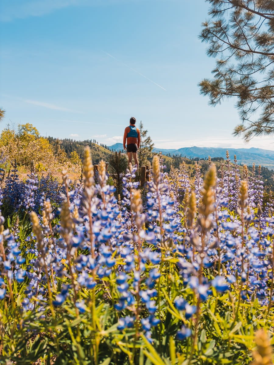
Lewis Butte Trail (Winthrop)
Hiking the Lewis Butte Trail just past balsamroot season
If you're willing to make the drive to the Methow Valley (about 2.5 hours from Leavenworth), Lewis Butte offers a completely different wildflower experience than the trails closer to Wenatchee and Leavenworth. This high desert valley features wide-open landscapes, ponderosa pine forests, and expansive meadows filled with balsamroot, lupine, and unique high desert wildflower species you won't see on the other hikes in this guide.
We've hiked Lewis Butte several times over the years, and honestly, we always seem to arrive just a bit too late to catch peak balsamroot bloom, but there's usually still plenty of lupine blooming in late May, which creates beautiful purple meadows against the pine forests. If you want to catch the balsamroot here, aim for late April to early May, which is a little bit earlier than the Leavenworth-area trails.
The trail itself is a mellow, well-graded loop with gentle elevation gain, making it one of the easier hikes on this list. The wide-open views and different ecosystem make it feel like you've traveled to a completely different part of Washington, even though it's just a few hours north.
Heads up: This is a popular spot with very limited parking, especially during peak wildflower season. Arrive early—ideally before 8 AM on weekends, or better yet, visit on a weekday if you can. Be prepared to wait for a parking spot or have a backup plan if the lot is full. You'll need a Discover Pass to park here.
Lewis Butte Trail Details
Trailhead:Rizeor Lake/Lewis Butte Trailhead
Difficulty: Moderate, mellow graded trail
Total Distance: 5.34 miles (8.6 km ) loop
Elevation Gain: 966 feet (294 m)
Duration: 3-5 hours
Best Time for Wildflowers: Late April - early May
Parking Permit:Discover Pass
Dogs Allowed: Yes, with leash.
Road: Suitable for all vehicles, gravel parking lot.
Bathrooms: Pit-toilets
Popularity: High, arrive early on weekends and be prepared to wait for a space to open up in the parking lot.
Hiking with small day packs on the Olalla Ridge Trail
What to Pack for a Wildflower Hike in Washington
Packing smart for Central Washington wildflower hikes makes a huge difference in how much you enjoy the day. These trails are hot, exposed, and often have zero shade, so you need to be prepared for intense sun, limited water sources, and dry, dusty conditions. Trust us, we learned some of these lessons the hard way during our first few wildflower hikes in the area.
For a complete day hiking packing list, check out our full What to Pack for Day Hiking Guide, but here are the wildflower-season-specific essentials you absolutely need for these Central Washington trails.
Essential Spring Hiking Gear
Trekking Poles: Essential for climbing steep sections and stability with a heavy pack. We love Z-style collapsable poles for their lightweight compact style.
Sun Protection: (This is Critical) The sun in Central Washington during spring is no joke. You're hiking at elevation with minimal tree cover and low humidity, which means you're getting blasted with UV rays for hours. Here's what we always bring:
Sun hoodie or long-sleeve sun shirt - We never hike these trails without one. Check out our guide on The Best Sun Hoodies for Hiking for our favorite tested options.
Sunscreen - We've tried a lot of sunscreens over the years and Dermatone Sport SPF 50 is our favorite that stays on while hiking (it’s sweat and water resistant) and is lightweight and feels good on, it isn’t oily.
Wide-brim hat or visor - Extra face and neck protection, we both have been loving visors over the past few years to keep the sun off your face and head cool.
Sunglasses: We love our Ombraz for their compact size, adjustable cord and eco conscious business practices.
Anti-Chafe Stick: High mileage in hot conditions can make for some gnarly chafing situations. Love putting a Dermatone travel size body stick in our hip belts.
Navigation: GaiaGPS or similar with downloaded maps.
Antihistamines: Pollen and dust are in their high season, don’t forget to pack some allergy armor.
Water (Bring More Than You Think): There are no reliable water sources on most of these trails, and you'll be sweating more than you expect. We bring at least 2-3 liters per person for these hikes, even the shorter ones. The dry heat is deceptive—you'll go through water faster than you think.
Camera Gear (If You're Into Photography): These trails are incredibly photogenic, so if you're bringing a camera, plan for:
Extra batteries (they drain faster in the heat)
Lens cloth (dust is everywhere)
Polarizing filter for deeper blue skies and richer wildflower colors
For our complete gear recommendations and full packing list for day hikes, check out our Day Hiking Packing Guide.
Skye wearing her Stio Vescent Sun Hoodie while hiking Olalla Canyon
Hiking Clothing to Wear and Pack:
Sun Hoodie or Sun Shirt: The UV rays are no joke in the alpine, so wearing a lightweight sun shirt while hiking is key. Not sure which sun hoodie is right for you? Check out our full roundup of the Best Sun Hoodies for Hiking.
Buff:Great for additional face protection, improvised headband or night time sleep mask.
Fleece Mid-Layer: For breathable warmth while moving through windy or cold conditions. See our Best Fleece Mid-Layers for Hikingguide for our top picks across every budget.
Insulated Puffy Jacket: Nights are cold, we bring our Stio Hometown down jackets.
Rain Jacket: Windy days and alpine storms are common, the lightweight OR Helium is easy to tuck into your pack.
For a full packing list for backpacking, see our What to Wear for Hiking & Backpacking guide. We also have gear reviews on Sun Hoodies and Mid-Layers for hiking and backpacking that are based on years of gear testing and trial and error with different brands.
Downtown Leavenworth, Washington
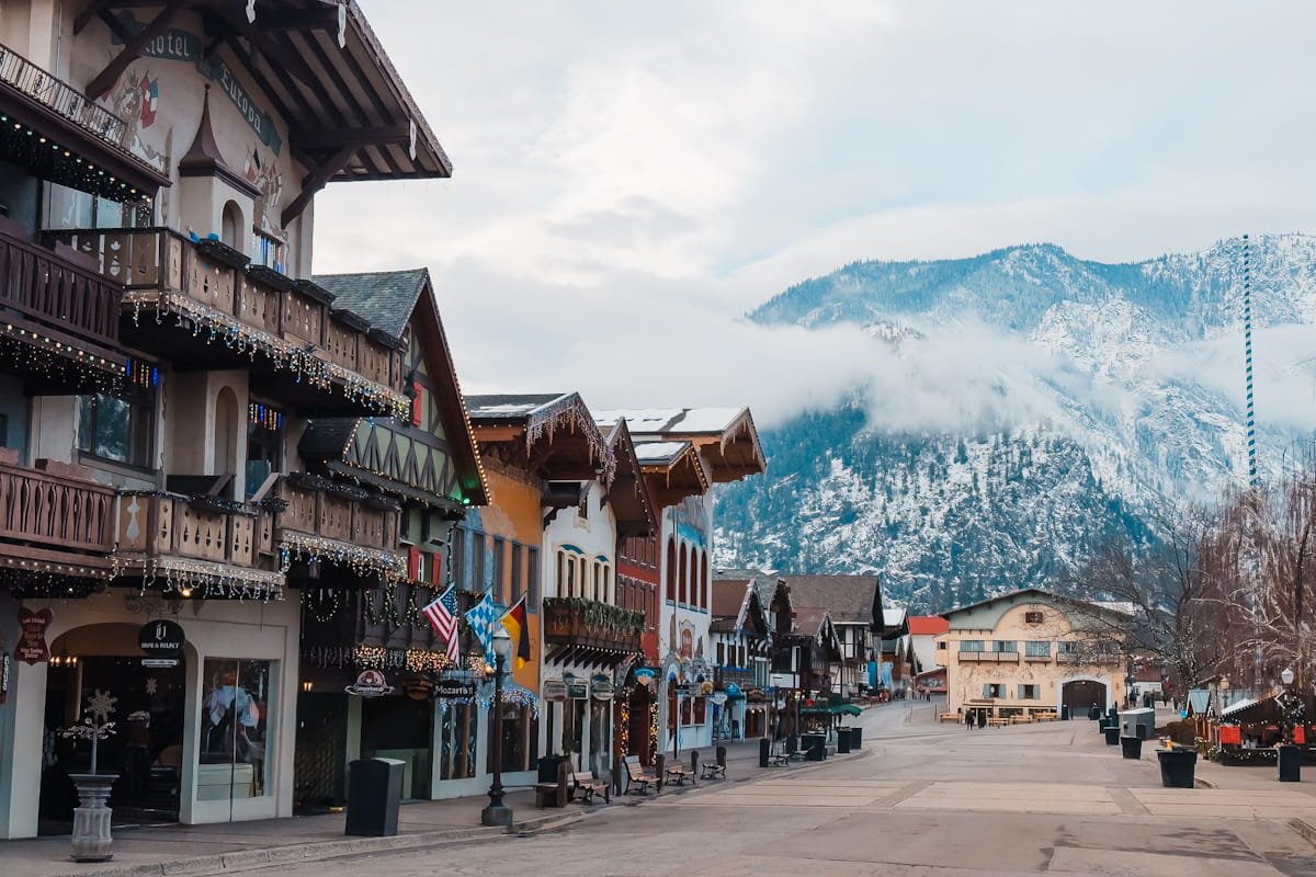
Where to Stay When Hiking in Leavenworth & Wenatchee, Washington
Most of the trails in this guide are within a short drive from either Leavenworth or Wenatchee, making either town a great base for a wildflower weekend. Leavenworth's Bavarian village charm and walkable downtown make it a popular choice, while Wenatchee offers more lodging variety and easier access to the southern trails.
For hotels, cabins, vacation rentals, and camping options in the area, check out our full Where to Stay in Leavenworth guide, we cover everything from budget-friendly motels to creekside cabins and dispersed camping spots.
Frequently Asked Questions (FAQ): Washington Wildflower Hikes
When is the Best Time to See Wildflowers in Central Washington?
The best time varies by elevation. Lower trails (2,000-3,000 feet) peak from late April through mid-May. Late April through early May is generally the best time for classic balsamroot displays.
When do wildflowers bloom near Leavenworth and Wenatchee?
Check recent trip reports on Washington Trails Association starting in mid-April. Local PNW hiking communities (e.g PNW Hiking Reddit) also share real-time bloom updates. Peak bloom timing varies by 1-2 weeks each year depending on snowpack and spring temperatures.
Can I pick wildflowers?
No. Picking wildflowers damages the ecosystem and reduces next year's blooms. It's also illegal in many areas. Enjoy wildflowers with your eyes and camera, but leave them rooted in the ground.
Do I need a parking permit for trailheads?
Most of the trails listed in this guide do not require a parking or hiking permit. Only the Lewis Butte in Winthrop requires a Discover Pass parking permit. Check individual trail details above.
Are dogs allowed on Central Cascades trails?
Most trails allow leashed dogs. Always keep dogs on leash to protect wildlife and vegetation.
How crowded are these trails during wildflower season?
Popular trails near Leavenworth and Wenatchee can be very crowded on weekends during peak bloom (late April-May). Arrive before 9:00 AM for parking, or hike on weekdays for more solitude. More remote trails like Steliko Ridge and Lewis Butte see lighter crowds.
Are there rattlesnakes in the Central Cascades?
Rattlesnakes are present on lower-elevation trails in Central Cascades, particularly on warm, sunny days. Watch where you step, especially near rock outcrops and sunny slopes. Stay on trail, make noise, and give snakes space if you encounter them. Encounters are rare.
Is there cell service on these trails?
Cell service generally available throughout all these hikes (carrier dependent). Download offline maps before heading out and let someone know your hiking plans.
Can I camp on these trails?
Most of these are day hikes without designated camping. Some trails connect to longer backpacking routes with backcountry camping options. Check individual trail information.
What if I can't hike the full trail?
You don't have to complete entire trails to see wildflowers. Most blooms are visible from the first few miles of each hike. Turn around whenever you've had your fill of wildflowers and views.
Are these trails suitable for kids?
These are family-friendly for older kids who can handle moderate elevation gain. Longer, steeper trails like Icicle Ridge and Steliko Ridge are better suited for experienced hikers.
Balsamroot flowers in full bloom at sunset in the Entiat
Final Thoughts: Washington’s Best Wildflower Hikes
If you've never experienced wildflower season in Central Washington, you're missing out on one of the Pacific Northwest's best-kept secrets. Seriously, from the golden balsamroot hillsides of Olalla Canyon Ridge to the endless lupine meadows on Icicle Ridge, these trails deliver some of the most spectacular wildflower displays we've seen anywhere in the country. And we've hiked a lot of wildflower trails.
We spent an entire spring exploring these hikes, timing our visits for peak bloom, hiking trails multiple times to catch different flowers, and figuring out which ones are worth the drive and which ones live up to the hype. All seven of these trails absolutely delivered.
Whether you're a photographer chasing that perfect golden-hour shot with balsamroot glowing against mountain peaks, a hiker who wants solitude among the blooms, or just someone who loves beautiful landscapes, Central Washington's wildflower season won't disappoint.
The key to an amazing wildflower experience? Timing is everything. Check trip reports, aim for late April through mid-May for lower-elevation balsamroot, and don't be afraid to hike the same trail twice if you want to catch both balsamroot and lupine seasons. Come prepared with sun protection and way more water than you think you need. And please, please follow Leave No Trace principles—stay on the trail, don't pick the flowers, and pack out your trash. These wildflower meadows are fragile, and they'll only stay beautiful if we all take care of them.
Now get out there and experience it for yourself. Trust us, once you've stood on a ridge surrounded by thousands of balsamroot flowers with snow-capped peaks in the distance, Central Washington wildflower season will become one of your favorite times to hike.
Happy trails!
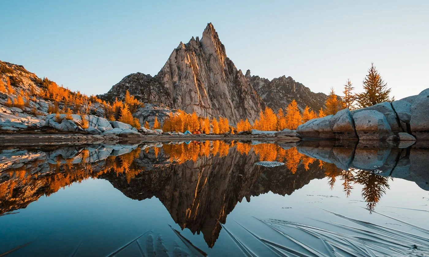
Prusik Peak at sunrise in the Core Enchantments
More Hiking & Leavenworth Posts to Check Out Next
Gear Discount Codes & Links
We've partnered with a few of our favorite outdoor brands to hook you up with exclusive discounts on trail-tested gear. These are all affiliate links, meaning we earn a very small commission at no cost to you, that helps us keep this blog going.
20% off SkyGOAT (grid fleece) - Code: SKYEGOAT
15% off LUNA Sandals - Auto-applied
15% off Stio - Code: SKYE15
10% off Will and Bear hats - Code: SKYESTOURY
20% off Wild Deodorant - Code: SKYESTOURY
Like this Post, Pin it & Save it For Later
What to Pack for Backpacking the Enchantments (Complete 2026 Gear Guide)
How to Hike the Enchantments in One Day: Complete Thru-Hike Guide (No Permit Needed)
This image is copyrighted and owned by Skye Stoury Photography and skyestoury.com, if you would like to licence any images on this site, please email us at hello@skyestoury.com