
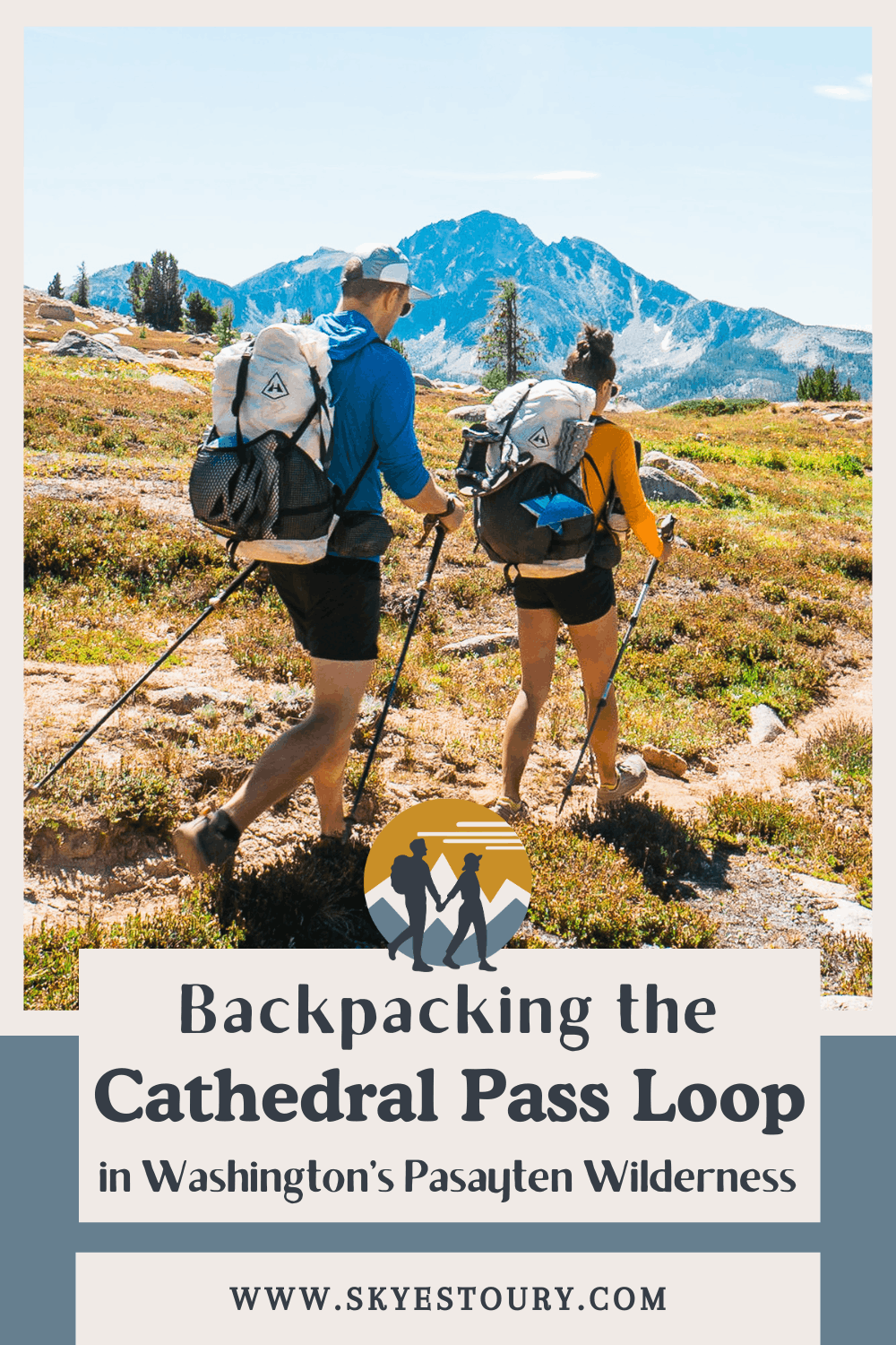
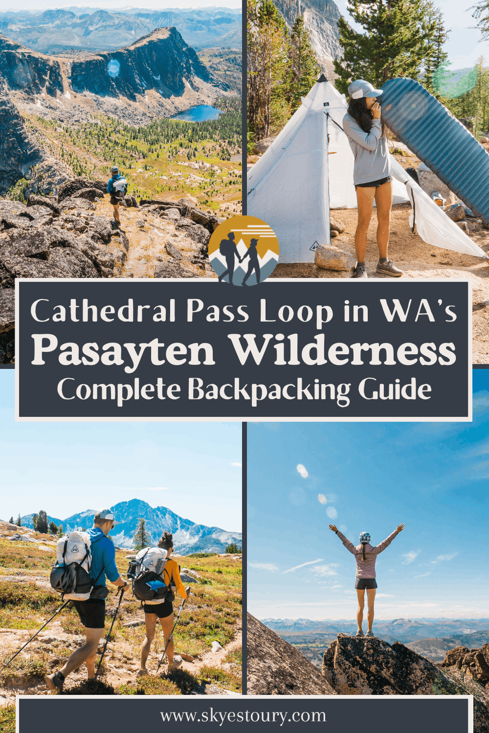
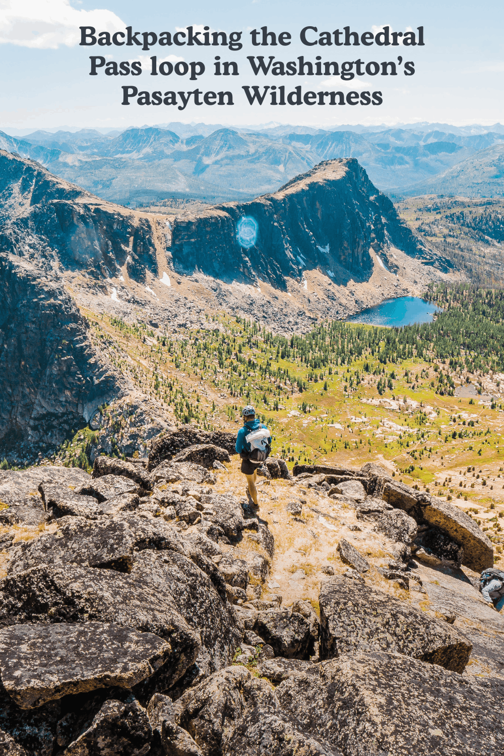
Cathedral Pass Loop: Backpacking the Pasayten Wilderness in Washington
Backpacking in the Pasayten Wilderness: A Comprehensive Guide to the Cathedral Pass Loop
The Pasayten Wilderness is one of Washington State's best-kept secrets; a sprawling, remote backcountry area tucked against the Canadian border in the North Cascades. It’s an amazing area, in our opinion, as stunning as the Enchantments but without the crowds and permit system.
One year when we didn’t get Enchantment permits but wanted a trip just as epic, we researched remote trails in the North Cascades and found the Cathedral Pass Loop. The Pasayten Wilderness is often overlooked since most backpackers in Washington want to visit the National Parks (Rainier, Olympics, North Cascades) and the Enchantments. But this area should be on your backpacking bucket list.
What is the Cathedral Pass Loop Trail?
This 35-mile lollipop loop through the Chewuch River valley, over the Boundary Trail ridgeline, and up to the beautiful Upper Cathedral Lake basin is one of the finest multi-day backpacking trips in all of Washington. Beyond just backpacking, there are also some amazing scrambles and alpine rock climbs in the area as well. In this guide, we share some bonus side trips that include a Class 4 scramble to the summit of Cathedral Peak and a hike up Amphitheater Mountain.
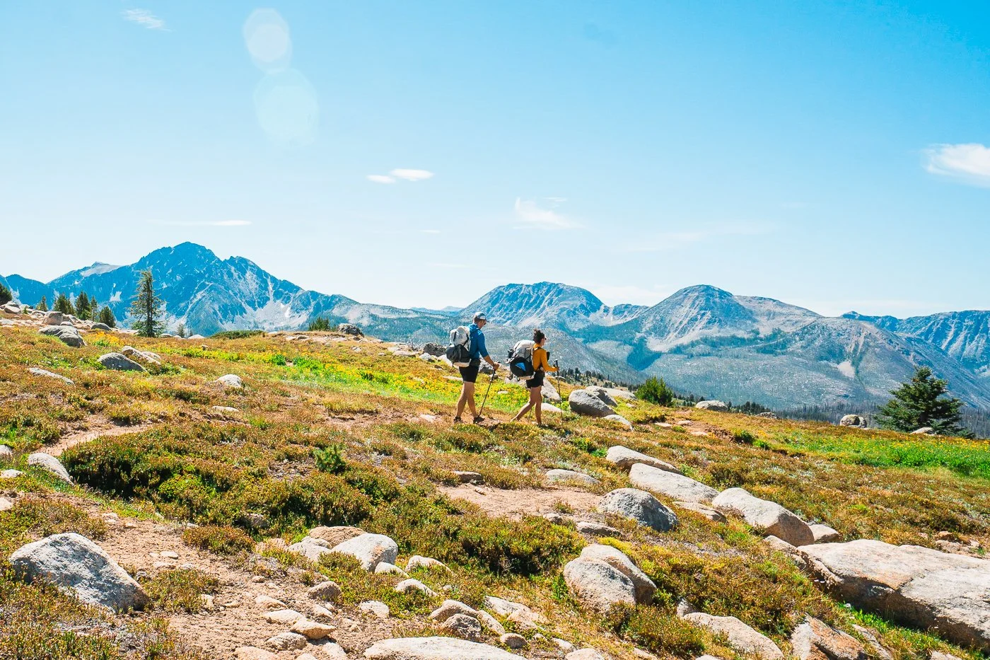
What makes this loop stand out is the combination of solitude, variety, and some summit objectives. You're not going to fight for campsites here. You're not going to share the ridgeline with a hundred other hikers. The Pasayten rewards those willing to put in the miles, and this loop delivers in a big way.
Below you'll find everything you need to plan a 3-night / 4-day backpacking trip through this corner of Washington's Okanogan-Wenatchee National Forest, including a full day-by-day itinerary, campsite breakdowns, the Cathedral Peak scramble beta, and all the gear and logistics details you need.
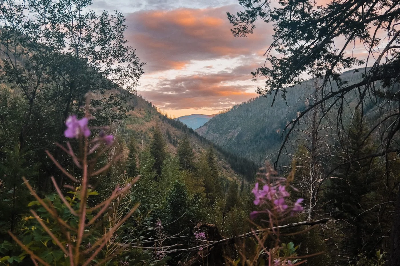
Hiking down from Amphitheater Mountain on our hike out of the Cathedral lakes basin
Quick Hit Trail Facts on the Cathedral Pass Loop
Below is a quick overview of the backpacking route, but keep reading for more details on what to expect and how to plan your trip. The distance and elevation noted below does not include side trips up to Cathedral Peak or Amphitheater Mountain.
Trailhead
Chewuch Trailhead (Thirtymile Trailhead Alternative)
Distance
35 mi (56 km) — lollipop loop
Elevation Gain
5,490 ft (1,673 m) for the main loop
Trip Length
3 nights / 4 days
Difficulty
Strenuous — long days, remote terrain
Permit Required
Self Register at trailhead (Pasayten Wilderness)
Best Time to Go
July through mid-August
Dogs Allowed
Yes
Affiliate Disclaimer: This post contains affiliate links, meaning we earn a small commission on purchases made through our links at no extra cost to you. We only link gear we actually use and trust.
Table of Contents
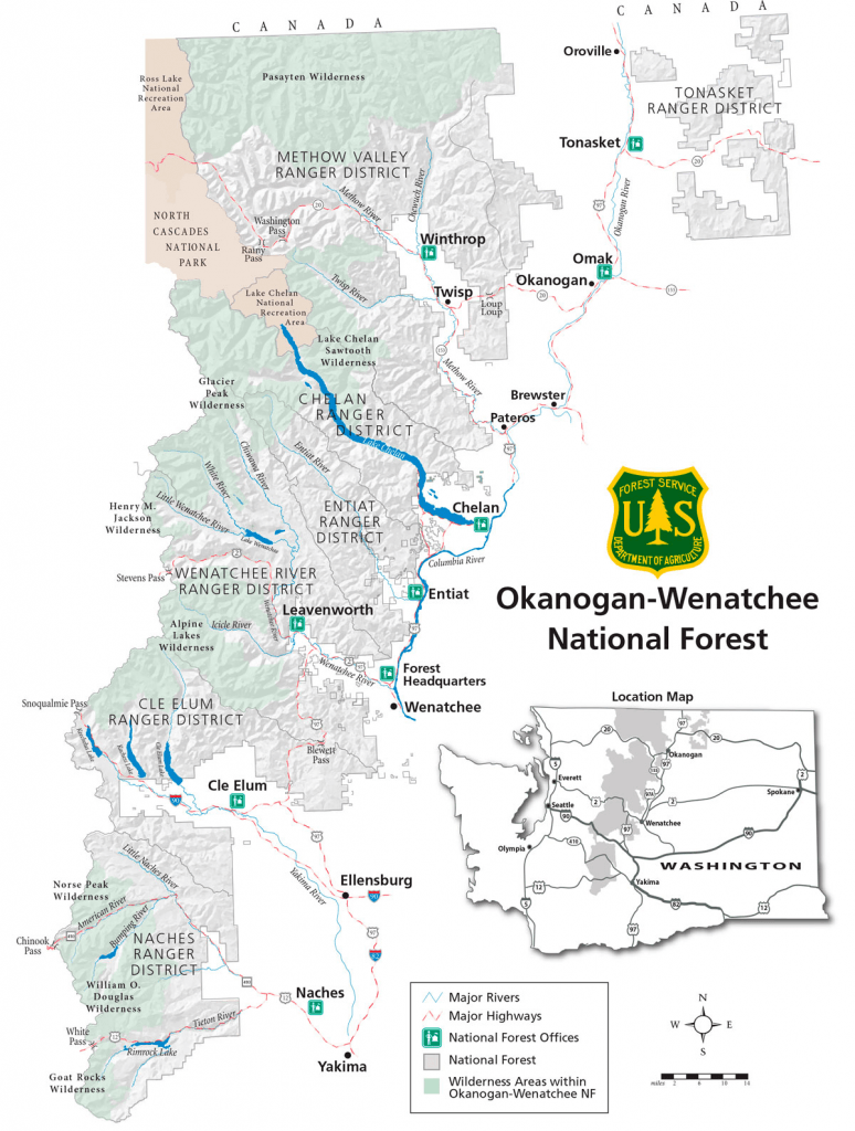
Where Is the Pasayten Wilderness?
Pasayten Wilderness shown at the very top of the map.
The Pasayten Wilderness sits in the far northeastern corner of the Washington Cascades, bordering British Columbia to the north, and encompassing nearly 530,000 acres of roadless terrain.
It's managed as part of the Okanogan-Wenatchee National Forest and is one of the largest wilderness areas in Washington State. Winthrop, WA, is the closest large town to the area and has a unique country western theme. The Pasayten sits in a rain shadow of the Cascade range, giving it a drier, more continental character with big open ridge lines.
What You Need to Know to Plan a Trip into the Pasayten Wilderness
The Pasayten Wilderness is a true backcountry experience. You’re going to see significantly fewer people than a backpacking trip in the heart of the Cascades or in a National Park boundary. There is no backcountry infrastructure (toilets, bear boxes, bear hangs) and no permit requirements.
That freedom is a big part of the appeal. Below are the key things to know for this specific area and route.
The trailhead at the start of the hike. Photo credit: Nick Block (one of our friends who did this trip with us)
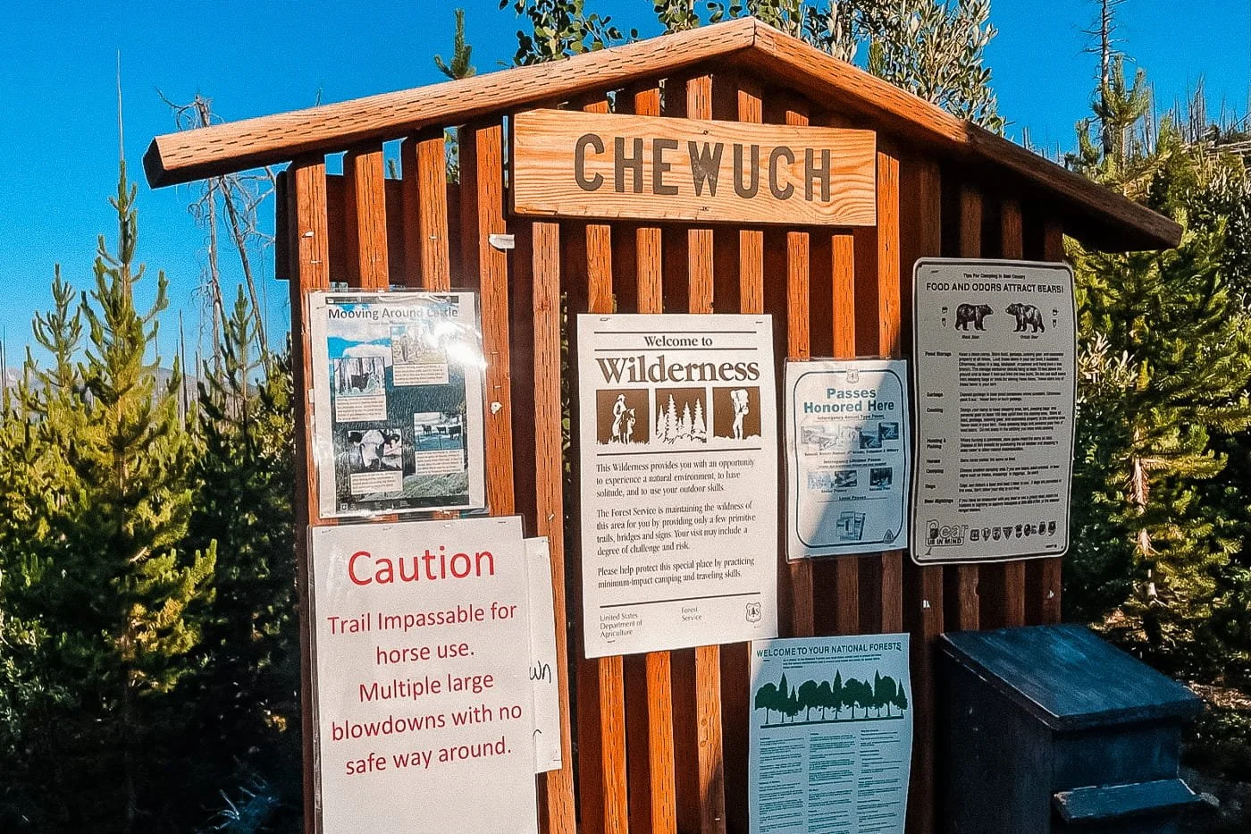
No Advanced Permit Reservation Required
Backpacking in the Pasayten Wilderness requires a free, self-issued Wilderness permit, which you fill out at the trailhead before starting your hike. No advance online reservations are required for Pasayten backcountry camping. But you will need a Northwest Forest Pass or America the Beautiful pass to park at the trailhead.
Water Availability
Water is the most important logistics consideration on this route, and its availability on trail changes significantly throughout the season. The Pasayten is in a drier region of Washington and water isn’t as abundant as in the western slopes of the Cascades.
We detail water logistics in the day-by-day itinerary lower down, but here's what you really need to know.
Water Sources Along the Trail:
Tungsten Mine Camp (Day 1): Water can be scarce in the late summer and early fall. The upper portion of Tungsten Creek may have some flow, but it's roughly a mile away from that camp (one-way). We did encounter some small trickles and swampy watering holes but don't count on reliable water here if hiking in August. We recommend filling up at the Chewuch River before ascending and carrying enough to last through the night and morning.
Upper Cathedral Lake (Days 2–3): Plentiful, reliable water year-round directly from the lake. This is the most water-secure camp on the route.
Lower Tungsten Creek Camp (Day 3-4): The Chewuch River and Lower Tungsten Creek typically have flowing water later in the season.
Water carry capacity: We recommend at least 2–4 liters of water capacity per person depending on weather and seasonality. Always treat or filter before drinking from any source.
Navigation
Cell service is nonexistent for the entire trip. Download our GPX track and maps at home, before your trip. We use and recommend GaiaGPS for all offline navigation.
Hiking up towards Cathedral Peak from camp in the basin
Best Time to Hike the Pasayten Wilderness Loop
Early July to early August is ideal for backpacking in the Pasayten Wilderness. By mid-summer, snowpack has typically cleared, water is still flowing at most sources, and the weather window is stable. By mid-September, expect colder nights, potential early snow at elevation, and drier conditions throughout. But if you plan to hike in early October, you will be treated to golden larches in the lake basin.
Early season (before late June) can mean significant snow on the trail and more difficult route-finding. Come prepared with navigation tools regardless of the season.
| Season | Conditions | Required Gear | Recommendation |
|---|---|---|---|
| Early Season May – June Advanced Skills |
|
|
Best left to experienced backpackers comfortable with snow travel and off-trail navigation. Not recommended for a first Pasayten trip. |
| Peak Season Top Pick July – Early-August All Skill Levels |
|
|
The best combination of clear trails, reliable water, long days, and stable weather. Ideal for all experience levels. |
| Late Summer Late August – Mid-September All Skill Levels |
|
|
Still a great window with excellent weather and fewer crowds. Hotter day-time temperatures in August and less water availability from seasonal streams. Check air quality reports before heading out during fire season. |
| Fall Late September – October Advanced |
|
|
For experienced backpackers only. Short days and cold conditions demand solid cold-weather skills and gear. The valley colors can be beautiful which balances out the extra preparation needed for the cold weather. |
How to Leave No Trace in the Pasayten
The Pasayten Wilderness provides a very rustic backpacking experience compared to the nearby national parks and national forests. There are no designated camping sites, backcountry toilets, or food storage options.
It’s up to all visitors to help care for and practice Leave No Trace (LNT) ethics to preserve this special area.
Below are LNT best practices that all backpackers should abide by:
- Camping: Camp on durable surfaces. The Pasayten's meadows are fragile, stick to established sites where possible.
- Campfires: Campfires are prohibited in certain high-elevation and sensitive areas. Always check current fire restrictions at the local ranger district before you leave.
- Food storage: Use a bear canister, bear bag, or hang your food at least 200 feet from camp and 10 feet off the ground.
- Stay on trail: Cutting switchbacks causes vegetation damage and erosion.
- Pack out everything: All trash, food scraps, and toilet paper. If you packed it in, pack it out.
- Waste disposal: Dispose of human waste properly by digging cat holes at least 200 feet from water, trails, and camp.
- Don't feed wildlife: Human food is harmful to wildlife and creates problem animals.
- Leave rocks and plants: Don't build cairns, pick flowers, or move large rocks.
- Be considerate of others: Although this area sees much less traffic, respect people's space and wild experience.
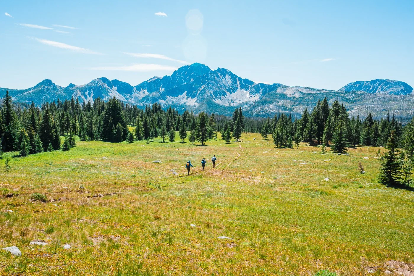
Hiking through meadows beneath Amphitheater Mountain
The Route: Cathedral Pass Loop via the Chewuch Trailhead
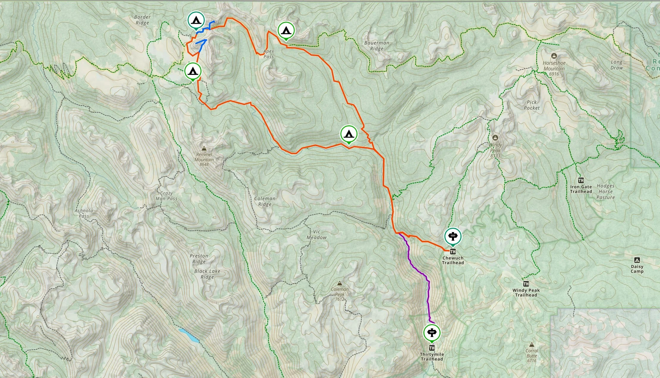
Pasayten Wilderness Route Overview. Orange - Main Route, Purple - Alternative Thirtymile Trailheal start, Blue - Amphitheater Mountain and Cathedral Peak side trips.
This route is a lollipop loop starting and ending at the Chewuch Trailhead. We recommend doing it counterclockwise by ascending via the Tungsten Trail and descending the Chewuch Trail back out.
The counterclockwise direction is a more mellow ascent and has amazing views coming into the Cathedral Peak basin. The lake basin is likely where you’ll want to spend the most time and then decide on additional side trips (Cathedral Peak scramble, Amphitheater Mountain summit) along the way.
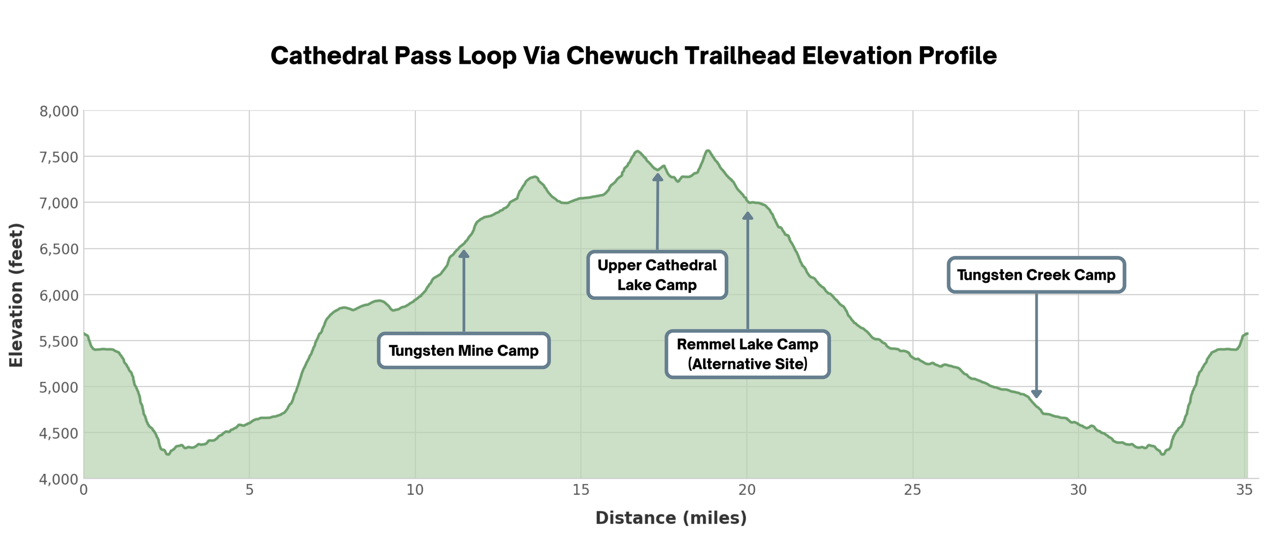
Elevation profile of the backpacking trip from Chewuch Trailhead. Excludes side trips to Cathedral Peak and Ampitheater Mountain
Alternative Trailhead Start: Thirtymile Trailhead
Though we recommend starting from the Chewuch Trailhead, it’s also possible to start at Thirtymile Trailhead (purple on the topographic map above). Thirtymile trailhead starts lower in elevation, ascends up the river valley more gradually than the Chewuch Trailhead and is closer drive from Winthrop.
That said, choosing the Thirtymile Trailhead adds 2.43 miles compared to the Chewuch start. We preferred the Chewuch Trailhead for the overall reduction in mileage and higher elevation for car camping the night before.
Below is a breakdown in the difference between the two starts to help you decide what works best.
→ Note that this guide and the itinerary below assumes you start from the Chewuch trailhead for all mileage and itinerary estimates.
Thirtymile vs Chewuch Trailhead Comparison
Chewuch Section — 2.43 mi Thirtymile is ~2× longer to the Chewuch junction
Chewuch Section — 0 ft Chewuch is all downhill on the approach
Chewuch Section — 1,221 ft Chewuch exit climbs 1,087 ft more than Thirtymile
Backpacking the Cathedral Pass Loop, a Day-by-Day Itinerary
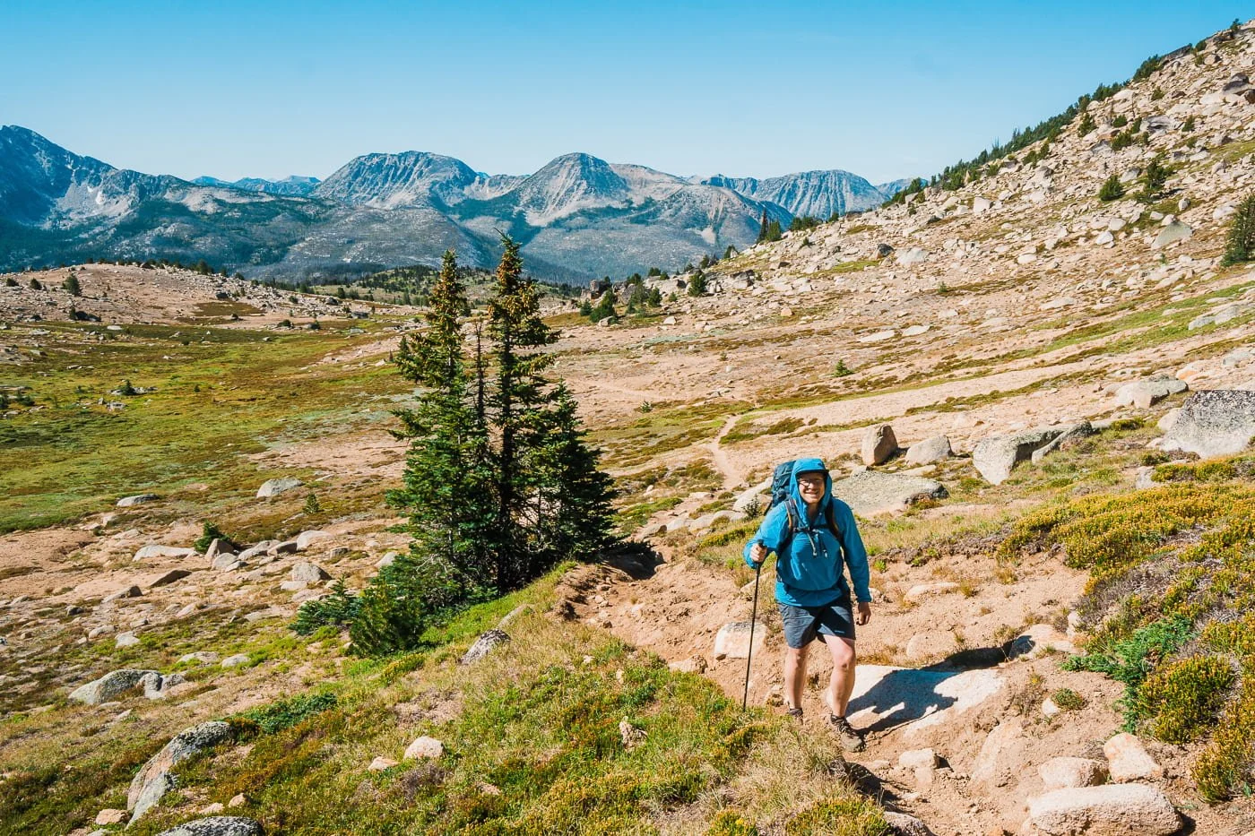
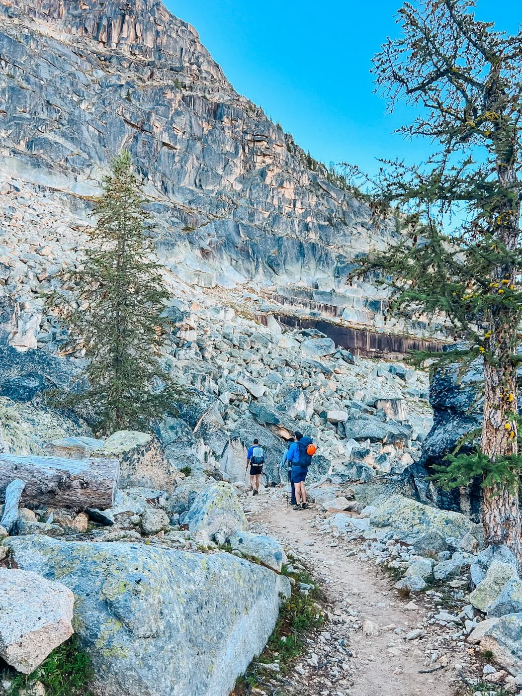
A forested section of the trail heading towards Tungsten Mine Camp
Day 1: Chewuch Trailhead to Tungsten Mine Camp
11.8 mi (19 km) | Gain: 2,670 ft (814 m) | Time: 5 - 8 hours
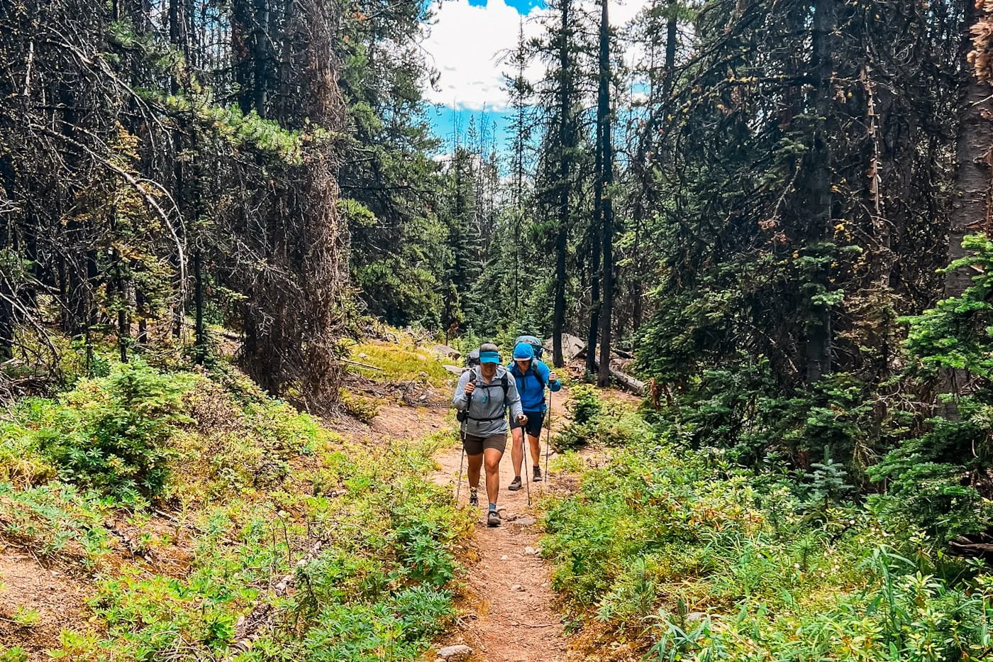
Day 1 is your biggest mileage day and gets a good portion of the ascent into the Cathedral Lake basin over with. From the Chewuch Trailhead, you'll follow the Chewuch Trail north, down into the Chewuch River valley.
On the way down there will most likely be some tree blowdowns in the first 2 miles, but they weren’t difficult to get around when we visited. The Chewuch trail continues up the river valley before turning off onto the Tungsten Trail, which climbs steadily toward the Tungsten Mine Camp.
The trail is well-maintained through this section and gains elevation gradually at first before steepening as you approach the mine area. The forest transitions from mixed conifers to more open subalpine terrain as you climb.
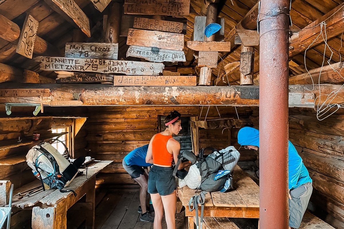
Taking an early afternoon break inside the Tungsten Mine Cabin. Photo credit: Nick Block
Tungsten Mine Camp sits in an open area near the historic tungsten mining site. It's a decent camp with flat open areas to pitch your tent or you can sleep inside the rustic cabin remains of the camp. If you do sleep inside the cabin, be prepared for nighttime critters to visit you…
Water can be scarce in late summer in this section. When we visited in mid-August, there were a few trickling streams along the trail and some swampy watering holes. Filter and fill your water supply at the seasonal tarn and/or where the trail nears Tungsten Creek about 2.3 miles before reaching camp. Carry enough for the evening and morning if you’re visiting later in the season (late-August to late September). There are internet rumors that you can descend from the mining camp to Tungsten Creek via a social trail but we didn’t find it in-person or a credible track online.
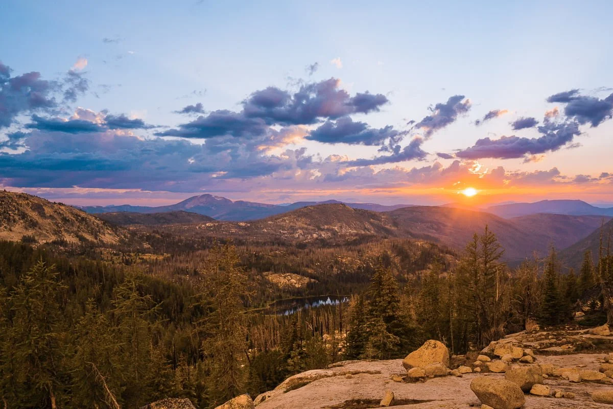
Sunset in the Cathedral Lake basin, views from camp
Alternative Day 1 Itinerary: Skip Tungsten Mine Camp and go straight to Upper Cathedral Lake
17.4 mi (28 km) | Gain: 3,793 ft (1,156 m) | Time: 8 - 12 hours
If you're a strong backpacker and want to maximize time at Upper Cathedral Lake, it's absolutely possible to skip Tungsten Mine Camp and push all the way through to Upper Cathedral Lake on Day 1 (this is what we did).
We had a fast group with an early start time so we made it to Tungsten Mine Camp by lunch time and decided we could continue on and make it all the way to the lake. This is a big day at 17.4 miles with significant gain, but it gives you an extra full day at Upper Cathedral Lake.
When we did this trip we only had a long three day weekend to complete the loop so we opted for this option and can vouch that it’s possible.
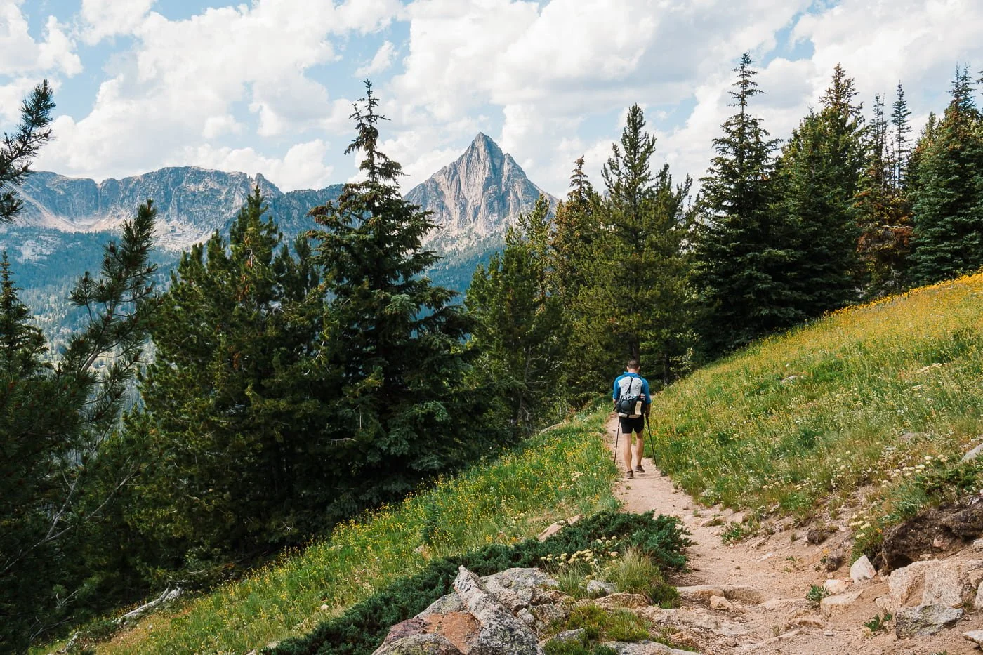
Hiking on the Boundary Trail before getting to the base of Cathedral Peak
Day 2: Tungsten Mine Camp to Upper Cathedral Lake
5.6 mi (9.0 km) | Gain: 1,123 ft (342 m) | Time: 2.5 - 4 hours
Day 2 is a short day of travel that leaves you extra time to enjoy Upper Cathedral Lake in the afternoon or take on the Cathedral Peak scramble (details below) and catch sunset from camp.
From the Tungsten Mine Camp, continue on the Tungsten Trail to the Boundary Trail, where the landscape opens up dramatically onto one of the finest ridgelines in the Pasayten, with views of Cathedral peak in the distance.
From the Boundary Trail, you'll turn south toward the Cathedral Lakes area and drop into the Upper Cathedral Lake basin.
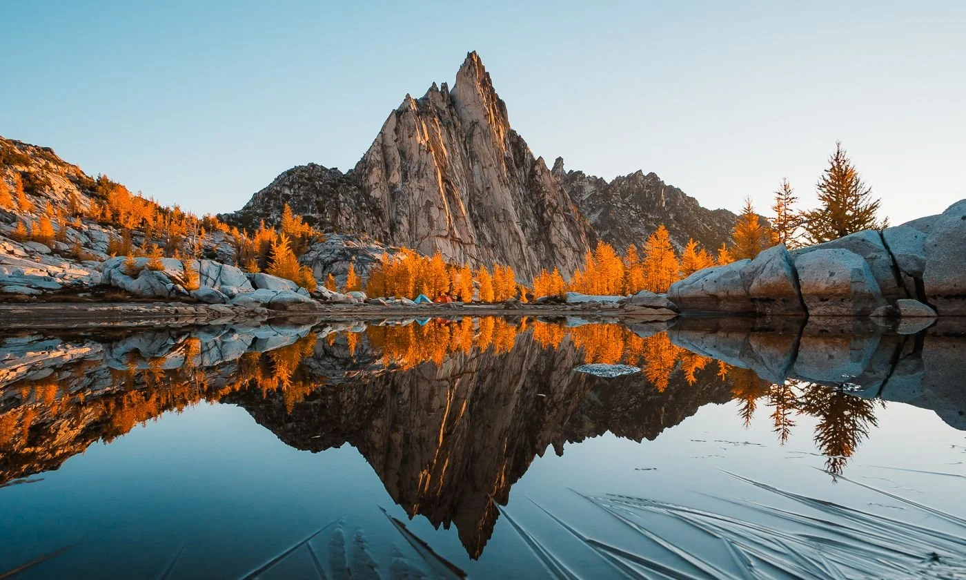
Camping spots are dispersed throughout the area. There are no official sites and all are first-come-first-served. We chose to camp on some lovely rock slabs near a tarn above Upper Cathedral Lake. There were additional sites along the shore of Upper Cathedral Lake too.
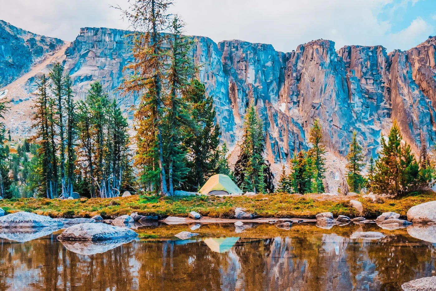
Camping at the tarn above Upper Cathedral Lake
Camping at Upper Cathedral Lake, or the tarn where we camped, is the highlight of the whole trip. The camp areas are flat, water is abundant year-round directly from the lake, and the views from camp are extraordinary. We recommend focusing the majority of your camping time here.
It’s worth mentioning that despite the drier climate of this area, there is still plenty of standing water for mosquitoes. When we visited in mid-August, they were still swarming us at our campsite unfortunately.
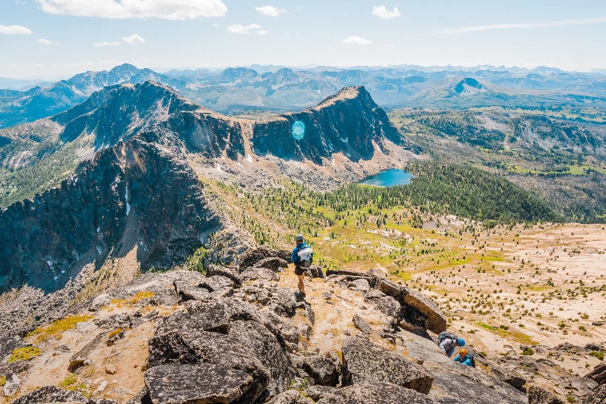
Side Trip from Camp: Scramble Cathedral Peak
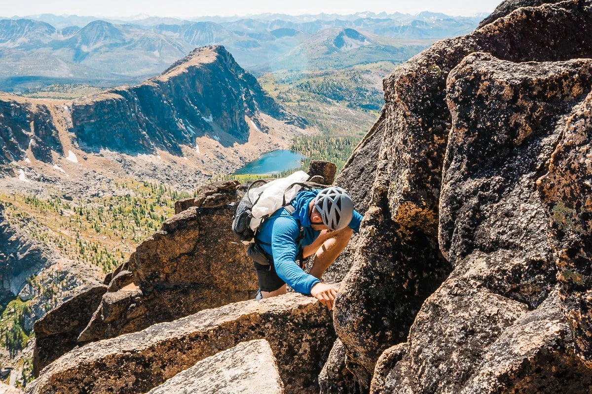
Garrett on the scramble up Cathedral Peak
Doing the scramble up Cathedral Peak was one of the biggest highlights of the trip for our group. The scramble can be done in the morning or afternoon from Upper Cathedral Lake Camp. Just note that if you choose an afternoon/evening summit, there is a risk of being caught in an afternoon thunderstorm. In this area, always keep a close watch on the mountain weather.
Cathedral Peak Scramble Stats:
Distance: ~1 mi (1.6 km) one way from Upper Cathedral Lake Camp
Elevation Gain: 1,222 ft (373 m) one way
Difficulty: Class 4 with a few short low class 5th moves.
Gear recommended: Helmet, approach shoes, trekking poles for the steeper lower section
Route: Approximate Track from Upper Cathedral Lake Camp to Summit
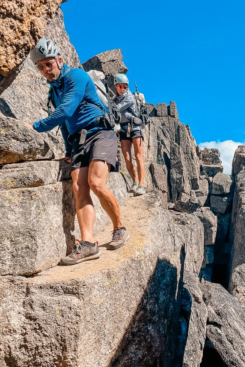
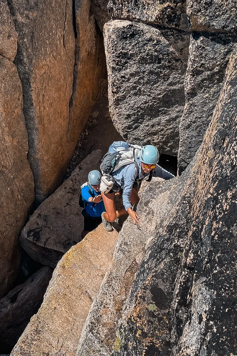
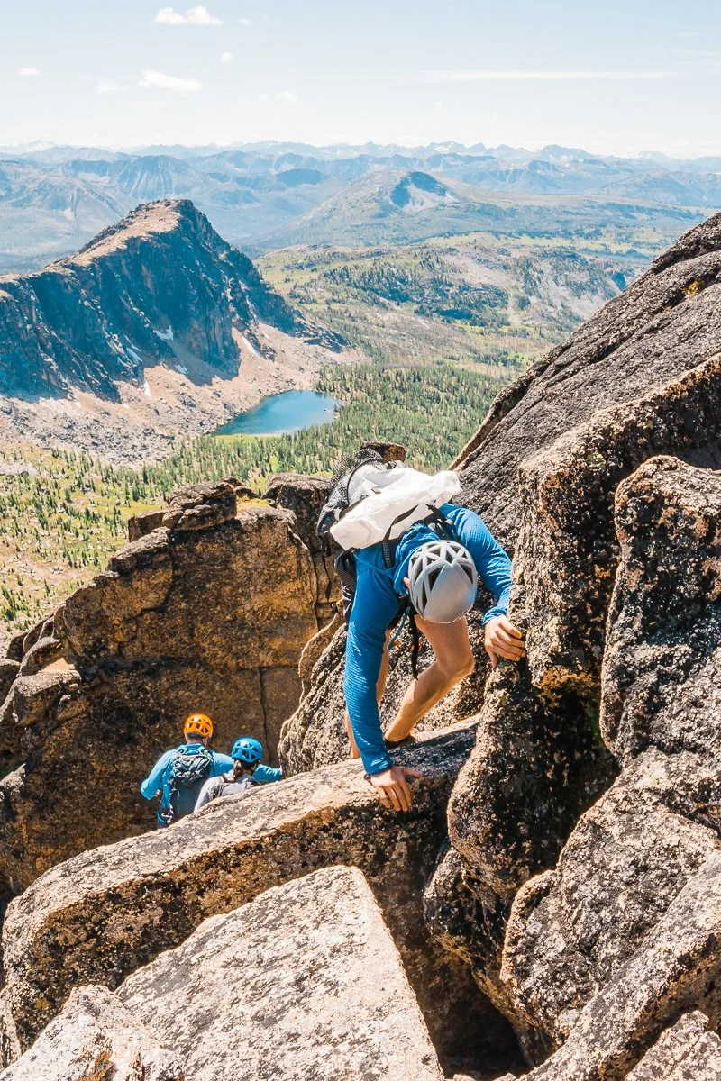
The scramble begins directly from Upper Cathedral Lake camp and gains elevation quickly. The lower section is Class 2-3 on loose scree and talus, while the upper section involves some Class 4 moves where you'll be using both hands and feet on steeper rock.
There were some cairns along the way but you’ll also have to use some route finding skills to find the path to the top. As you ascend the peak, there are a few short low 5th class sections of climbing (images above) where we spotted each other as a group since a fall would likely injure the climber.
You’ll eventually reach the top of the peak, which is a large boulder field with expansive views in all directions. Unfortunately, it’s difficult to reach the true summit without some serious bravery or climbing gear. The summit lies beyond a high consequential cliff gap that you need to jump up and across. We only recommend this for experienced scramblers and climbers.
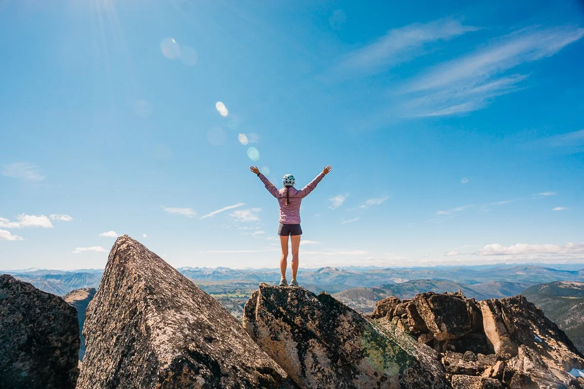
Skye standing on top of Cathedral Peak
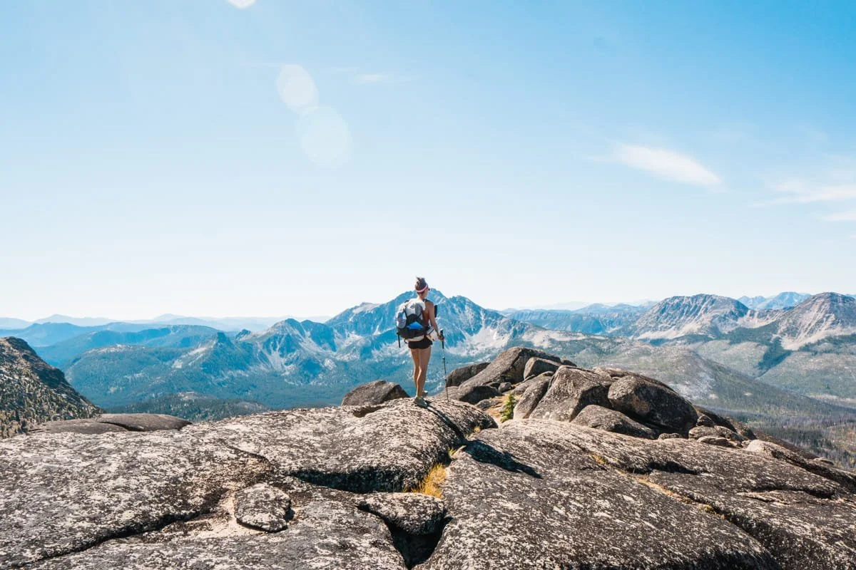
All that said, the summit views are exceptional with a full 360-degree panorama of the Pasayten, north into Canada, west toward the high Cascades, and east toward the rolling terrain of the Okanogan. This is one of the best scrambles we've done in Washington that doesn't require climbing gear or a rope.
As mentioned above, we do recommend a helmet and approach shoes for scrambling as an extra precaution. Fall potential does exist on the upper section.
Descend carefully; the upper Class 4 section is committing in both directions, and can be harder to down climb. Three of the four people in our group did wear approach shoes for the scramble, but Skye chose to do the entire backpacking trip and scramble in her trail runners. So it’s up to you based on your scrambling experience and personal preference what type of shoes you wear.
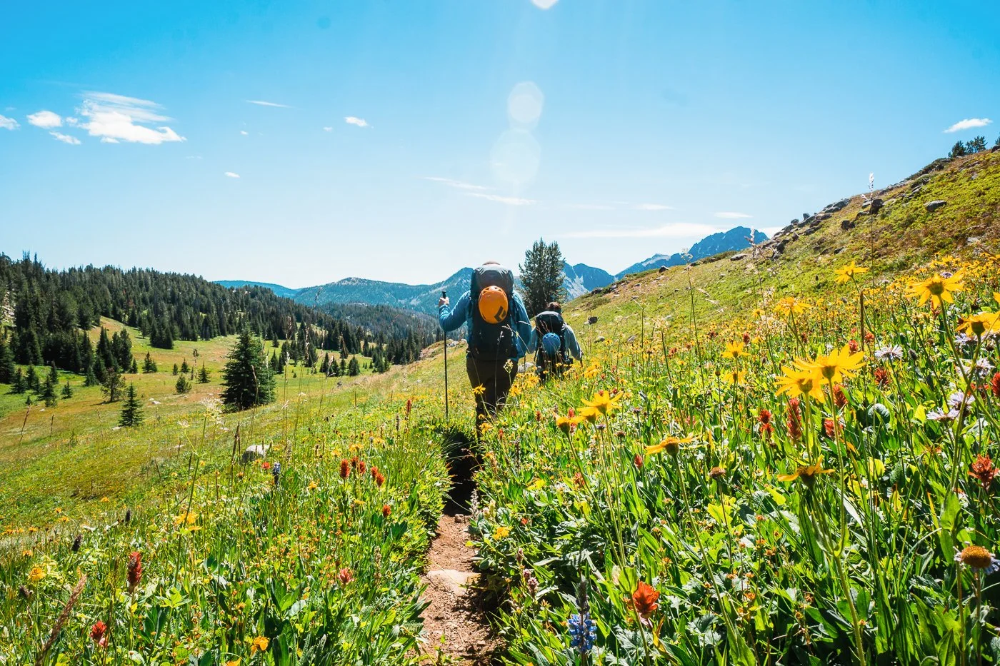
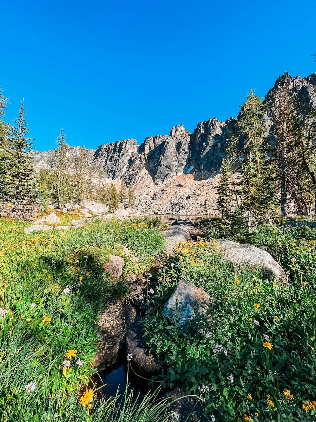
Mid-August wildflower bloom between Amphitheater Peak and Remmel Lake
Day 3: Upper Cathedral Lake to Tungsten Creek Camp
10.5 mi (16.9 km) | Gain: 363 ft (111 m) | Time: 4 - 7 hours
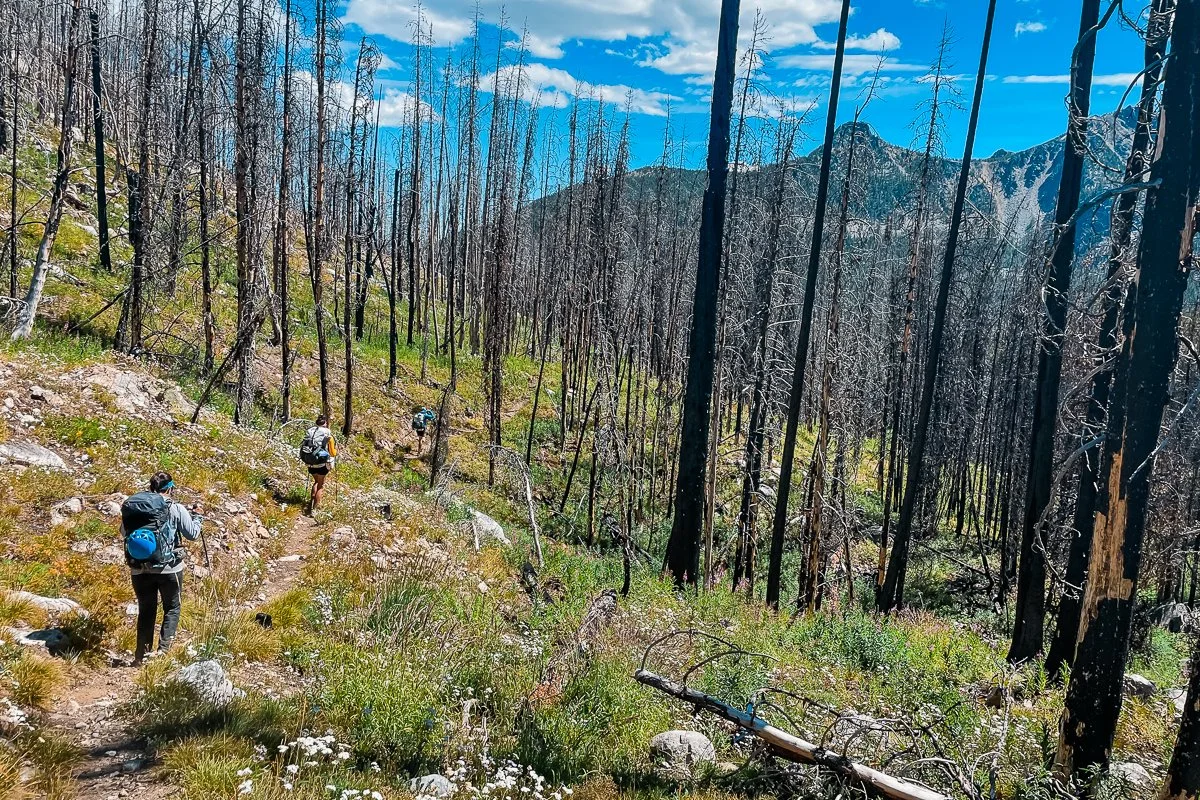
Day 3 takes you out of the Cathedral Lakes basin and back to the Boundary Trail and eventually the Chewuch Trail heading south toward Tungsten Creek. The route deviates along a short section of unmaintained — yet well traveled — trail to head up to the summit of Amphitheater Mountain.
Although the mileage is moderate, there is a ~2 mile stretch on the Chewuch Trail where it crosses Cathedral Creek to the junction with Four Points Creek with a large amount of blowdown trees. The down trees are a result of the 2001 Thirty Mile forest fire as well as fires in 2003 and 2006.
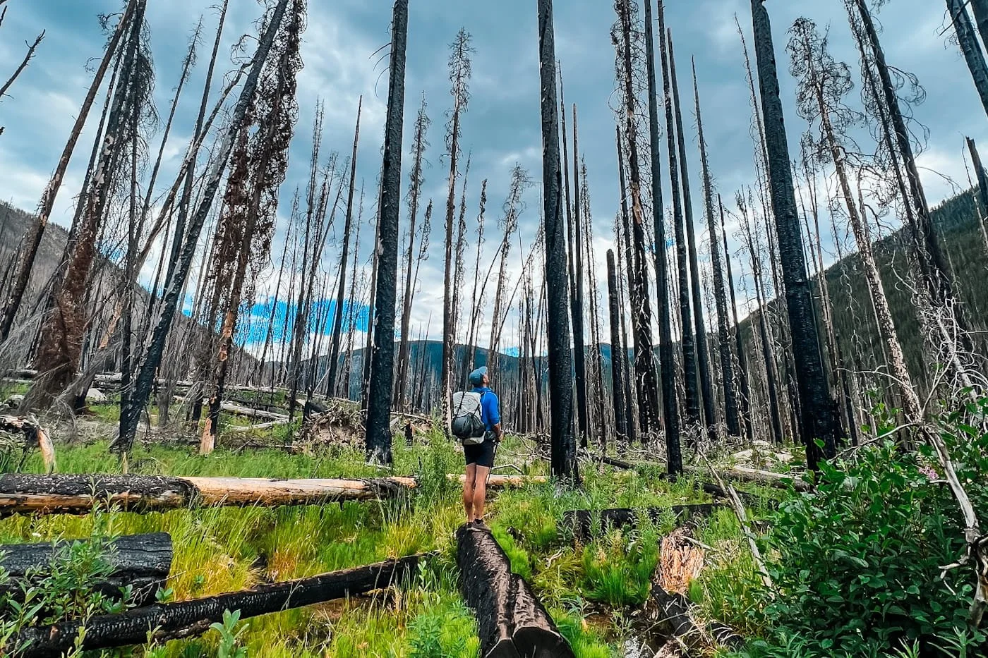
Garrett standing in a huge section of burnt forest
This slows progress significantly since you still need to climb up and over down trees with heavy packs on a generally overgrown trail. Additionally there are still sections of the trail that have a large amount of tree snags that can present a falling hazard in windy conditions. And it’s also worth noting that there is little shade on hot days.
The trail is clear again at the Four Points Creek junction and is well maintained beyond this point back to the Chewuch Trailhead.
If you’re planning to summit Amphitheater Mountain (details below) make sure you factor some extra time and energy in to navigate the down tree section.
Side Trip: Hike to the Summit of Amphitheater Mountain
Hiking up Ampitheater Mountain, photo credit: Nick Block
About 1.5 miles from Upper Amphitheater Lake, you'll reach the junction for Amphitheater Mountain. This is a well-traveled class 2 trail (not off-trail or any scrambling) and the grade is pretty mellow up to the summit of Amphitheater Mountain.
Amphitheater Mountain Trail Stats:
Distance: 1.8 mi (2.9 km) round trip from the junction
Elevation Gain: 739 ft (225 m) round trip
Difficulty: Moderate — trail hiking, no scrambling
Time: Allow 1–2 hours
Route: Approximate route from the trail junction
On the way up the southwest side of Amphitheater Mountain, you can cache your overnight gear at the trail junction, but do not leave food in your pack since this is still critter and bear country. Carry your food and any smelly attractants in a daypack if you choose to cache your packs.
Unfortunately, there aren’t any tall trees in this area to build a bear hang with. We emptied our packs and shared two backpacking packs turned daypacks among the group.
The trail climbs steadily to the broad summit of Amphitheater Mountain, where the views open up across the Pasayten's rolling terrain in every direction. It's a completely different vantage point from Cathedral Peak.
Exploring the flat summit of Amphitheater Mountain
Alternative Campsite: Upper Cathedral Lake to Remmel Lake Camp
3.2 mi (5.1 km) | Gain: 389ft (119m) | Time: 2-3 hours
If you’d rather soak up more time at Upper Cathedral Lake or at the summit of Amphitheater Mountain there is an alternative camp site along Remmel Lake. This makes for a shorter mileage day but also allows for more side trip flexibility and a longer day on the last day out. Remmel Lake is a small detour from our route but is worth visiting if you need to top-off water too.
Day 4: Tungsten Creek Camp to Chewuch Trailhead
6.9 mi (11.1 km) | Gain: 1,334 ft (407 m) | Time: 3 - 4.5 hours
Day 4 is a relatively short, pleasant walk out through the Chewuch River valley back to the trailhead. The Chewuch Trail follows the river closely through the shady forest. Just save some energy for that final climb up to the Chewuch Trailhead if you started there instead of Thirtymile trailhead.
Additional Resources to Check Pasayten Wilderness Conditions & Weather
NOAA Point Forecast for Upper Cathedral Lake - Detailed weather including hourly temps
USFS Pasayten Wilderness Page - Rules and updates regarding the Pasayten Wilderness
Air Now Fire and Smoke Map - Air quality and wildfire updates, point set to Upper Cathedral Lake
Washington Trails Association Cathedral Pass Loop - Trip reports and real-time trail conditions from recent hikers
Timeanddate.com - Sunrise and sunset times for the Pasayten Wilderness
How to Get to the Chewuch Trailhead
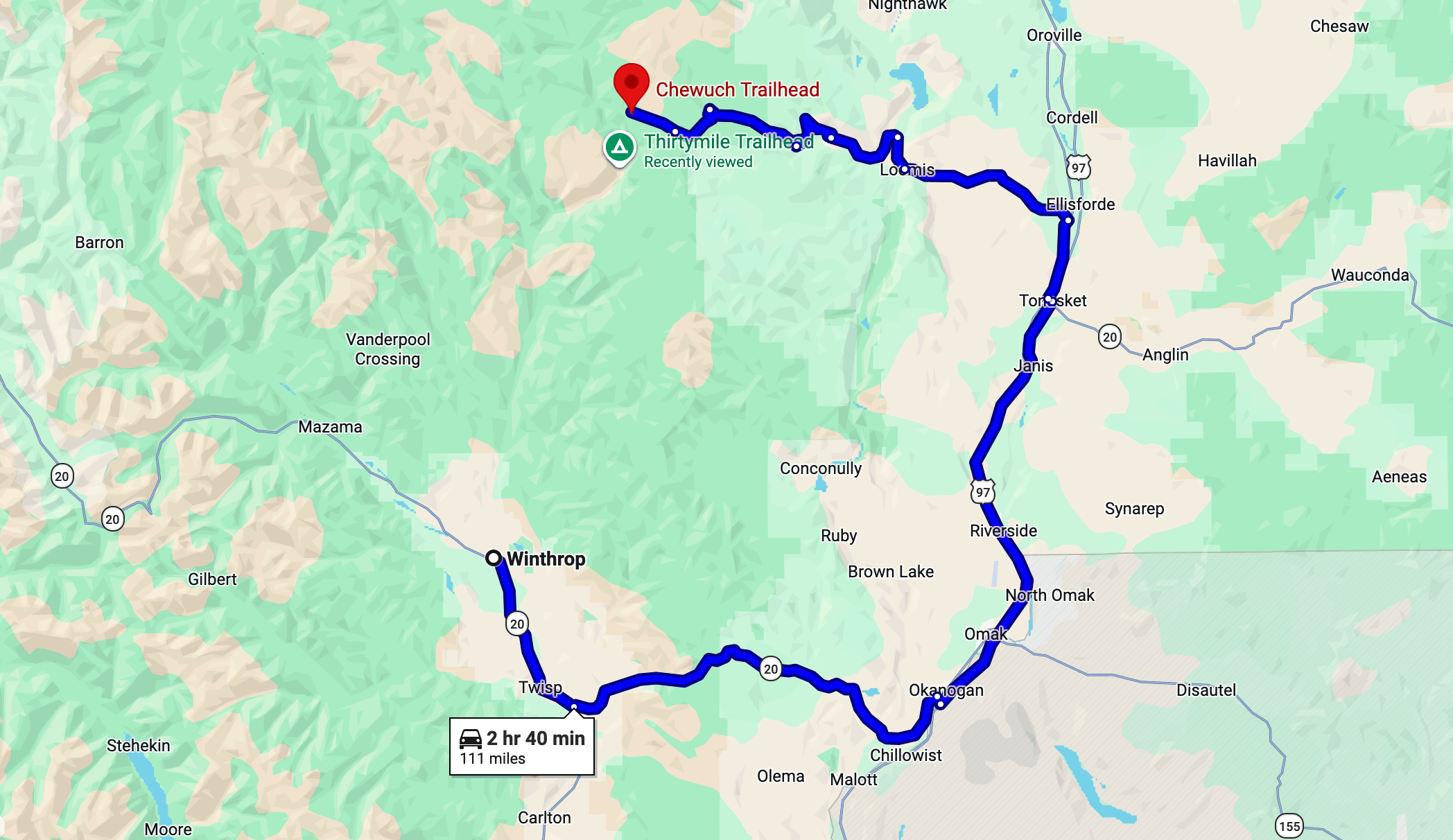
The Chewuch Trailhead is located northeast of Winthrop off Chewuch Road (Forest Road 51). The drive from Winthrop takes approximately 2.5-3 hours and the last several miles are on a maintained forest road suitable for low clearance vehicles.
From Winthrop, WA
Head north on WA-20 briefly, then turn right onto East Chewuch Road. Follow it north as it transitions to Forest Road 51 and continues up the Chewuch River valley. The trailhead is located at the end of the road near the wilderness boundary. Always call the local ranger station for the most recent roadway updates.
Trailhead Facilities
There is a vault toilet and trailhead signage at the Chewuch Trailhead. No water. Stock up on water, food, and fuel in Winthrop before heading up the valley. You do need a Northwest Forest Pass or America the Beautiful pass for trailhead parking.
How to Get to Thirtymile Trailhead
The Thirtymile Trailhead is located north of Winthrop off Forest Service Road 51. The drive from Winthrop takes approximately 60 minutes and is suitable for low clearance vehicles. Always call the local ranger station for the most recent roadway updates.
From Winthrop, WA (~1 hour, ~29 miles)
Head north on Okanogan County Road 1213 (West Chewuch Road) from downtown Winthrop. The road transitions to Forest Service Road 51 as it heads up the Chewuch River valley. After ~20 miles on FSR 51, fork left to FSR 5160. Follow FSR 5160 for approximately 11 miles total to the Thirtymile Trailhead at the road's end. A high-clearance vehicle is recommended for the final forest road miles, especially early in the season.
Trailhead Facilities
Vault toilet and picnic tables on-site. No potable water, but Chewuch River is nearby for filtering water. You will need a Northwest Forest Pass or America the Beautiful pass to park at the trailhead.
Descending from Amphitheater Mountain near the lower trail junction. Andrew Peak in background.
What to Pack for Backpacking in the Pasayten Wilderness
Packing the right gear is essential for any multi-day trip, but even more so with the remote nature of the Pasayten Wilderness. Alpine conditions and variable weather demand the right preparation with lightweight, durable gear.
Layers are critical, temperatures can swing from hot sun to near-freezing at night, and afternoon thunderstorms can happen. We recommend a solid layering system including a warm puffy jacket for camp. Trail runners or lightweight hiking boots work well for most people, though some prefer approach shoes for scrambling Cathedral Peak.
Below are our gear recommendations, products we regularly use on all of our backpacking trips, and what we find necessary after countless backpacking trips throughout the Cascades and around the world.
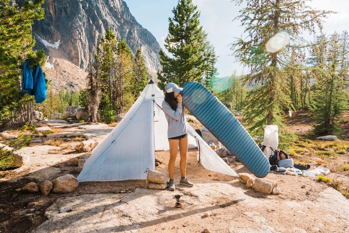
Skye setting up camp near Upper Cathedral Lake, with the base of Amphitheater Mountain in the background
Backpacking Big Three: Backpack, Tent, and Sleep System
Your big three—backpack, tent, and sleep system—are the foundation of your gear. For long mileage backpacking trips like this, ultralight gear makes a huge difference. We’ve listed what we use and recommend below, but for a complete list of the best ultralight backpacking gear, check out our Ultralight Backpacking Gear Guide.
The Big Three We Use and Recommend
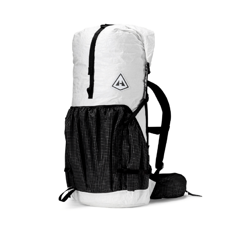
55L Backpack: A comfortable, ultralight pack in the 50-60L range is ideal for a 2-4 day trip. Our all-time favorite backpacking pack is the Hyperlite Mountain Gear Southwest 55L, we both brought ours on this trip and it was perfect in size and comfort. It's waterproof, lightweight, and comfortable.
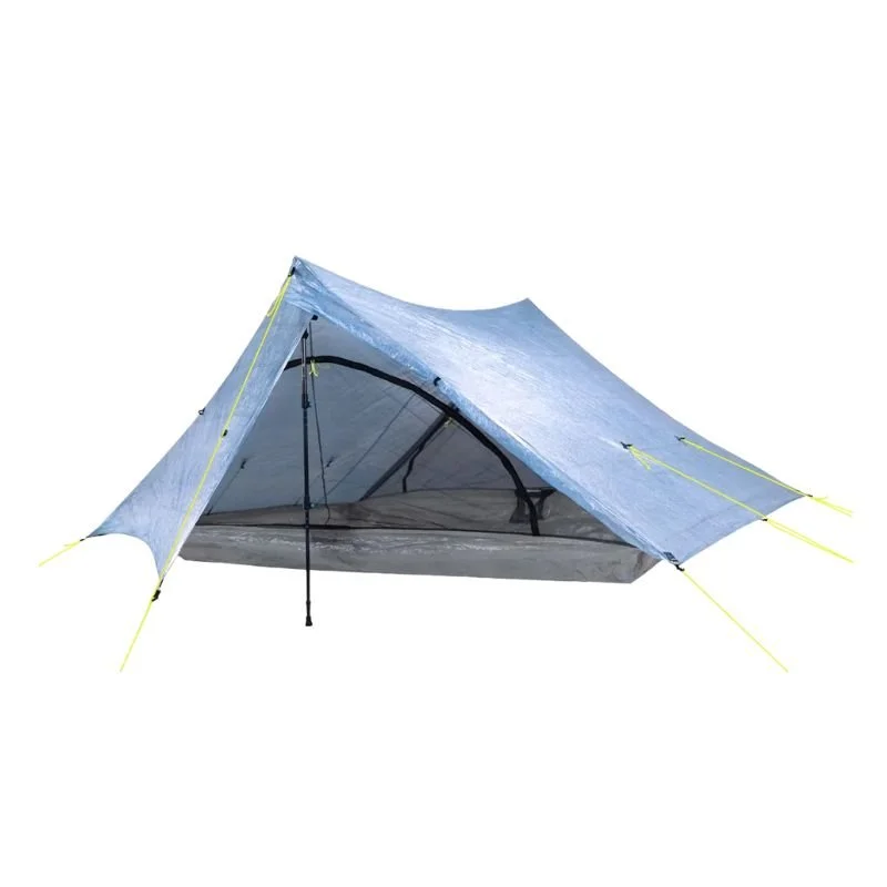
Tent/Shelter: We love light weight trekking pole tents for backpacking, they are spacious and packdown small. Just make sure you have your own extendable trekking poles to pitch your tent with. Our two favorites are the Zpacks Triplex and Hyperlite Unbound 2. Both are spacious and under 1.5 lbs!
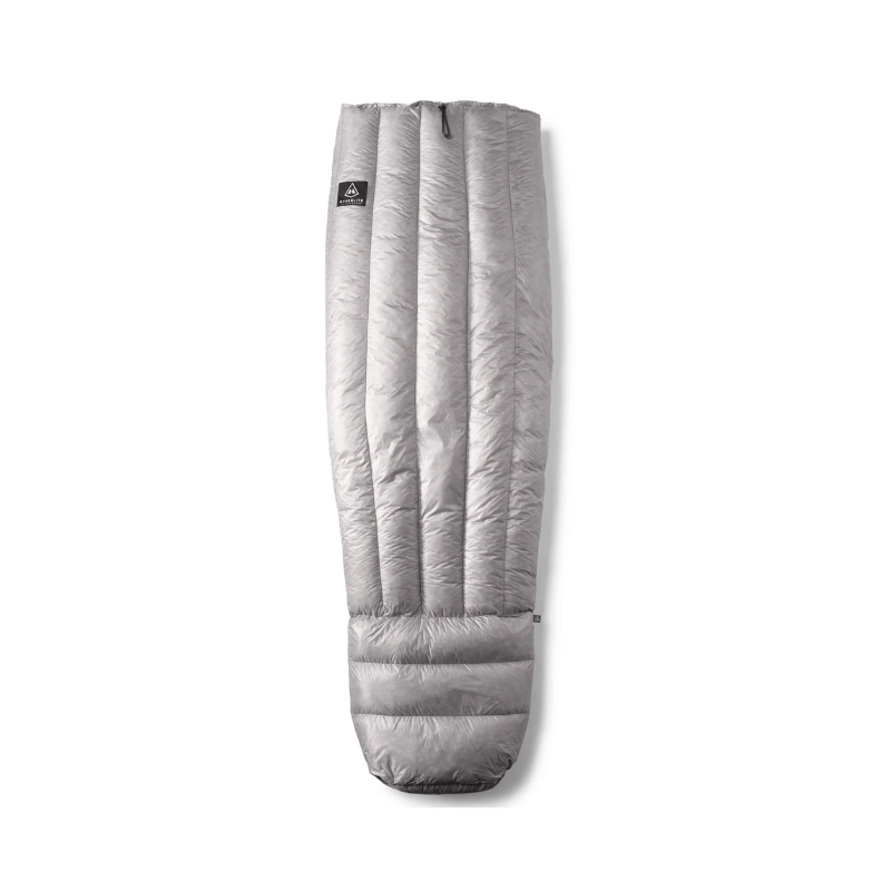
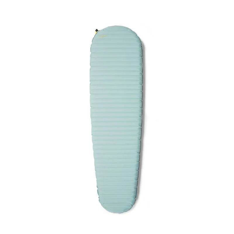
Sleeping Bag or Quilt & Sleeping Pad: We both use lightweight quilts and brought our 20-degree Hyperlite and Therm-a-Rest quilts for this trip. A good insulated sleeping pad like the Nemo Tensor All Season or a Therm-a-Rest NeoAir Xtherm NXT is essential for comfort on rocky ground.
Backpacking Essentials for the Pasayten
Backpacking in the high alpine terrain of the Pasayten Wilderness is different from forest trails and lower elevation. Alpine areas and even the lower fire scarred Chewuch Canyon requires extra sun protection, warm layers for cold mornings, and gear that can handle rocky scrambling.
Below is a checklist of our favorite trail-tested backpacking items we bring with us.
Backpacking Gear to Pack with You
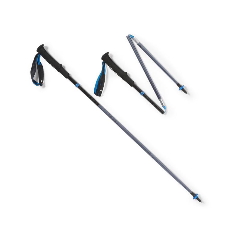
Trekking Poles: Essential for climbing steep sections and stability with a heavy pack.
Sun Protection: High-SPF sunscreen (Dermatone Sport SPF 50).
Anti-Chafe Stick: High mileage in hot conditions can make for some gnarly chafing situations. Love putting a Dermatone travel size Anti-Chafe Stick in our hip belts.
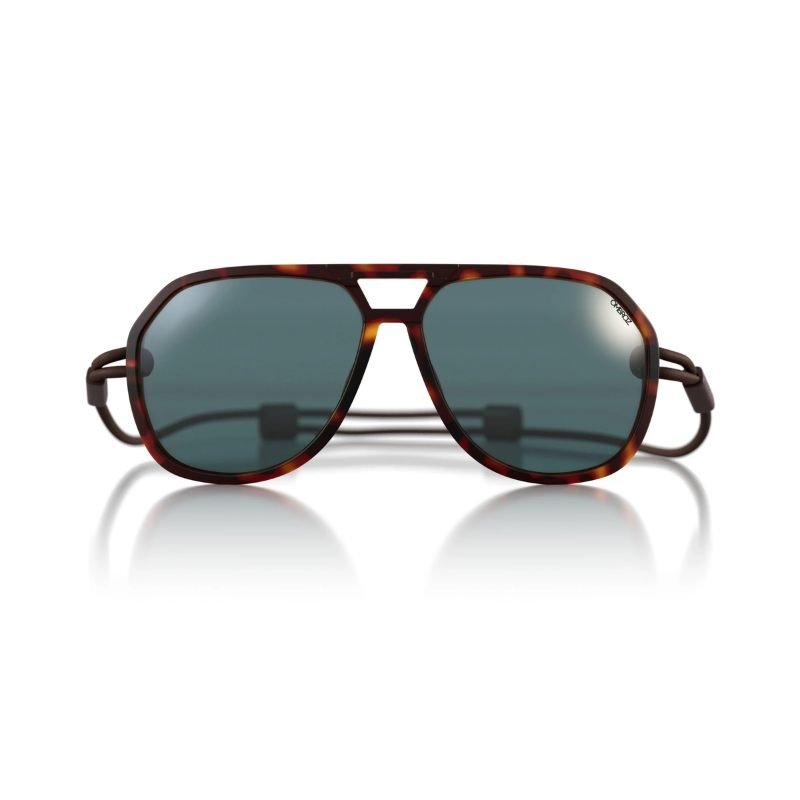
Sunglasses: Love our Ombraz for their compact size, adjustable cord and eco conscious business practices.
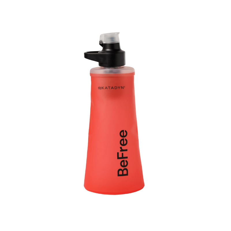
Water Filter: A Katadyn BeFree 1L filter is compact and easy to filter and drink from on-the-go.
Bear Cannister or Bear Bag: There are no formal bear hangs or bear boxes on this trail, proper food storage is essential.
Headlamp: Nitecore NU25 400 is one of the lightest and brightest rechargeable headlamps out there.
Navigation: We always use GaiaGPS or similar with downloaded maps. Cell service is unreliable in this area.
Power Bank: For recharging phone/GPS, the UL Nitecore 10000 powerbank is one of the lightest and gives 2-3 iPhone charges.
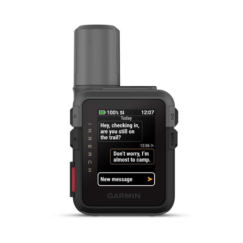
Garmin InReach Mini 3: A small lightweight locator and satellite messenger for emergencies, we never go into the backcountry without it.
Microspikes or Crampons (seasonal): Essential for early season (May) or late season (mid-Oct) if snow/ice is present.
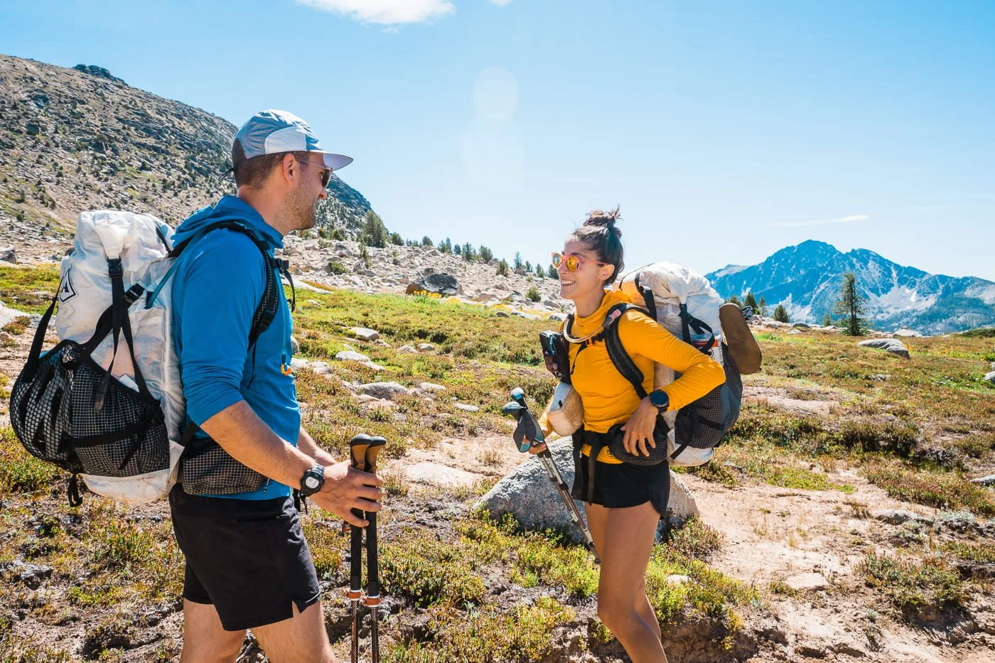
Both of us wearing OR Echo Sun Hoodies and running shorts in the Pasayten
Hiking Clothing to Wear and Pack
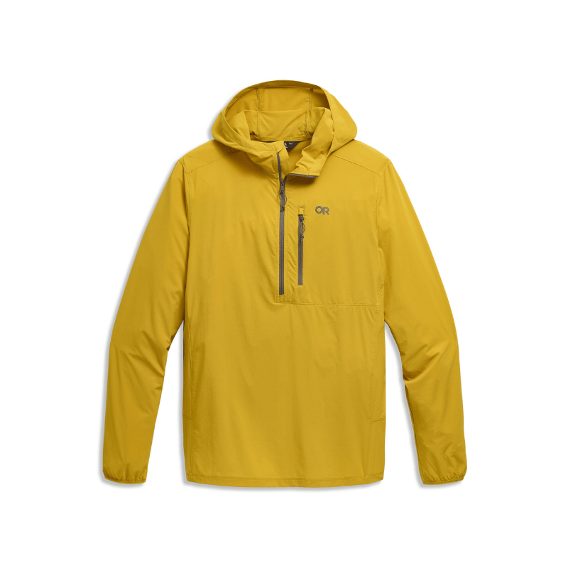
Sun Hoodie or Sun Shirt: The UV rays are extra intense at higher elevations, so wearing a lightweight sun shirt while hiking is important. We love our Outdoor Research Astroman Sun Hoodies the best for backpacking since they feel breezy, dry quickly and are lightweight.
Buff: Works great for additional face protection from the sun, as a snot rag, or as improvised headband or nighttime sleep mask.
Fleece Mid-Layer: For breathable warmth while moving through windy or cold conditions and to wear at camp. Check out our mid-layer gear guide for our top fleece recommendations.
Insulated Puffy Jacket: Nights can get cold, so we usually bring our Stio Hometown down jackets for extra warmth at camp.
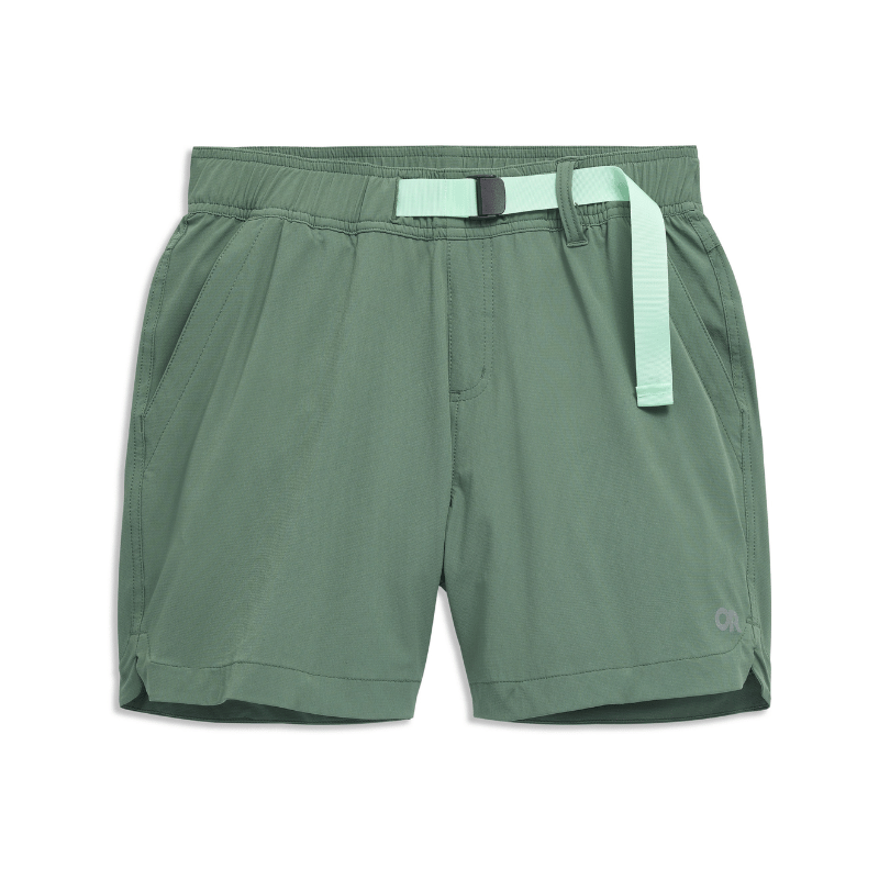
Hiking Shorts and/or Hiking Pants: We usually hike in shorts, but sometimes bring a pair of pants depending on weather.
Patagonia Strider Pro Shorts are our all time favorite for backpacking
OR Ferrosi Shorts for those who want pockets with a stretchy, breathable, and durable short.
OR Ferrosi Pants are made from the same material as the shorts but provide full leg coverage.
Toe Socks: Injinji Toe socks have been lifesavers for protecting our feet and toes on dusty mountain trails.
Rain Jacket: Windy days and alpine storms are common, the lightweight OR Helium is easy to tuck into your pack.
→ For a full comprehensive checklist for backpacking clothing, check out our guide on What to Wear Backpacking and Hiking.
Extra Gear for Scrambling Cathedral Peak:
Helmet: Recommended for rockfall and falling protection. We carry a Black Diamond Vision Climbing Helmet for its comfort and weight savings.
Approach shoes: Dedicated approach shoes if you have them but trail runners with lugged soles work well for us. Our favorite is the La Sportiva TX4
Hiking through the end of the burned section of trail, photo credit: Nick Block
FAQ for Backpacking the Cathedral Pass Loop
Do you need a permit to backpack in the Pasayten Wilderness?
No. Unlike many popular Washington wilderness areas, no overnight permit is required for the Pasayten Wilderness. A free self-issue permit is required at the trailhead and you'll need a Northwest Forest Pass (or America the Beautiful pass) for trailhead parking.
How long does this loop take?
We recommend 3 nights / 4 days for most backpackers. This gives you a comfortable pace, a full afternoon/morning for the Cathedral Peak scramble, and time to actually enjoy Upper Cathedral Lake. Strong, experienced hikers can do it in 2 days / 1 night by pushing directly to Upper Cathedral Lake on Day 1 and out via Tungsten Creek on Day 2.
Is Cathedral Peak safe to scramble without a rope?
For experienced hikers and scramblers comfortable with Class 4 terrain, yes. The route does not require ropes or technical climbing gear. There are a few short low 5th class sections but they don’t require climbing equipment. A helmet is still recommended. If you're not comfortable on Class 4 and low 5th class terrain, the lake itself is a spectacular destination and the scramble can be skipped without any regret.
What is the water situation on this route?
Water is the most important logistics consideration. Tungsten Mine camp can be dry or have very limited water in late summer. Upper Cathedral Lake has reliable year-round water. Lower Tungsten Creek typically has flow in summer but this can vary. Always carry extra capacity and treat all water.
Are dogs allowed in the Pasayten Wilderness?
Yes, dogs are allowed. Keep them under control and practice Leave No Trace ethics with their waste as well.
What is the best campsite on the route?
Upper Cathedral Lake, without question. If you can only spend extra time in one place, make it here.
Can this loop be done in reverse (clockwise)?
Technically yes, but we don't recommend it. Counterclockwise puts you at Upper Cathedral Lake on Day 2 with a short hiking day and a full afternoon for the Cathedral Peak scramble. Clockwise up Chewuch valley adds uphill travel with heavier packs through a 2 mile burn section with down trees from the 2001, 2003 and 2006 forest fires.
Do I need a bear canister in the Pasayten Wilderness?
Bear canisters are not legally required in the Pasayten Wilderness, but proper food storage is mandatory and strongly encouraged. There are no bear boxes or established bear hangs on this route, so you'll need to bring your own solution, a bear canister, an Ursack, or a cord and stuff sack for a hang at least 200 feet from camp and 10 feet off the ground.
Are campfires allowed in the Pasayten Wilderness?
Campfires are allowed in the Pasayten Wilderness but are prohibited in certain high-elevation and sensitive areas, and subject to seasonal fire restrictions during dry conditions. Always check current fire restrictions with the Methow Valley Ranger District before your trip. During peak summer and late summer, when this route sees the most traffic, fire restrictions are common. All that said, we highly recommend a camp stove as your primary cooking method regardless of restrictions. Campfires can scar the ground and gathering wood for campfires can deplete local wood resources for animals and insects and are a top cause of human caused forest fires.
Are there designated campsites on this route?
No. All camping on this route is dispersed, there are no designated sites, established tent pads, or first-come-first-served reservation systems. You choose your own site within Leave No Trace guidelines: at least 200 feet from water sources and trails, on durable surfaces like rock or dry dirt wherever possible. The Cathedral Lakes basin has several well-worn spots near the lake shore and on rock slabs above the lake that previous parties have used. In general the Pasayten sees low enough traffic that finding a good site at any of the three camps on this route is rarely an issue.
How fit do I need to be for this loop?
This is a strenuous trip that requires a solid base of hiking fitness. In our guide, Day 1 is 11.8 miles with 2,670 feet of gain and a fully loaded pack. If you can comfortably complete a 10+ mile day hike with 2,500 feet of gain before this trip, you're in good shape. The optional Cathedral Peak scramble and Amphitheater Mountain hike add additional physical and technical demands on top of the base loop. This is not a beginner backpacking trip, but fit and motivated intermediate backpackers who put in the preparation will handle it well.

Looking down at Amphitheater and Upper Cathedral Lake from Cathedral Peak
Final Thoughts on Backpacking in the Pasayten
The Pasayten doesn't get the attention it deserves, and honestly, that's part of what makes it so good. This backpacking loop is just scratching the surface of the massive Pasayten Wilderness and is a great introduction to the area, and if you love it, there’s so many more trails out here.
As a reminder, the itinerary in this guide is a suggestion, not a prescription. A fit group with an early start can push straight through to Upper Cathedral Lake on Day 1, giving you more time in the basin for Cathedral Peak, Amphitheater Mountain, or simply sitting by the water.
A more relaxed pace with an extra night — either at Tungsten Mine Camp or Remmel Lake — lets you slow down and enjoy the moment more. The flexibility is one of its strengths.
However you choose to break it up, the Pasayten asks a little more of you than a high traffic trail in a national park. In return, it gives you something genuine wilderness, extraordinary views, and a summit or two you'll be talking about for years.
Enjoy the trail!
Backpacking in the Core Enchantments in October
Further Reading & More Backpacking Guides
More Backpacking Trips You Will Love:
Backpacking the Enchantments — Washington's most iconic permit-required backpacking trip, right in our backyard
The O-Circuit in Torres del Paine — Patagonia's full circuit, the longer and wilder sibling of the famous W Trek
Berg Lake Trail Backpacking Guide — A jaw-dropping Canadian Rockies route under the north face of Mount Robson
Mount Assiniboine Backpacking — The "Matterhorn of the Canadian Rockies," one of our all-time favorite backcountry destinations
Backpacking Buckskin Gulch & Paria Canyon, Utah — The longest slot canyon in the world, a completely different kind of backpacking adventure
Backpacking the Idaho Sawtooth Mountains — A stunning multi-day loop through one of the West's most underrated wilderness areas
Backpacking Gear Guides & What to Pack:
Like this Post? Pin it & Save it For Later
Canyon Crest Trail: A Short Day Hike in Leavenworth, WA
Best Hikes & Must-Stop Spots in Valley of Fire State Park
This image is copyrighted and owned by Skye Stoury Photography and skyestoury.com, if you would like to licence any images on this site, please email us at hello@skyestoury.com