
12 Best Larch Hikes Near Banff and Canmore: Fall Colors Guide (2026)
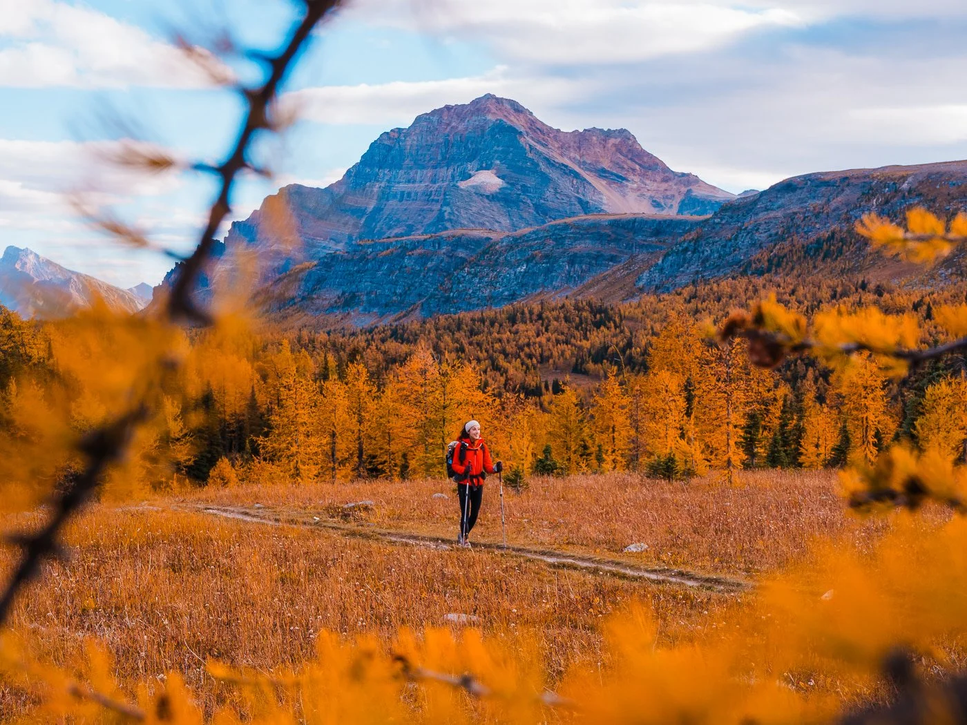
The Best Fall Larch Hikes and Backpacking Trips Near Banff in the Canadian Rockies
If you're looking for the best larch hikes near Banff, this guide is for you! These are all truly bucket list worthy day hikes and backpacking trips in and around Banff, Canmore, Lake Louise, and Kananaskis, all of which are amazing year round, but that truly shine during the fall for stunning fall colors and golden larches.
After spending four falls in a row in the Canadian Rockies, we really think late September is the best time of year to visit Banff. There are a ton of fall color hikes and backpacking trips in the greater Banff area, but getting to see the larches in all their golden glory is by far our favorite, so each year while we are there, we do as many larch hikes as we can (it’s called larch madness for a reason).
Larches are usually prime in the greater Banff area in mid to late September, so it’s the perfect fall getaway. We have personally hiked and backpacked all of the trails in this guide, and these are truly our favorites in the area.
*Updated August, 2026 with new, additional hikes, current trail and permit information, and up-to-date pricing. We also keep this guide updated annually so it is as accurate as possible.
Why Trust This Larch Hiking Guide?
We have spent years chasing larches in Banff and Canmore, and between day hiking and backpacking every trail on this list multiple times, this guide reflects what these hikes are actually like in peak larch season, not just trail stats pulled from a map. Between the two of us, we've spent over six months in the greater Banff area over the past several years. Garrett has been visiting Banff annually since he was a kid, and I (Skye) first started coming here for hiking and photography back in 2016. These are the hikes we'd send anyone visiting for the first time.
Disclaimer: This blog post contains affiliate links, meaning we receive a small commission of every purchase made with our links at no additional cost to you. Sometimes there is even a discount code for my readers which we specify next to the links.
Table of Contents
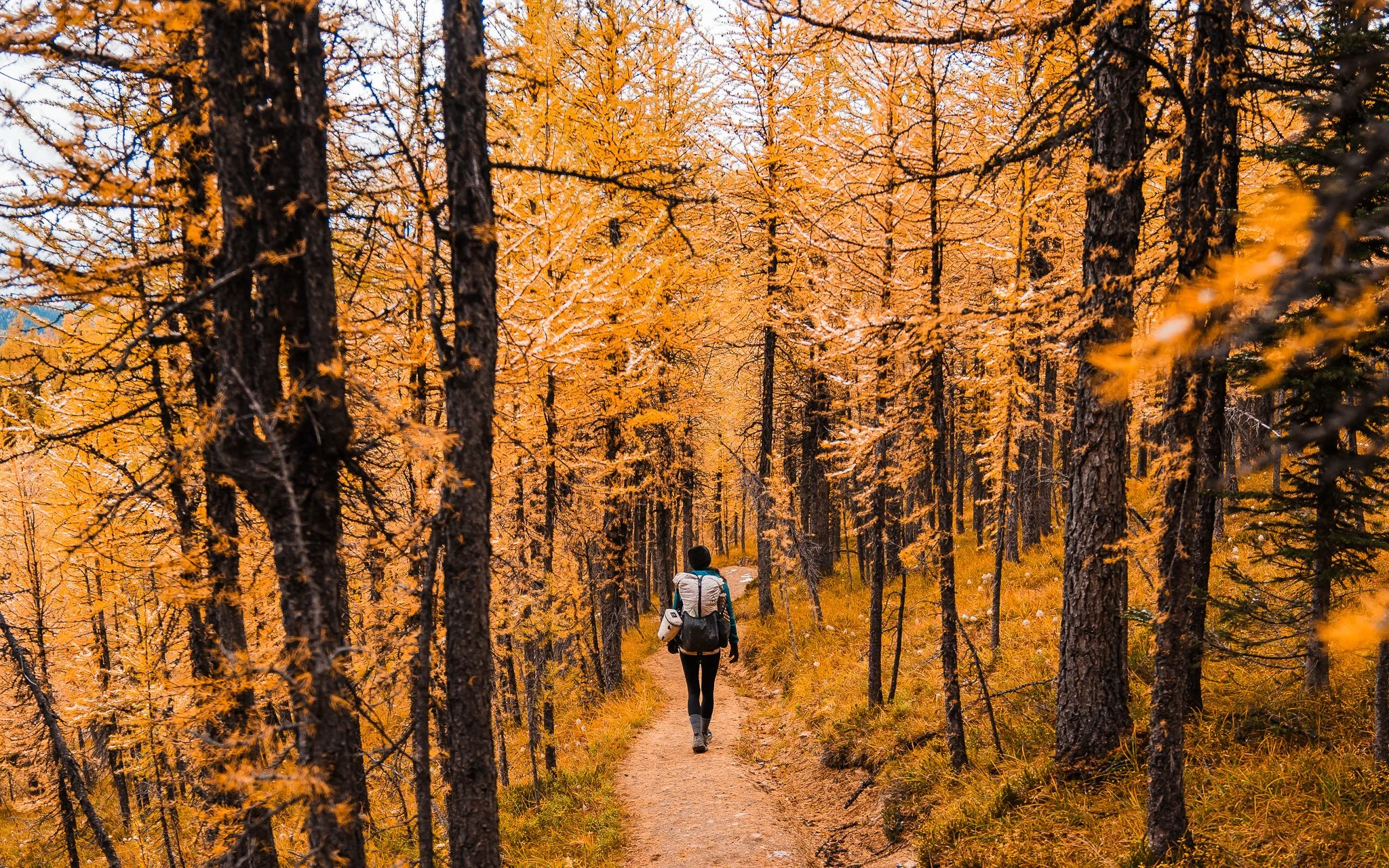
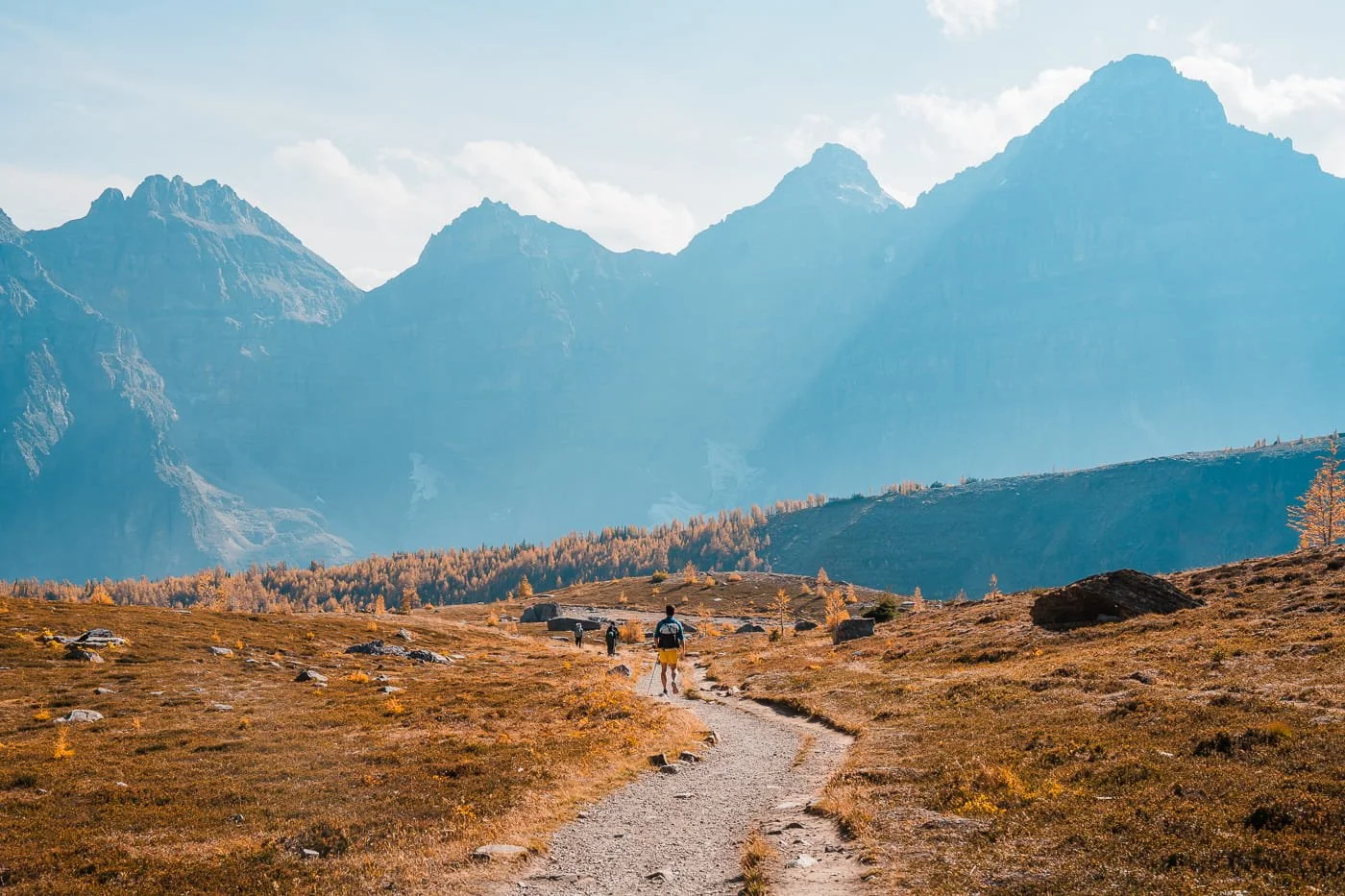
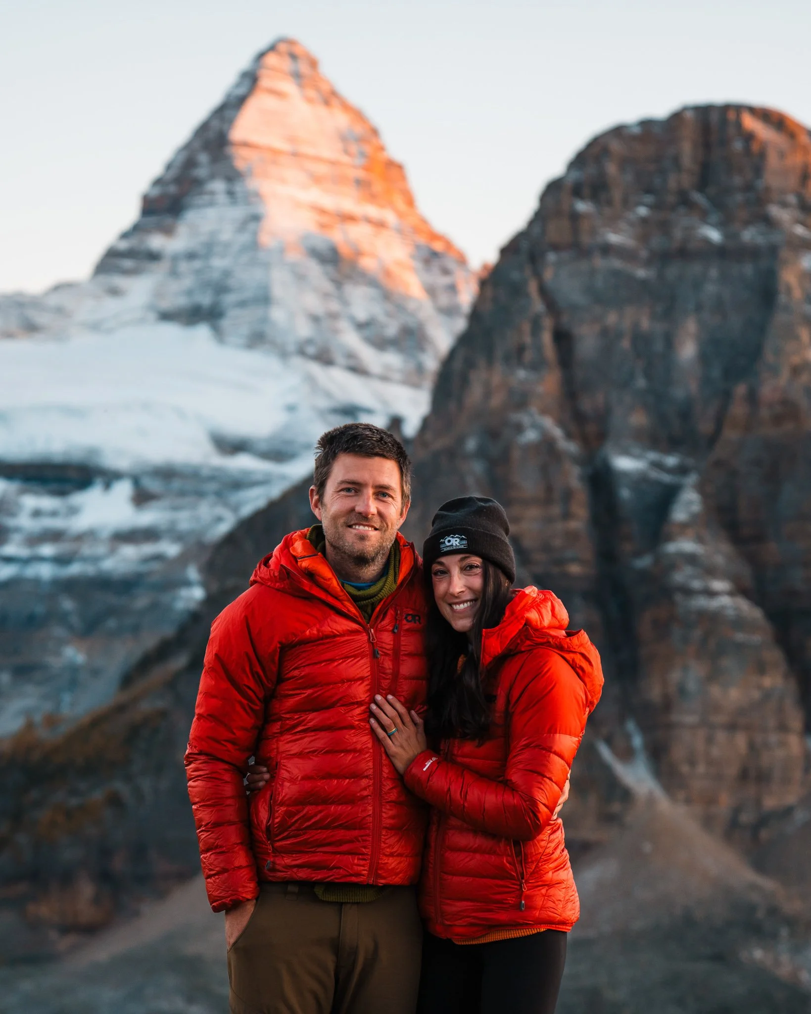
Hiking through a larch forest on the way to Mount Assiniboine
Larches in Banff: What They Are & When to Visit to See Fall Colors
Larches are deciduous conifers, meaning they lose their needles every year in the fall and turn a brilliant bright yellow and gold. The larches can be found in the mountains between 5,900 and 7,900 feet. Yes, larch madness is real and since larches only are at their peak golden color for about a week, hikers and photographers go crazy trying to get to as many spots to see them as possible. Hopefully this blog will help you narrow down where to go on your next fall Banff adventure.
The best time to see larches in their prime golden color is in late September and early October in the Canadian Rockies. The timing can change from year to year but I have had the best colors usually between September 20th and October 3rd.
Planning a trip to Banff? Check out our mega guide on the Canadian Rockies!
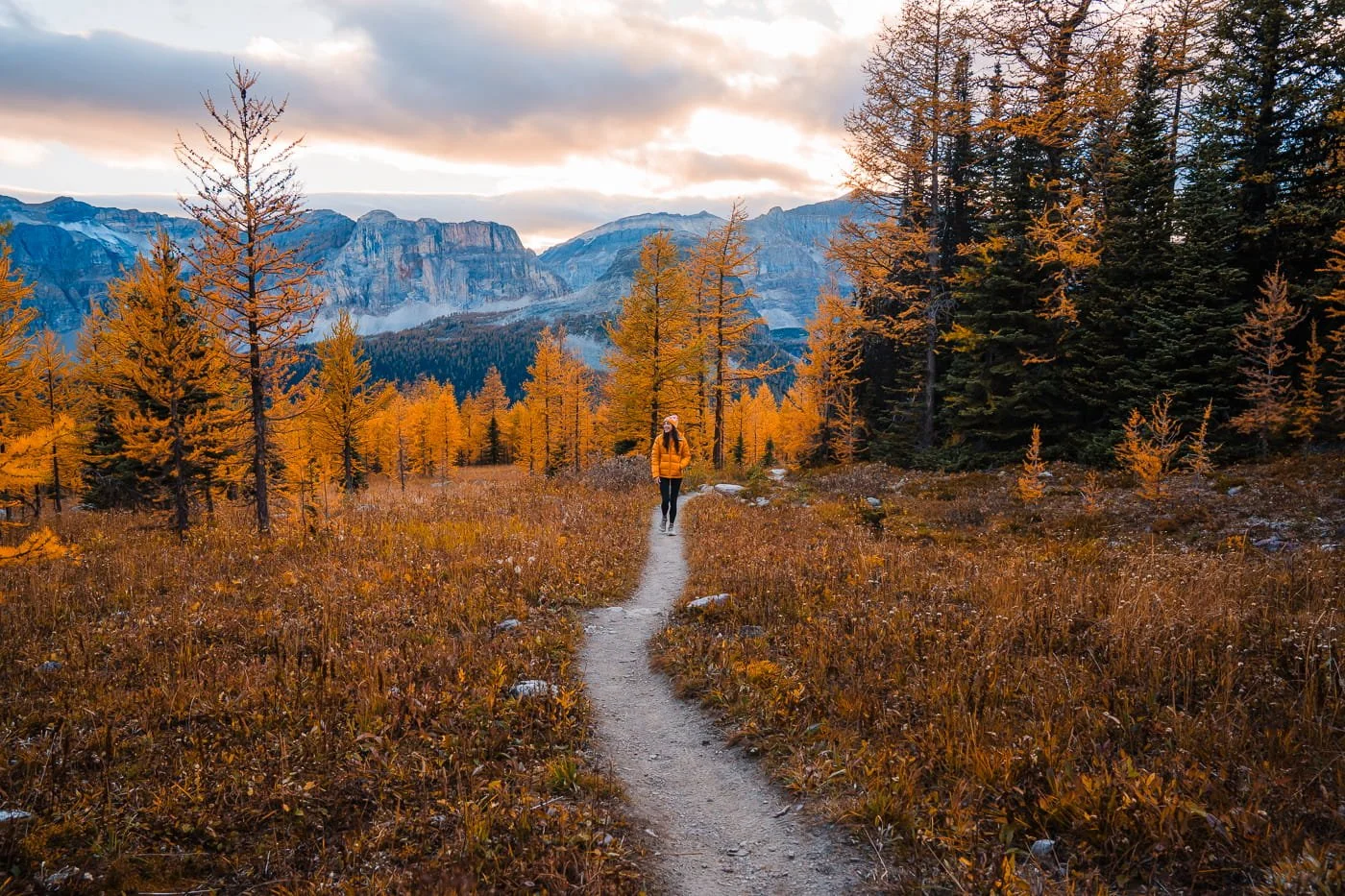
Hiking below Healy Pass in Banff
Banff & Canmore Larch Hiking Tips: Permits, Crowds, & Trail Etiquette
Larch season in Banff and Canmore is famously busy. Trailheads at Lake Louise and Sunshine Village can fill before sunrise on peak weekends. Before you hit the trail, here's what you need to know about permits, avoiding the worst crowds, and hiking responsibly in this heavily-trafficked but fragile alpine environment.
Parks Canada & Kananaskis Conservation Passes: What You Need Before Your Hike
Almost all of these hikes require a Parks Canada Discovery Pass for parking inside Banff, Yoho, or any other Canadian national park. It can be purchased either by the day or annually. Unlike US national parks, Canadian park passes are per-vehicle but require every adult in the car to be covered, so we opted for the family pass since there were two of us. If you're spending five or more days in the park, the annual pass is worth it.
For hikes near Canmore in the Kananaskis area, a separate Kananaskis Conservation Pass is required to park at any trailhead, and it's registered directly to your license plate rather than displayed on your dash. You can buy it online any time before 11:59pm on the day of your visit.
Recreation Pass Breakdown for Banff & Kananaskis Trails
| Pass | Cost | Area | Registered To | Best For | Get Your Pass |
|---|---|---|---|---|---|
| Discovery Pass Adult (18–64) | Annual $83.50 CAD | National Parks | Per Person | Solo hikers spending 5+ days in the parks | Buy Online |
|
Discovery Pass
Best Value
Family / Group
|
Annual $167.50 CAD | National Parks | Per Vehicle (up to 7 people) | Couples & groups hiking together | Buy Online |
| Discovery Pass Senior (65+) | Annual $71.50 CAD | National Parks | Per Person | Visitors 65 and older | Buy Online |
| Kananaskis Conservation Pass Day Pass | Per Day $15 CAD | Kananaskis | Per Vehicle (license plate) | A single trip out to Canmore / Kananaskis | Buy Online |
| Kananaskis Conservation Pass Annual Pass | Annual $90 CAD | Kananaskis | Up to 3 vehicles, same household | Multiple Kananaskis trips or locals | Buy Online |
Prices reflect 2026 rates and are set by Parks Canada and Alberta Parks — confirm current pricing before your trip, as both are reviewed periodically.
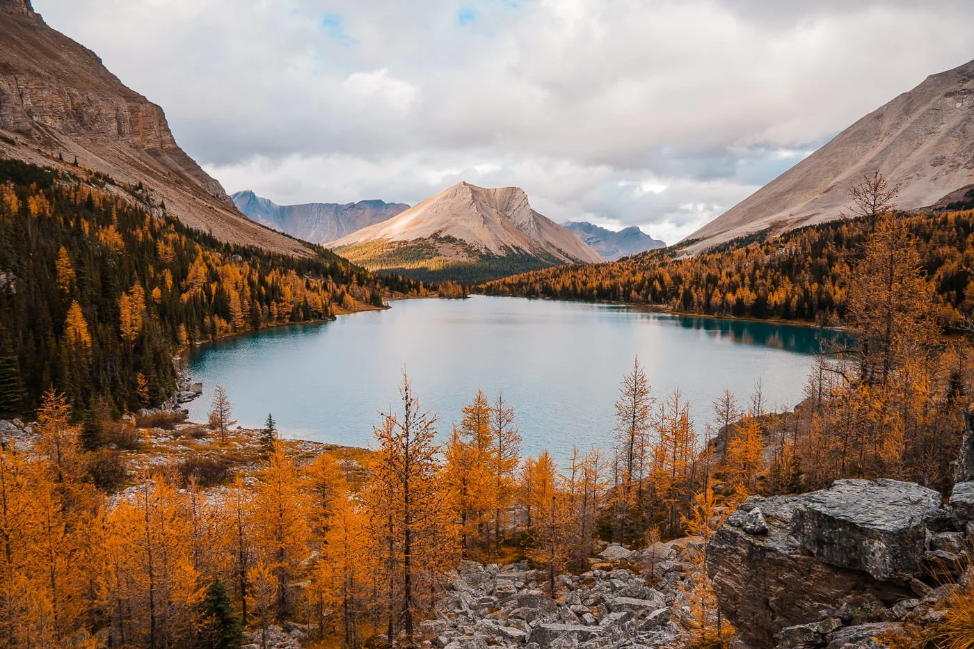
Larch views along the Skoki Lakes trail
How to Beat the Crowds During Larch Season
Larch season draws serious crowds to Banff and Canmore — narrow windows of peak color mean everyone is trying to hit the same trails during the same one to two weeks, so a little planning goes a long way.
Hike on weekdays when possible. Weekend trailheads, especially at Lake Louise and Sunshine Village, fill up fast during peak larch color. If your schedule allows any flexibility, a Tuesday or Wednesday hike will mean a fraction of the crowds you'd hit on a Saturday.
Go early for sunrise, or late for sunset. Both ends of the day thin out the crowds significantly compared to midday. In our experience, sunset actually tends to be the quietest window of all — most hikers are focused on getting an early start, so trails and viewpoints clear out noticeably by late afternoon and evening.
Have a backup plan. If a trailhead lot is full when you arrive, it helps to already have a second (less popular) larch hike from this list in mind so you're not scrambling to figure out plan B on the fly.
Wildlife to Watch For on Larch Hikes Near Banff
The greater Banff area is home to black bears, grizzly bears, elk, and other wildlife, and fall hikers are especially likely to cross paths with them, since bears are actively foraging ahead of winter and elk are in the middle of their fall rut.
A few rules to hike by in the Canadian Rockies:
Keep your distance. Parks Canada recommends staying at least 100 meters (about the length of a football field) from bears, wolves, and cougars, and at least 30 meters from elk, deer, and mountain goats. Never approach wildlife for a photo, no matter how good the shot looks.
Never feed wildlife. It's illegal in national parks, and it's genuinely dangerous for the animal, not just you. Habituated animals are far more likely to be relocated or put down.
Carry bear spray on every hike, not just the backcountry ones. Keep it somewhere you can reach in seconds (a hip holster or chest strap, not buried in your pack), and know how to use it before you're relying on it. Bear spray is only effective at close range (around 5 meters), so it's a last resort, not a substitute for keeping your distance in the first place.
Watch for elk during rutting season. September and October, which overlaps almost exactly with larch season, is when bull elk are at their most aggressive. Give them extra space, well beyond the standard 30 meters, especially if you see a bull with cows nearby.
Make noise on trail and hike in a group when you can, especially on hikes through dense forest or near creeks, so you're not surprising a bear at close range.
Larch Valley, above Moraine Lake
Leave No Trace on Every Larch Hike
Leave No Trace principles are always important to practice when visiting these special wild places. Remember to stay on trail, even when the alpine meadows look inviting for a shortcut, and pack out everything you bring in, including food scraps and toilet paper. Small impacts add up fast when a trail sees this much traffic in such a short window, so treat every hike this fall as a chance to help these fragile alpine areas stay just as stunning for the next round of hikers.
How to Leave No Trace on Hikes:
- Stay on trail: Cutting switchbacks causes vegetation damage and erosion.
- Pack out everything: All trash, food scraps, and toilet paper. If you packed it in, pack it out.
- Waste disposal: Use the porta-potty toilet at the trailhead before you leave. If you need to go on trail, use a WAG bag or dig a cat hole at least 6–8 inches deep and 200 feet from the trail.
- Don't feed wildlife: Human food is harmful to wildlife and creates problem animals.
- Leave rocks and plants: Don't build cairns, pick flowers, or move large rocks.
- Be considerate of others: The trail draws a lot of people. Give other hikers space and yield to uphill hikers on the trail.
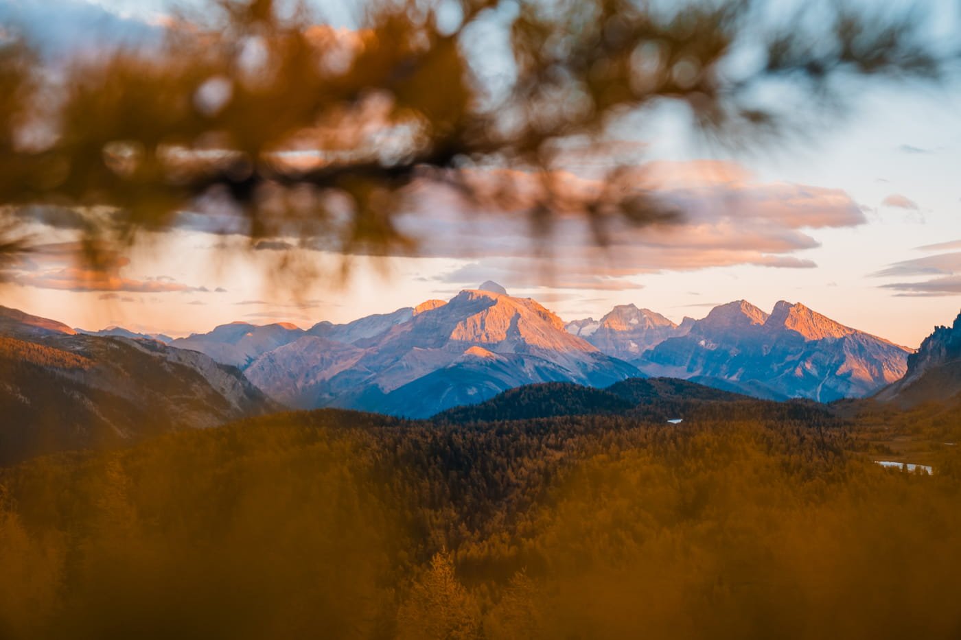
Sunset views from Healy Pass in Banff
Larch Hikes Near Banff & Canmore at a Glance
We've broken down all 12 hikes below so you can compare them at a glance — sort by distance or elevation, filter by region, or narrow it down to our top picks, then jump straight to the write-up. But don't stop at the table: the full details, tips, and trail notes for every hike are below and broken out by region.
| Trail | Distance & Elevation | Difficulty | Region | Parking Permit | Jump To |
|---|
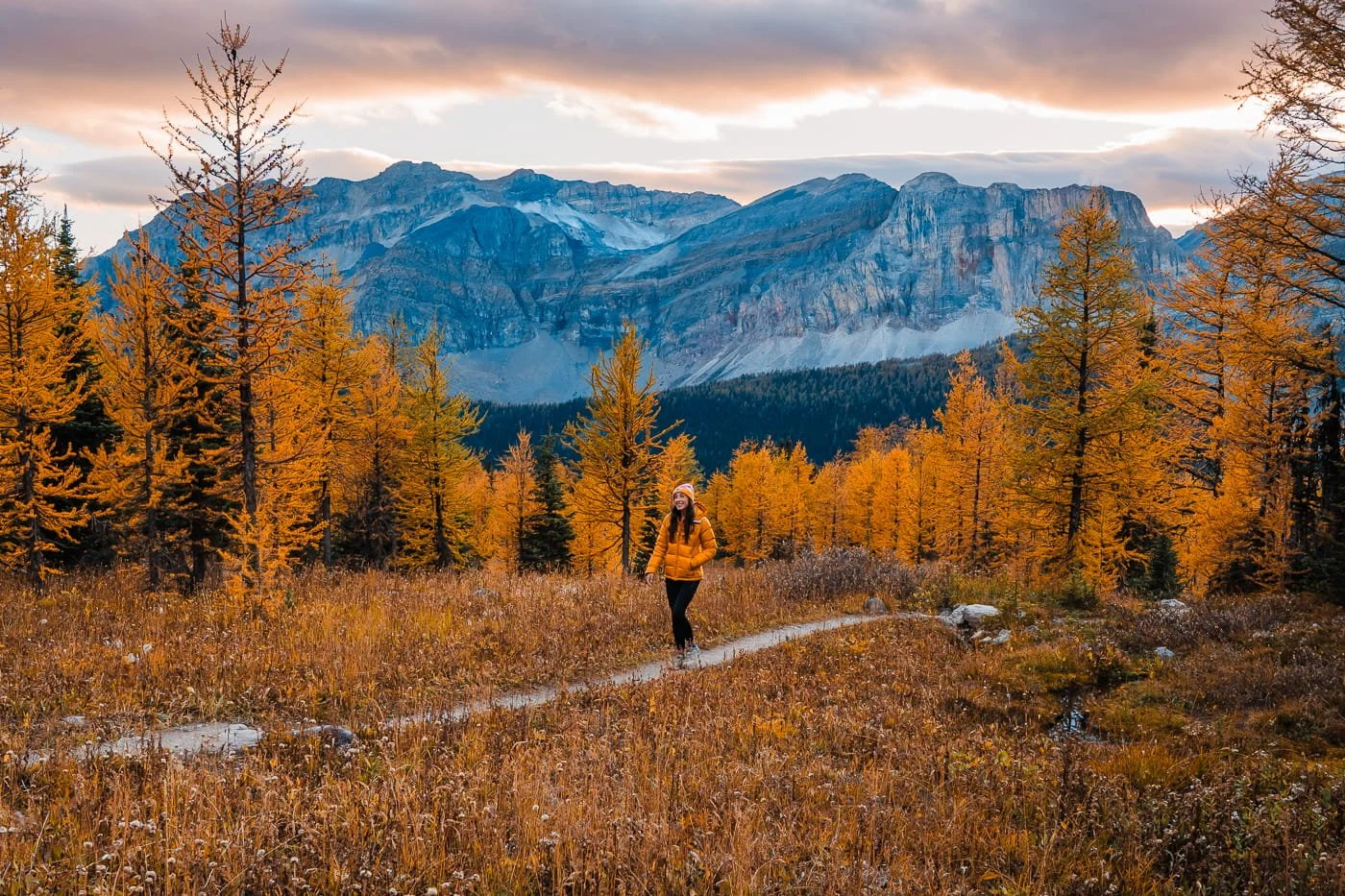
Healy Pass in Banff
The Best Larch Hikes in Banff National Park
Banff National Park is home to some of the most iconic larch hikes in the Canadian Rockies, from classic day hikes to backcountry trails that reward a little extra effort with far fewer crowds. Here are our top picks, from moderate outings to full-day adventures.
Healy Pass (Day Hike or Overnight)
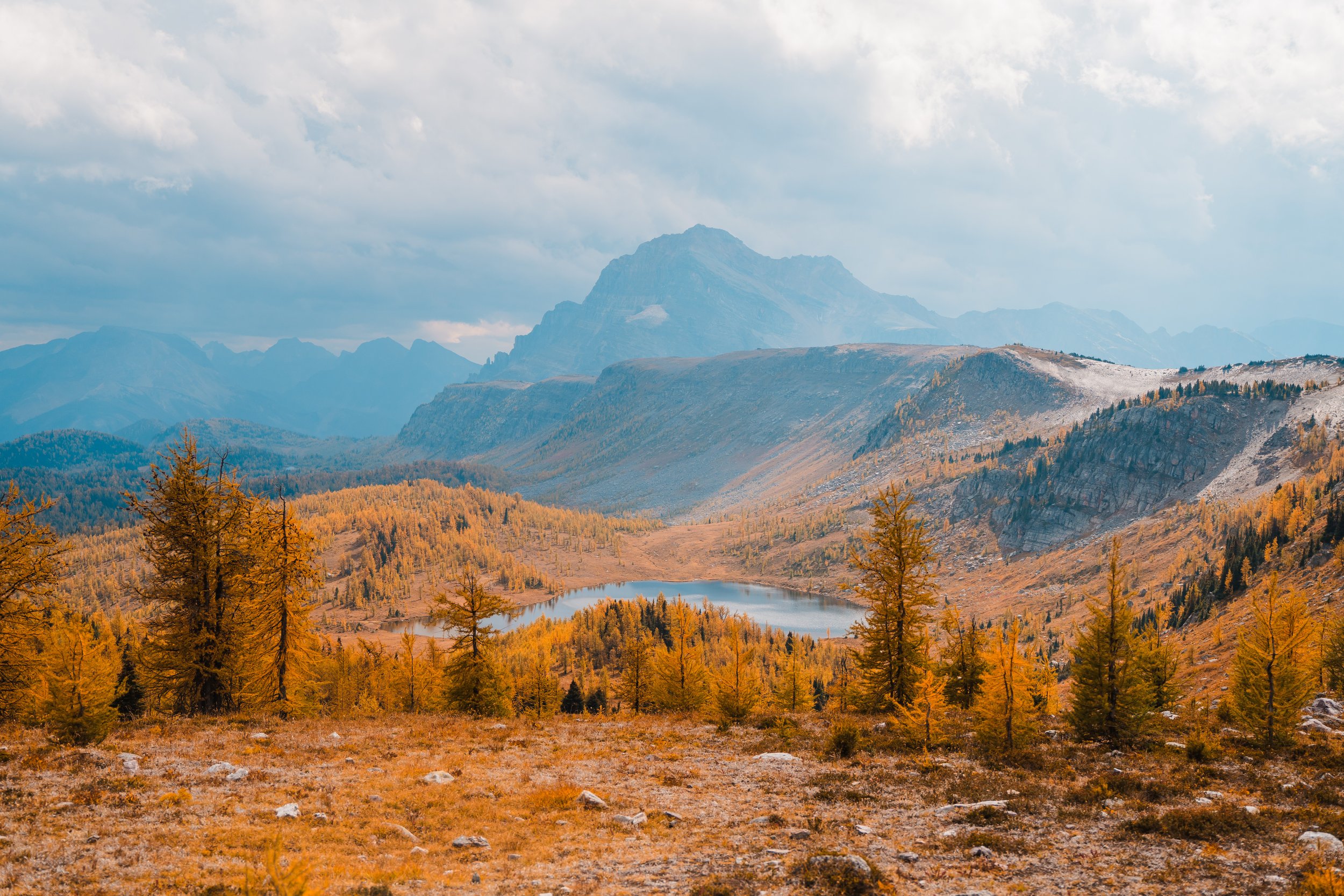
Moderate Day Hike for Larches & Alpine Views in Banff
Healy Pass is a stunning larch hike that starts at the Sunshine Ski Resort on a wide road that winds through the forest until you reach an open meadow and gain elevation to the top of the pass. Larch trees surround you as soon as you exit the forest, and at the top of the pass you will get amazing views of Egypt and Scarab Lakes along with all of the peaks in the area. You can stop at the pass, or continue on down to Egypt lake which adds more mileage.
Do note, that when you reach the pass, stay on trail, and do not hike on closed trails. There is a sign with a map at the top showing what areas are open and closed for hiking.
Hike Details:
Trailhead: Banff Sunshine Village Ski Resort - Creekside Lodge
Total Mileage: about 11 miles (18 km) RT
Elevation Gain: 2,050 feet (625 m)
Parking Permit: Parks Canada Discovery Pass (annual or day pass)
GaiaGPS Map and Route: Download the route and map for all 12 larch hikes
Larch Valley & Sentinel Pass (Day Hike)
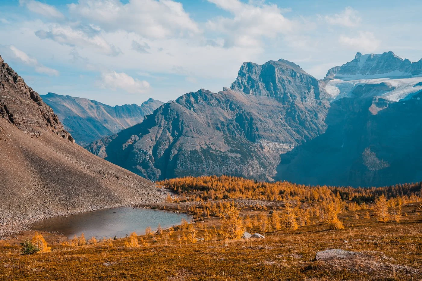
Larch Valley above Moraine Lake in Banff
The Most Iconic Larch Hike in Banff, Starting Right at Moraine Lake
If you only do one larch hike near Banff, this is the one. Larch Valley starts right at Moraine Lake and climbs through a steep set of switchbacks before opening up into a golden larch forest set against the Valley of the Ten Peaks, arguably the single most photographed larch scene in the Canadian Rockies. Most hikers turn around here at the upper alpine meadow, and it's more than enough of a payoff to justify the climb on its own.
From the valley floor, the trail continues up to Sentinel Pass, a narrow gap between Pinnacle and Sentinel Peaks with sweeping views down into Paradise Valley on the other side. It's a meaningful step up in elevation gain from stopping at the valley, so it's really best suited to hikers who are ready to keep climbing after already covering some ground. If your legs and your schedule allow it, the view from the pass is worth the extra effort, but Larch Valley alone is a completely legitimate turnaround point.
Because Moraine Lake Road is closed to private vehicles, getting to the trailhead takes a little more planning than most hikes on this list. There are two ways to get there: the Parks Canada shuttle is the cheaper option, but reservations open up in a narrow booking window and sell out fast, especially during peak larch season. We booked with the Moraine Lake Bus Company instead, a private shuttle service, which cost more but was far easier to lock in without stress over sold-out reservation windows. Whichever option you go with, book it well in advance.
Hike Details:
Trailhead: Moraine Lake (accessible by shuttle only — private vehicles are not permitted on Moraine Lake Road)
Total Mileage: 5.5 miles (8.9 km) RT to Larch Valley, or 6.9 miles (11.1 km) RT to Sentinel Pass
Elevation Gain: 1,790 feet (545 m) to Larch Valley, or 2,306 feet (703 m) to Sentinel Pass
Parking Permit: Parks Canada Discovery Pass (required in addition to a booked shuttle reservation since you cannot park at the trailhead)
GaiaGPS Map and Route: Download the route and map for all 12 larch hikes
Arnica Lake (Day Hike)
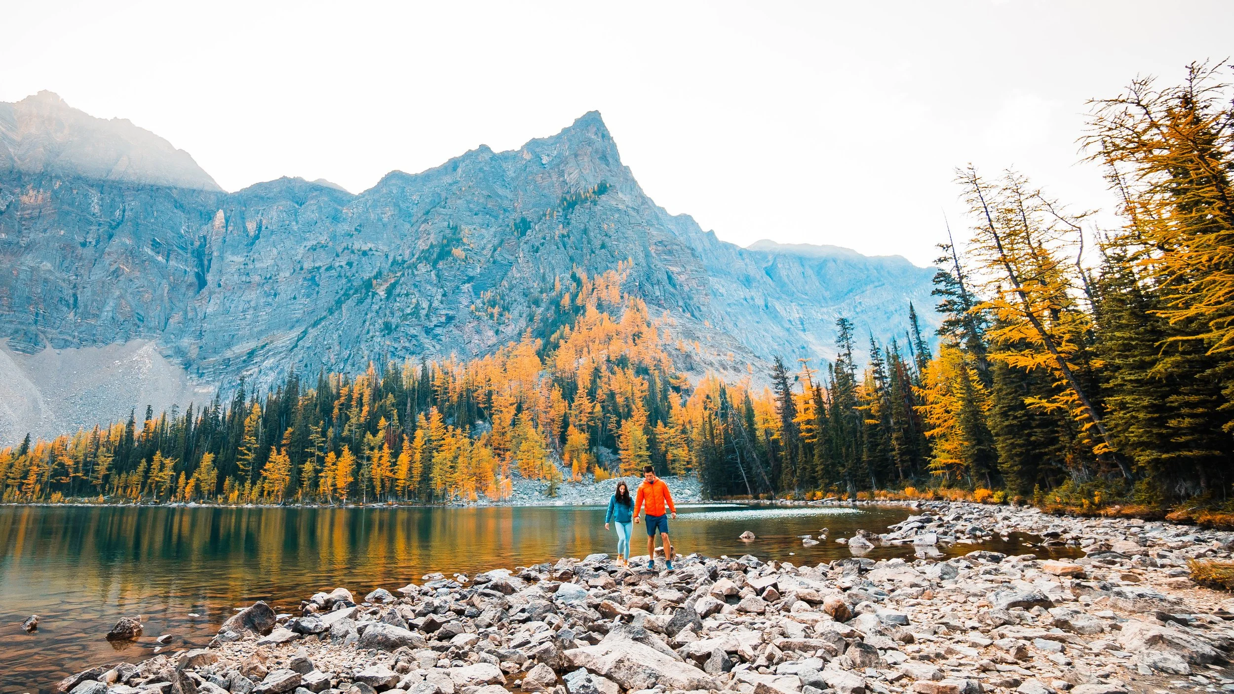
Short but Steep Day Hike with Larches, Perfect for Sunset
Arnica Lake is a relatively short but steep hike that was great late in the day. We hiked up in the late afternoon and had the whole lake to ourselves. This is a beautiful lake surrounded by larches and is perfect if you already have something planned in the morning or are looking for a quick and semi-easy sunset hike.
You also have the option to continue on above the lake to both Upper and Lower Twin Lakes if you want to add more mileage.
Hike Details:
Trailhead: Vista Lake Trailhead
Total Mileage: 5.9 miles (9.6 km) RT
Elevation Gain: 1,817 feet (554 m)
Parking Permit: Parks Canada Discovery Pass (annual or day pass)
GaiaGPS Map and Route: Download the route and map for all 12 larch hikes
Lake Agnes Loop & Big Beehive (Day Hike)
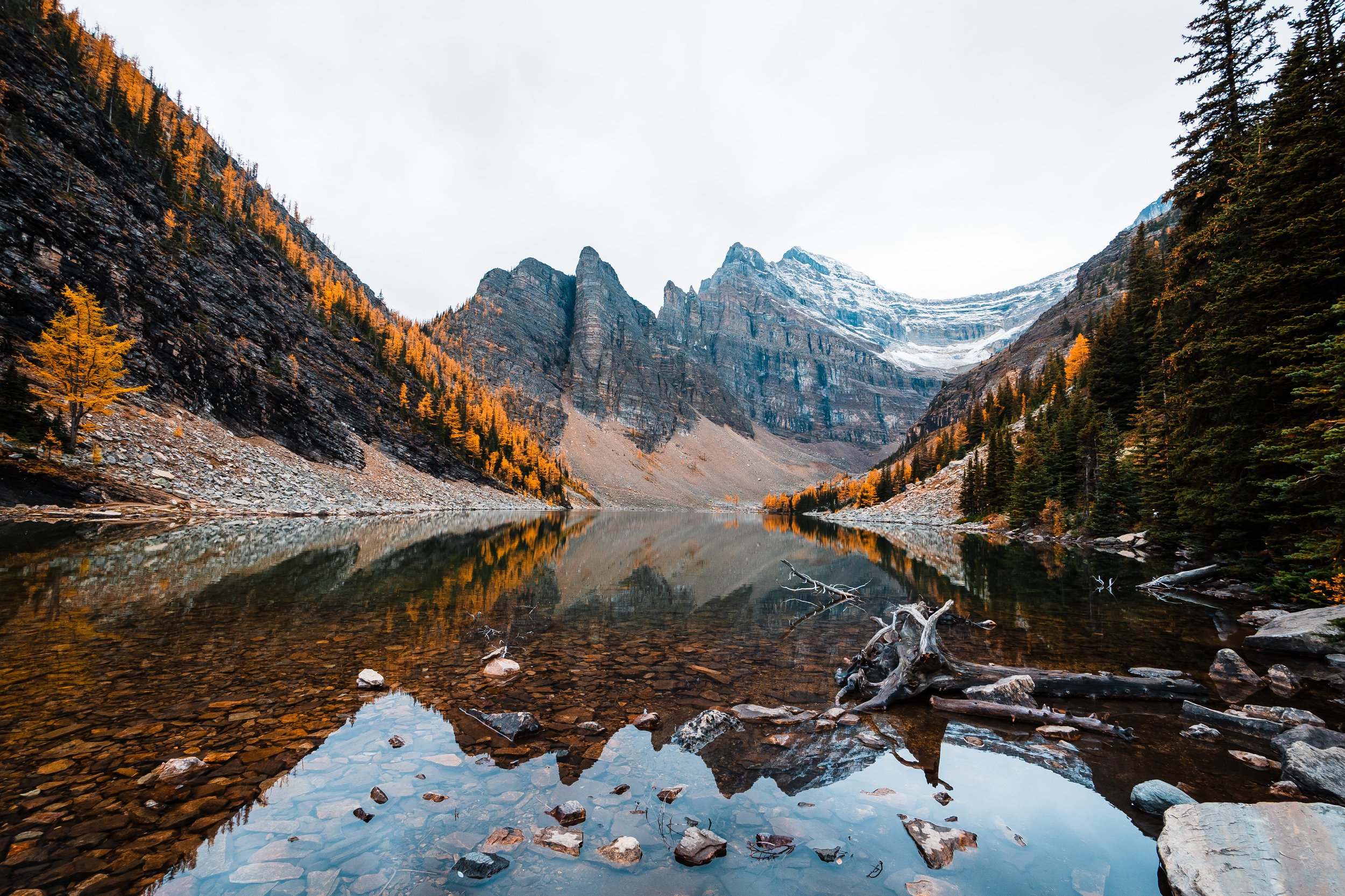
Easy Day Hike at Lake Louise for Fall Colors & Larches, Make Sure to Stop at Lake Agnes Tea House
Lake Agnes sits above Lake Louise and has a tea house at the lake that you can visit. We hiked up just after sunrise to beat the crowds and had tea and biscuits at the tea house before hiking up to the Big Beehive and then down to the Plain of Six Glaciers Trail and along the back side of Lake Louise.
It was such a fun way to experience a busy area, and seeing the back side of Lake Louise was really beautiful. This is a relatively easy trail, and the larches at Lake Agnes are beautiful and golden. So if you are looking for something different to do around Lake Louise, add this to your list.
Hike Details:
Trailhead: Lake Agnes Trail at Lake Louise
Total Mileage: 6.9 miles (11.2 km) RT for the loop | 3.9 miles (6.4 km) RT to the Tea House and back
Elevation Gain: 2,132 feet (650 m) for the loop | 1,233 feet (376 m) to the Tea House
Parking Permit: Pay to park at Lake Louise ($32 CAD per car) or take a shuttle in
GaiaGPS Map and Route: Download the route and map for all 12 larch hikes
Don’t want to deal with parking? Book a shuttle with Moraine Lake Bus Company
Skoki Lakes via Boulder Pass & Packers Pass (Long Day Hike or Overnight)
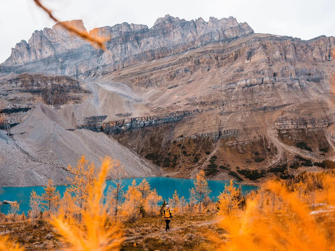
Hiking past Zigadenus Lake in the Skoki Lakes are
A Long Day (or Overnight) Into Banff's Backcountry with the Most Amazing Views
Skoki Lakes is a different kind of larch hike than most on this list, this is Banff backcountry, and it can be done as either a long day hike or an overnight backpacking trip out of one of the area's many backcountry campsites. We hiked it as a day hike in early October and got caught in snow flurries partway through, a good reminder that fall weather in the alpine can turn fast, even on a clear-looking morning.
The hike starts up an old forest road, since the upper parking area near Temple Lodge is reserved for guests staying at Skoki Lodge. Once you leave the road behind, the trail climbs into true alpine terrain, eventually reaching Boulder Pass and Ptarmigan Lake before you head left toward Packers Pass.
There's a dense network of trails back here, enough that you can turn this into a lollipop loop or an out-and-back depending on how far you want to go. We continued past Packers Pass to Zigadenus Lake, the most beautiful lake on the entire section we hiked, and kept going until we turned around at Myosotis Lake.
If you want to turn this into an overnight, there are several backcountry campsites scattered throughout the Skoki region, all of which require permits booked in advance through Parks Canada.
Hike Details:
Trailhead: Fish Creek Parking Lot (near Lake Louise Ski Resort; upper lot reserved for Skoki Lodge guests)
Total Mileage: 14.3 miles (23 km) RT for what we did, you can hike a lot farther into this area though
Elevation Gain: 3,205 feet (977 m) RT
Parking Permit: Parks Canada Discovery Pass (backcountry camping requires a separate permit, booked in advance)
GaiaGPS Map and Route: Download the route and map for all 12 larch hikes
C-Level Cirque Trail (Day Hike)
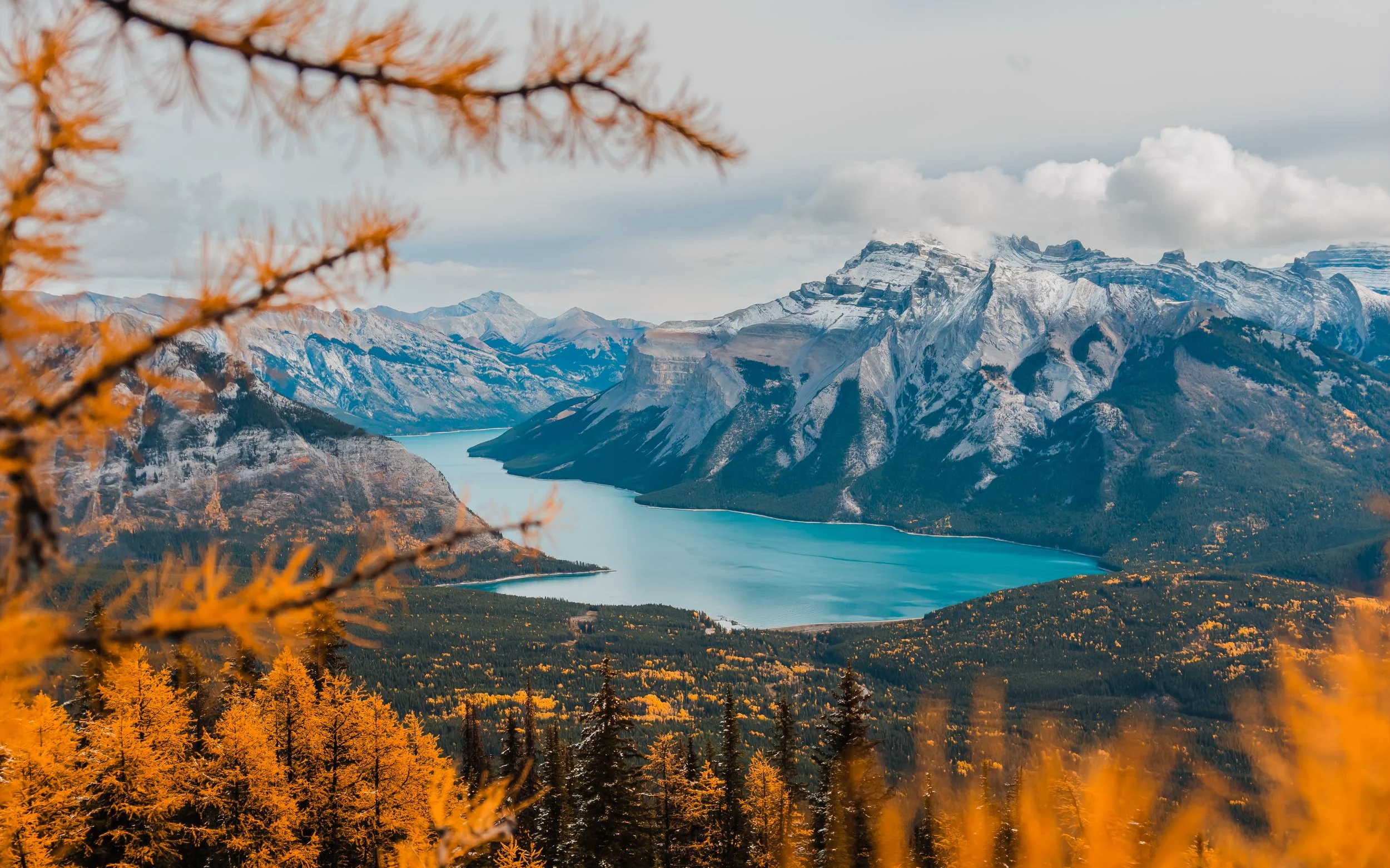
Short but Steep Trail Run or Day Hike with Fall Colors and Lake Views in Banff
Though this is not typically known as a larch hike, we trail ran the C-Level Cirque Trail above Lake Minnewanka and there are larches and amazing views at the top. This trail was a great trail run because of the relatively flat trail lower down, with not too many rocks or tree roots to trip you. The first few miles are in a forest and you pass old mines along the way.
Once you hit the bowl under Cascade Peak, the trail opens up and steepens as you climb up to the end of the trail and view point looking down at Lake Minnewanka. This was a majorly underrated trail in our opinion, we had not seen any other posts or photos from it before and the top is stunning.
Hike Details:
Trailhead: Upper Bankhead Parking Lot
Total Mileage: 5.8 miles (9.3 km) RT
Elevation Gain: 2,050feet (625 m)
Parking Permit: Parks Canada Discovery Pass (annual or day pass)
GaiaGPS Map and Route: Download the route and map for all 12 larch hikes
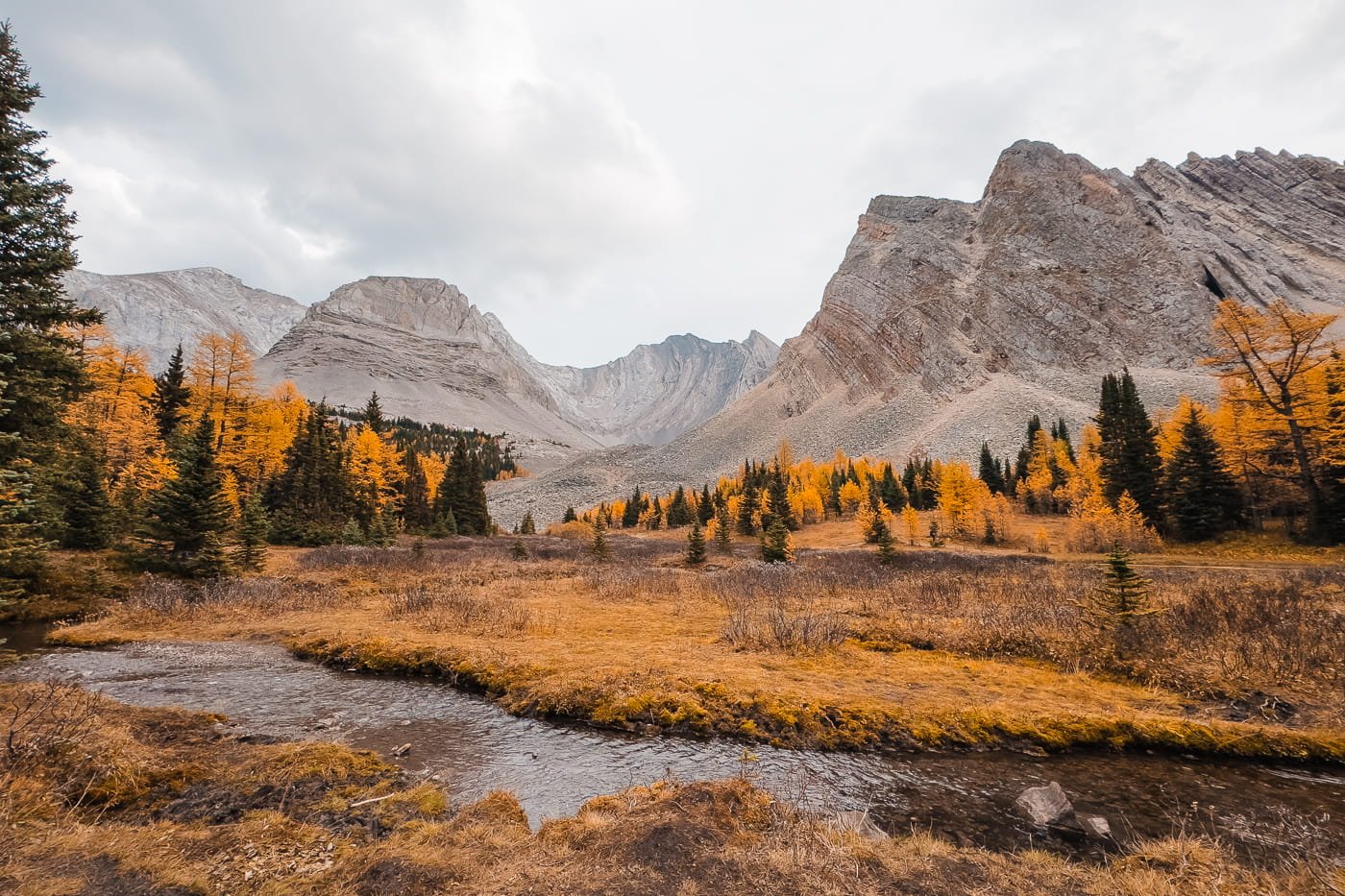
Arethusa Cirque in Kanananskis
The Best Larch Hikes Near Canmore in Kananaskis
A short drive from Banff, and just past Canmore, is Kananaskis, which holds some absolutely stunning larch hikes, including one of the entry points to Mount Assiniboine via the Mount Shark trailhead, even though the park itself sits just across the BC border. All of these hikes require a Kananaskis Conservation Pass to park at the trailhead, so make sure you've got yours before you go.
Tent Ridge Loop (Day Hike)
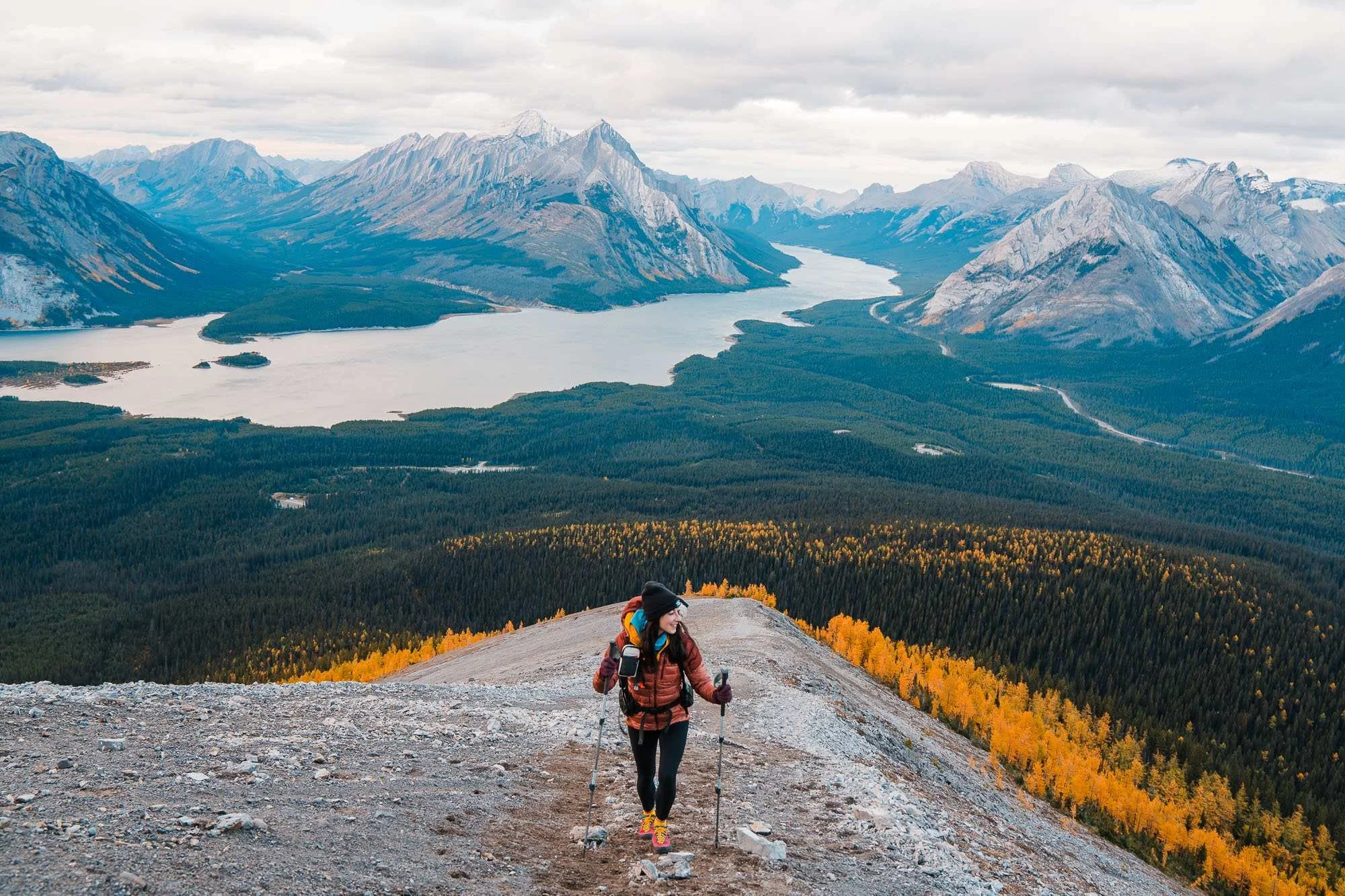
Hiking up Tent Ridge
Day Hike or Trail Run with Alpine Larches & Ridgeline Views Near Canmore
Tent Ridge is a stunning hike or trail run in the Kananaskis area, just outside of Canmore. We have done this hike several times now and it never disappoints. The trail really has it all, a ridge line walk, a mini scramble, and beautiful lake and mountain views.
We highly recommend hiking the loop clockwise, this gets the short scramble section out of the way as you crest the ridge. You will hike through a forest, gaining elevation until you reach the alpine and begin ascending the ridge. This is a true ridge run, as you scramble up to gain the ridge and remain on the ridge crest for beautiful views before descending back into the forest at the end of the hike. Larches dot the hill slopes, and the views from the top are stunning.
This is a more difficult hike, and hikers should be ready for steep elevation gain, 3rd class and a very short 4th class scramble, and strong winds.
Hike Details:
Trailhead: Tent Ridge Trailhead
Total Mileage: 6.3 miles (10.1 km) RT
Elevation Gain: 2,273 feet (693 m)
Parking Permit: Kananaskis Conservation Pass - $15 per vehicle, per day
GaiaGPS Map and Route: Download the route and map for all 12 larch hikes
Smutwood Peak (Day Hike + Scramble)
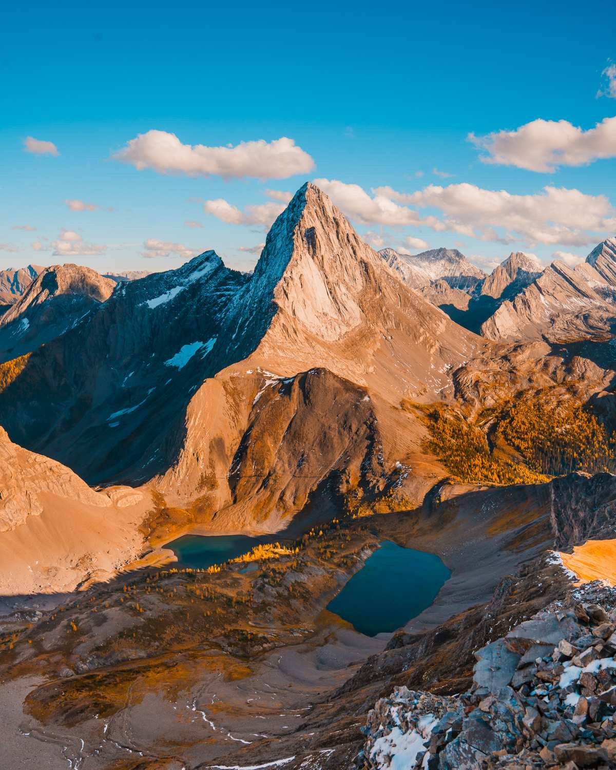
Mount Birdwood as seen from the summit of Smutwood Peak
Challenging Larch Day Hike and Scramble With Big Payoff Views Near Canmore
The trail to Smutwood Peak starts at the Smutwood Trailhead near Mount Shark, leading you through a mix of forest, open meadows, and dramatic alpine terrain. The first section follows an old logging road and a well-established trail, gradually gaining elevation before opening up to sweeping views of Mount Birdwood and Commonwealth Peak.
As you approach the alpine basin, the scenery becomes spectacular with rugged peaks all around, and Birdwood Lakes nestled below. From here, the route steepens as you ascend a rocky gully toward the ridge.
The final push to the summit is a moderate scramble with some loose rock and hands-on sections, but nothing overly technical in dry conditions. At the top, you’re rewarded with 360° views of the Spray Valley, Mount Birdwood and the surrounding Kananaskis peaks.
Hike Details:
Trailhead: Smutwood Peak Trailhead
Total Mileage: 11 miles (17.1 km) RT
Elevation Gain: 2,229 feet (710 m)
Parking Permit: Kananaskis Conservation Pass - $15 per vehicle, per day
GaiaGPS Map and Route: Download the route and map for all 12 larch hikes
Arethusa Cirque Trail (Day Hike)
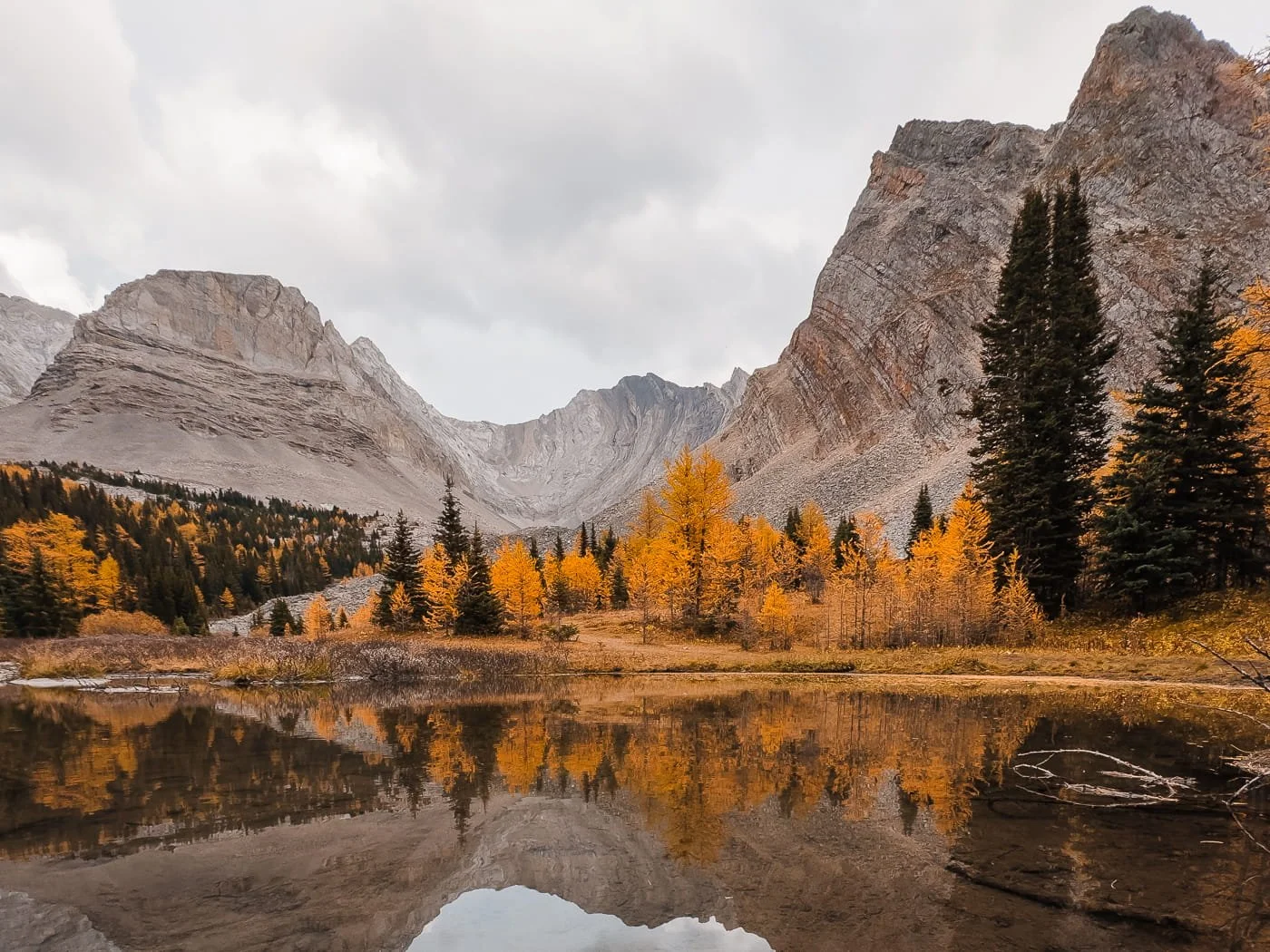
Arethusa Cirque
An Easy Larch Loop in Kananaskis, Perfect for Families
If you're looking for a larch hike that doesn't demand a full day of effort, Arethusa Cirque is it. This short lollipop loop climbs into an alpine lake basin ringed by big peaks, with larches scattered across the whole bowl, and it's gentle enough to work for hikers of nearly any level, families included. The trail loops around the lake basin for those who want the full experience, but if you're tight on time, hiking straight in to the lake and back is a completely worthwhile shorter option on its own.
We added this one onto the same day as another nearby hike rather than making the drive out to Kananaskis just for this trail alone. Given how short it is, it pairs well with something bigger if you're already headed this direction.
Hike Details:
Trailhead: Arethusa Cirque Parking Area (unmarked dirt pullout on Highway 40, just south of Highwood Pass)
Total Mileage: 2.6 miles (4.2 km) loop
Elevation Gain: 961 feet (293 m)
Parking Permit: Kananaskis Conservation Pass
GaiaGPS Map and Route: Download the route and map for all 12 larch hikes
Pocaterra Cirque & Pocaterra Ridge (Day Hike)
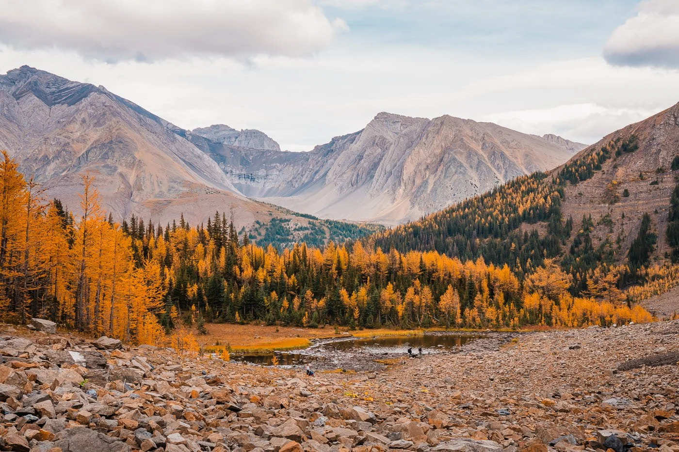
Pocaterra Cirque
A Golden Larch Bowl With the Option to Push On to a Ridge Traverse
Pocaterra Cirque is a shorter, out-and-back option that climbs through forest before opening into a meadow and a small tarn, then continues on to a wide alpine bowl framed by Mount Tyrwhitt and Pocaterra Ridge, absolutely packed with larches in fall. We hiked to the cirque and turned around there. Weather was rolling in that day with rain on the way, and even without pushing further, it was completely worth the trip on its own.
For hikers with better weather (or more time) than we had, the cirque trail also connects to the full Pocaterra Ridge, a point-to-point traverse over four summits with sweeping views the entire way, widely considered one of the best larch hikes in Kananaskis.
The catch is logistics: since it's point-to-point, you'll need a car shuttle between the Highwood Pass and Little Highwood Pass trailheads, or a hitchhike back to your car, since there's no local shuttle service running through this stretch of Highway 40. Starting at Highwood Pass rather than Little Highwood Pass gets you a head start in elevation and less overall gain.
Hike Details — Pocaterra Cirque (Out-and-Back):
Trailhead: Highwood Pass Day Use Area (Highwood Meadows), Highway 40
Total Mileage: 3.2 miles (5.2 km) RT
Elevation Gain: 547 feet (167 m) RT
Parking Permit: Kananaskis Conservation Pass
GaiaGPS Map and Route: Download the route and map for all 12 larch hikes
Hike Details — Full Pocaterra Ridge (Point-to-Point):
Trailhead: Start at Highwood Pass Day Use Area, finish at Little Highwood Pass parking lot (requires a two-car shuttle)
Total Mileage: 6.4 miles (10.3 km) RT
Elevation Gain: 1,650 feet (503 m) RT
Parking Permit: Kananaskis Conservation Pass (required at both trailheads)
GaiaGPS Map and Route: Download the route and map for all 12 larch hikes
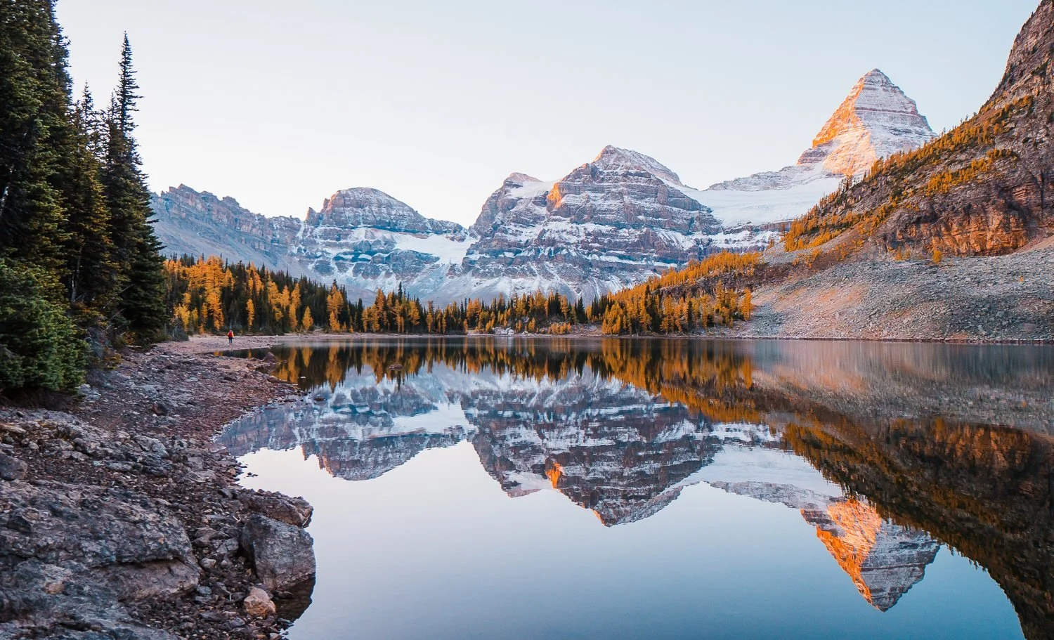
Sunrise at Sunburst Lake while camping at Mount Assiniboine
Larch Hikes Worth the Extra Drive: Mount Assiniboine & Lake O'Hara
Two hikes on this list stand apart from the rest, not because of the larches themselves, but because of what it takes to get there. Mount Assiniboine and Lake O'Hara both require advance planning well beyond a Kananaskis Conservation Pass or a Discovery Pass on your dashboard, think reservations, quotas, and in Assiniboine's case, a serious backcountry commitment.
They're not hikes you can decide to do the morning of, but for hikers willing to plan ahead, both reward the extra effort with some of the least crowded, most spectacular larch scenery near Banff.
Lake O’Hara - Yoho National Park (Long Day Hike or Overnight)
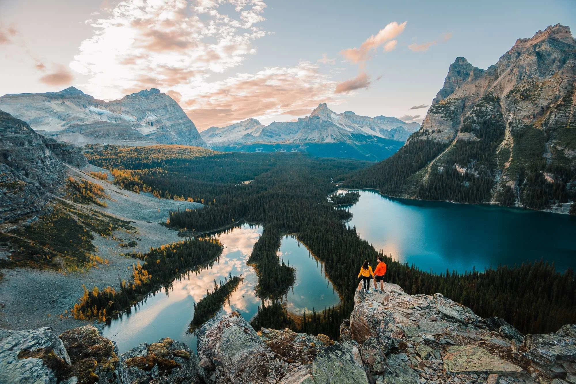
Overlooking Lake O’Hara at sunset
The Best Larch Hike or Backpacking Trip in Yoho National Park Near Banff
Lake O’Hara is one of the most stunning alpine areas in the Canadian Rockies located in Yoho National Park, known for its turquoise waters, dramatic peaks, and an intricate network of well-maintained trails. Access is limited to protect the fragile environment, so visitors must either secure a Parks Canada shuttle reservation or hike the 11 km (6.8 mi) access road to reach the lake. We hiked to Lake O’Hara and the Alpine Circuit above the lake all in one day last fall. It was a long day, about 11 hours car to car, but totally worth it!
For more information on how to hike Lake O’Hara and hiking the Alpine Circuit in a day, check out our guide on Lake O’Hara.
Hike Details:
Trailhead: Lake O’Hara Trailhead
Total Mileage: Trailhead to lake if walking the road - 6.8 miles (11 km) one way, the Alpine Circuit from Lake O’Hara Lodge 6 miles (9 km) round trip
Elevation Gain: Trailhead to lake 1,477 feet (450 m), Alpine Circuit from Lake O’Hara Lodge 2,194 feet (668 m)
Parking Permit: Parks Canada Discovery Pass (annual or day pass), reservations required for the shuttle bus and to stay at the Lake O’Hara lodge or campground overnight.
GaiaGPS Map and Route: Download the route and map for all 12 larch hikes
Magog Lake - Mount Assiniboine Provincial Park (Overnight)
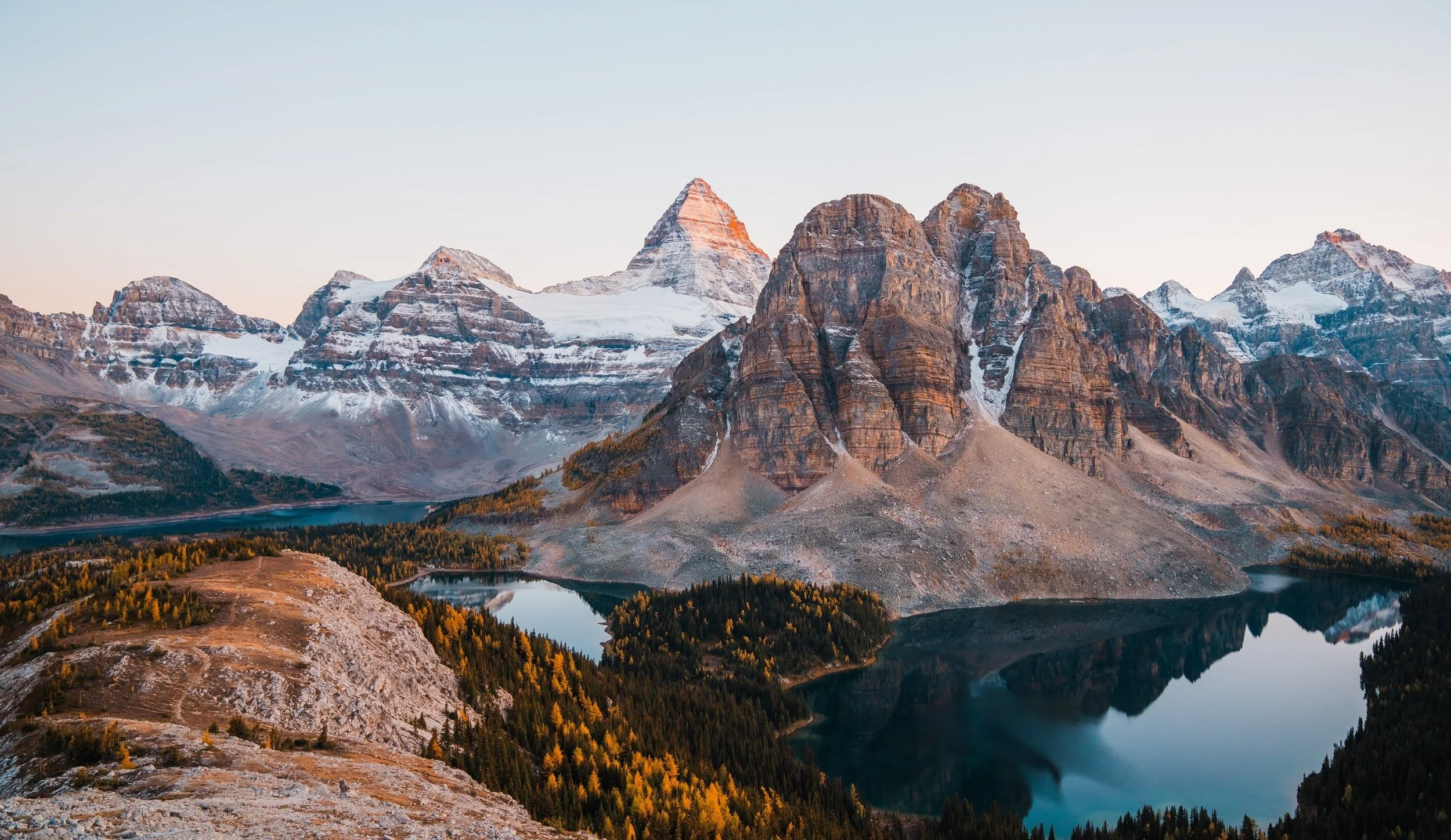
Overnight Larch Backpacking Trip (the Best Views Near Canmore in Fall)
Mount Assiniboine is truly a fall dream come true. This was a bucket list backpacking trip for us and one we would happily do over and over again (we are actually going back in September 2026).
If you are able to secure an overnight permit, you will be in one of the most beautiful parts of the Canadian Rockies. There are multiple ways to hike into the campground at Magog Lake, on our first trip we went in through Kanananskis and the Mount Shark Trailhead, hiking in through Wonder Pass, but this next time we are entering through Sunshine Ski Resort and hiking over via the Citadel Pass trail to Og Lake and then Magog Lake.
We have a full blog post dedicated to our Mount Assiniboine backpacking trip, so take a look at that for more information on this trip and trail.
Hike Details:
Trailhead: Mount Shark Trailhead, hiking in through Wonder Pass
Total Mileage: about 33.5 miles (54 km) RT
Elevation Gain: 2,552 feet (778 m)
Camping Permit: Hard to get, must obtain online through Parks Canada months in advance - $30 per person
Parking Permit: Kananaskis Conservation Pass - $15 per vehicle, per day for Mount Shark TH and any hikes in Kananaskis
GaiaGPS Map and Route: Download the route and map for all 12 larch hikes
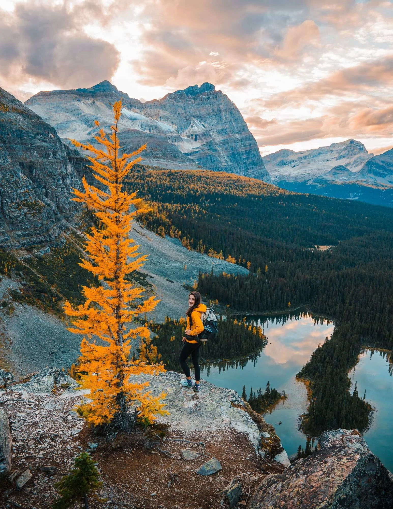
What to Bring on Fall Hikes in the Canadian Rockies
As temperatures drop during the fall season, layering is key: bring a warm mid-layer, a waterproof shell, gloves, and a hat. Mountain weather can change fast in the fall, so be prepared for rain, snow, or sudden winds even on a sunny day. With shorter daylight hours, start early and carry a headlamp just in case.
Essentials like plenty of water, snacks, a map or GPS, first aid kit, and bear spray are still must-haves. Trekking poles, sturdy shoes with micro-spikes can help on early-season ice. For a full packing list for cold weather hiking, check out our Fall Hiking Guide.
What to Pack for Hiking in the Canadian Rockies
Day Pack: Our favorite all-around pack is the Hyperlite Southwest 55L (works for backpacking and rolls down small for day hikes) or a smaller day pack like the Osprey Sportlite 25
Trekking Poles: REI Trail Made Trekking Poles
Bear Spray: Bear Spray
Down Jacket: Outdoor Research Helium Down Hoodie
Rain Jacket: Outdoor Research Men’s Foray and Women’s Aspire
Gloves: Sureshot Soft-Shell Gloves
→ For more on what to pack for your trip to the Canadian Rockies, check out our guide on What to Pack for Banff.
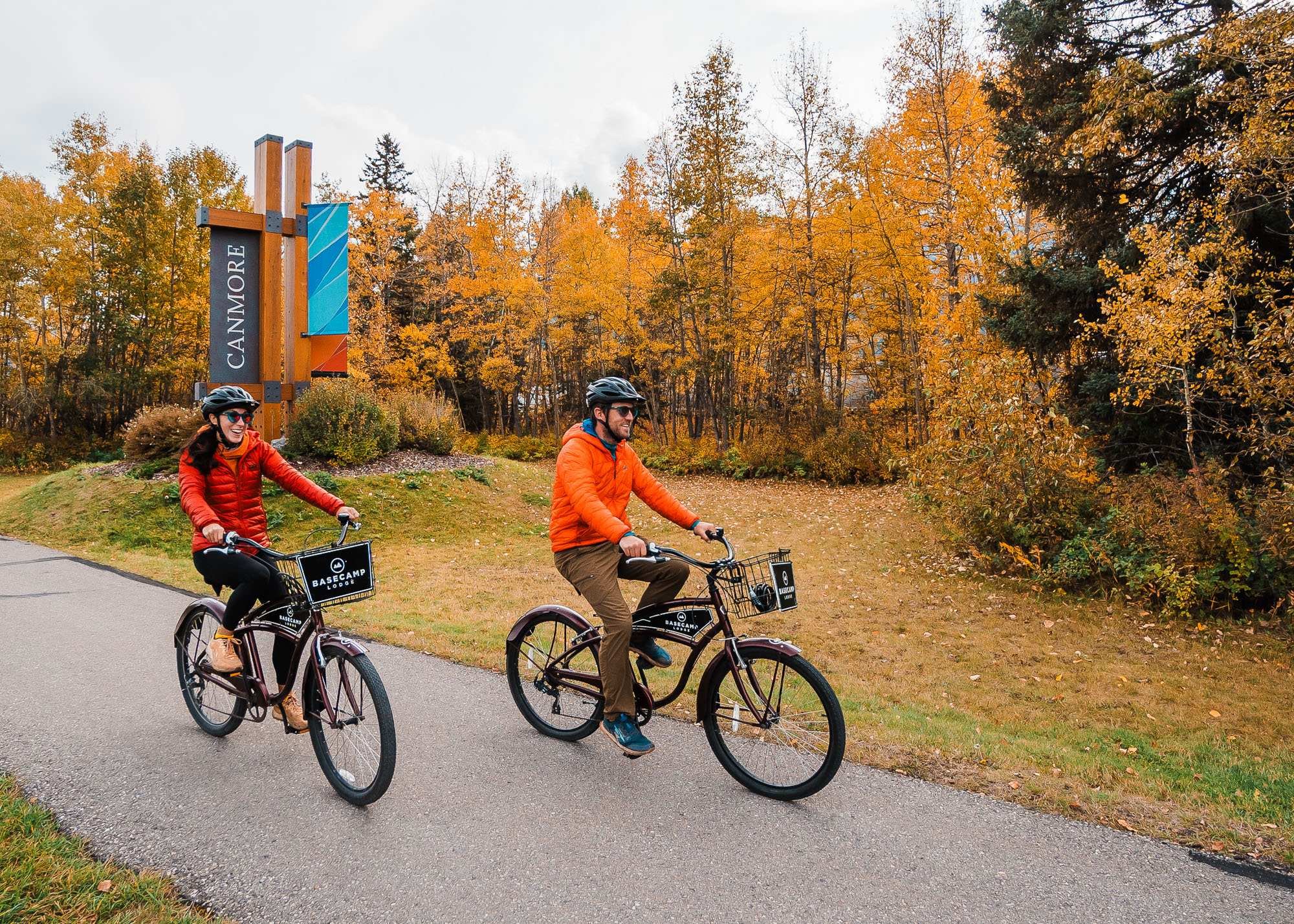
Where to Stay Near the Best Larch Hikes in Banff, Canmore & Lake Louise
Planning to chase golden larches this fall? The right basecamp makes all the difference. Whether you want the convenience of staying in Banff town, the cozy charm of Canmore, or quick access to iconic trails from Lake Louise, there are plenty of great lodging options. If you want more information on lodging in and around the Banff area, check out our Banff lodging guide.
Banff: A central hub with easy access to dining, shopping, and trailheads for popular larch hikes like Healy Pass and C-Level Cirque. Check out hotels in Banff.
Canmore: A quieter mountain town just outside the park gates, perfect for hikers tackling Smutwood Peak or Tent Ridge. Check out hotels in Canmore.
Lake Louise: Ideal for early starts on classic trails like Lake Agnes and quick access to Moraine Lake and Larch Valley. Check out hotels in Lake Louise.
Wherever you stay, booking ahead is essential during larch season, rooms fill quickly in September and early October.
More Things to Do in Banff
Banff Larch Hiking FAQ
When is the best time to see larches near Banff and Canmore?
Peak larch season typically falls in the last two weeks of September into the first few days of October, though the exact window shifts year to year depending on weather. A cold snap or early snowstorm can knock the needles down fast, so it's worth checking recent trail reports in the days before your hike rather than planning strictly by the calendar.
Do I need a permit for larch hikes near Banff?
Yes. Hikes inside Banff or Yoho National Park require a Parks Canada Discovery Pass, while hikes near Canmore in Kananaskis Country require a separate Kananaskis Conservation Pass. Some hikes, like Mount Assiniboine and Lake O'Hara, also require advance reservations on top of the standard park pass.
Which larch hike near Banff is best for beginners or families?
Arethusa Cirque is the easiest hike on this list and works well for most fitness levels, including families with kids. C-Level Cirque and the shorter Larch Valley out-and-back (stopping before Sentinel Pass) are also solid options if you want a moderate hike without a full day of elevation gain.
Is Larch Valley worth the crowds?
Yes, it's the most iconic larch hike near Banff for a reason. That said, it's also one of the busiest, and getting there now requires booking a shuttle in advance since Moraine Lake Road is closed to private vehicles. Going on a weekday, or timing your hike for early morning or sunset, will noticeably cut down the crowds.
Are dogs allowed on these trails?
Dogs on leash are generally allowed on most trails in this guide, though a few, including Larch Valley, have restrictions depending on shuttle access. Check current regulations for each specific trail before you go, since rules can vary by park and can change season to season.
Do I need bear spray for these hikes?
Yes, on every hike on this list, not just the backcountry ones. Both black bears and grizzly bears are active in this area through the fall, and carrying bear spray somewhere you can access quickly is standard practice for hiking in the Canadian Rockies.
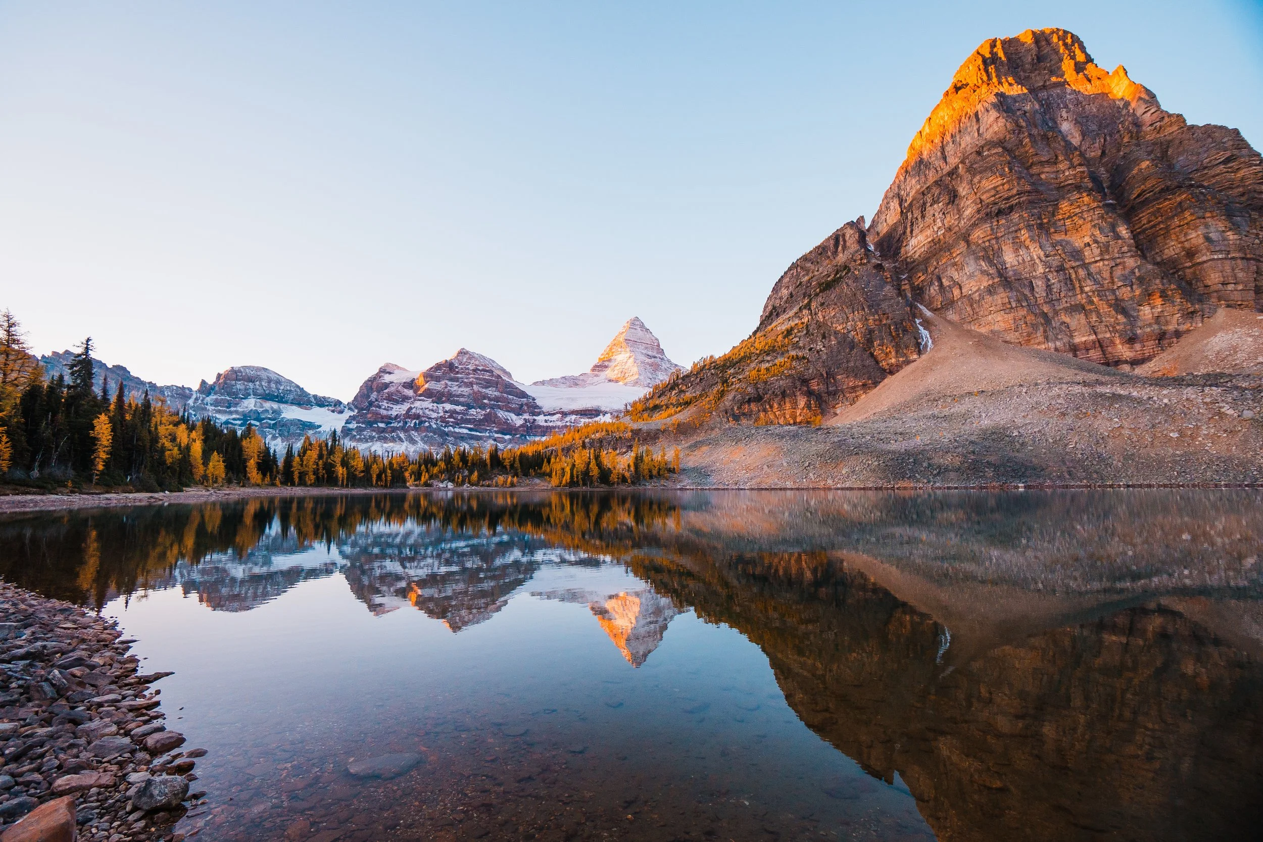
Sunburst Lake near Mount Assiniboine
Final Thoughts on Larch Hikes Near Banff, Alberta
All of these hikes are worth doing at any time of year, but they were so magical in the fall. The greater Banff area is very popular for hikers and photographers, so if you can, plan your hikes on weekdays to avoid the majority of the crowds.
As always, when hiking in fragile alpine environments, or for any outdoor recreation, please leave no trace, pack out any and all trash, and don’t go off trail (no, not even to get a better shot).
More Fall Hiking Guides for The Canadian Rockies
Save this Post for Later
We Took Our Own Engagement Photos
The Complete Guide to Backpacking Mount Assiniboine in the Canadian Rockies
This image is copyrighted and owned by Skye Stoury Photography and skyestoury.com, if you would like to licence any images on this site, please email us at hello@skyestoury.com